Tuesday: January 26th
Today was going to be a full day. It started by leaving the hotel around sunrise and ended with a return around sunset. We visited 3 very different places in the park and each one was unique and interesting.
Click on the photos below for a larger image.

This was the view from the roadway in front of the motel just after sunrise. I had to use my hand as a lens hood and a few fingers got in the way. So I chopped down the picture to remove them.
I thought you might find Betsy's journal entry for this morning a bit less boring than my usual drivel so I have included some of it below. (Entries in parentheses are mine)
Today we planned to hike the Lost Mine Trail. We wanted to get started with a good breakfast, so we stopped in at Indies Cafe (In Study Butte. Suggested by the staff at the El Dorado). As we walked in the door, we were surprised to see a very small room with only three tables, two of which were occupied.
A women told us to pull up a chair and get our own coffee. The other tables, apparently occupied by locals, who immediately asked us where we were from. The gentlemen sitting by himself talked to us the most. He said he was from North Carolina and he and his wife spent the winters down in the Big Bend area. (He also mentioned they had been coming here for 30 years. Finally the area they were in NC got to busy and they moved here permanently and lived in house which was off the grid. All their water was from roof catchment and stored in a tank. Solar panels provided electricity. He did not mention it, but I would be willing to bet they also had propane for hot water and cooking.)
We ordered small sausage and egg quesadillas with salsa, and Indie and her husband from London immediately began to cook.
Indie said when she married her husband he wasn't used to Texas women and she told him "In Texas, the man wears the pants in the family - after his wife gets through with them."
The quesadillas were very good, but they forgot to bring us the salsa and charged us for the large instead of the small. Oh well...
After breakfast we drove to Chisos Basin. Just past the crest of the pass is the trail head for the Lost Mine Trail. The parking area could easily accommodate 20 cars. There were 3 other cars parked when we arrived.
When we got out of the van cold air hit us in face. Study Butte is at 2543', the trail head is at 5750' so we had gained about 3200' feet in elevation and it felt like it!
We pulled on some extra fleece, loaded up the packs with food, water and wind breakers and were on our way.
This moderately difficult trail begins at mile marker 5 along the Basin Road. With it's accompanying trail guide (available at the trailhead), this is an excellent introduction to the plants and animals of the Chisos Mountains. The trail starts at an elevation of 5,600' and steadily climbs to the top of a 6,850' promontory overlooking Pine and Juniper Canyons. If you don't want to hike the whole way, one of Big Bend's greatest viewpoints is at the end of the first mile. Take a lunch and enjoy the sights and sounds of the High Chisos. 4.8 miles round trip. Source: NPS
Check out John Crossley's site for a more detailed trail description of the Lost Mine Trail.

The trail starts out somewhat steeply for the first 100' then is surprisingly gradual for the rest of the 2.4 miles which climbs 1200' to the "summit". Once again the CCC boys show us how to do it right. Rocks walls, cut and natural stone culverts, numerous water bars and many switchbacks make this a surprisingly easy hike considering the elevation.
The view above of Casa Grande (7325') was to stay with us for most of the hike. But, as we climbed it was joined by sweeping views of the Basin, Vernon Baily Peak, Pulliam Bluff, Toll Mountain and, of course, Emory Peak (7,825').
Emory Peak is the highest peak in the Chisos Mountains of Texas, located in Big Bend National Park. The peak is named for William H. Emory, the chief surveyor of the U.S. Boundary Survey team of 1852. From the Chisos Basin the peak appears to be a minor ridge, while the summit of Casa Grande (one mile closer) seems to be much taller. From the west, Emory Peak is clearly visible as a point slightly higher than most of the mountain range.
The peak can be reached by a moderate hike on a well-marked path along steep rocky terrain with an elevation gain of approximately 2500'. The Emory Peak Trail is about 9 miles. Once at the base there is a semi-technical rock scramble to navigate before reaching the top. No gear is needed for this climb although hikers should take great care. High-desert flora and fauna including alligator juniper, pinon pine, mule deer, prickly pear cacti, Mexican jay, sotol, and Texas madrone may be seen along the trail. There are signs warning of mountain lions and bears.
The view from the top takes in most of the northern section of the Park and a good portion of the Chisos range to the south. One surprise at the top for some hikers is the population of lady bugs on the summit. There are solar panels, radio transmission equipment, and antennae at the top.
Source: WikiPedia

This is our first look at Juniper Canyon and not too distant Mexico. This shot was taken about 1 mile from the parking area. Now, we are out of the more woodsy part of the trail and out in the open for the rest of the hike.

The Juniper Canyon overlook made it difficult to keep my shutter finger still.


Casa Grande as seen from the Juniper Canyon overlook.

There were lots of interesting plants along the way, including this Hedge Hog cactus.

The tree behind Betsy is Mexican drooping juniper (Juniperus flaccida) or weeping juniper. It is the most common juniper in Mexico. But, in the U.S. it is only found in the Chisos Mountains.

Every turn in the trail provided another spectacular view.

From this vantage point the Chisos Basin belied the fact there is a campground, lodge and visitors center all tucked into it.

What can I say...?


Now, here is a way cool woody! This is Texas Madrone (Arbutus xalapensis).

Growing from a tiny crack in the rock the ever expanding trunk has forced open the rock to accommodate the growth.
According to good old WikiPedia there are 6 species of Madrone in the U.S.
Arbutus arizonica (Arizona Madrone). New Mexico, Arizona and western Mexico south to Jalisco.
Arbutus glandulosa. Central and southern Mexico.
Arbutus menziesii (Pacific Madrone). West coast of North America from southern British Columbia to central California, on the west slopes of the Sierra Nevada and Pacific Coast Range mountains.
Arbutus peninsularis. Baja California Peninsula of Mexico.
Arbutus tessellata. Mexico[5]
Arbutus xalapensis (Texas Madrone; syn. A. texana). Texas, New Mexico and northeastern Mexico.
We recently saw Madrone in Arizona and I have seen the west coast species on many of my trips.

Here we are almost 2 miles up the trail. At this point the trail started trending northeast - away from the basin.
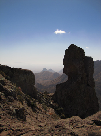
And here we are - the "summit"! The trail had led us out over a bald saddle to a promontory on the ridge which gave us a commanding view in all directions.
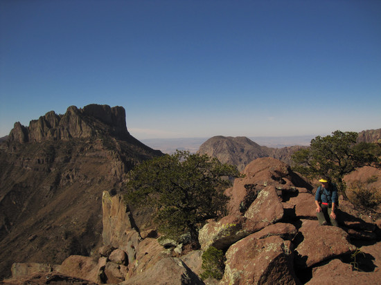
We soaked up the views along with the sunshine.
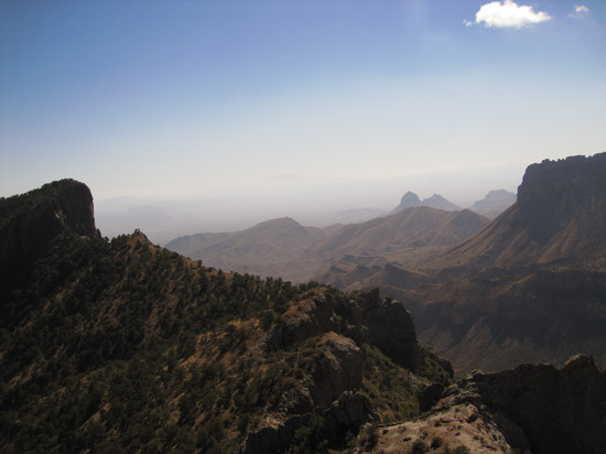
Looking south towards Mexico it seemed the mountains never stopped.
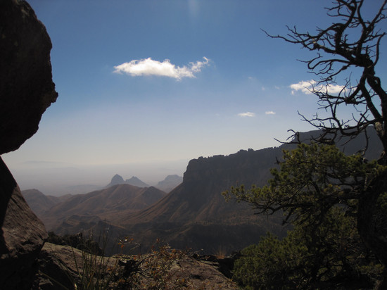
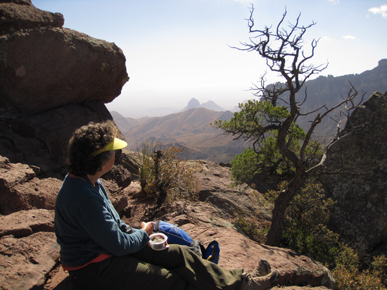
Our lunch spot.
We relaxed and enjoyed the silent view and then started our way back down the mountain.
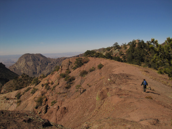
Here, Betsy crosses the bald saddle which had led us to our lunch spot.
I had a had time believing what I was seeing as this looked to me like a scene from some outdoor adventure show.
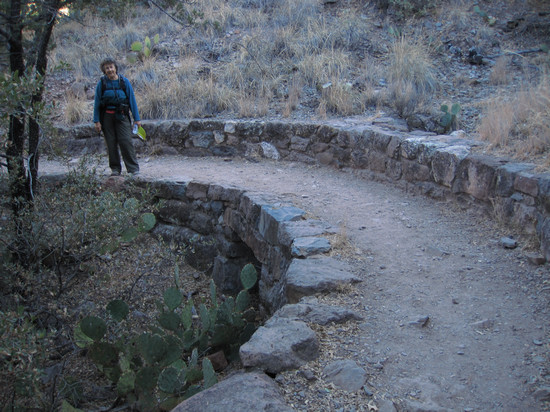
On the way back down I took this shot of some of the CCC handy work. This trail really made me appreciate the time and effort which had been taken to make this one of the best hikes we have ever been on.
Next installment: Day 2 Part 2: Big Bend - A quick look around Boquillas Canyon.
'Till then... Adios!
~ Mike and Betsy

