Mike Breiding's Epic Road Trips ~2018~
California Road Trip
Morgan Hill to San Francisco
Mom and I hike the Coastal Trail in San Francisco
Sunday - October 7th: Mom and I hike the Coastal Trail in San Francisco
After a fitful night of on and off sleep I rose at 5:00, got my coffee and tried to relax and think about the day ahead of me. This would be the day when mom and I arrived in San Francisco for our final walkabouts.
I had pretty much packed up the night before so there was little to do in that department. I heard Steve stirring upstairs and took that opportunity to put a few things in the car. By that time Steve had his coffee and was already doing some laptop chores.
It was time to go. Steve and I said our final farewell and then it was off to Betsy's Restaurant as planned.
I arrived before opening at 6:00so I used that time to re organize the DaddyMobile and to make handy the maps I would need for the day. Maps. Maps?! Where are my California and Tucson state maps?! Aaaargh!!! Before I had even asked myself that question I knew where they were - back at Steve's on the table where I set up my laptop. Ok. Time to do an about face.
I hustled back to Steve's forcing myself to go the speed limit. Prior to leaving the restaurant parking lot I texted Steve to let him know I was on my way back and why. When I got there I still had no reply. I sent another text. Nothing. Finally I did the old fashioned thing and called. Fortunately he picked up. I told him I was outside and why. Soon I had the maps in hand and was on my way back to Betsy's. BTW - the reason Steve had not texted back? He had put his phone on "silent" so he could watch a movie in peace. Guess I spoiled that plan!
I had checked with Steve prior to arriving for a place which might be open early on Sunday. I was glad to hear Betsy's opened at 6am so I could get an early start on the drive to The City.

My breakfast. Fuel for the Coastal walk we would be enjoying in less than two hours. The sausage is linguica. I ordered it because I had never heard of it before. It was sorta like chorizo. A bit on the greasy side but flavorful with a bit of spiciness. Tasty. And, the serving was big enough I was able to use half of it and my rye bread toast to make a walking lunch.
Linguiça is a form of smoke cured pork sausage seasoned with garlic and paprika in Portuguese-speaking countries.
Linguiça, like many other sausages, is generally served as part of a heavy meal, typically accompanied by rice, beans, and other pork products. Feijoada, for example, is a traditional Portuguese dish, also common in Brazil and Angola, that incorporates linguiça with beans, ham hocks, and other foods.
In Brazil, one variant is specially popular, the linguiça calabresa or simply calabresa, prepared originally with Calabrese pepper (nowadays with South American pepper) by Italian immigrants and particularly used in pizzas as a spicy sausage. Its popularity compares with pepperoni in the United States. Thus it's common to differentiate the linguiça calabresa from its counterpart linguiça portuguesa, prepared from the original Portuguese recipe and also served in pizzas as mild sausage, generally with egg slices.
Source: WikiPedia
I departed Betsy's Restaurant at about 6:45 and hit the road. The route was pretty straight forward.
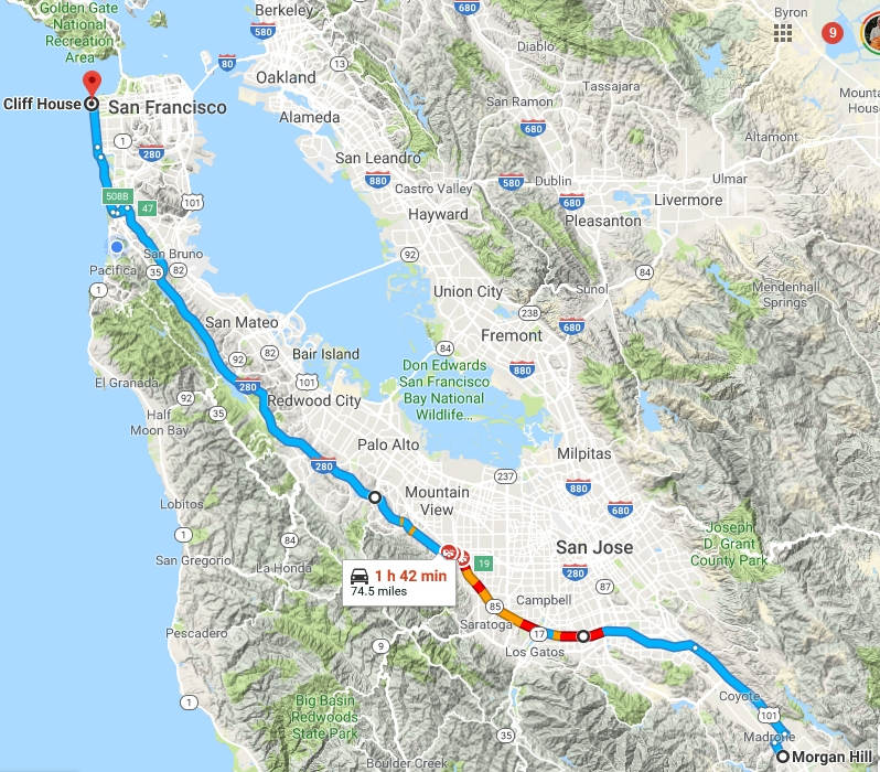
The screen shot above was captured at 8:30 in the morning on a weekday. Thus the red sections showing slow traffic. I was driving the route at 7am on a Sunday morning and thankfully the roads were nearly empty.
As we neared our destination we passed by the San Francisco Zoo. Here is my first memory of that place.
Mom had moved us out of the Tenderloin and into an apartment house at 2466 California Street between Steiner and Fillmore Streets. When I say "us" I mean brothers Bill, Wayne, Sutton and myself. My sister Susan was able to find a job and had rented a studio apartment around the corner on Steiner Street. My sister Joan was still in Morgantown at that time and would arrive later in San Francisco with her boyfriend Julian Martin.
We had help moving into the place (cleaning, donated furniture, etc) by one Grace Reike (sp?). She was a friend of my mom's oldest sister Mildred who we had visited in Tucson on the way out.
One day Grace called my mom and asked her if we would like to go to the Zoo. My mom said "yes" and soon we were all piling into Graces' car.
When we arrived we all got out. All except Grace who told us to have fun and enjoy the day. This was a surprise to my mom because she and all of us had assumed Grace would be showing us around the Zoo.
We all watched as Grace drove off up the Great Highway and disappeared. It was then we all found out neither my mom or any of us had one cent in our pockets. No money to get into the zoo and no money for bus fair. Now instead of a fun time at the Zoo we all got to walk the 8 miles back to 2466 California. I remember we were all a bit crancky at this point and walked back in silence.
Click on the photos below for a larger image.

We made it! It was just about 8 o'clock. It was cool and breezy and pretty quiet at Ocean Beach. But, already the parking spots were filling up and it would not be long before people would be waiting to get one.
Shown here is Seal Rocks and up on Point Lobos bluff is the Camera Obscura.

The waves were really crashing and the sky was clear and sharp.
Here is a rather shaky video of the wave action.

I am not a fan of salt water but I had to at least "tip my toes" into the Pacific.


My shadowy selfie.

It was hard to stop snappin'.

The Camera Obscura is a large-scale camera obscura, in the Lands End area of the Outer Richmond District in western San Francisco, California.
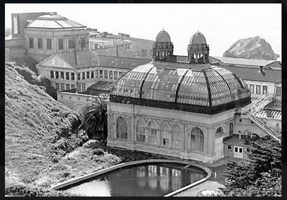
Cameras obscura, devices which project an image of the surroundings onto a surface using only existing exterior light sources, usually sunlight, have a long history in San Francisco. The first recorded reference to one in the city is from the 1860s in an attraction called Woodward's Gardens. A previous incarnation of the Cliff House was noted to have had a camera obscura on its fourth floor in 1896. This camera obscura was destroyed when the restaurant burned down in 1907.
Source: WikiPedia

A look down Ocean Beach. Right now it is still pretty quiet.

Gorgeous!

Seal rocks as seen from up on the bluff.

This is all that remains of the once lavish Sutro Baths.
The Sutro Baths was a large, privately owned public saltwater swimming pool complex in the Lands End area of the Outer Richmond District in western San Francisco, California.
Built in 1896, it is located near the Cliff House, Seal Rocks, and Sutro Heights Park. The facility burned down in June 1966 and is now in ruins. The site is within the Golden Gate National Recreation Area and the Sutro Historic District.
On March 14, 1896, the Sutro Baths were opened to the public as the world's largest indoor swimming pool establishment. The baths were built on the western side of San Francisco by wealthy entrepreneur and former mayor of San Francisco (1894–1896) Adolph Sutro.
Source: WikiPedia

No shit. One mis step along this trail and you would most likely never been seen again.

Another look at the Sutro Bath ruins.

Yes. I know. Still more pictures of Seal Rocks!!


Hmmm... dare I?

I did dare to and a young gal who was out on the edge already snappin' snapped this one of me.

Every step revealed another gorgeous view of the coastline.

Everyone was enjoying the lovely weather and fabulous views.

In addition to some fairly flat sections the Coastal trail has a lot of up and down steps.

Still more nice scenery.

Back in the late 1960s when we came out here there were no official trails. Just tracks running all over the place. As you can imagine this caused some damage over the years. And although a few people still go off trail there is little need to now.

Eagle's point is where I will leave the natural section of the trail and pick up Camino del Mar and Sea Cliff streets to the 25th Avenue gate which is the access point for Baker Beach.

My first good view of the Golden Gate bridge. Always a delight...

Here you can read about what the trail used to be. It is hard to imagine and visualize such a thing.
It was at about this point I looked up from the trail and saw my mom and another woman walking towards me. What a shock! Then I was brought back to reality as they approached. The two passed by and I took a chance. I turned around and asked the women if I could speak to her for a moment. I asked her if I could get my picture taken with her and explained why. She agreed.

And here is the woman who was not my mom. I explained how I was on a memorial walk with my mom and was going to leave a little bit her throughout "the city of her dreams". They wished me well and then we went our separate ways.

Here is a shaky look of another spot I left my mom. Off the precipice and down into the crashing surf below.

There are some nice peeks through the big old Monterey cypress trees which forest the bluffs.

Here is a distant look at China and Baker beaches.

In this spot once stood a large wooden viewing platform. I had been on it a number of times to take it the view. It had grown shabby and was starting to need repairs so it was removed and the area was re vegetated with native plants. It was replaced with a half circle concrete platform with a low sitting wall and benches.

In the lower left you can see our starting point and upper right is Eagles Nest.

The upper section is clipped and it shows the trail going to the Golden Gate Bridge.

This is one of the many big houses on Camino del Mar and Sea Cliff streets. They are valued at many millions of dollars. Many have unobstructed views of the bridge and the Marin Headlands.

Here we are at Baker Beach, a very popular spot which has a fair sized parking lot and is served by the MUNI 29 Sunset bus.

Lunch time! I sat and took in the view slowly munching on my linguica on rye sandwich.

After lunch I took a stroll down Baker Beach to the next section of Coastal Trail.

It was still a little chilly for bikinis. Dang it!!

Here is the gun emplacement or "battery" at Baker Beach.
Battery Chamberlin holds the last 6-inch "disappearing gun" of its type on the west coast. Built near Baker Beach in 1904, Battery Chamberlin was constructed to accommodate the lighter, stronger, more powerful coastal defense artillery developed in the late nineteenth century.
In 1977, the National Park Service received the 6-inch gun and disappearing carriage from the Smithsonian Institution and installed them in gun emplacement No. 4. Today, visitors can attend demonstrations and the underground cartridge room, which contains photos and small exhibits on the coastal defenses of San Francisco.
Source: NPS

Soon we will be at The Bridge.

Gorgeous Baker Beach as seen from the bluffs along the Batteries to Bluffs Trail.

Yet another battery. That is a lot of concrete.

And still another shot of Baker Beach. On the return trip there would be quite a few more people there.

At this point all the elevation gained would be lost and then gained again in about a 1/4 of a mile. Many steps!

Stunning, no?

The bay and the Gate area were full of sail boats.

We are getting close to The Bridge now and soon the crowds would thicken.

The Bridge was taking a lot of traffic on this busy holiday weekend.

I had not been to the bridge area in a while and always avoided weekends when I was here so the number of people I saw was a bit of a shock to me.


I had not been on the bridge proper in many years so I decided to take a stroll. This shows a new section of recently installed fencing. It was put up to try to discourage jumpers.

A look at down town from the Golden Gate Bridge.

Alcatraz Island is on the left.

A closer look at downtown. The San Francisco–Oakland Bay Bridge can be seen far left.

It was busy and noisy and by now I could not wait
to get back to the Coastal Trail for the return trip.

One last snap and I was outta there!

This display explains some of what happens for the seismic retrofit of south end of the Golden Gate Bridge.

Time to start the walk back to Ocean Beach.

Yes indeed. If it were not for this when one looked at the Marin Headlands there would be thousands of houses instead of the natural landscape which was left relatively undisturbed.

As I approached Baker Beach I spotted the two young women dancing on top of the battery. They were really going at it! When I passed by then I told them I had enjoyed the show. One of the gals said they were practicing their Zumba dancing. Ah, to be young again...

Someone offered to snap a picture of me and this is the result.

Baker Beach is now getting busy.

Hopeful for a hand-out these Ravens were sitting waiting patiently.

A big change from this morning.

Now it is starting to look like a homeless encampment.

My last view of Baker Beach before I hit the streets.

And then mom and I were back at Ocean Beach.
That was a long walk! 11 to 12 miles depending on which GPS devise you believe. You can see our route map here.

Here is the elevation profile as generated by Google Earth.
When I got back to the car it was 2:30. Mom and I had started the hike at 8:00. I good days walk. Now I popped the trunk, grabbed a cold one and sat on the beach for a bit. I admit it: I was exhausted, both physically and mentally.
After a while I got in the car and pointed it south. Time to find my digs for the night. For the next three nights actually.
Tomorrow mom and I will walk around the old neighbor hood. We hope you will join us.
Until then...
~Mike and Mom
![]()
![]()