PLAYA, PINACATE BIOSPHERE RESERVE
A playa is a temporary lake, where water accumulates
after rains but then evaporates during the hotter times
of year, causing the soil to become increasingly salty as
the dissolved minerals accumulate, so that eventually no
plants grow in that area. This image shows a playa
(light-coloured circular area) in the middle distance.
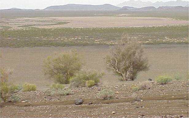
View from the rim of the cone, Cerro Colorado. Rocks and
other large particles thrown from volcanic eruptions are
seen on the steep slope of the cone colonised by shrubs
and trees in the foreground. The land then flattens out
into a brown coloured area of very fine soil apparently
devoid of plants (but see the images below), before
another vegetated zone is seen stretching back to the
distant mountains. Within that vegetated zone is a large
light-coloured playa.
The brown-coloured area below the cone consists of
cinders and gravel overlying sand, with a slope of a few
degrees, causing water to run off this area into the
playa. Although apparently devoid of plants, its surface
was covered with two low-growing species that typically
grow in dry, sandy areas - trailing four o' clock (Allionia)
and cranesbill (Erodium), shown in the images
below.
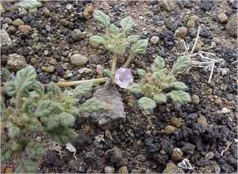
Trailing four o' clock
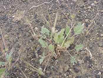
Cranesbill (click image for details)
GO TO:
Pinacate Thumbnail
images?
Pinacate Volcanic
Field: space radar image?
El Elegante crater?
Elegante crater rim?
"Bombs and cinders"?
Colorado crater?
Lava fields?
Pinacate desert floor?
Pinacate campsite?
Pinacate plants?
Lava plants?
Pinacate desert wash?
|