Sunday, October 4th
After my "late" night with Steve I decided to sleep in - sorta. I woke at 4am and felt ready to get up, but I resisted. Instead I dozed on and off until about 7:30 and finally got up. Now, I had to get cracking if I was to meet up with a Public Library sponsored tour which started at 10:00 over in the Haight. This tour was be of the Woodlands of Mt Sutro which are behind the U of CA Hospital. I got out the door just before 9:00 and headed to the bus stop. I know sooner got there when the bus rolled in and once again I was...
Click on the photos below for a larger image.
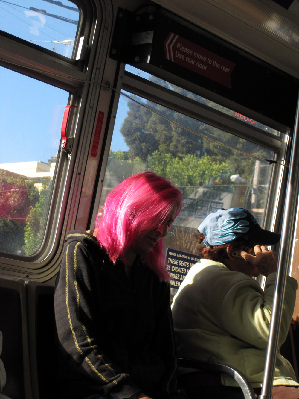
...ridin' the 22.
I rode the 22 up to Church and Dubose and then caught the N Judah outbound. I shared the wait with some shabby looking' 20 somethings who were getting their breakfast out of brown bagged tall boys.
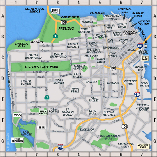
Poor planning caused me to miss my stop at around Stanyan Street so I ended up getting off at the U of CA Hospital stop and then walking back the 5 blocks or so. After a little bit of walking around I was at the corner of Stanyan and Frederick where our tour was to meet. I was a bit early - and hungry.
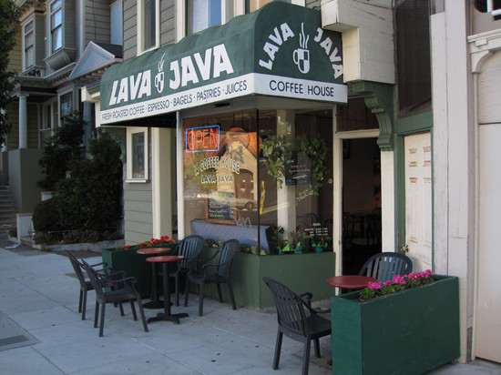
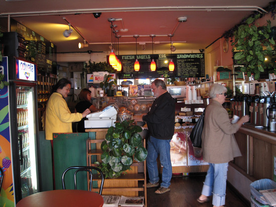
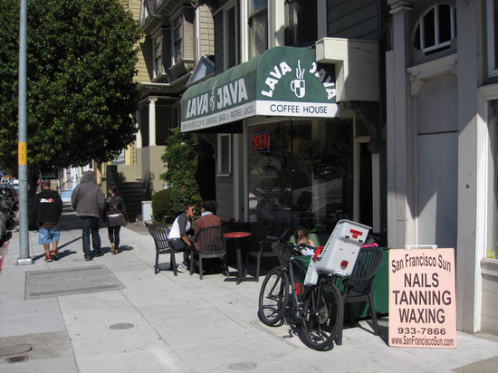
I decided to see if the Lava Java (852 Stanyan Street - between Beulah St & Frederick St) had anything to eat. Luckily they had a selection of sandwiches and I ordered the Ham and swiss with spicy ranch dressing ($5.75). It came on a fresh, crusty roll with cukes, tomatoes, lettuce and red onions. I ate half and saved the rest for later.

This menu was cropped out from the photo below.
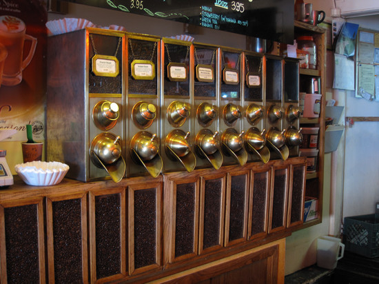
That's a lot of coffee beans!
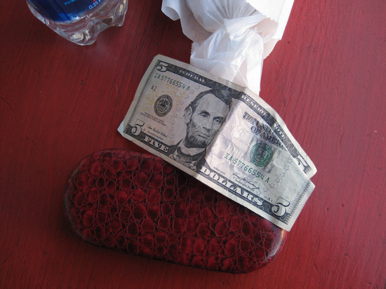
Found object. When I walked out of Lava Java I saw this laying under one of the chairs and snagged it. It would put it to good use later.

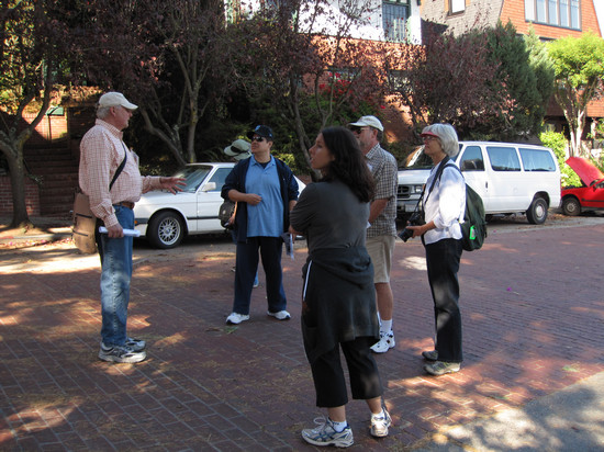
This is where we were to meet our tour guide Greg Pabst, a historian who has lived in San Fran since 1967.
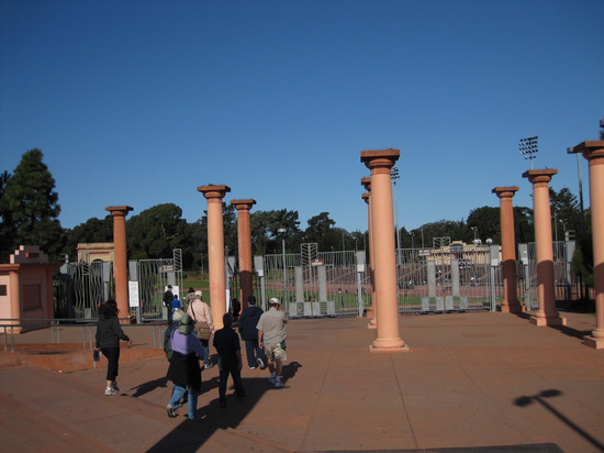
There were 7 of us on the tour, including me. Our first stop was Kezar Stadium which is at the southeast corner of Golden Gate Park. Greg gave us a little history of the place: built in the 30s, razed in the 70s and then reconstructed. The only thing left which is original is the field.

Kezar Stadium in 1930. Kezar Pavilion is at the top center of this photograph.
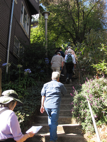
We then walked up Willard Street to the Farnsworth Stairs. They are considered a street right of way so the houses have actual street addresses.
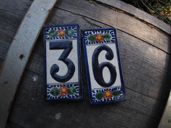
These address tiles were on an old barrel next to the steps.
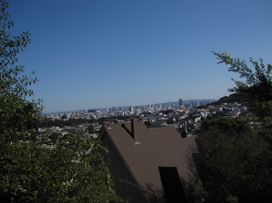
This view from the steps looks towards downtown and the Financial District. The Trans America pyramid can be seen right of center.
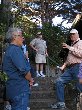
Greg had a wealth of information to share. He has been with San Francisco City Guides for 21 years. City Guides is a non profit group which has been providing free, guided walks for 31 years. Tours are offered 7 days a week, year round.
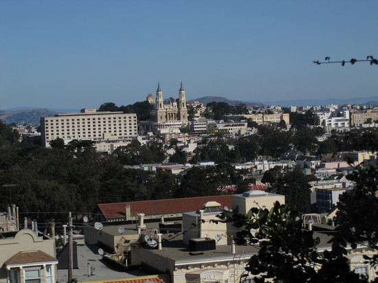
This is a good view of the U of SF main campus near Fulton and Masonic Streets.
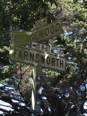
This street sign is at the top of the steps. Notice the greenish tinge which is probably algae. It is dry and sunny on this day, but I am sure there are many days and weeks this hilltop is enshrouded in fog.
I was quite surprised to see this brick street. And it is no accident it is still there. Greg told us after WWII the city wanted to remove the bricks and pave the street. The residents wanted to keep the bricks. So, they offered to take over ownership of the street and maintain it in perpetuity. The city agreed to the terms.
Apparently several well known artist and writers have lived her over the years, some still do. If you would like to know who you will have to contact Greg.
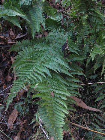
We continued on up the street to the upper Service Road and then took a foot path to the Mount Sutro Open Space Reserve and into a grove of huge Eucalyptus trees. It was here I saw several plants of this Dryopteris fern. We then went by what is called Ishi's cave, through the Fairy's Gate and then back out on the roadway.

This is the Chancellor's house. Nice crib. And the view must be fantastic.
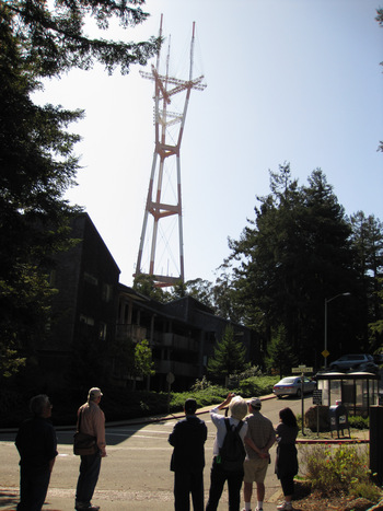
We are now getting close to the top of Mt Sutro, elevation 805' and the so called Sutro Tower. To me, this tower is just as much a San Francisco landmark as the Golden Gate Bridge. It it a multi purpose communications tower which is 977 feet tall. It was preceded by a much shorter tower which was originally built in the early 50s and owned by ABC. One can only get a grasp of the enormity of the tower - it's structural members and it's height, by actually standing at the base of the tower as we did.
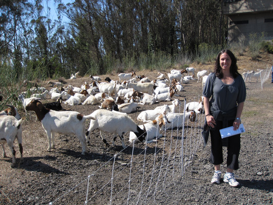
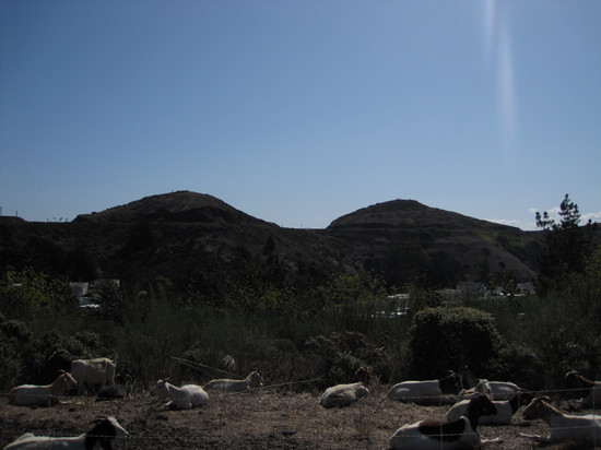
There are efforts in many places to eradicate invasive, non-native plants. Here on Mt Sutro they are being controlled by a herd of goats which are moved from place to place. Once eradicated, restoration will take place using native plants.
The are also plans to to remove 90% of trees under 12 inches in diameter and selectively remove larger trees �only to maintain a sparse canopy of dominant trees�.
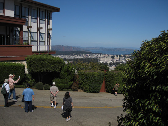
The lovely breasts shown here are known as Twin Peaks. Apparent from this perspective is the roadway which climbs to the top to provide access to several observation areas. As one might expect, all of San Francisco's high points offer breath taking views. Sounds corny, but it's true.
We started our meander down off the Mountain, all the while Greg kept our attention with a steady steam of facts, figures and stories about all we could see before us.
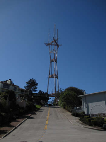
Many people hate this tower and see it as a blot on the landscape. But, anyone who watches TV, or listens to the radio, or uses a cell phone, had a hand in building it.
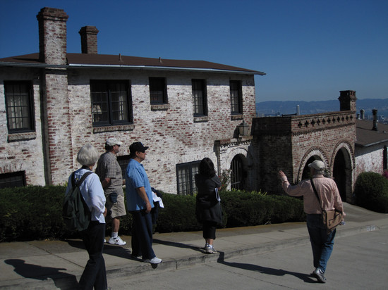
As I recall this place was built by a U of CA art Prof with used bricks. It is quite a stand out.
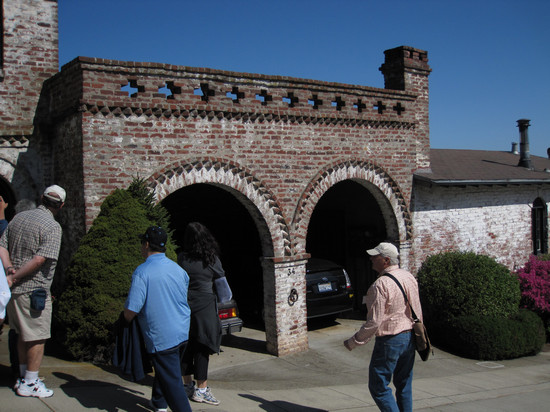
Pretty classy garage.
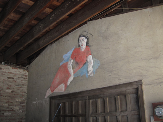
This painting is on the inside of the garage.
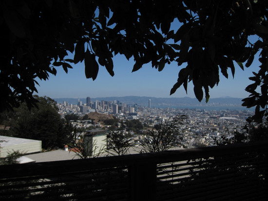
Yet another view of the downtown area. Not sure if the fuzziness in this picture was me or the bit of haze which was in the air.

As we dropped in elevation we came to what is called " Tank Hill". Formerly, there was a water tank here. When the reservoir atop Mt Sutro was built it made the tank obsolete and it was removed.
This site is on most of the better maps and is usually marked simply with " Tank Hill (UNDEV.)". It can be accessed from the top of Shrader Street from below or Clarendon from above.
To the left and off in the distance, is Bolinas Point which is just north of Stinson Beach on US Highway 1, the Coast Highway.
Shortly after this the tour ended and we all went our separate ways. But prior to our parting Greg made the obligatory call for donations. I gladly donated the found fiver and I was on my way.
I headed back down the hill for a cup of coffee and basked in the warm sun while polishing off the rest of my sandwich. With my batteries now recharged I headed down Stanyan to Haight and then up Haight to Cole Street.
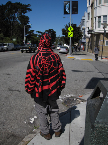
OMG!!! It's Spidey! Well, not quite. Just another member of The Legion of the Homeless.
Wandering up Haight Street brought back memories of my ill spent youth. Although it doesn't look quite the same now as it did back in the 60s.
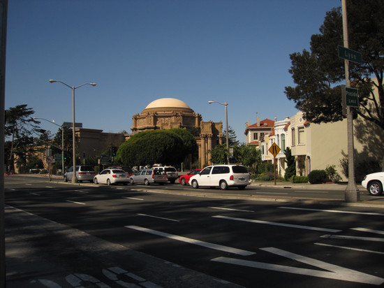
At Cole street I boarded the 43 Masonic bus and was soon heading north to, and then through the Presidio. I got off at the bottom of the hill somewhere around Lombard and Lyon Streets. I crossed over and was soon at the Palace of Fine Arts.
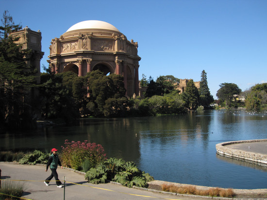
Built in 1915 for the Panama-Pacific International Exposition it now houses the Exploratorium, a hands on science playground.
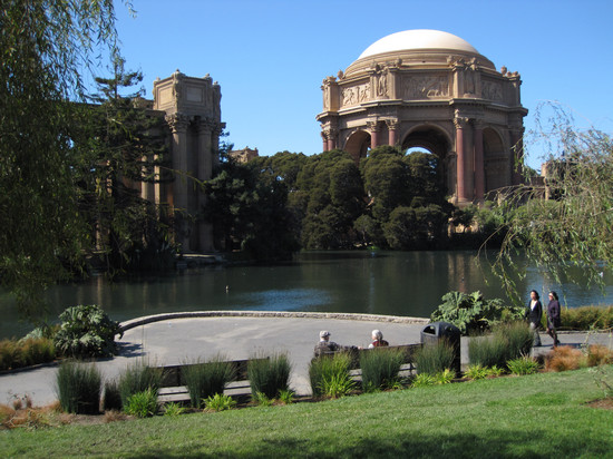
This spot is popular with tourist and San Franciscans alike.
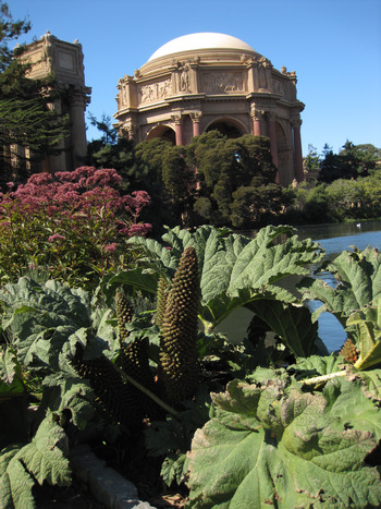
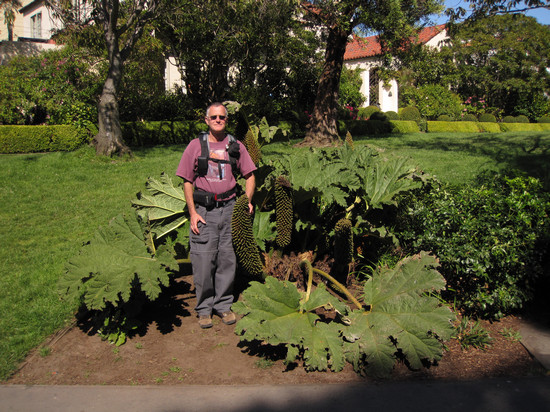
I used to know the name of this plant, but try as I might, I cannot remember it.
NOTE: Friend Jim of Virginia asked "was it Gunnera?"
Yes! Thanks!
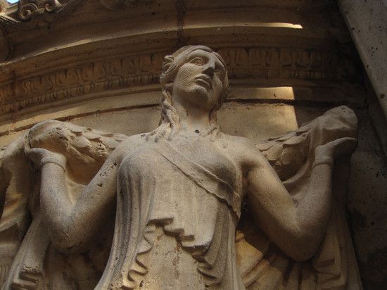
The stone embellishments are quite beautiful and I never tire of looking at them.


This shot is from an informational signs about the ongoing restoration of the Palace. Compare this one to the one above.
There's that plant again. Since I cannot remember the proper name we can just refer to it as "The Excited Man Plant."
See
above.
As I headed back up towards Lombard Street I took this parting shot. Fabulous building!
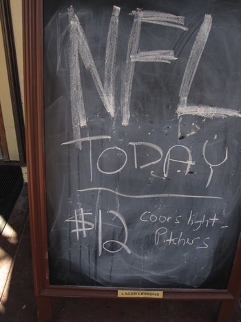
Wow - what a deal...
This was the bar right next to the bus stop. It wasn't long after I took this shot I was once again...

...Ridin' the 22.
I got back to the apartment around 3:30. I had left at 9:00 so that made for a pretty full day. I spent the rest of the afternoon and early evening doing web work and then walked up to Goat Hill Pizza for some take out. Good old spaghetti and meatball(s).