20/21 July 2015
As some of you may remember we are now officially Arizona Snow Birds. This all started 5 years ago when trying to decide how to get away from month after month of dismal winter weather that the Ohio Valley is well known for.
But, where to go? Making a wish list helped:
Sunshine
No Snow
Sunshine
Hiking
Sunshine
Biking
Sunshine
Some might think Florida would fulfill this wish list. Ha! It has been known to snow in Gainesville and the winter weather can be cool and wet if the storms from up north push south. If you want predictably warm winters in Florida you had better head south towards Miami or Venice. But then you are in the land of high prices. And hiking? Very little compared to the size of the state. And it is mostly flat. And you have to drive and drive. No thanks.
Now, if you like to spend time on a boat fishing, or golfing, or lounging around the pool or on the beach, Florida might be for you. But not for us. We will be happy with occasional trips to the beach at other times.
With our wish list in mind there seemed only one place for us to spend the winter - Arizona. And last winter was our 4th stay there. The first 3 years were in Green Valley. We found the constant Interstate noise not to our liking and were always running up to Tucson for hikes and shopping.
When it came time to think about winter number 4 we decided to look for a place in the Tucson area. But where? This decision making was helped along after talking to Stephen who I met hiking in the Tucson Mountains. He could not say enough good things about where he and his wife spent their winters - Tucson Estates (TE).
Betsy and I checked it out and liked what we saw and were lucky enough to find a beautiful place to rent. The front porch had a killer mountain view and we could walk to a trail head which led to many miles of wonderful hiking. And TE had two swimming pools, and Tucson's largest hot tub. Party on, Garth!
Another bonus? There was a couple from PA living a few doors up. That would be Lil and Lou. We lucked out meeting them so early on. Lil made sure we got in the pipe line for TE dinners and Lou was always on hand to answer questions about this or that, especially if they involved anything related to house construction and maintenance. In other words, more friendly and helpful neighbors would be hard to come by.
And Lil and Lou were responsible for getting us out to Fred's Arena Bar & Steakhouse for dinner. Considering we are such stay at home stick-in-the muds this was a real change in direction for us. Fred's was great fun and you can see the pics here.
This is getting long winded so I will try to wrap this rather bloated prologue up. The upshot is Lil and Lou invited us to visit them at their place in PA when we got back home. We did. And we are glad of it.
Lil and Lou live in what is call the Ridge and Valley region of Pennsylvania where the mountains are characterized by long, even ridges, with long, continuous valleys in between. If you look at a satellite image or a terrain model the land forms are quite striking.
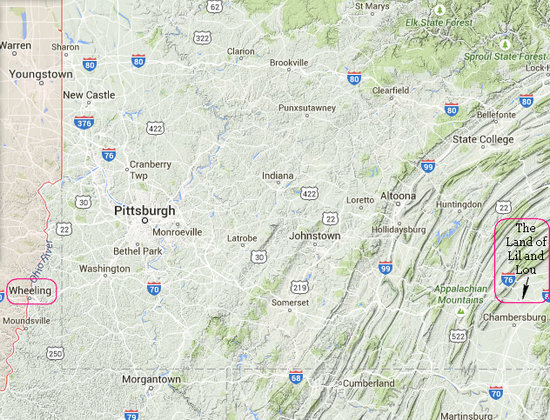
The Ridge & Valley of Pennsylvania shows up nicely on this GoogleMaps terrain map. Very different from the terrain around Wheeling!
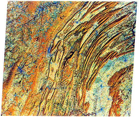
This is a 1976 LANDSAT image of the Ridge & Valley of Pennsylvania. Pretty cool.
I was fortunate to see many images like the one above way back in 1976 when I purchased a copy of "Mission to Earth: Landsat Views the World (NASA SP-360)". This amazing book was a spell binder back in the day and nothing like it had ever been seen before.
We arrived at Lil and Lou's mountain side home about 3:30. After getting settled in and doing a little catching up it was off to the Shippensburg Fair where we would do a walkabout and have some locally made victuals for dinner.
Click on the photos below for a larger image.

A gorgeous summer evening it was, but man oh man, was it warm and sultry. Whew!

Here is out dinner locale. The local Church of the Brethren is well know for their "Big Boy" Steak sandwiches. Lou and I got in line to order and Lil and Betsy went off to snag us a place to sit under the big tent. (Shade!!)

It was all asses and elbows in the cook tent and we soon had our dinners in hand.

Mmmm... tasty!

I don't know if it's safe the say the local economy is mainly fuelled by agriculture but there are sure alot of farms in these lovely valleys. And farms usually mean livestock.

There were all manner of farm critters to been seen and admired.

"You lookin' at me??!!"

I'll bet Liam would dig this pig!

It was stifling hot under the shed roofs and this feller was mistin' his porker.

Ahhhh... such a blue eyed beauty.

As many different patterns and colors as one would see with kitty-cats.

"Lemme out! Please...?"

Bye, bye my bovine buddy.

What better way to try to cool off than a bit of ice cream? It was tasty but it didn't make it seem any cooler.
We had not been to a country fair in a long time. Thanks Lil and Lou!
The next day we went on a driving tour of the beautiful country side. It was here we got a really up close and personal look at all the ridges and all the valleys. We went to Cowans Gap State Park and walked around the lake. Lil had fixed a picnic lunch which we had lakeside under a shady tree. Very nice.

Our buddies, Lil and Lou. Seeya when we get back to Tucson!
When we departed the ridge and valley we headed north east to Canoe Creek State Park. Here we took a nice 4 mile hike in the woods and then headed to the beach at the lake to cool off. This park is well know for the historic Blair Limestone Kiln remnants which we got to see. There are photos of the preserved ones here. We also saw some kiln ruins out in the middle of the woods while on our hike.
We then drove east to Ebensburg where we had booked a hotel. But it turned out not to be to our liking and we ended up staying at the Red Carpet Inn on the far side of town. Why were we staying in Ebensburg? It is now the eastern terminus of the Ghost Town Rail-Trail. Betsy and I last visited the Ghost Town Rail-Trail in 2004. Since then they have added 20 miles. The western terminus is now on the outskirts of Blacklick. As of this writing the total length is 36 miles which includes the 4 mile Rexis Branch spur.
The trail is named for the numerous towns that were served by the Ebensburg & Blacklick Railroad, as well as the Cambria & Indiana Railroad. It winds through scenic Blacklick Creek watershed, from Ebensburg to Grafton, passing historical artifacts and offering opportunities to see a variety of wildlife. The trail, originally established in 1991, is a designated National Recreation Trail
Source: traillink.com
The Ghost Town Rail-Trail goes through the towns and former towns of Beula, Nanty Glo, Vintondale, Wehrum, Dilltown and finally Blacklick. These were formerly coal mining boom towns. Not anymore. As is typical with this kind of boom and bust economy all that is left now is abandoned infrastructure, despoiled land and polluted water.

Here is a snapshot of some of the Rail-Trails in the area. Click the map to see more.
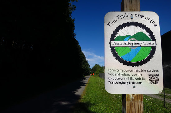
This sign is just to the west of the trail head parking area in Ebensburg.
Here in the heart of Pennsylvania’s Allegheny Mountains, the Trans Allegheny Trails are a system of rail-trails.
- 6 to 10 Trail
- Apollo's Kiski Riverfront Trail
- Bells Gap Trail
- Blairsville Riverfront Trail
- Ghost Town Trail
- Hoodlebug Trail
- Jim Mayer Riverswalk
- Lower Trail
- Path of the Flood
- Roaring Run Trail
- Staple Bend Tunnel Trail
- West Penn Trail
- Westmoreland Heritage Trail
Source: TransAlleghenyTrails.com
As you can see from the list above there is a lot of car free cycling to enjoy in a relatively small area of west central Pennsylvania.

The Ghost Town Rail-Trail has every mile marked.
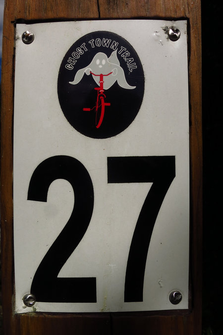
Casper's cousin perhaps?
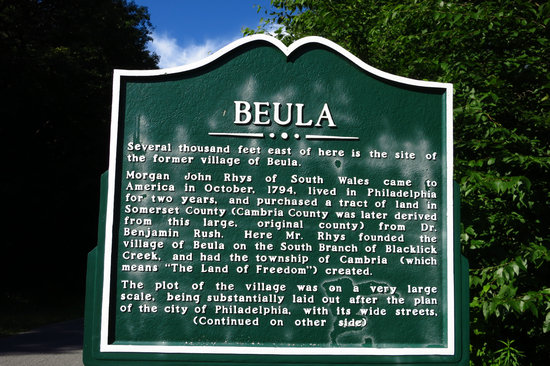
Now we are starting to see first hand the reason for this Rail-Trail's name.
Several thousand feet east of here is the site of the former village of Beula.
Morgan John Rhys of South Wales came to America in October, 1794, lived in Philadelphia for two years, and purchased a tract of land in Somerset County (Cambria Courty was later derived from this large, original county) from Dr. Benjamin Rush. Here Mr. Rhys founded the village of Beula on the South Branch of Blacklick Creek, and had the township of Cambria (which means "The Land of Freedom") created.
The plot of the village was on a very large scale, being substantially laid out after the plan of the city of Philadelphia, with its wide streets, squares, cross steets and alleys. Reverend Rhys desired to make Beula the new county seat and sixty log houses were constructed in the business center of the embryonic town, which later contained hotels, stores, along with a church, mill, school and library.
The selection of the nearby town of Ebensburg as the county seat in 1805 was an important factor in the decline of the village of Beula. Rocky ground and the fact that no major roads passed through Beula also contributed to its demise. A few old tombstones and foundations are all that remain of the pioneer settlement today.
Thanks!! to my ever lovin' wife for transcribing all the trail signage.
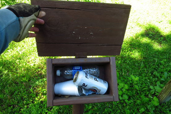
Just on the east side of Nanty Glow I opened this box looking for maps. Guess they need a refuse can here.
Just beyond this point was one of the new (to me) signs and map boxes that did have maps in them.
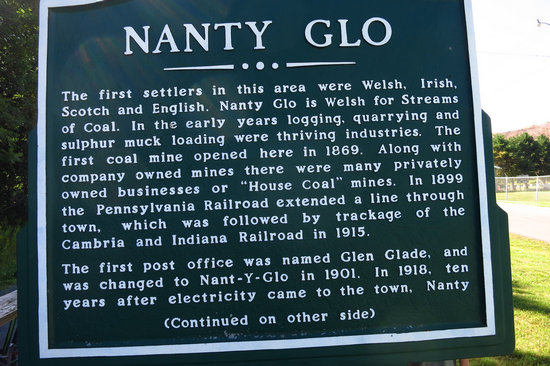
The first settlers in this area were Welsh, Irish, Scotch and English. Nanty Glo is Welsh for Streams of Coal. In the early years logging, quarrying and sulphur muck loading were thriving industries. The first coal mine opened here in 1869. Along with company owned mines there were many privately owned businesses or "House Coal" mines. In 1899 the Pennsylvania Railroad extended a line through town, which was followed by trackage of the Cambria and Indiana Railroad in 1915.
The first post office was named Glen Glade, and was changed to Nant-y-Glo in 1901. In 1918, ten years after electricity came to the town, Nanty Glo was incorporated as a Cambria County Borough. Education evolved from a one room school house to the four year high school program still in operation as the Blacklick Valley School System.
In March 2005 twenty years of effort to begin cleanup of acid mine drainage from the Webster Mine into the South Branch of the Blacklick Creek culminated with the installation of a large ecosystem restoration system. Reclamation of the waste coal or "boney piles" along the creek is also underway. This project will eliminate dangerous contaminants leaching into the stream.
I had not run into the term "boney piles" before and did a quick web search. As usual WikiPedia came to the rescue.
A spoil tip (also called a spoil bank, boney pile, gob pile, bing, batch or pit heap) is a pile built of accumulated spoil - the overburden or other waste rock removed during coal and ore mining. These waste materials are typically composed of shale, as well as smaller quantities of carboniferous sandstone and various other residues. Spoil tips are not formed of slag, but in some areas they are referred to as slag heaps.
Source: WikiPedia
Just to the east of Vintondale is a big ugly mess of boney piles and waterways laced with AMD. Some effort has been made to reclaim the area but there is a lot left to do.
There are several interpretive signs along the trail explaining what happened and what is being done to try to fix it.
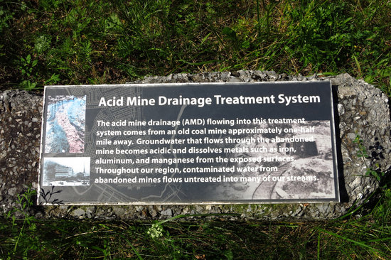
The acid mine drainage (AMD) flowing into this treatment system comes from an old coal mine approximately one half mile away. Groundwater that flows through the abandoned mine becomes acidic and dissolves metals such as iron, aluminum, and manganese from the exposed surfaces. Throughout our region, contaminated water from abandoned mines flows untreated into many of our streams.
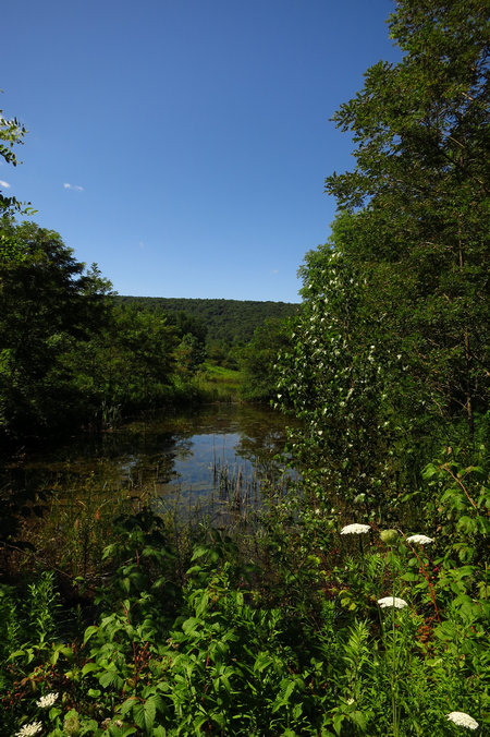
This is one of the ponds that is part of the "treatment system" mentioned above.
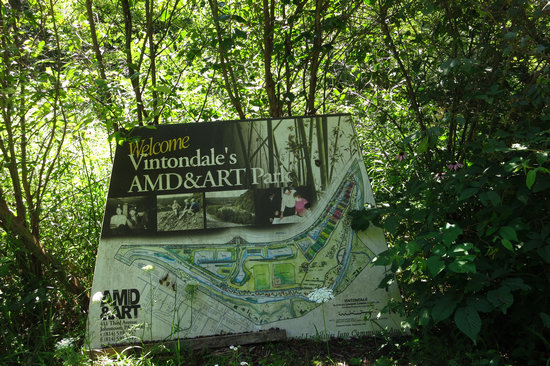
The hopeful vision of a greener future. Read all about it.
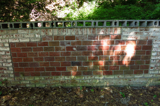
On the outskirts of Vintondale is this memorial to the fallen miners.
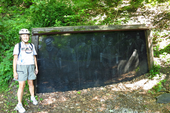
A ghostly view of the fallen.
Vintondale is no longer the wild and wooly town it used to be. All is quiet and peaceful here now.
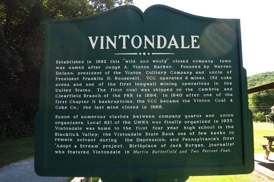
Established in 1892 this "wild and wooly" closed company town was named after Judge A. Vinton Barker. Founded by Warren Delano, president of the Vinton Colliery Company and uncle of President Franklin D. Roosevelt, VCC operated 6 mines, 152 coke ovens and one of the first longwall mining operations in the United States. The first coal was shipped on the Cambria and Clearfield Branch of the PRR in 1894. In 1940 after one of the first Chapter II bankruptcies, the VCC became the Vinton Coal & Coke Co.: the last mine closed in 1968.
Scene of numerous clashes between company guards and union organizers, Local 621 of the UMWA was finally organized in 1935. Vintondale was home to the first four year high school in the Blacklick Valley; the Vintondale State Bank one of the few banks to remain solvent during the Depression; and Pennsylvania's first "Adopt a Stream" project. Birthplace of Jack Burgan, journalist who featured Vintondale in Martin Butterfield and Two Percent Fear.
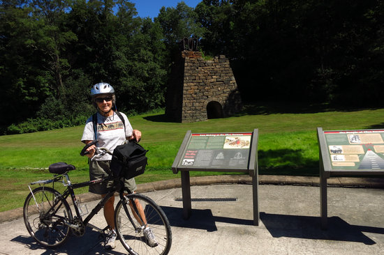
On the western edge of Vintondale stands the remains of the Eliza Furnace.
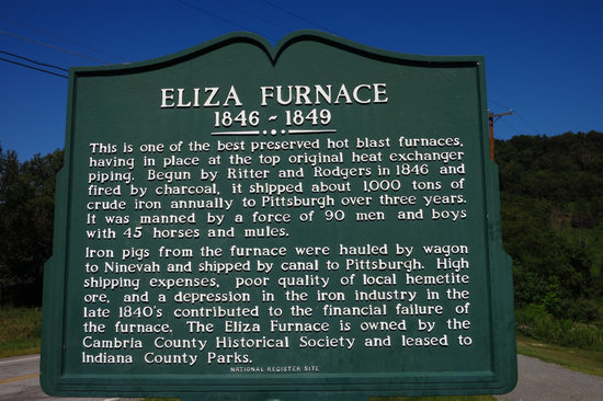
This is one of the best preserved hot blast furnaces, having in place at the top original heat exchanger piping. Begun by Ritter and Rodgers in 1846 and fired by charcoal, it shipped about 1000 tons of crude iron annually to Pittsburgh over three years. It was manned by a force of 90 men and boys with 45 horses and mules.
Iron pigs from the furnace were hauled by wagon to Ninevah and shipped by canal to Pittsburgh. High shipping expenses, poor quality of local hemetite ore, and a depression in the iron industry in the late 1840's contributed to the finanacial failure of the furnace. The Eliza Furnace is owned by the Cambria County Historical Society and leased to Indiana County Parks.
..."manned by a force of 90 men and boys with 45 horses and mules." I cannot image these kind of work conditions. I am sure it was close to slave labor.
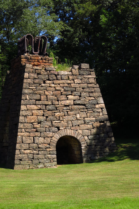
A closer look showing the original heat exchanger piping.
When you leave Vintondale the trail and roadway cross Blacklick Creek.

This is the bridge where SR 3047 (Plank Road) crosses Blacklick Creek. See the white plume?

Here is a closer shot. I am assuming this is mine water resurging from a flooded deep mine. But, it looks like three holes were drilled in the creek bed creating three uniform jets of water. I could find no web info on this which surprised me.
This water was jetting out when we were here in 2004. I wonder how many millions of gallons of water have poured into the creek since then?
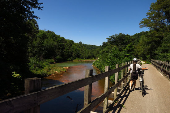
This is the view of Blacklick creek from the Rail-Trail bridge. The orange color tells the tale - AMD.
Bright orange-colored water and stained rocks are usually tell-tale signs of acid mine drainage. The orange color is caused by ferric hydroxide ( Fe(OH)3 ) precipitating out of the water. The precipitate forms as the acid mine drainage becomes neutralized. At low pH values, the metal ions remain soluble. When the pH rises, the iron oxidizes and precipitates out.
Depending on the conditions, the orange-colored precipitates may form inside the mine or several miles downstream. The precipitates can be harmful to aquatic life. The clumps reduce the amount of light that can penetrate the water, affecting photosynthesis and visibility for animal life. Futhermore, when the precipitate settles, it blankets the stream bed, smothering the bottom-dwellers and their food resources.
About 3 miles west of Vintondale is the Ghost Town of Wehrum.

Built in 1901 through the efforts of Judge A. V. Barker and Warren Delano, Wehrum was named for Henry Wehrum general manager of the Lackawanna Iron and Steel Company. Wehrum was a non-union closed company town. The town plan was six streets, sixty feet wide and consisted of 250 houses, a bank, a hotel, company store, post office, school and two churches. Coal mined here was shipped to Buffalo on the Buffalo Rochester and Pittsburgh Railroad.
Wehrum was the scene of several mine explosions. In 1909, twenty-one miners were killed in Lackawanna's No. 4 mine. In 1922, the mine was sold to Bethlehem Mines Corporation. Notices of Wehrum's closing were posted unexpectedly in May, 1929. The houses were sold for lumber and the mine buildings were sold for scrap. Mining supported many families and when mining died so did many mining towns. By 1934 only one house, the school and jail remained. Wehrum had truly become a "Ghost Town".
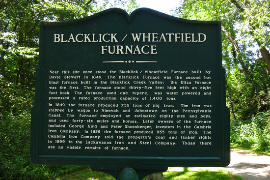
About a mile east of Dilltown, our turn around point, stood yet another furnace. The distance (19 miles) we have now covered on our bikes must have been really bustling during the big steel and coal booms of the turn of the century.
Near this site once stood the Blacklick/Wheatfield Furnace built by David Stewart in 1846. The Blacklick Furnace was the second hot blast furnace built in the Blacklick Creek Valley; the Eliza Furnace was the first. The furnace stood thirty-five feet high with an eight foot bosh. the furnace used one tuyere, was water powered and possessed a rated production capacity of 1,400 tons.
In 1849 the furnace produced 756 tons of pig iron. the iron was shipped by wagon to Ninevah and Johnstown on the Pennsylvania Canal. The furnace employed an estimated eighty men and boys, and used forty-six mules and horses. Later owners of the furnace included George King and Peter Shoenberger, investors in the Cambria Iron Company. In 1856 the furnace produced 955 tons of iron. The Cambria Iron Company sold the property's coal and timber rights in 1899 to the Lackawanna Iron and Steel Company.
Today there are no visible remains of furnace.
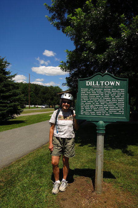
We made it! After 19 miles in the saddle we were ready for a break and a bite to eat.
Streams and abundant springs drew pioneer farmers to this valley. Colonel Matthew Dill came from York County in 1770 and William Bracken established the first grist mill in Indiana County here in 1773. In 1850 the original community of 'Franklin' was renamed in honor of town planner James Dill's family.
Three nearby iron furnaces operated during the middle of the 19th century, utilizing local iron ore, limestone, and charcoal. During the early 1900's, a coal boom swept the area.
The flood of 1977 caused the abandonment of the former Pennsylvania Railroad along Blacklick Creek, which led to the creation of the Ghost Town Trail in 1994.

Now we have the 19 miles back to our starting point to think about and we must regain all the elevation we lost on our ride down to Dilltown. It was a slow ride back and we were mighty glad to see the trailhead at Ebensburg.
Great ride
Great scenery
Great weather and
Great company.
'Till next time...