Mike Breiding's Epic Road Trips: September 2022
California
Visiting Our Favorite Aussie
Out of the Central Valley to the Coast Range and Parkfield and on to Morgan Hill
California and Oregon Road Trip:
A Refresher for Day 1 - Tucson to Buttonwillow
For those of you who might need a refresher for the Day 1 post and for those of you who did not read it, here is your refresher.
On Day 1 of this California and Oregon Road Trip we left Tucson at 5:45 am on Monday, September the 26th. Our destination for the day would be Buttonwillow, California. Along the way we passed through the Mojave Basin and Range.
The high point of the day was 103 degrees at the Boron Rest Area which is about 45 miles west of Barstow and 30 miles east of the town of Mojave.
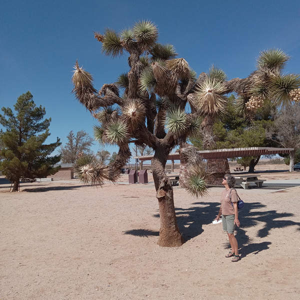
A Joshua Tree at the Boron Rest Area where the temperature was 103 degrees.
26 September 2022
Much closer to the Boron Rest Area than Mojave or Barstow is the U.S. Borax mine.
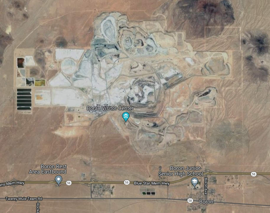
Note the bottom of the satellite image shows the town of Boron, the rest area and the "Twenty Mule Team Road".
For those of you who are the age of Betsy and me (or near it) you may remember the old western "Death Valley Days".
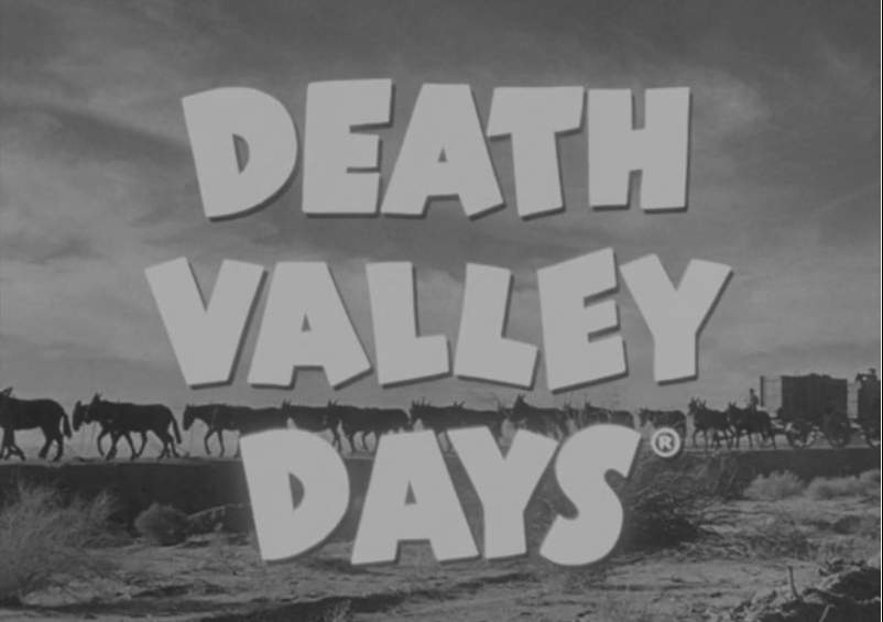
This is the title card for Death Valley Days which ran from 1952 to 1970. 1952 is the year I was born so that means the show's first episode ran 70 years ago.
Death Valley Days was sponsored by "20 Mule Team Borax" and along with Wagon Train, the show was a Breiding family favorite. I can remember watching many of the episodes on our fuzzy black-and-white TV which received only 2 channels.
20 Mule Team Borax is a brand of cleaner manufactured in the United States by The Dial Corporation, a subsidiary of Henkel. The product is named after the 20-mule teams that were used by William Tell Coleman's company to move borax out of Death Valley, California, to the nearest rail spur between 1883 and 1889.
Source: WikiPedia

Source: Wisconsin Historical Society
Anyone recognize this guy? Ronald Reagan was in 21 episodes of Death Valley Days.
Had Betsy and I known the U.S. Borax mine and visitors center just a stone's throw from the Borax Rest Stop had a "20 Mule Team museum" we might have made a quick stop. But that will now be saved for another time.
We finished up our business at the rest stop and then it was on through the Edwards AFB. This is where West Virginian Chuck Yeager manned the flight that broke the sound barrier in the Bell X-1.
Then it was on up into the Tehachapi Mountains and The Loop and then a quick stop at the César E. Chávez National Monument and then it was our long decent into the San Joaquin Valley area of the Central Valley, the latter being home to 7,000,000 irrigated acres. We then skirted south of Bakersfield saying "Howdy" to Buck Owens as we drove by and then finally arriving at the Buttonwillow Motel 6 which sits there next to busy I-5.
Now, on with Day 2!
Click on the photos below for a larger image.
Day 2: 27 September 2022
California and Oregon Road Trip
Buttonwillow to Morgan Hill
Sunrise at the Buttonwillow Motel 6. Betsy and I took a quick dip in the pool the previous evening but it was a tad chilly for us to stay in very long.
In case you hadn't guessed it by now today we will be travelling from Buttonwillow to Morgan Hill where we will be visiting an expat Aussie of great renown.
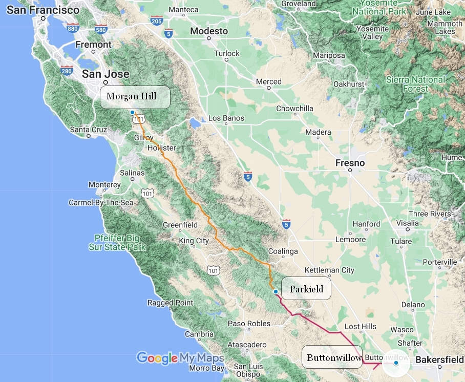
Here is today's route:
As you can see from the maps above and below most of the drive will be high up in the Coast Ranges before we drop down into the Bay Area.
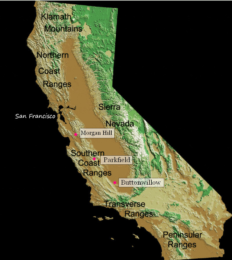
Below is a detail of the first leg of today's drive.
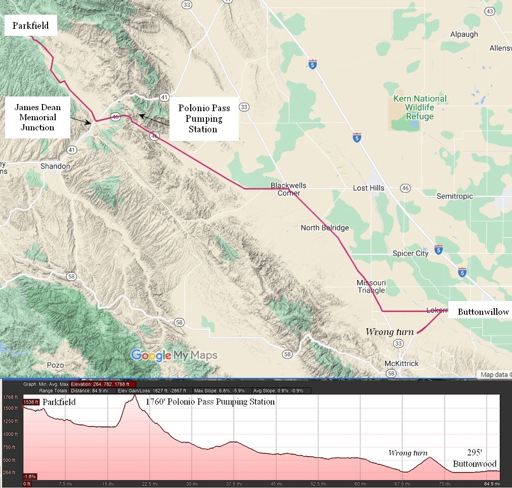
The elevation spike just out of Buttonwood (el 295') was where we made a wrong turn.
Once on the right track we slowly gained elevation until we reached Polonio Pass at 1760'. We have now gained nearly 1500' of elevation in 60 miles. The Polonio Pumping station is one of 27 which supply water all over California.
The California State Water Project (SWP) supplies water to an almost 27 million Californians and 750,000 acres of farmland. It spans more than 705 miles from Northern California to Southern California and includes 36 storage facilities, 21 pumping plants, five hydroelectric power plants, four pumping-generating plants, and approximately 700 miles of canals, tunnels, and pipelines.
Source: California State Water Project
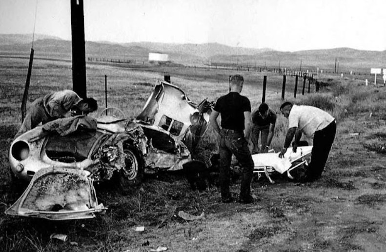
Before reaching Polonio Pass and while still in the valley we went by the intersection where James Dean, at the age of 24 was killed in a car crash near the junctions of California State Route 46 (former 466) and California State Route 41. He was driving a Porche Speedster.
...along on Route 466, the Porsche crested Polonio Pass and headed down the long Antelope Grade, passing cars along the way toward the junction of Route 466 and Route 41. At approximately 5:45 pm, a two-tone black and white 1950 Ford Tudor was headed east on Route 466 (now SR 46) just west of the junction near Shandon. Its driver, 23-year-old US Navy veteran and Cal Poly student Donald Turnupseed,made a left turn onto Route 41 headed north, toward Fresno. As Turnupseed's Ford crossed over the center line, Dean (clearly seeing an imminent crash) apparently tried to steer the Spyder in a "side stepping" racing maneuver, but with insufficient time and space, the two cars collided almost head-on. A witness, John Robert White, reportedly saw the Spyder smash into the ground two or three times in cartwheels...
Source: WikiPedia
The aftermath.
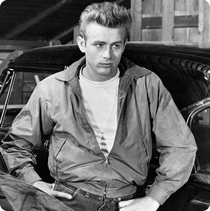
Adios, James...
Leaving James behind we entered into the Cholame Valley. We are now just 16 miles south of Parkfield.
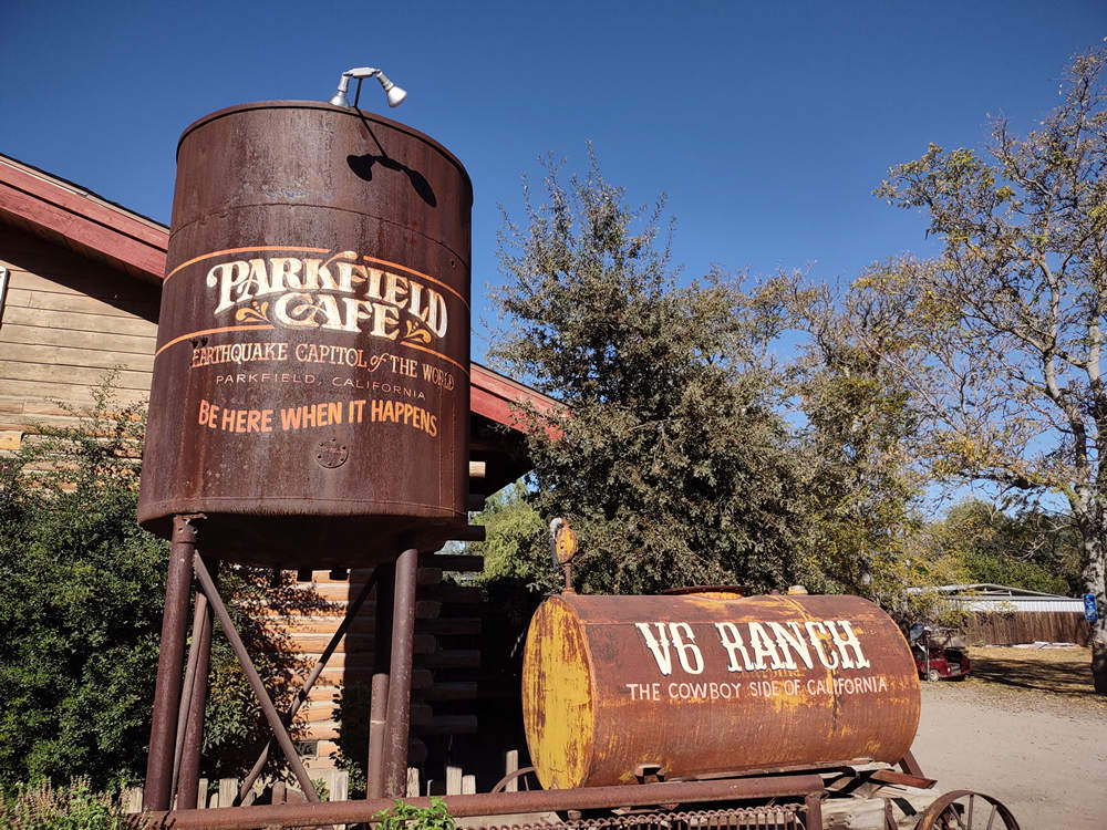
"Earthquake Capitol of the World
Be Here When It Happens".
The V6 is a dude ranch which has 20,000 acres for all those dudes and dudettes to explore.
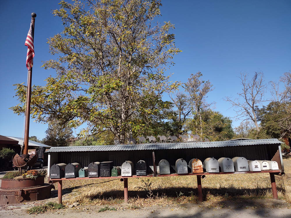
Do these 17 mailboxes represent the population of Parkfield? Some sources say the population is 18, others 200. This site lists the population as 2,336. However the site also states Parkfield is in San Luis Obispo County, which it is not. It is in Monterey County. What is your guess?
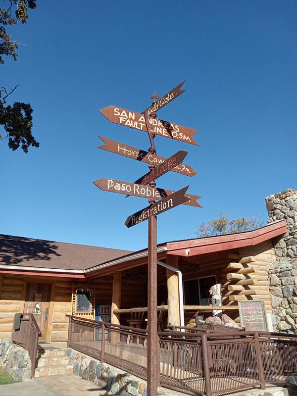
As you can see from the directional sign above Parkfield is rather close to the San Andreas fault line.
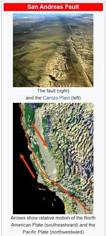
Parkfield lies along the San Andreas Fault, one of the longest and most active faults in the United States, which appears in the town as a seasonally dry creek bed. The fault marks the divide between the North American Plate and the Pacific Plate (see plate tectonics). There is a bridge across the creek with piers on either side that have shifted more than five feet relative to one another due to aseismic creep since the bridge was constructed in 1936. Google satellite images show that the bridge, which Simon Winchester described as "bent" and having cracked and patched pavement, has been replaced since Winchester's book was published, and a sliding joint installed; however, the west piers of the bridge remain displaced to the north. The bridge sports signage announcing to drivers that they are crossing the plate boundary.
Source: WikiPedia
The San Andreas Fault is a continental transform fault that extends roughly 1,200 kilometers (750 mi) through California. It forms the tectonic boundary between the Pacific Plate and the North American Plate, and its motion is right-lateral strike-slip (horizontal). The fault divides into three segments, each with different characteristics and a different degree of earthquake risk. The slip rate along the fault ranges from 20 to 35 mm (0.79 to 1.38 in)/yr. It was formed by a transform boundary.
Source: WikiPedia
"Britannica Kids" explains it in more simple terms which is perfect for most adults.
The San Andreas Fault in California represents the boundary between two major plates of Earth's crust. Along this fault the Pacific Plate slides laterally past the North American Plate. The movement of the plates sometimes causes earthquakes.
Source: Britannica Kids
One of those earthquakes that "sometimes" happens was the 1906 San Francisco quake which resulted in more than 3,000 people dying, and over 80% of the city being destroyed. There are lots of photos of the destruction here.
This is the USGS Parkfield Seismic Monitoring station.
To record earthquakes, seismologists place electro-mechanical devices called seismometers along faults, sometimes at the earth's surface and sometimes in drill holes a few hundred meters deep. When the ground shakes due to an earthquake, seismometers convert the motion into an electrical signal, which is recorded and saved, usually by a computer.
As part of the Parkfield Earthquake Experiment, a large number and variety of seismic instruments have been installed there, some to monitor the seismicity leading up to the next Parkfield earthquake and some to document the strong ground motion from that earthquake when it occurs.Source: USGS
Of the seismic stations operated by USGS Northern California Seismic Network, 18 are located within 25 km of Parkfield. The data are telemetered to Menlo Park, CA, where the earthquakes' location and magnitude are determined within 3-5 minutes of their occurrence. The network is well suited to the rapid detection and recognition of potential M>0.8 foreshocks at Parkfield.
Source: USGS
The "city center" of Parkfield has lots of things for tourists to take pictures of.
Feral hogs are a big problem in lots of places and California is no exception. They have been found in 56 of the state's 58 counties. Regardless of how they were established, hunters do what they can to keep the population up so they have a chance to kill one. Ignoring the environmental and crop damage from hogs some hunters have been known to capture and relocate hogs into areas with no population.
Fortunately California governor Gavin Newsom has signed a new law designed to help reduce the state's estimated 400,000 feral hogs.
Senate Bill 856 passed with unanimous support in both the state Senate and Assembly and will allow licensed hunters to kill an unlimited number of the wild pigs. The new law also lowers the tag prices for hog hunting and seeks to legalize the hunting of wild pigs at night. The law also prohibits the intentional release of a pig to live in the wild.
Source: © 1995 - 2022 Farm Journal, Inc
Of the 3,143 counties in the US, the pigs were found in 544 counties 40 years ago. In 2020 they were present in 1,915 counties.
The hog sign on the gate was not the reason I took these gate photos. It was this clever use of a horse shoe for a gate latch.
Whimsey!
Photo: Betsy Breiding
This shows some large Valley oaks which provide some shade in the town square.
Quercus lobata, commonly called the valley oak or roble, grows into the largest of California oaks. It is endemic to California, growing in interior valleys and foothills from Siskiyou County to San Diego County. Mature specimens may attain an age of up to 600 years. This deciduous oak requires year-round access to groundwater.
Its thick, ridged bark is characteristic and resembles alligator hide. The valley oak's deeply lobed leaves assist in identification.Source: WikiPedia
Conspicuous brown balls, as big as golf balls but not much resembling an acorn, are often noticed among the foliage. They are galls, popularly known as oak-apples, that result from a wasp depositing an egg, along with some plant hormone, to stimulate the growth of a protective home for the larva. Among the litter, one may find jumping galls about a millimeter in diameter that use the same strategy as the Mexican jumping bean, namely to reach shelter from the sun; when they land in a shady spot they cease jumping. If you take some home and put them in the bedroom they quiet down, but they start jumping when a bedside lamp is lit.
Source: trees.stanford.edu
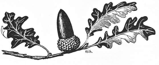
The above illustration by Jane Gyer is from the book "Discovering Sierra Trees" by Stephen F. Arno. It is a beautiful little volume and one of my favorite tree books. I highly recommend it. There is usually a plentiful supply of used copies available.
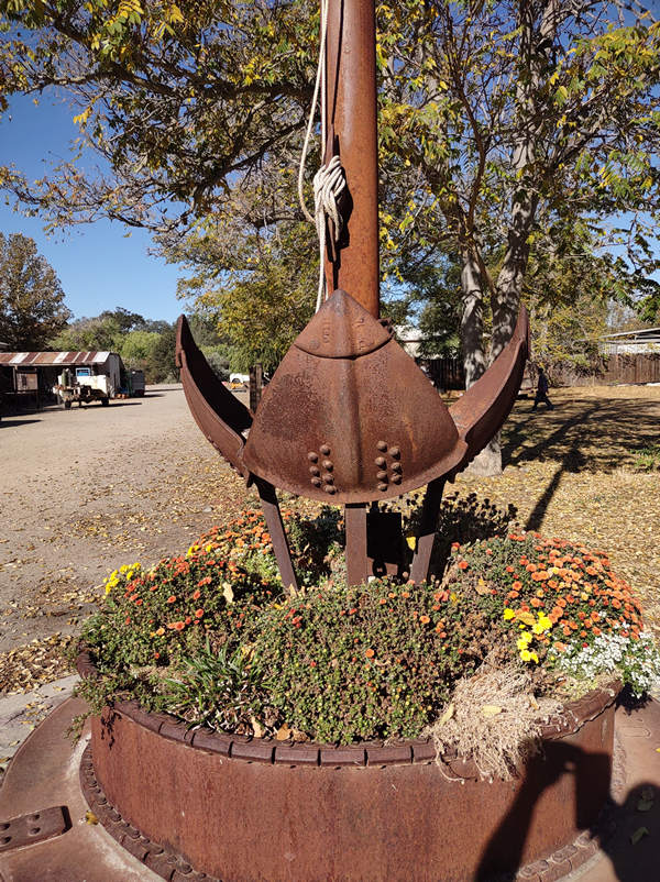
These bricks were placed around a metal sculpture in the square.
Carnegie Brick and Pottery Company was the manufacturers of pressed brick, with the Oakland sales branch located at the Adams Wharf, at the foot of Madison Street. In 1906.
Source: localwiki.org
TROJAN high-duty firebrick
Gladding, McBean & Company
Alberhill yard (1926-1935), Riverside County; Los Angeles yard (1935-1952) and South Gate yard (1935-1962), Los Angeles County, CA
1926-1962Source: CaliforniaBricks.com
ACORN PCP firebrick Pacific Clay Products, Inc. Los Angeles, Los Angeles County, CA 1921-1953
Source: CaliforniaBricks.com
The Excelsior Brick Company with its signature diamond mark was owned by the Fowler family. This yard started at the Bowline yards beyond lower main street in Haverstraw. One of the last yards to close on July 31, 1933 it was sold off at auction by order of foreclosure in 1935. One of two brickyards owned by the Fowler family, the Excelsior Brick Company was known for producing extremely high quality dark gray bricks.
Source: Haverstraw Brick Museum
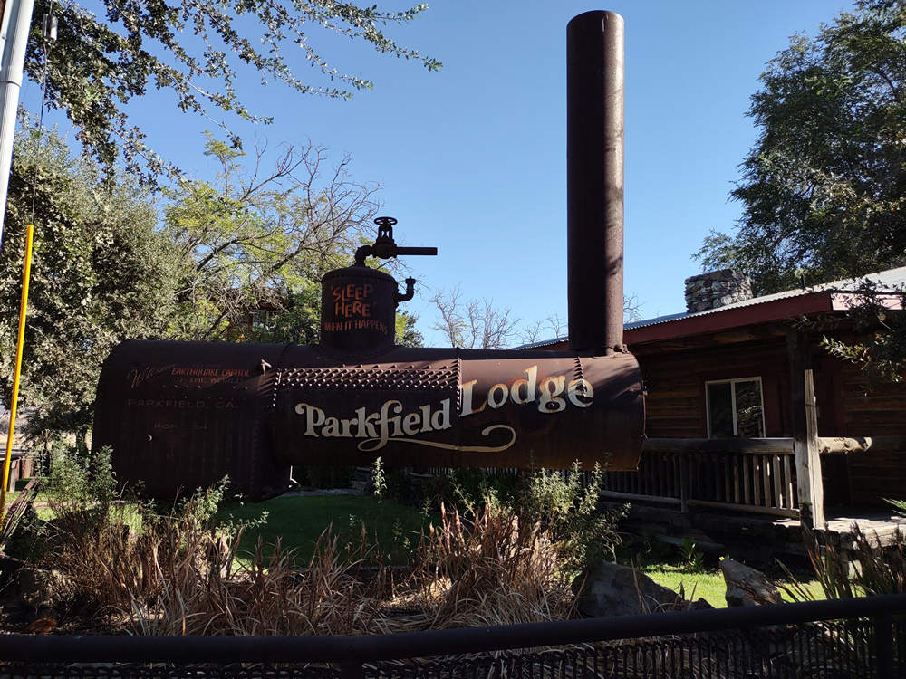
I would like to know the story behind this old boiler. Perhaps you know?
It took me a moment to recognize this shrub.
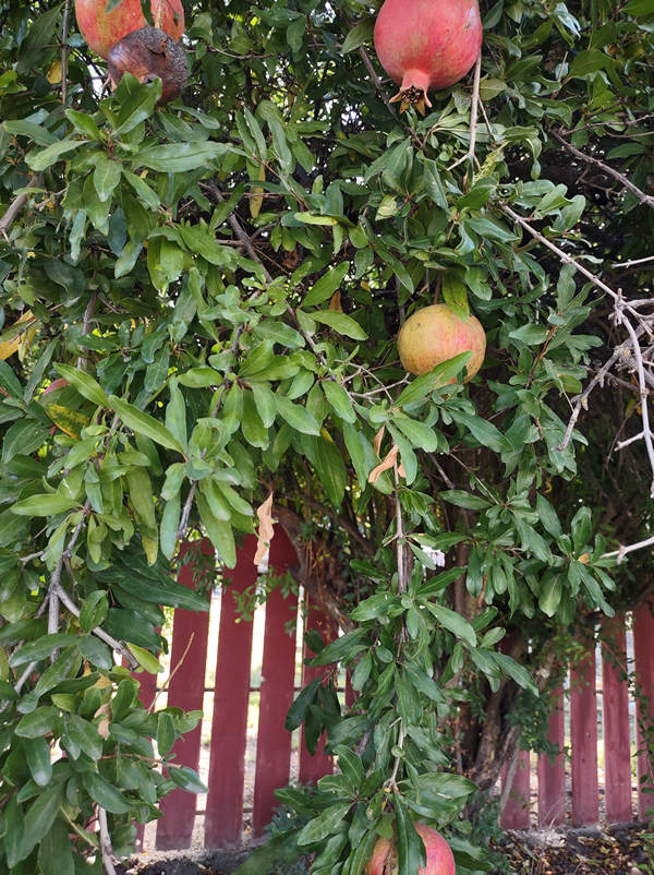
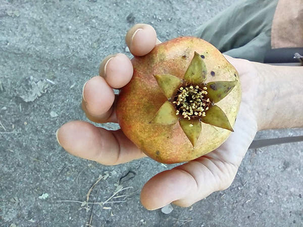
This was our first look at a pomegranate which was not in a grocery store.
The pomegranate was originally described throughout the Mediterranean region. It was introduced into Spanish America in the late 16th century and into California by Spanish settlers in 1769.
Pomegranates are widely cultivated throughout the Middle East and Caucasus region, north and tropical Africa, Iran, Armenia, the Indian subcontinent, Central Asia, the drier parts of Southeast Asia, and the Mediterranean Basin.
Source: WikiPedia
Hmmm... what might these be? They were at the bottom of the flag pole by the mailboxes.
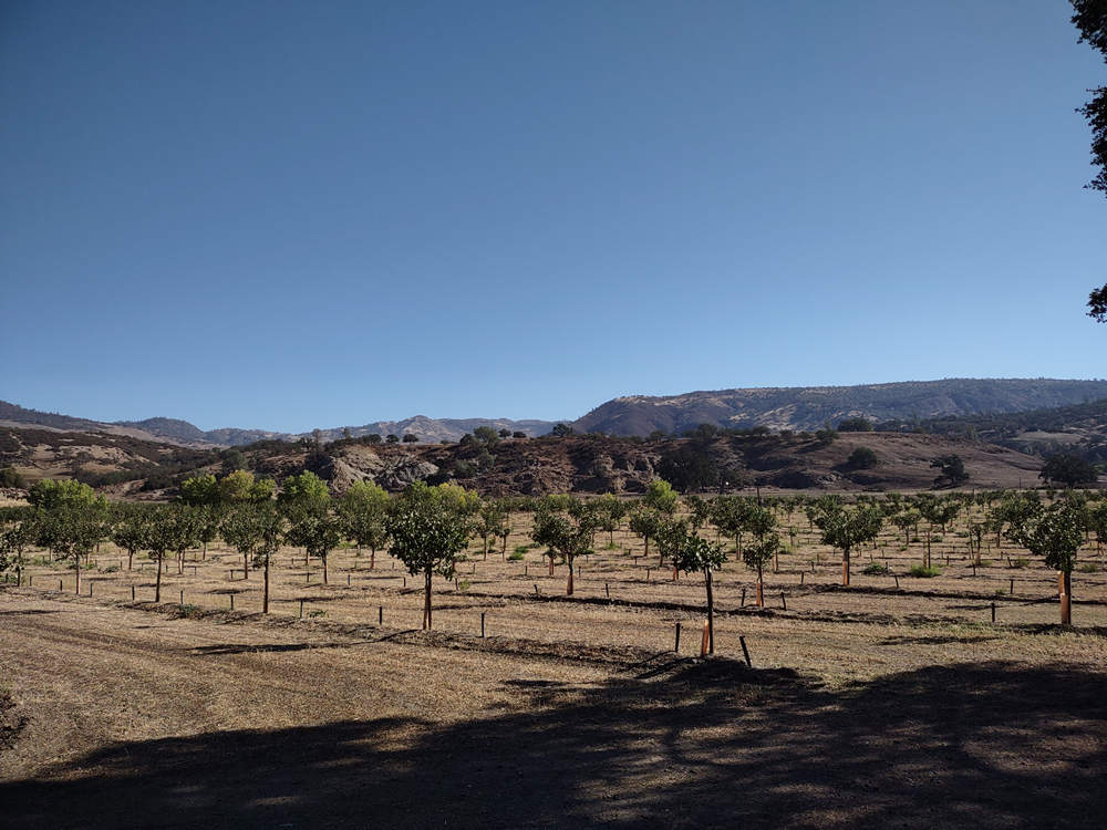
This orchard was just outside of town. I have no idea what the trees were.
Ok, bye-bye to Parkfield.
It is time we mosied down the Parkfield - Coalinga Road. This road would take us up and over the mountains for 19 miles, 5 miles of which were unpaved. It is one of the few places in Central California where within a few yards you can see the mountains of the coastal range to the west (~50 miles) and the Sierra Nevada range to the east (~110 miles) when conditions are clear.
After enjoying the unpaved country road we arrived back at the pavement. We are now at about 3500'. Parkfield sits at 1500'. This location is here.
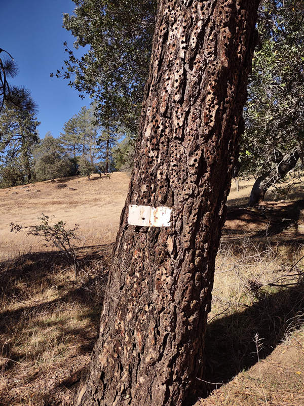
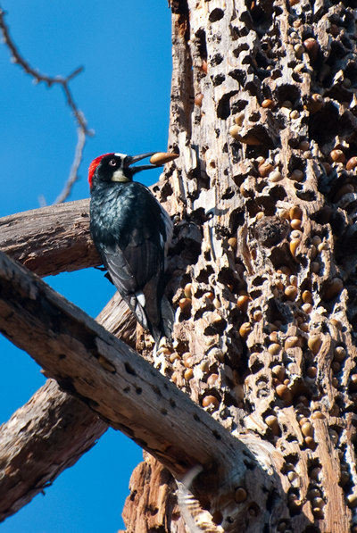
This conifer had been worked over pretty good by Acorn woodpeckers. They make the holes in the trunk and then stuff them all with acorns for later use.
We saw and heard quite a few Acorn woodpeckers while walking around Parkfield. They are very vociferous and make all kinds of crazy sounds. You can listen to them here.
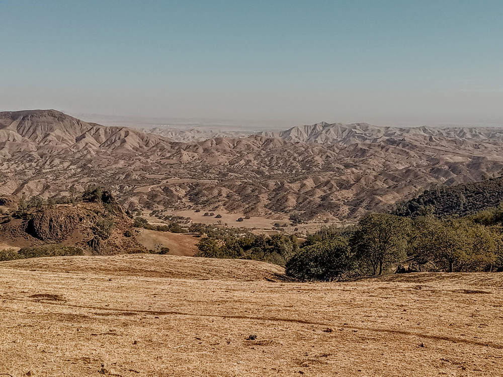
One of many fine views as we drove along the ridge top.
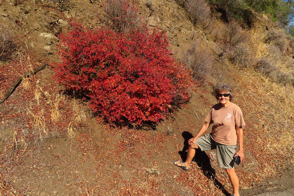
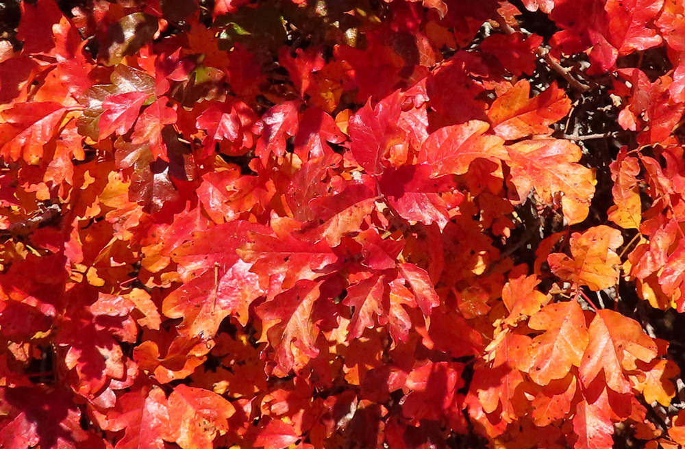
It was mighty dry and mighty brown so this splash of color really stood out.
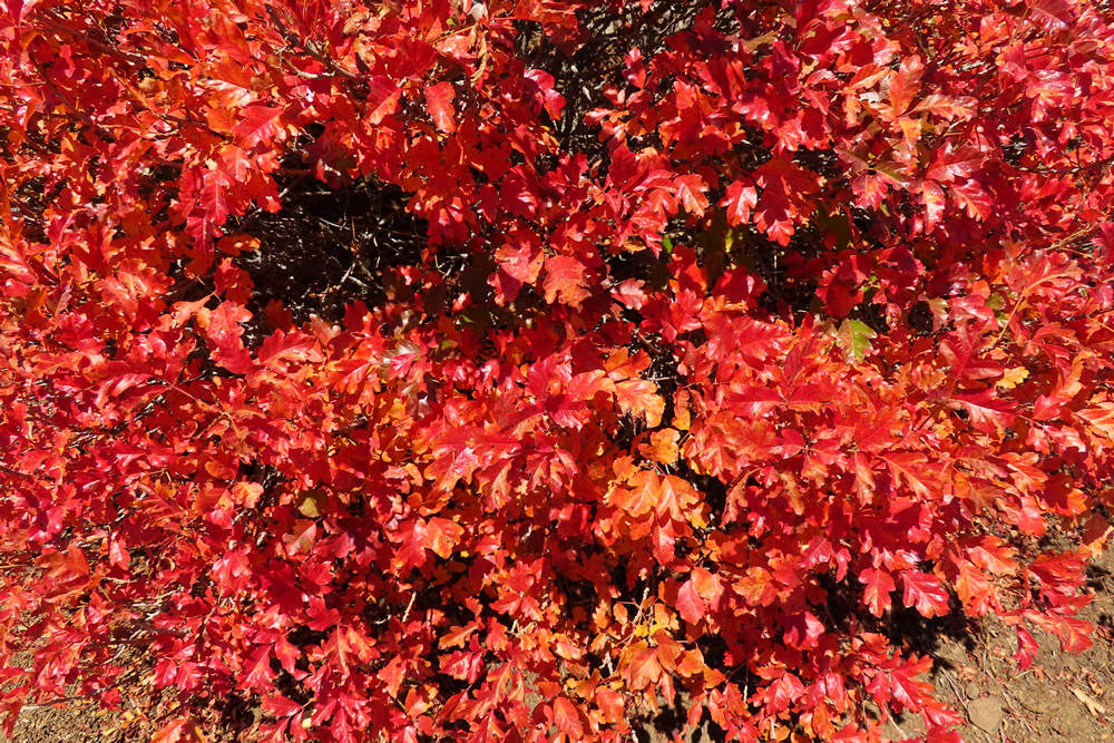
This is the Pacific poison oak (Toxicodendron diversilobum) the western counterpart to the Poison Ivy (Toxicodendron) of the eastern US.
Like its eastern counterpart the leaves are divided into three. Thus the saying "Leaves of three - let it be". Good advice if you are not sure. The poison ivy of the east can also have spectacular fall color.
Photo: Betsy Breiding
I would love to see this greened up from the spring rains.
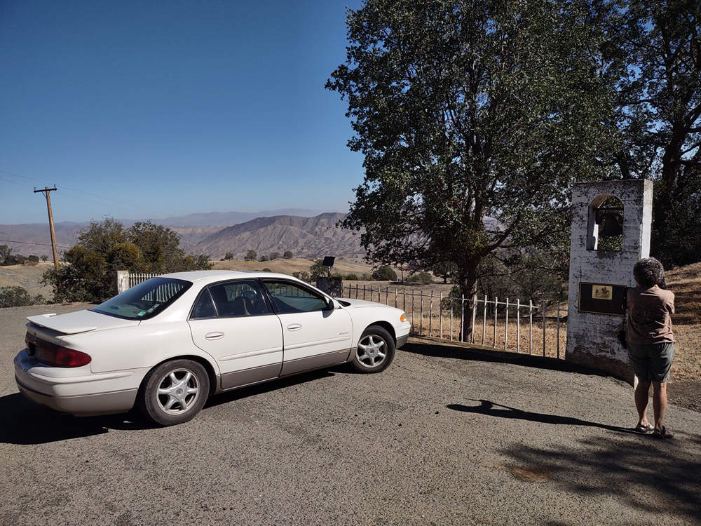
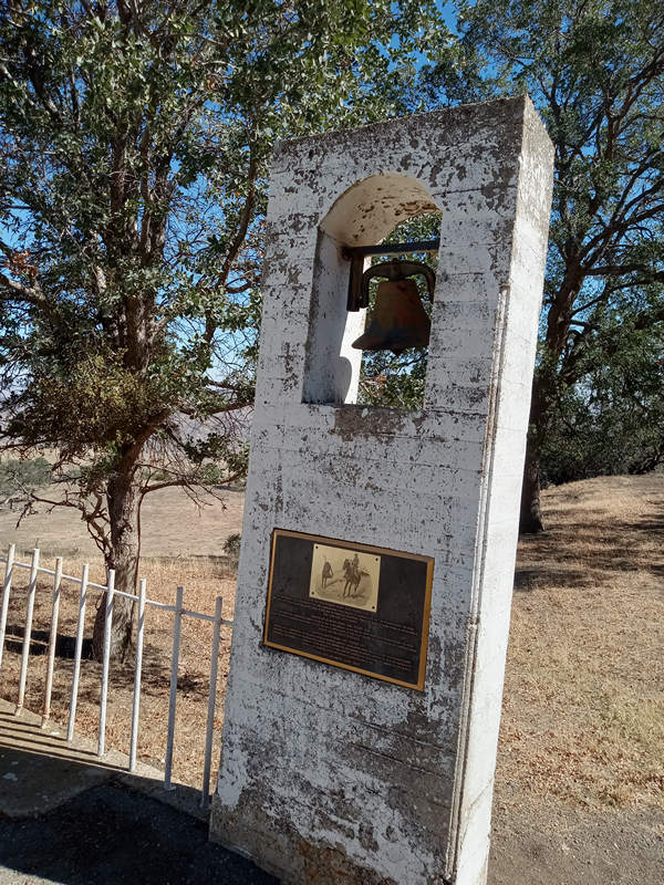
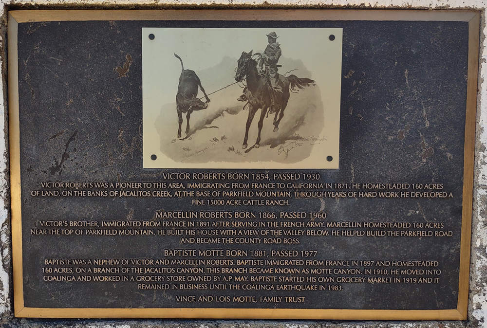
We are now on the descent back into civilization. We stopped at this historic site to take in the view and read the plaque. The location is here.
Roberts/Motte Homesteads and Ranch
Victor Roberts
Born 1854, Passed 1930
Victor Roberts was a pioneer to this area, immigrating from France to California in 1871. He homesteaded 160 acres of land, on the banks of Jacalitos Creek, at the base of Parkfield Mountain, through years of had work, he developed a fine 15,000-acre cattle ranch.
Marcellin Roberts
Born 1866, Passed 1960
Victor’s brother, immigrated from France in 1891 after serving in the French army. Marcellin homesteaded 160 acres near the top of Parkfield Mountain. He built his house with a view of the valley below. He helped build the Parkfield Road and became the county road boss.
Baptiste Motte
Born 1881, Passed 1977
Baptiste was a nephew of Victor and Marcellin Roberts. Baptiste immigrated from France in 1897 and homesteaded 160 acres, on a branch of the Jacalitos Canyon. This branch became known as Motte Canyon. In 1910, he moved into Coalinga and worked in a grocery storm owned by A.P. May. Baptiste started his own grocery market in 1919 and it remained in business until the Coalinga Earthquake in 1983.
Vince and Lois Motte, Family Trust
7 miles more and we were down to SR 198. We could have taken 198 directly west to US 101 but there was still more back road to enjoy so instead we drove north on SR 25 towards Bitterwater. It was in this area most of the California Condors were wiped out from DDT poisoning. DDT was eventually banned and now the Condors have made a comeback.
Then it was on through San Benito, Pinnacles, Paicines, Tres Pinos, through the town of Hollister, and finally Gilroy where we got on busy, busy US 101. We are now just 15 miles from the doorstep of our favorite Aussie.
And just who is this expat Aussie of great renown? That would be Steve Atkinson, who was, back in the late 90s, a member of what I now think of as the Geek Squad who used to gather along with other Geeks - aka nerds (and non Geeks) at the West Virginia Brewing Company in Morgantown for bar grub, 5 dollar pitchers of Appalachian Ale and conversation.
Who were those other Geeks? Gregory Kulczycki, Henry Ware, John Wood, Mark Aronszajn and John O'Reilly.
And then there was me. I was a wannabe Geek who was always a bit envious of the real geeks. I always hoped I would be one but I just didn't have what it took. But, hope springs eternal and I thought maybe rubbing shoulders with the likes of the Geek Squad just might make a difference. It didn't but is sure was lots of fun and I miss those days. When Steve left Morgantown for Geek Mecca in California I visited him a few times while on road trips. The last visit was 4 years ago in October of 2018 while on a pilgrimage to San Francisco. I might add Betsy had not seen Steve in 15 ??? years so the visit should be lots of fun.
And now, without further delay...
Introducing Steve Atkinson
"I was wondering if you would be willing to write up a short bio I could include." -Mike
⋄⋄⋄⋄⋄⋄⋄⋄⋄⋄⋄⋄⋄⋄
So Mike asked me to help "webulize" his California trip this year. Every time someone gives me a new verb to use I take their request seriously!
I'm Steven Atkinson. I was born in a hot little town called Ipswich outside the city of Brisbane, Queensland Australia in May 1972.
I grew up in Brisbane, leafy suburbs in the southwest. My brother Rob came two years after me. Every kid growing up in Australia plays cricket, and I played soccer as well. Typical really and comfortable - my parents did a good job. Even after they divorced when I was 10 years old, I still went to good schools and ended up doing well in school (I think I probably put a lot of the anger at the divorce into doing well at school).My Mom really got me started in computers. She travelled from Canada, met my Dad travelling to Europe and ended up teaching English as a Second language to kids who came to Australia from all over the world. One of her interests was how computers could help teach math without language barriers. So I found myself at about 11 years old face to face with an Apple IIe on the dining table and a Commodore Vic 20 for my birthday. I would type in programs from magazines into both - I now realize my Mom must have got those magazines for me too. A year later she got an IBM XT computer for her office. She wouldn't let me touch it for a year. When I got my hands on it I taught myself Pascal and wrote a few video games (boy I wish I had that code still). 5.25" floppies, monochrome screen. That was the real joy of creating something. Hooked me.
I went through Computer Science at the University of Queensland, got a PhD and wanted to leave - I had the travel bug like my Mom.
I gave a good talk at a workshop in Ohio and was asked to come work at West Virginia University. So that's what I did in October 1997.It was my first time away from home, and West Virginia accepted me with open arms, and the folks there were friendly.
I met Mike and soon after Betsy in late 1997 or early 1998 at the Brew Pub in downtown MorganTown, on the water.
A group of folks would get together and I was invited to join. As you might imagine, Mike was pretty hard to forget - he always had a sharp edge and challenged how what I was doing would help people, get on down out of the ivory tower Steve! but that's how he relates to people - you have to have the right type of humor skills to keep up with him, and he does actually care about the world around him.After two and a half years my time was up at WVU - my professor was leaving and I had an opportunity to join a startup in California during the boom, which I grabbed. Between that startup being acquired, then being the fourth engineer at LinkedIn and working for Netflix for the last 20 or so years, it really has become that Hotel for me. During my life here in California, Mike has visited a few times, on his journeys through San Francisco which is a drawcard for him I guess. So I'm looking forward to his trip this time. A helluva guy to have a beer with, says the Aussie!
Later this year will be the point in my life which I spent half of it in Australia, and half of it in the USA. I love both countries, they both have challenges and now both have heat waves. But California and West Virginia have been nice to me, and the opportunities for someone who works hard here are second to none. That's why I'm going to stay - I am that nerd who found the right area to live in - Sillycon Valley. :-).
Here is Steve at work. No he is not a DJ.
Steve, in collaboration with Associate Professor of Computer Science at Virginia Tech Greg Kulczycki teaches web application development and mobile application development to masters students.
From this work station he also works his Netflix gig.
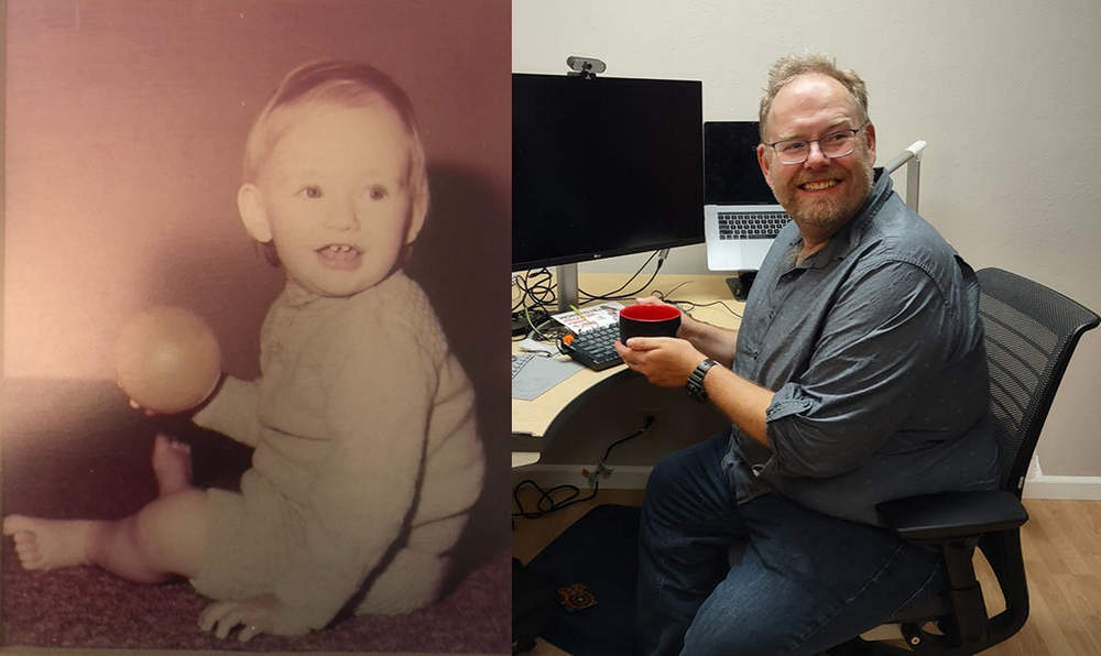
Since Steve was kind enough to write up his bio I though it would be fun to have a photo of him as a youngster. He kindly supplied one.
Steve the Younger and Steve the Older.
We had a groovy visit with Steve. We started out with a relaxing couple of drinks on his patio and spent some time catching up on what had been going on in his life over the last 4 years. Many changes...
Steve had alerted us he had a remote teaching session that evening (above photo) so Betsy and I took a walk while he was on the job.
When we got back Steve just about had dinner ready - brat hoagies and beer. Octoberfest!
Our visit was way too short but hopefully the next one won't be.
Steve, my friend, it was wonderful to see you.
Tomorrow we head north to San Francisco. See you then...
Mike and Betsy
⋄⋄⋄⋄⋄⋄⋄⋄⋄⋄⋄⋄⋄⋄
Day 2 Route

