Mike Breiding's Epic Road Trips: March 2022
Tucson to Morgantown
The Red River Route
Tucson, Las Cruces, Carlsbad, Throckmorton, Paris, Texarkana, El Dorado, Crump, Charleston, Weston, Morgantown
March 2022
Tucson to Morgantown
Part 1: Tucson to Carlsbad
Along came March of 2022 and the end of our 11th winter in Tucson. As before, I am getting ready to start the drive back to Morgantown and Betsy is getting ready to spend some much needed time by herself.
Then I started thinking: "How many times have I made the trip across the U.S. of A."?
I wish now I had kept track.
It all started in...
1972
This was the first time I drove across the US. That was also in March. On that trip from San Francisco to West Virginia were my mom, my sister Susan and my brothers Sutton and Bill as well as my sisters' "husband" Mike Taymor. Sister Joan and brother Wayne remained in SF. With the exception of boxes of books which were shipped back to Julian Martin in Charleston WV all our earthy possessions were packed into a Volkswagen Squareback and a International Harvester 3/4 ton D-1200 pick-up.
At that time there was lots of talk about "getting back to the land" and "home steading". The Mother Earth News and the Whole Earth Catalog were poured over by many would be "back to the landers".
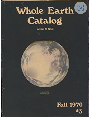
And let's not forget the back to the landers' bible "Living the Good Life" by Helen and Scott Nearing. That book along with "Five Acres and Independence" by Maurice Grenville Kains added fuel to the exodus of city hippies out into the county side in search of cheap land, self reliance and Living Happily Ever After.
The Back to the Landers' Anthem
Going Up the Country by Canned Heat
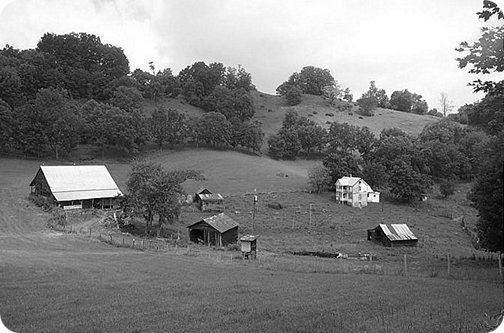
June 1972
The Everett Sheets Farm - Greenbank WV where the 6 of us tried to "get back to the land".
Suffice it to say the back to the land experiment did not work quite as planned for the six San Francisco refugees and within two years we had all gone our separate ways.
A few years later - 7 to be exact, I would be making the first of many pilgrimages back to San Francisco.
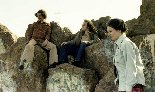
May 1979
Sutton, William and Joan Breiding atop Corona Heights - San Francisco
1979
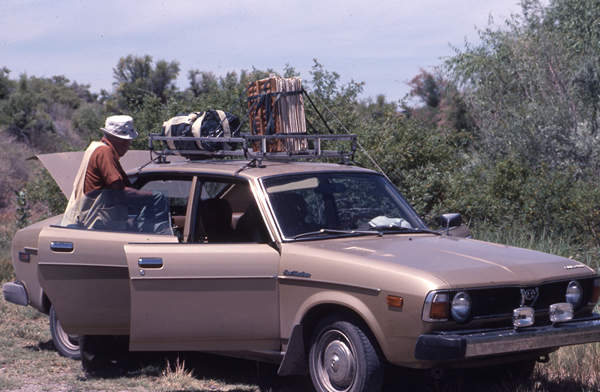
This was the second time I drove across the US. That was in July. I drove my new Subaru DL 4 door sedan.
At the time there was an organized boycott of Japanese products to protest their whale hunting. I can still remember driving the "Sube" over to 508 Cobun Ave to proudly show it to my sister Suzi. She looked at it with distain and told me "It smells like dead whales".
The 1978 DL 4 door sedan was a 5 speed manual with an EPA estimate 47/32 mpg. Going across Kansas I got 54 mpg. That was 42 years ago. Nowadays the only thing which would get 54 mpg is a moped.
My girlfriend Ethel "Hi-Test" Moffatt accompanied me on the drive west. When I told Ethel I was driving out to SF to visit family she asked about coming along. She had a sister who lived east of Seattle in the North Cascades and she planned to take a bus from SF to Seattle to visit. This she did. I then later drove up to see her and we spent two fun nights in a Rambler which her sister called the "Rumblin' Rambler".
When not in the Rumblin' Rambler drinkin' whiskey and doin' the wild thing Ethel and I were out hiking. One of those hikes was to Kennedy Hot Springs in the Mt. Baker-Snoqualmie National Forest.
August 1979
Ethel relaxes at Kennedy Hot Springs
What a grand place that was! Wonderfully warm spring water and just a few feet from the icy White Chuck River. I had always dreamed about going back there someday with Betsy. Sadly I waited too long. The Springs were buried in a 2003 flood. They are now inaccessible.
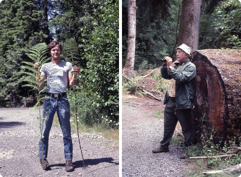
After Ethel and I parted ways I picked up my dad at the Sea-Tac airport and he and I spent some time exploring the Olympic Peninsula National Park and surrounding area. Being a novitiate FrondFondler I was in heaven seeing all the ferns and my dad kept pretty busy with his binoculars.
August 1979
Mike and George Breiding ferning and birding in the Olympic Peninsula
August 1979
My Sube - complete with plant press and sleeping bag.
My dad and I then road tripped our way back to Morgantown by a circuitous and mostly back roads route. This was the only trip I ever went on with my dad.
1982
This was the Big One! Betsy and I departed Uniontown Ohio on May the 16th to start what was to be a 7 week Honeymoon road trip. And we survived!
On that trip we stayed in motels, with family and camped out and we traversed 17 states. More than one fantasy was fulfilled on that trip.
1986
Saw me flying to San Francisco to help my brother Sutton and his girl friend Jenny (aka Stella) move from San Francisco to Morgantown. This was to be a final move and neither one of them would ever return to The City.
1997
This is what Betsy and I refer to as the year of the "Iowa Road Trip". We called it that because the main reason we planned the trip was so we could visit my brother Bill who at the time was living in Fairfield, Iowa. The trip finished up with 13 States and 5000 miles and we got as far west as Black Canyon of the Gunnison National Park. From there we headed north to our beloved Boswell Creek Campground which is now closed. Thank you USFS!!
Then it was back through South Dakota, Minnesota, Wisconsin, Michigan, Indiana, Ohio and West Virginia.
The road trips after 1997 Betsy and I made were mostly local to places like Wisconsin, Michigan to enjoy hiking and biking. Or they were trips by air to New Orleans and San Francisco. Then came 2005.
2005
This was the next time I drove across the US as far west as Tucson Arizona. This would become what I now refer to as my First Solo Road Trip and for me an Epic One. Thus was born www.EpicRoadTrips.us.
After that trip I caught Road Trip Fever and was back and forth and up and down the back roads of so many states I could not keep track of them. And I never have. I will have to sit down and tally them up sometime.
2010
This was the year I am sure Betsy thought would never arrive - Retirement! We kicked that off with our memorable "Three Weeks in Michigan". 2010 was also the year I made my first trip across the pond to Spain and my "10 Days in Segovia". To wrap up this year of travel I flew to San Francisco and spent two weeks revisiting my old haunts and finding some new ones.
2011
This was the year we packed up the car and drove to SE Arizona in search of a winter retreat for our Golden Years. We found a place and so began the annual road trips from Morgantown to Tucson and then Tucson to Morgantown. Lots of miles and mostly interesting ones.
The short list above is just a sampler of the many cross country trips. Now I am ready to head down the road again.
Click on the photos below for a larger image.
March 18th 2022
A few days before my departure from Tucson a group of us got together at Moto Sonora Brewery for drinks and farewells.
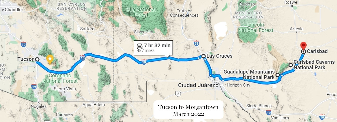
Two days later I was on the road. My first overnight would be in Carlsbad NM.
This is just on the western outskirts of Las Cruces NM at the Scenic Overlook Rest Area. I had passed by it many times before. This time I decided to stop.
The roadrunner is the official state bird of New Mexico, which explains why artist Olin Calk built a giant recycled roadrunner -- 20 feet tall and 40 feet long -- in Las Cruces in 1993. Back then it stood at the city landfill, and was made exclusively of items salvaged from it: Olin's way to call attention to what he called, "consumption, recycling, and just looking at stuff we throw away."
Source: RoadSideAmerica.com
Had I known it was built from recycled junk I would have taken a closer look.
I continued on 1-10 through Las Cruces to the point where 1-10 takes a dive south for a few miles to Woodrow Bean Transmountain Dr (Rt 375) which skirts to the north of traffic clotted El Paso. I then picked up US 62 which would take me on to Carlsbad.
About 55 miles southwest of Carlsbad is the entrance to Guadalupe Mountains National Park which is where I would be hiking tomorrow morning.
About 4:30 I arrived at Carlsbad and checked into the Parkview Motel.
Here are my DeLuxe accommodations for the next two nights. Obviously they are a U-Haul provider as well.
Every other time I came through Carlsbad I considered staying here. Not because of the quiet, scenic location but because it is directly adjacent the Pecos River Walk. But, it always looked just a bit rough around the edges and I always ended up somewhere else. No more, as hotel prices have climbed I have lowered my standards to match and so here I am at the Parkview. And, I have found over the years these small bare bones places are perfectly fine if you are not too picky. I am not.
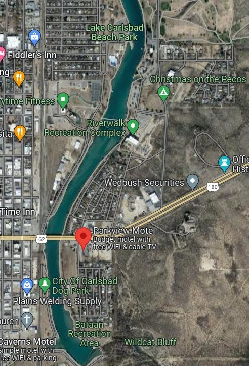
I dropped my stuff in the room and then went behind the Parkview to a chain link fence which someone had conveniently chopped a hole into. Once I was through that I was just feet away from the Pecos River Walk.
A rather bleak view of the River walk on this cool and windy late winter day. But I imagine it gets quite busy on a warm and sunny summer day.
This shot was taken from the River walk Recreation Center overlook of the Alejandro Ruiz Memorial Park. Just beyond the overlook is a floating bridge which crosses the Pecos River.
The City of Carlsbad has put a lot of money in to developing this into a wonderful outdoor recreation area.
I walked south to the end of the River walk, crossed over and then headed back north to my chain link portal and was soon back at the hotel.
What a lovely view I had from my lofty perch on the second floor of the Parkview.
To better enjoy the view I pulled out a room chair and set up my Happy Hour Station and cracked open a beer all the while missing my Betsy.
I sat there and watched as a van pulled in the lot and out steps mom and two teen daughters. They began hauling their belongings up the steps and past me to their room a few doors down. Along with all their luggage they carried up bags of groceries and 3 gallons of milk. I couldn't help but wonder what their story was. They were gone the next day.
Supper time at the Parkview!
I had brought all the fixins' for a nice salad including about a pound of marinated and grilled chicken thighs I had fixed before leaving Tucson. This fed me for the next 2 nights and kept me away from the fast food joints - for awhile anyway.
An uneventful night in a hotel is always a good thing and it was so at the Parkview.
I was up at 5AM as usual, got my hiking stuff together and headed out the door to the local Micky D's for some breakfast.
I arrived at the turn off for McKittrick Canyon around 7:00. The weather was looking interesting back up in the 'Lupes and I started wondering what might be in store for me.
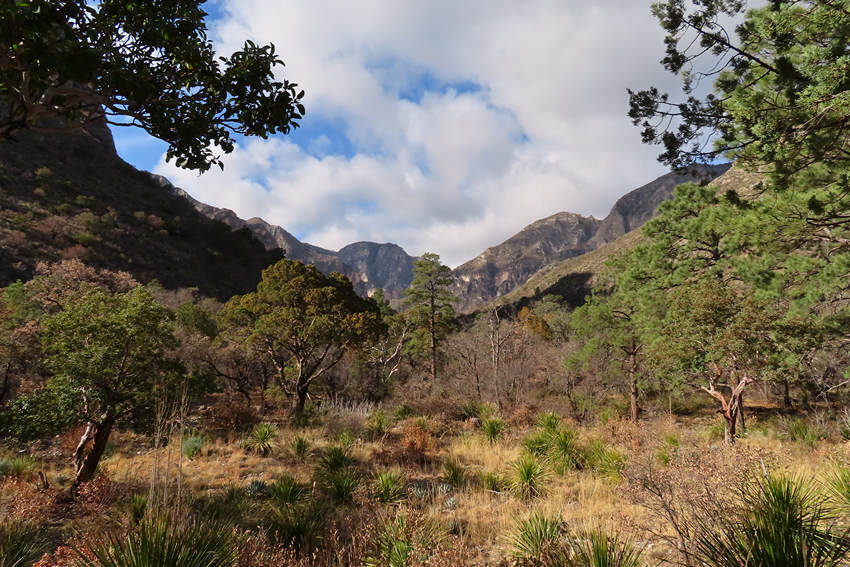
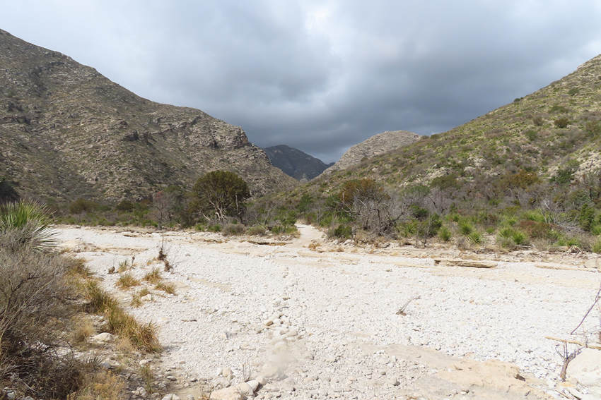
McKittrick Canyon is a scenic canyon within the Guadalupe Mountains of West Texas and Eddy County, New Mexico. The steep, towering walls of McKittrick Canyon protect a rich riparian oasis in the midst of the Chihuahuan Desert.
McKittrick Canyon Trail begins at the visitor center and initially follows a dry stream, crossing the stream bed several times as it works its way up the canyon. At first, the vegetation is more typical of the Chihuahuan Desert with various species of yucca, agave, and cacti, such as Spanish dagger (Yucca faxoniana), sotol (Dasylirion leiophyllum), ocotillo (Fouquieria splendens), lechuguilla (Agave lechuguilla), century plants (Agave americana), prickly pear (Opuntia spp.), and claret cup cacti (Echinocereus triglochidiatus). Scattered among these desert plants are a few hardy pines, junipers, and the occasional Texas madrone (Arbutus xalapensis), an unusual tree with red-colored bark that tends to curl up and peel off each year
.Source: Read more at WikiPedia
At this point some information on the geology of the Guadalupe Mountains National Park seems appropriate.
I must say, as much as I enjoy looking at craggy mountain peaks and deep rocky gorges when I read about the formation of such places it is always a bit mind bending. To me the time spans and forces involved in creating such landscapes border on the unimaginable. I just can't quite think like a geologist.
During the middle part of the Permian Period a reef developed along the margin of the Delaware Sea. This was the Capitan Reef, now recognized as one of the most well-preserved fossil reefs in the world.
About 80 million years ago tectonic compression along the western margin of North America caused the region encompassing west Texas and southern New Mexico to be slowly uplifted. A transition in tectonic events 20-30 million years ago initiated the formation of steep faults along the western side of the Delaware Basin. Movement on these faults over the last 20 million years caused a long-buried portion of the Capitan Reef to rise several thousand feet above its original position. This uplifted block was then exposed to wind and rain causing the softer overlying sediments to erode, uncovering the more resistant fossil reef and forming the modern Guadalupe Mountains. Today the reef towers above the desert floor as it once loomed over the floor of the Delaware Sea 260 to 265 million years ago.
Reef
The reef, a submerged resistant mound or ridge formed by accumulation of plant and animal skeletons, is composed of the Capitan limestone. The Capitan is a massive, fine-grained fossiliferous limestone that formed by growth and accumulation of invertebrate skeletons of algae, sponges, and tiny colonial animals called bryozoans. These skeletons were stabilized by encrusting organisms that grew over and cemented the solid reef rock, unlike modern reefs built by mainly a rigid framework of corals. The Capitan limestone forms the thousand-foot high cliff of El Capitan, the most striking feature of Guadalupe Mountains National Park.Source: Read more at NPS
Here is some information on nearby Carlsbad Caverns National Park.
Carlsbad Caverns National Park preserves a portion of the Capitan Reef-one of the best-preserved, exposed Permian-age fossil reefs in the world. Water, geologic forces, climactic changes, and vast spans of time have produced and changed the fossil reef and its spectacular caves, a process that continues to the present day.
From a Permian Reef to Guadalupe Mountains
The ocean fossils here reveal a detailed picture of life along a coastline of a shallow inland sea some 265 million years ago. These fossils show that the "Capitan Reef" was built mostly of sponges and algae, not by coral like many of today's reefs. Other marine fossils found here include ammonites, crinoids, snails, nautiloids, bivalves, brachiopods, and the occasional trilobite. This coastline eventually became a horseshoe-shaped limestone layer of rock over 1,800 feet (549 m) thick, two to three miles (three to five meters) wide and over 400 hundred miles (644 km) long. By the end of the Permian age, the Capitan Reef was covered by thousands of feet of newer sediments, burying the reef for tens of millions of years.Source: Read more at NPS
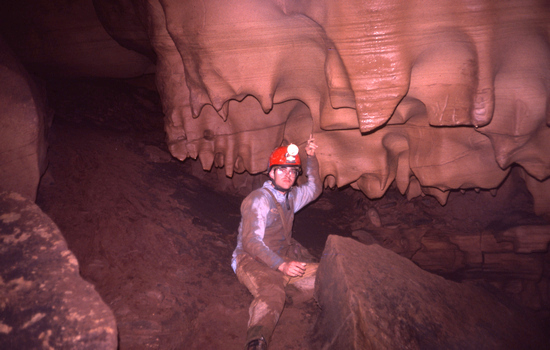
Once upon a time a I got down and dirty with some limestone.
March 1980
Exploring Bowden cave in Randolph county West Virginia
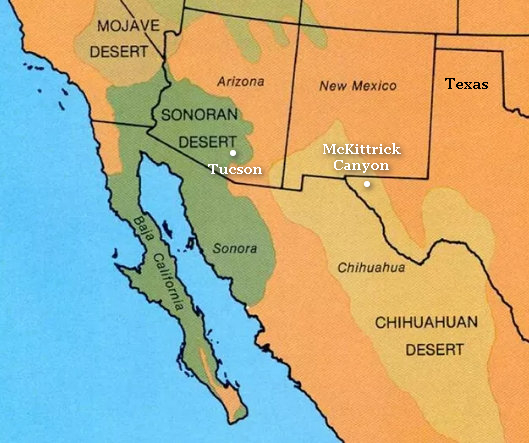
Ok, time for the obligatory location orientation.
Source: National Park Service
I would be remiss in my duty as your humble reporter if I did not mention something about Deserts.
Betsy and I spend the winter in Tucson which is in the Sonoran Desert. This part of Texas is in the Chihuahuan Desert. As you can see from the above map most of both deserts are within the borders of Mexico.
The Sonoran Desert receives both summer monsoon and winter rains. The Chihuahuan Desert receives summer monsoon rain but the winters are usually dryer and colder than the Sonoran Desert. The Chihuahuan Desert is also at a higher elevation than the Sonoran Desert. This has an effect on the species of plants which grow in both deserts.
The site Desert Ecology has a good explanation about the differences between the deserts in the southwest US.
Whites City is at the turn off for Carlsbad Caverns National Park. There is a hodgepodge of tourist services at this intersection including cabins and a hotel. On previous visits to the area the place always looked like it was abandoned and falling into ruin. Not any more. The cabins have been remodeled and the old hotel is now a Rodeway Inn. It would be a very convenient place to stay to visit both parks but the $100 plus per night is too rich for my blood. And there is no food available in the off season so one would still have to drive to Carlsbad for grub.
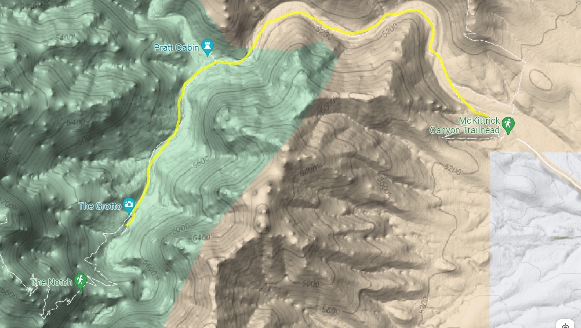
As you can see from this Google terrain map the McKittrick Canyon trail follows the creek all the way up to The Grotto which was my turn around point. The distance out and back was 7.0 miles with about 350' of elevation gain. A very easy going trail to be sure.
Here is a NPS trail map.
When I arrived at the trailhead at 6:45 there were just 3 cars in the 50 car parking lot.
This is why I like to start hiking early - not a soul in sight.
A detail of the photo above. "No pets, weapons, rock hammers or bikes are allowed in the canyon".
Fortunately I saw none of the above.
It was sunny down below but up in the mountains the sky was changing constantly.
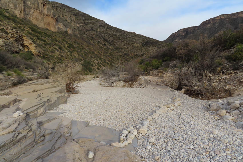
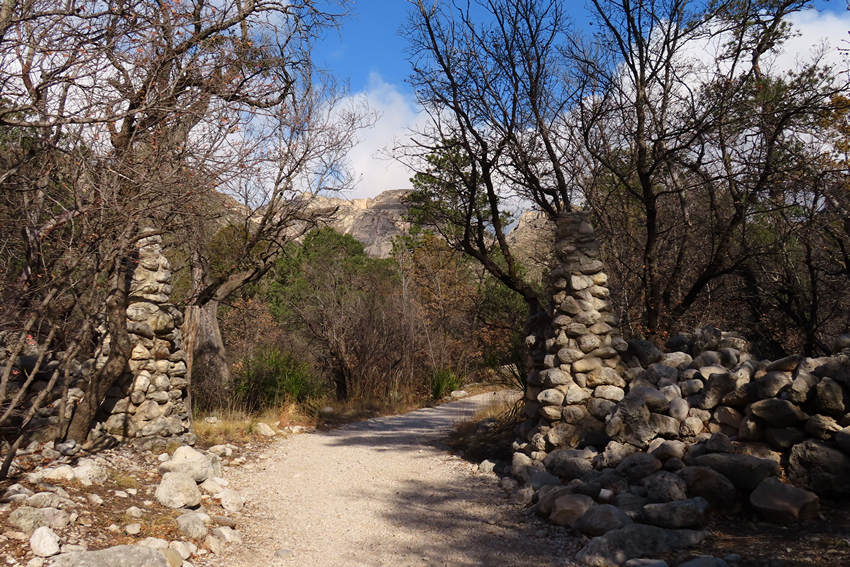
This was the first of several creek crossings. You can see some of the limestone cobbles laid out to help keep people on the trail.
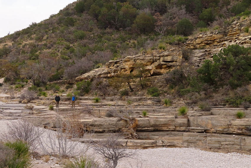
The rounded and smooth sides of the outcrops along the creek stood out in sharp contrast to the craggy and jagged walls of the upper canyon.
These limestone cobbles in the creek bed reminded me of some of the limestone cobble shores we saw on the north shore of Lake Huron.
Cobbles galore!
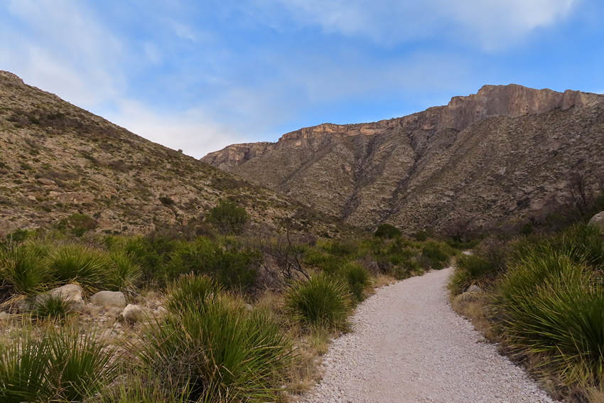
The lower section of the Canyon trail sees a lot of use thus the wide and smooth trail on this section.
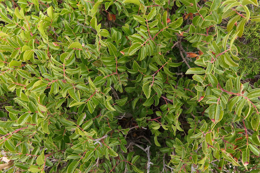
This is smooth sumac (Rhus virens). At home in West Virginia we have several species of sumac but none are evergreen. There is a good write up about both smooth and little-leaf sumac over at TexasBeyondHistory.net
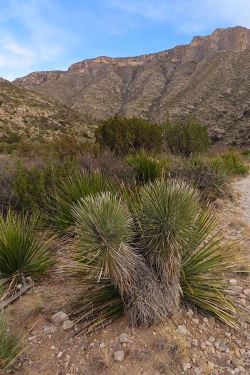
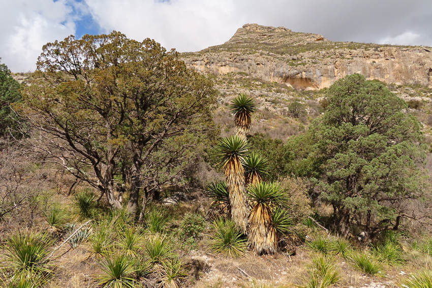
In the foreground is soaptree yucca (Yucca elata). The base of the plant and the fibrous leaves can be processed and used as a soap substitute. Wanna know how? Check out this video.
Soap-tree yucca was used by native peoples as a source of food, fiber for basketry and cord, soap, and building material. The towering plant often resembles a palm tree with relatively thin leaves arranged in a rosette around a central stem or trunk.
Mature plants develop a trunk, and can grow to a height of 5 or 6 meters, hence the name soap-tree. The leaves are long and leathery with tough stringy fibers. Young plants spread from the roots, so it is often observed in large colonies. When flowering they present an impressive show on the landscape.
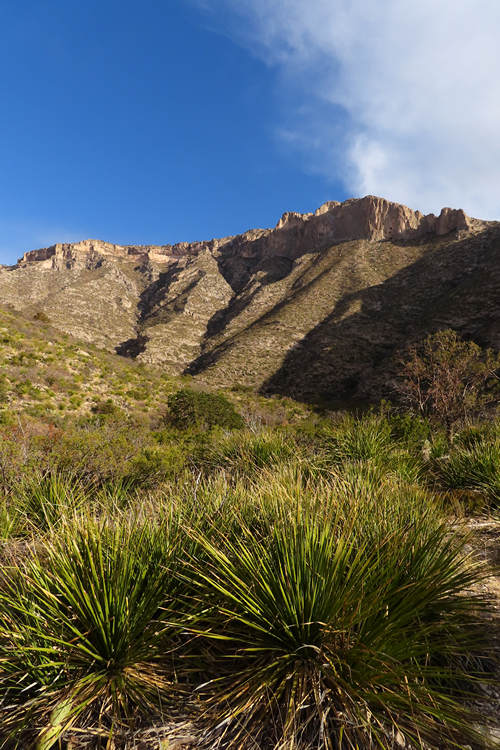
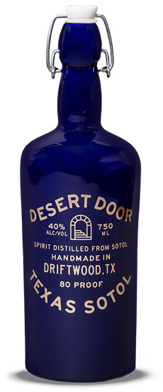
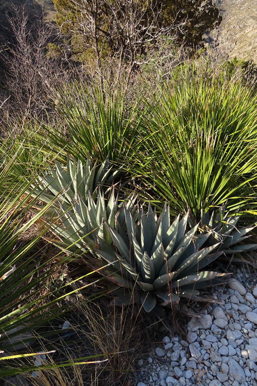
This is Texas Sotol (Dasylirion texanum), the sotol of the Chihuahuan desert. The Sonoran desert also has a sotol but it is a different species (Dasylirion wheeleri). Both species can be used to make an alcoholic beverage called, can believe it? - Sotol!
Sotol is an alcoholic beverage obtained after the spontaneous fermentation of the sotol plant (Dasylirion spp), commonly known as a pineapple. However, the microorganisms and chemical changes involved during this fermentation process are unknown.
The above is from the research article entitled: "Microbial and chemical changes during the production of sotol: a Mexican alcoholic beverage"
Source: DesertDoor.com
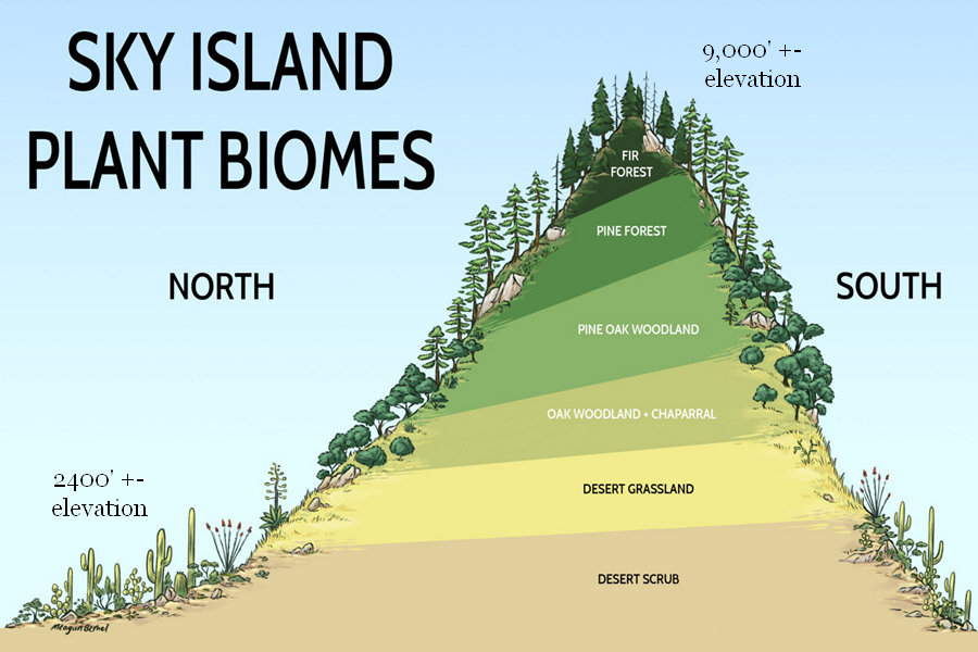
It is worth mentioning the trail starts at an elevation of about 5000'. To see this kind of elevation in the Sonoran desert would require being up in the Sky Islands of the Santa Rita and Catalina Mountains. For comparison the Tucson basin is at about 2400'. As one gains elevation the vegetation changes significantly.
Source: SkyIslandAlliance.org
Why am I showing a biome graphic for the Sonoran Desert when we are currently in the Chihuahuan Desert? To illustrate this point. The sotol that we saw above was at 5000' elevation. That same elevation in the Tucson area Sky Islands would be up in the Santa Rita and Catalina Mountains and that is where the sotol is the most abundant.
The sotal will grow in the Tucson basin (2400') if it is planted as a garden plant. But I have never seen sotal in the wild below an elevation of 3,000'.
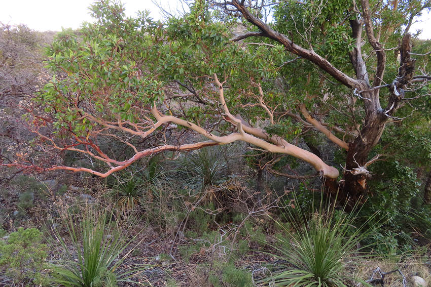
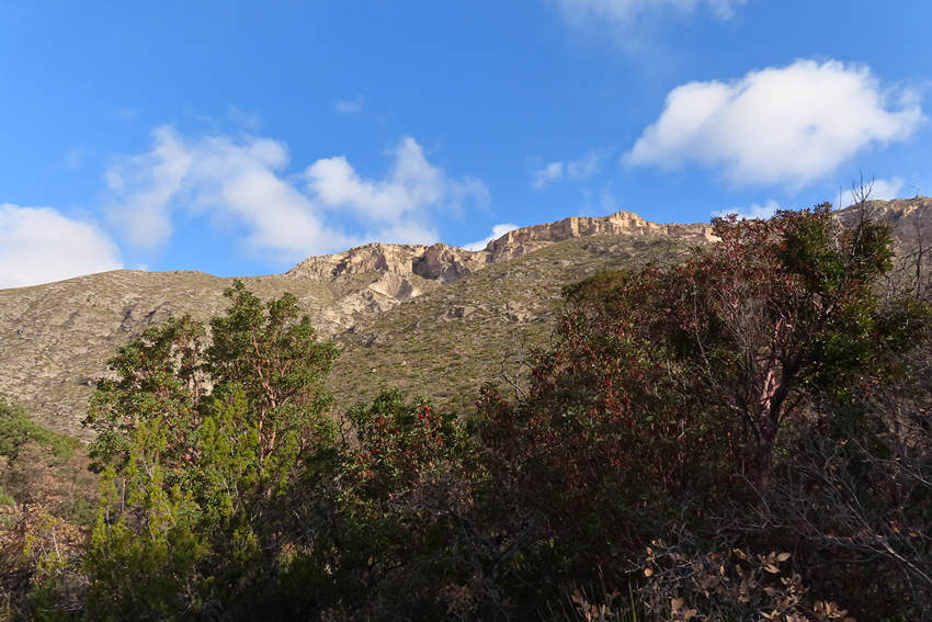
The further up canyon I hiked the thicker the vegetation became and the bigger the trees got. Pictured here is a Texas Madrone. Again, elevation is key to its growth. In the Tucson area this tree is only found in the Sky Islands at elevations above 5000'.
Agaves are beautiful but difficult for me to identity. So we will just call it an agave. Agaves are prized as ornamentals and, like the sotol, they also are used to make an alcoholic beverage.
Pulque (Spanish: ['pulke] (
listen); Classical Nahuatl: metoctli), or octli, is an alcoholic beverage made from the fermented sap of the maguey (agave) plant. It is traditional in central Mexico, where it has been produced for millennia. It has the color of milk, a rather viscous consistency and a sour yeast-like taste.
The drink's history extends far back into the Mesoamerican period, when it was considered sacred, and its use was limited to certain classes of people. After the Spanish Conquest of Mexico, the drink became secular and its consumption rose. The consumption of pulque reached its peak in the late 19th century. In the 20th century, the drink fell into decline, mostly because of competition from beer, which became more prevalent with the arrival of European immigrants. There are some efforts to revive the drink's popularity through tourism. Similar drinks exist elsewhere in Latin America, such as guarango in Ecuador (see miske).
Source: WikiPedia
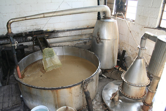
Photo: Geary Schindel
This is a pulque still. The photo was taken in Bustamante, Nuevo León in 2008. I bought a bottle to take home. It was a little harsh for my tastes.
The skies are clearing! Maybe it won't snow after all.
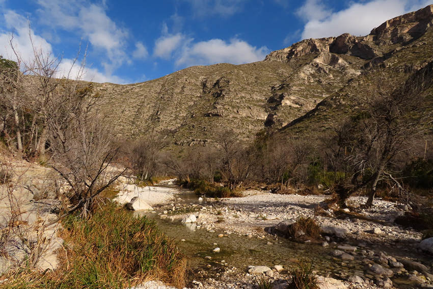
There is now a steady flow in this lovely ephemeral creek.
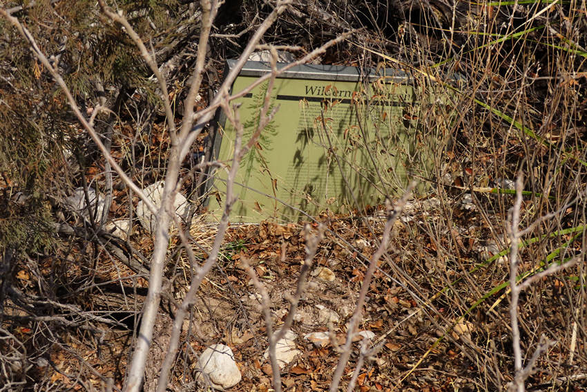
During the heavy monsoon rains the creek must rage as this partially buried sign would seem to indicate.
Hmmm... what's this. It would seem to be the entrance to a driveway.
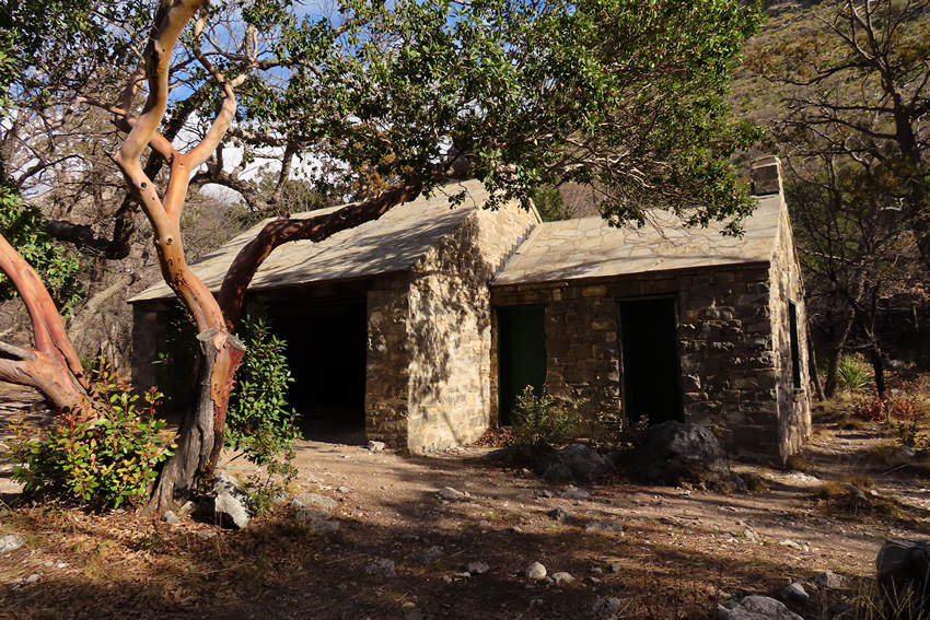
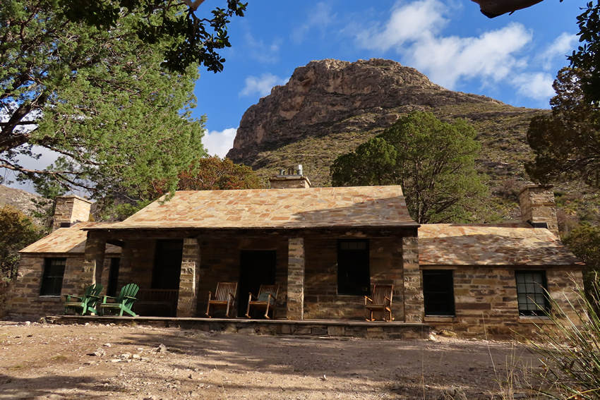
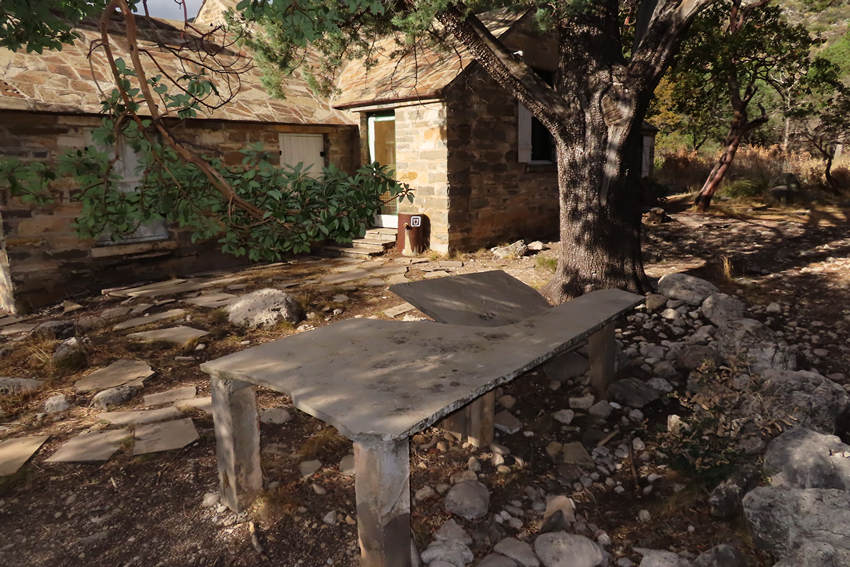
And indeed it is. Welcome to the Pratt cabin.
The view from Mr Pratt's front porch.
How would you like to wake up to this view and at night see a million stars?
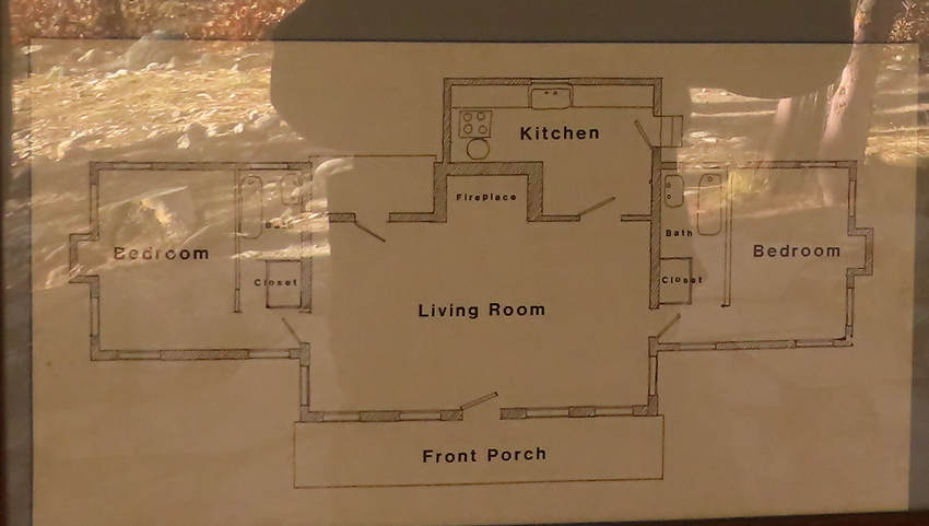
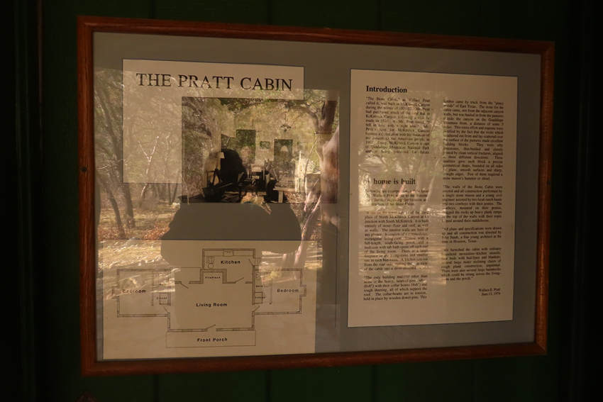
How did this cabin come to be? The framed text contained above was transcribed by Betsy so you could read all about the Pratt Cabin.
Introduction
"The Stone Cabin," as Wallace Pratt called it, was built in McKittrick canyon during the winter of 1931-32. Mr. Pratt had purchased much of the land that is McKittrick Canyon following a visit he made in 1930. As Mr. Pratt stated, " I fell in love with it right now. " Mr. Pratt's love for McKittrick Canyon became a declaration with his donation of the canyon to the American people in 1961. Today, McKittrick Canyon is part of Guadalupe Mountains National Park and is being preserved for future generations.A home is built
Following are excerpts from a 1974 letter Mr. Wallace Pratt wrote to the National Park Service regarding the location and construction of his Stone Cabin."It sits on the upper terrace of the flood plain of North McKittrick Canyon at its junction with South McKittrick. It is built entirely of stone-floor and roof, as well as walls. The interior walls are bare of any plaster. It consists of a commodious, rectangular living-room flanked with a full-length, south-facing porch... and a bedroom with tub bath opens off each end of the living room. There is a large fireplace in the living room and smaller one in each bed- room. A kitchen juts out from the rear side making the plan view of the cabin into a short-stemmed "T".
"The only building material other than stone is the heavy, heart-of-pine rafters (6x8") with their collar beams (4x6") and rough sheeting, all of which support the roof. The collar-beams are in tension, held in place by wooden dowel-pins. This lumber came by truck from the "piney woods" of East Texas. The stone for the cabin came, not from the adjacent canyon walls, but was hauled in from the pastures outside the canyon on the Guadalupe Mountain front, a distance of some 3 miles. This extra effort and expense were justified by the fact that the rocks which weathered out from and lay scattered over the surface of the pastures made excellent building blocks. They were silty limestones, thin- bedded and closely jointed by clean vertical fractures, aligned in three different directions. These qualities gave each block a precise geometrical shape, bounded on all sides by plane, smooth surfaces and sharp, straight edges. Few of them required a stone mason's hammer or chisel.
"The walls of the Stone Cabin were erected and all construction performed by a single stone mason and a young civil engineer assisted by two local ranch hands and two cowboys with their ponies. The cowboys, mounted on their ponies, drag the rocks up heart plank ramps to the top of the walls with their ropes looped around their saddle horns.
"All plans and specifications were drawn up and all construction was directed by John Staub, a fine young architect at the time in Houston, Texas.
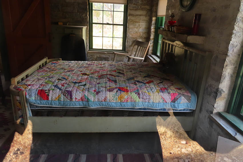
"We furnished the cabin with ordinary household necessities - kitchen utensils, four beds with bed-linen and blankets; several large rustic reclining chairs of rough plank construction, unpainted. There were also several large hammocks which could be strung across the living room and the porch."
Wallace E. Pratt
June 13, 1974
What a bummer. This most unusual table is now damaged. Hopefully the NPS has plans to make repairs.
The table top was a single thin piece of limestone quarried from a pasture about 4 miles from the cabin site.
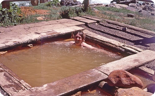
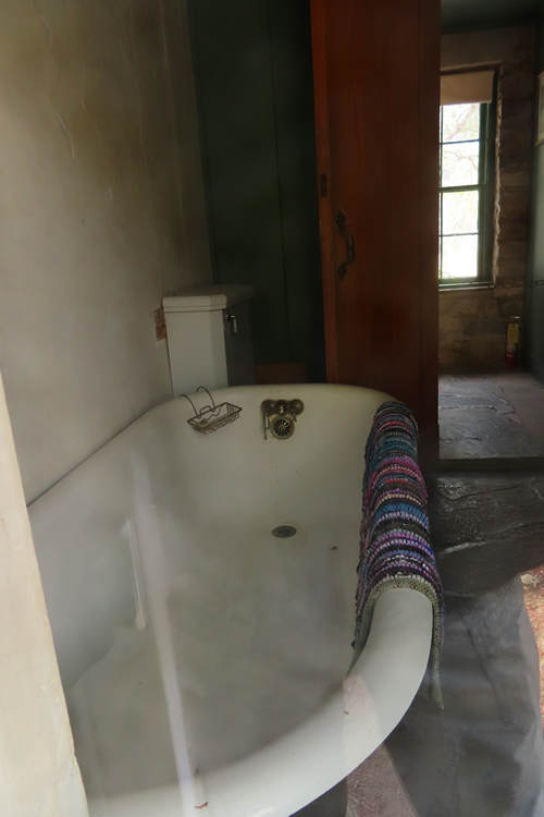
Ahhh... I have spent many hours in tub like this. I miss that.
What a cozy and inviting place.
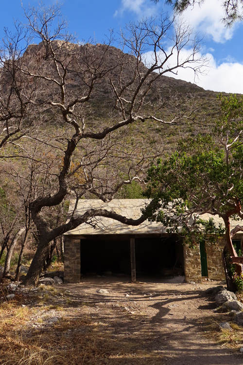
Complete with two car garage!
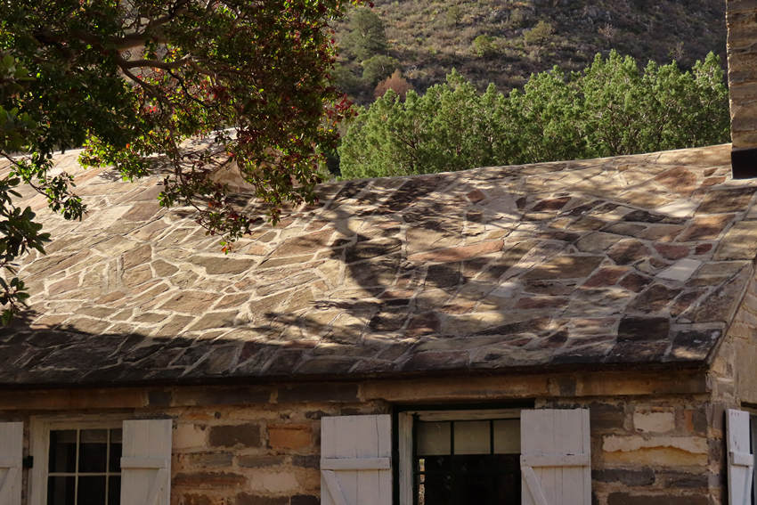
I was amazed to see the cabin roof was stone. How is it possible this could not leak?!
One final shot before heading back up the trail.
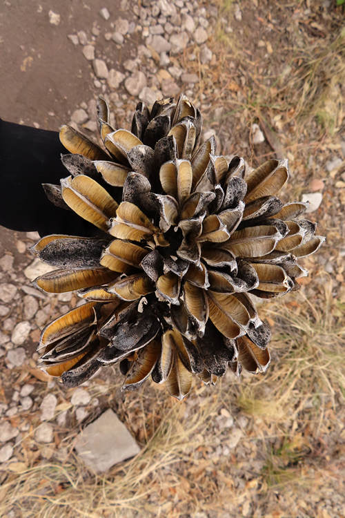
This is the seed pod of one of the agaves. It looked like a carved flower.
I placed the seed pod head there. It does not grow that short.
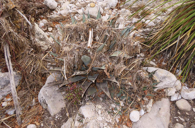
This small agave is completely enshrouded in debris washed up by high water.
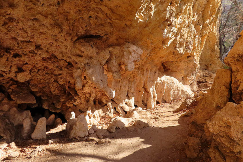
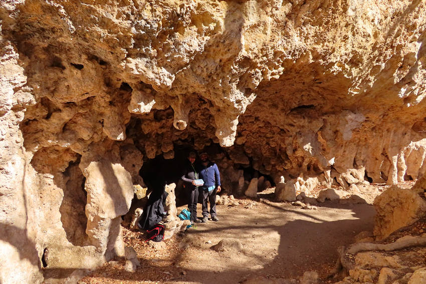
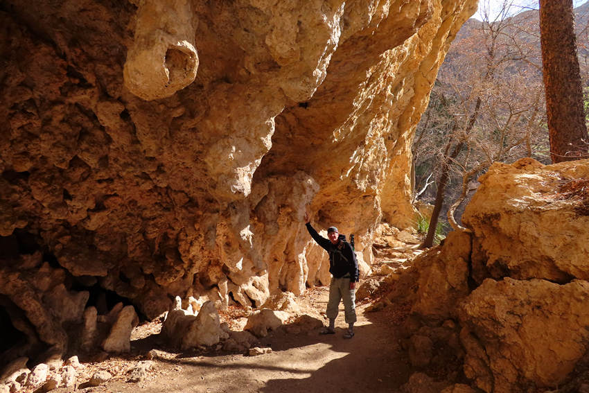
We have arrived at "The Grotto" which is the "open face of a small cave". The limestone face has been eroded away and what is left behind are features similar to what one might see in a limestone cave.
When I arrived at the Grotto there were just two people - this couple from San Jose. I had seen them at the parking area when I arrived and not again until now. In other words I had the entire hike to myself - on the way out. On the way back it was a different story.
They offered to take a photo of yours truly and I obliged.
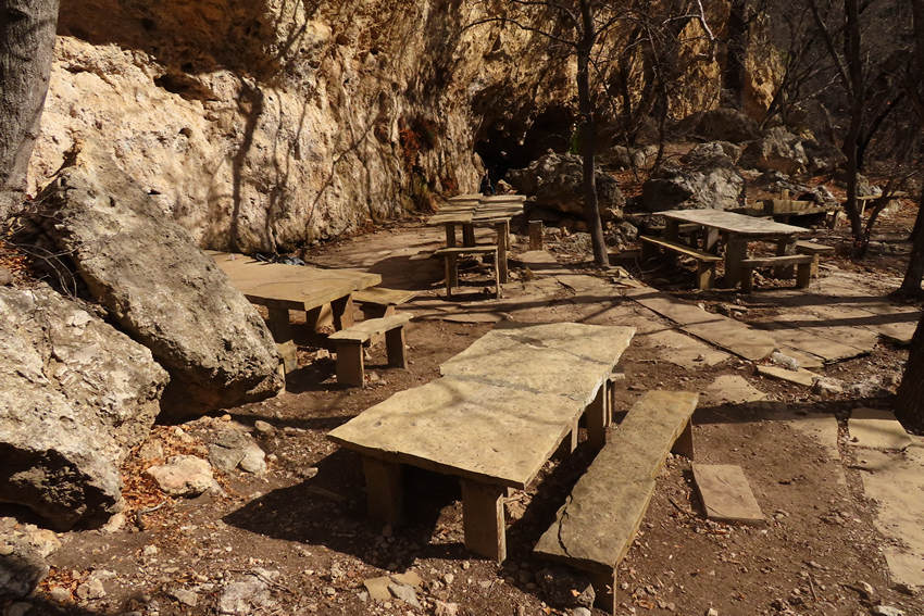
More of those cool stone tables. All of these were intact and undamaged.
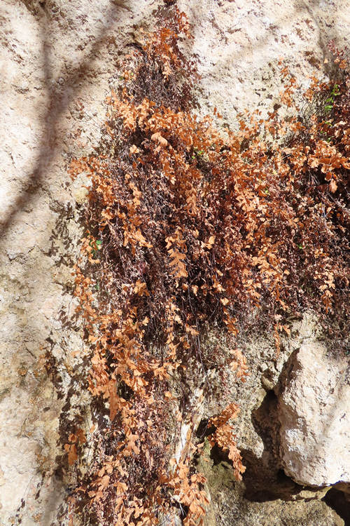
This I did not expect to see. These are the withered fronds of the Southern maidenhair fern (Adiantum capillus-veneris).
I did not know until I did some web surfing just how cosmopolitan this fern is.
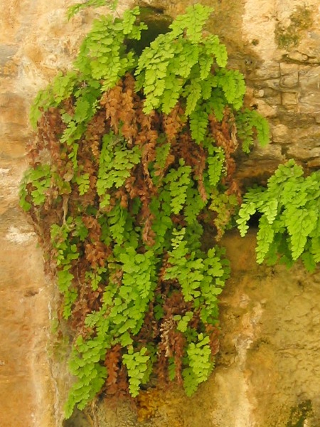
Adiantum capillus-veneris is native to the southern half of the United States from California to the Atlantic coast, through Mexico and Central America, to South America. It is also native to Eurasia, the Levant in Western Asia, and Australasia. There are two disjunct occurrences in the northern part of North America: at Cascade Springs in the Black Hills of South Dakota and Fairmont Hot Springs, British Columbia. In both instances, the warm microclimate created by hot mineral springs permits the growth of the plant far north of its normal range. It is similar in Zvonce spa resort (???????? ????, Zvonacka Banja), near Pirot in Serbia, where hot mineral springs provide adequate heat and humidity for the survival of this species.
Source: WikiPedia
Source: WikiPedia
The photo above was taken at a limestone cliff seep habitat, Judean Desert, Israel. Imagine that!
What a beautiful scene. But soon those clouds thickened and the wind it did blow!
Soon it was spitting snow and sleet.
The clouds were really hanging low and I was now glad I had decided not to continue the hike up to "The Notch".
For a while I was being pelted with hail and the wind got really wild. FUN!
I passed these two fellas (and many others). They were looking up canyon at the dark and brooding clouds. One of them asked: "What's it doing up there?" I told him. I don't know it they continued on or not.
When I got back to the contact station and parking lot it was quite busy and nearly all of the 50 spots were taken. Again - I was glad I got an early start.
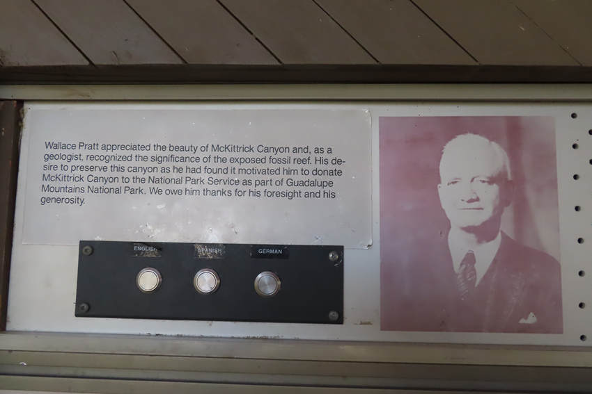
In the shelter area of the contact station there is a short video interview with Mr Pratt which I decided to listen to.
I took a video of the video with my camera so you could hear the voice of Wallace E. Pratt tell the tale of McKittrick Canyon and The Pratt Cabin.
Betsy - who must have the patience of a saint - laboriously transcribed the video and then formatted it so it had some continuity.
Thanks, honey!
My name is Wallace E. Pratt. I was born on the ides of March, 1885.
In 1920 I went out to Pecos, Texas. That's on the Pecos River, about 100 miles southeast from McKittrick Canyon. I was looking for oil.
We came to a weekend. Judge Drane said "If you wouldn't mind 100 miles over rough country with no roads, I'll show you the most beautiful spot in Texas." He took us to McKittrick Canyon and I decided it was the most beautiful spot I had ever seen. I'm in love with it right now.
It was in the midst of the desert, arid country, cactus and desert plants. It was in the face of a great mountain range, Guadaloupe Mountains. The canyon just sawed a cross section through the front of that mountain range. That front is 40 miles long, extends from Carlsbad out to Guadaloupe Peak, stands up 3000 feet above the surrounding terrain. And here's McKittrick Canyon - a, cold bold stream of water comes flowing out of that canyon. The moment it gets to the outlet of the front, walls rising on either side, it sinks and you don't see a sign of that out on the desert but in the canyon it's a wonderful, bold stream of cold clear water.
The water cut that canyon. What makes it beautiful that water is charged with calcium carbonate, lime, and as it flows and bubbles over these rocks and is aerated thoroughly. It evaporates and as it evaporates it precipitates that lime and that lime veneers all the bed of that stream . The gravel is inside but it's covered in travertine which is calcium carbonate coming out of solution . The travertine formed a dam across the whole width of that shallow 20-feet-wide stream and dammed up with a travertine dam all the way across it.
Now it wasn't a linear wall. It was little arcs making little dams one after the other. There were those pools dammed up by the travertine dam and going to the shore on either side and birds are coming right down to the ferns and really in the middle of the desert it's just inconceivably beautiful. The desert plants stop at the mouth of the canyon and in the canyon you have, you'd never guess, it maples, maples. And if you go there in the autumn the maples are beautiful reds and yellows and tremendous color. One of the most beautiful trees that lines the canyon is what the natives told us was manzanita, little apples, and it has a beautiful white blossom, it has waxy leaves and hold through the winter. The blossoms give a little red berry which is the apple. We sent some of them up to the forestry bureau in Santa Fe and they said this is not manzanita, this is a madrona. And it's a rainforest tree.
We built the stone cabin in 1930. We built that at the junction of North McKittrick and South McKittrick. That's about 2 miles up from the mouth of the canyon. A beautiful pool there at that time.
What makes the canyon geologically important is the Capitan Barrier Reef. The shores of Central America are coral reefs. The Capiton Barrier Reef is formed of these reef building creatures but they're not corals. It formed in the Permian times in other words it formed 245 million to 250 million years ago and it is formed of algae - not coral - algae, a grasslike filamentous, kelp-like creature.
In Permian times the shallow inland sea extended from Western Kansas continuously and widening a little bit down into Old Mexico. And the shores of that sea were muddy. So Barrier Reef looking for a place to grow, the reef creatures they moved out, some places 30 miles from shore. and there they found a clean bottom and they attached themselves to it and grew up. While they were growing up the bottom was sinking. Finally that reef got to be 1,800 to 2,000 feet high and the bottom sinking continuously for twenty millian years.
Finally it stopped at the end of the Permian. The crust of the earth was rising. The sea flowed off back into the ocean. So that the moment it began to rise, the reef died at the end of the Permian time but its skeleton was there. Finally it stood above sea level McKittrick Canyon cuts a gash through Capitan Barrior Reef.
I was fascinated with the beauty of McKittrick Canyon. And the geology of course fascinates me wherever I find it. The McKittrick Canyon had the geology and it also had a nice place to live.
And so ends my visit with Mr. Pratt and a very memorable hike up McKittrick Canyon.
On the way back to Carlsbad I decided to stop and see what was happening at the Caverns. Not surprisingly it was a mad house of cars and people.
I decided to take the Walnut Canyon Desert Drive which is a 9.5 mile scenic drive though some of the back country.
I had hoped to sneak in a short hike here but all the parking spots were taken so I decided my day in the 'Lupes had come to an end.
Now it was back to the room for another nice salad with my grilled chicken and of course a few beers. I looked over the map to refresh my memory on tomorrow's route. Next stop - Throckmorton TX. Not long after that it was lights out.
See you tomorrow...
