Mike Breiding's Epic Road Trips: September 2022 California and Oregon Road Trip
California
Morgan Hill to San Francisco: Day 1 - Part 1
Farewell to Steve, Back to Alice's, The Skyline Blvd, Half Moon Bay, Pacifica and on to San Francisco
Day 1 - Part1 : Wednesday, September the 28th 2022
Farewell to Steve, Back to Alice's, The Skyline Blvd, Half Moon Bay, Pacifica and on to San Francisco
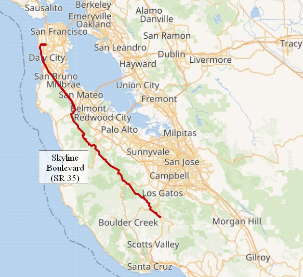
Todays route - about 100 miles. Thankfully a short day for us.

Wednesday, September the 28th 2022
Betsy and I were up early as was Steve. We said our good-byes and by 6:30 we were out the door. This would put us at our breakfast stop at 8:00 am - their opening time.
Thankfully the early departure allowed us to miss the heavy rush hour traffic and it was smooth sailing all the way to our turn off for the Skyline Boulevard.
Click on the photos below for a larger image.
I had not driven the Skyline Boulevard since 2007. I had forgotten just about everything I saw in the those 15 years so this was like driving if for the first time.
State Route 35 (SR 35, generally known as Skyline Boulevard for most of its length, is a mostly two-lane state highway in the U.S. state of California. It runs along the ridge of the Santa Cruz Mountains from the high point of State Route 17 near Lexington Reservoir in Santa Clara County to State Route 1 just south of Daly City in San Mateo County, where it crosses SR 1 and loops around Lake Merced to become Sloat Boulevard in San Francisco. SR 35 then continues along Sloat Boulevard until it reaches its terminus when it meets SR 1 again at 19th Avenue.
Because of its high elevation and location, it is one of the few places on the southern portion of the San Francisco Peninsula from which the San Francisco Bay and the Pacific Ocean are both visible at the same time. It also provides scenic views of the Silicon Valley metropolitan area.
Source: WikiPedia
This is looking east from the Skyline Boulevard towards Palo Alto and Silicon Valley. The photo location is here.
This is looking west towards the Pacific Ocean from the Skyline Boulevard. Somewhere out there is Tunitas Beach and San Gregorio. The photo location is here.
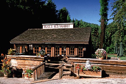
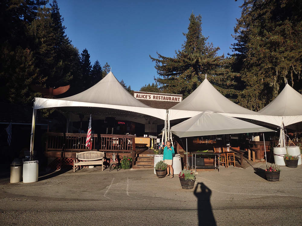
When I came through here in 2007 I stumbled upon Alice's Restaurant at the intersections of SR 35 and 84. Back then it was just a little place.
Like most people, Alice's Restaurant got bigger during the last 15 years.
Alice's Restaurant of Sky Londa, California, founded in the 1960s, was originally founded by Alice Taylor with no direct connection to Alice Brock. Subsequent owners of the restaurant kept the original name as a homage to the song, eventually adding a "Group W bench," because the name had made the restaurant a tourist attraction that was "good for business."
Source: WikiPedia
The building was originally constructed in the early 1900’s as a general store to support the logging industry. A hub of local history, it served the area (then called “Four Corners”) until the 1950’s when it was turned into a restaurant.
Sometime during the 1960’s the restaurant was bought by Alice Taylor who renamed the restaurant after herself and the now famous Arlo Guthrie song of the same name. Already, a world famous stop for motorcyclist, hikers and tourists, Alice’s Restaurant (and the adjacent buildings) was bought in the 1970’s and has been family owned & operated ever since.
Source: AlicesRestaurant.com
The song referred to above was "Alice's Restaurant Massacree" by Arlo Guthrie which was released in 1967. I am sure most of you old timers remember it. I and some of my family members listened to that song many times while stoned on weed.
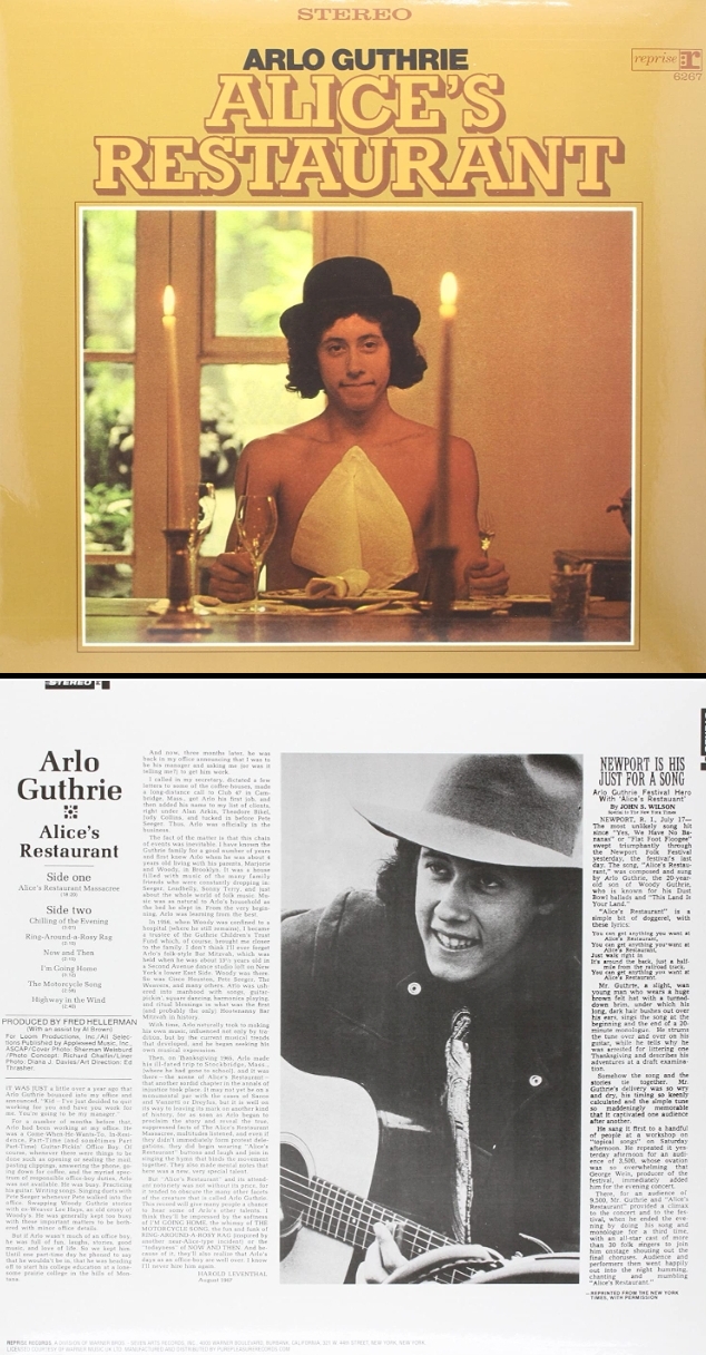
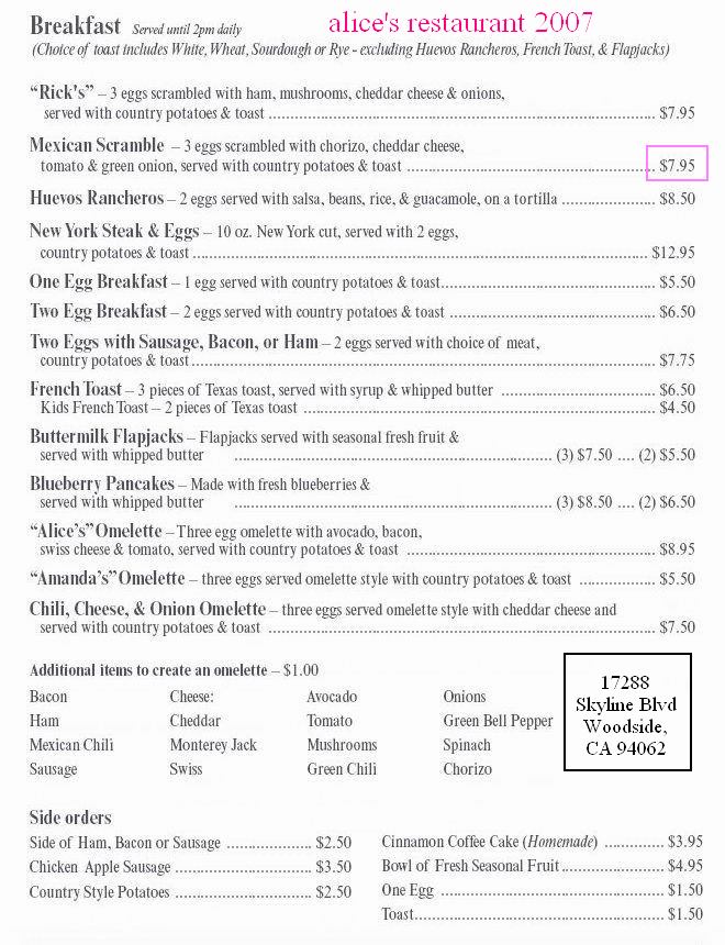
In 2007 I got the "Mexican Scramble". It was all I could do to eat the entire portion so Betsy and I shared the order this time.
In 2007 the "Mexican Scramble" was $7.95.
Here I am at Alice's Restaurant with my $4.00 cup of coffee. The "Mexican Scramble" has doubled in price since 2007.
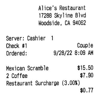

My how the prices have changed in 15 years!
Thus fortified we headed down the road in search of our next meal. We eventually wound our way down to Half Moon Bay and the lovely beaches there. We had now dropped 1500' in elevation since our breakfast at Alice's.
With the gold rush, Americans and others of many cultures soon followed. The early community became known as “Spanishtown” because of the number of Spanish speaking inhabitants there. In 1874, Spanishtown officially became known as Half Moon Bay, named for the beautiful crescent-shaped harbor that lies just north of town. As the late 1800s passed, the area’s character became established by the diverse representation of cultures that made the Coastside a prime example of the American melting pot.
The 1906 earthquake destroyed Mexican adobes and some early American efforts to build brick business buildings in Half Moon Bay. Wooden homes and shops survived the quake, and many of those early wooden structures still remain.
Source: VisitHalfMoonBay.org
I first visited Half Moon Bay in 1968. This is how I ended up going there.
In 1968 my mom fled Morgantown WV with her kids (Susan, Sutton, Michael, Wayne, William) to San Francisco. My mom now had 5 kids to feed and house and no place to live and no job. But she managed to take care of all of us. Our first house was on California Street near Steiner. I am not sure how we met them but at some point two fellas from Half Moon Bay were coming by on a regular basis. The reason? My lovely sister, Suzi.
These same two fellas knew all the hippie lingo like "far out man", "heavy man", "groovy" and "bummer". This was new to us and fascinating. They also smoked dope and dropped acid and they may have been the ones who got us our first hits of acid and guided us on our first trip. That trip included my brothers Sutton and Wayne. Although it seems neither Sutton nor I have a specific memory of Wayne being there.
Brother Bill? I think mom still considered him too young (13) for such a thing and he did not join us.
I remember my trip vividly - at least the hallucinations. The living room where we were tripping had an acoustic tile ceiling. I can remember seeing each tile floating in an undulating motion with green sand dripping down from between them.
I was sitting in an overstuffed velour arm chair and I can remember looking down into the fabric and seeing a whole city of moving people and also cattle and other animals. It seemed like it was a peasant village. I was captivated. Spellbound. A very nice first trip to be sure.
Sutton has this memory of that trip.
I recall it being an Orange Wedge, very strong , hallucinations yes, I saw 2 black dragons in mid air rising from a primal muck, it was amazing.
The "Orange Wedge" Sutton refers to was the name given to the little orange tablets compounded by the chemist who made them.
Although Wayne and I had never dropped acid before, Sutton had. The summer of 1967 Sutton made his first trip to San Francisco. Here is how he remembers his first trip.
Chester Anderson came by one evening. He passed out tabs of acid. He stayed all night and was a guide for the likes of me. My first trip did include some fear as I recall. Nothing extreme.
Over several years I continued to drop acid and went on 17 trips. Or was it 27? I don't remember. Every trip I had was full of hallucinations and I was stunned to find out later some people did not hallucinate when they tripped. And music. Oh, my - it was like having an aural orgasm. Incredible.
Back to the two guys from Half Moon Bay.
At some point they were going down to Half Moon Bay and then coming back to The City the same day. I went along for the ride and it was there I saw my first artichoke fields. I had no idea what they were or what you did with them. On a later visit down there with Gene Young he told me about how they were used as food. They looked weird to me. It was not until the mid 70s I actually had them to eat. Tasty. But still weird.
Speaking of artichokes...
In the late 1800s the climate and soil in the Half Moon Bay area were found to be ideal for growing artichokes. By 1930, 95 per cent of America’s entire artichoke crop was grown in the town of Half Moon Bay.
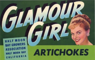
Crate label from the 1950s
Almost all of the crop was shipped east, primarily for the New York City market. Profits were good and big money was being made - local farmers were paid 5.5¢ per artichoke and they sold for 75¢ each in New York.
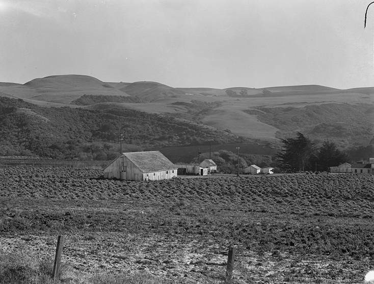
November 14, 1938. Near Half Moon Bay, California - Artichoke ranch
Source: Library of Congress
So much money was being made from the crop the NYC mafia got involved and tried to corner the market. They used varous methods to control production, distibution and sales including buying an entire season's crop and then reselling it at greatly inflated prices.
Farmers who would not sell were beaten and their crops hacked down with machetes. It makes for fascinating reading. If you want to know more check out these articles:
* The kingdom of the artichoke and the battle for its profits
* Coastside Chronicles ~ “Half Moon Bay, the Mob, and the Artichoke Wars”
Finally... the beach!
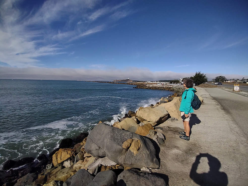
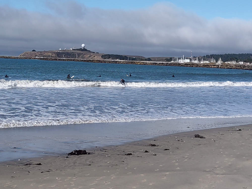
The beaches at Half Moon Bay are popular with surfers. You can see a few of them bobbing around in this photo.
That is the "Midcoast Multi-modal Trail" Betsy is standing next to.
More surfers ("Shred the gnar! Hang ten!" sez Martin) and the Pillar Point Air Force Station in the background.
Pillar Point Military Reservation, later Pillar Point Air Force Station is a United States Armed Forces facility on 48 acres founded on October 10, 1940, overlooking Pillar Point Harbor, California. Pillar Point is 15 miles south of the City of San Francisco in San Mateo County. The facility was built as part of the World War II harbor defenses of San Francisco, as there was concern that the Japanese may attack San Francisco.
Source: WikiPedia
What a gorgeous place for a walk or a bike ride, right along the Pacific coast.
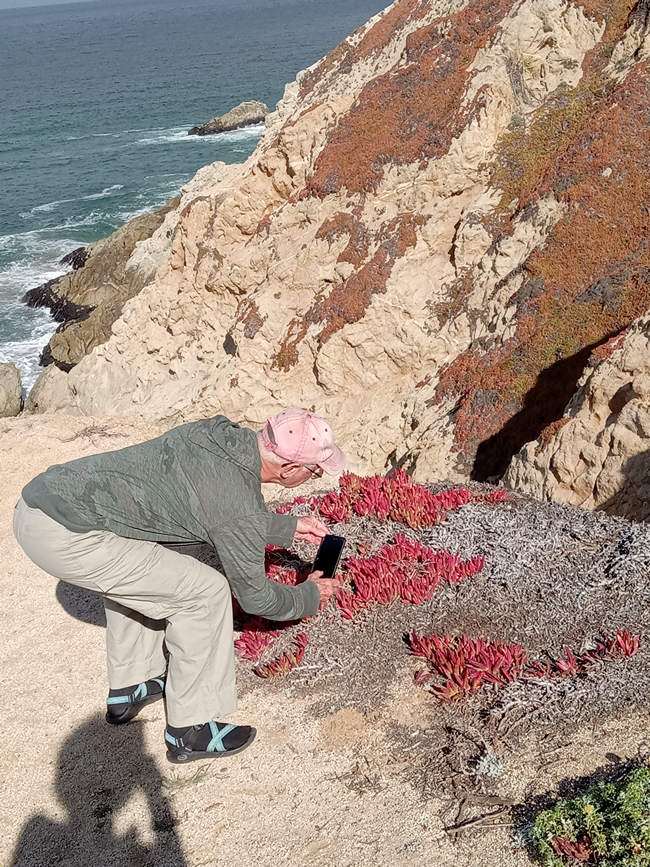
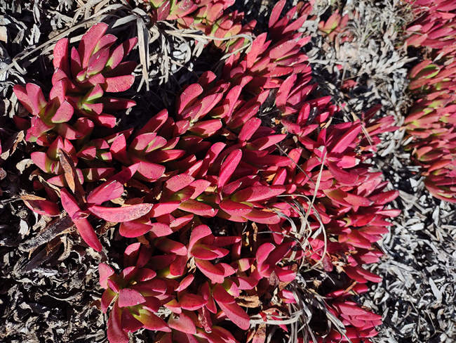
We departed the beach area and drove north. We stopped at a vista point for another look at the beach and Betsy took this shot of me taking a shot of some Ice plant (Carpobrotus edulis)
Although quite beautiful in foliage and flower, it is a non native species which has now engulfed countless acres of dune habitat.
Carpobrotus edulis is a ground-creeping plant with succulent leaves in the genus Carpobrotus, native to South Africa. Its common names include hottentot-fig, sour fig, ice plant or highway ice plant.
Carpobrotus edulis has naturalised in many other regions throughout the world, and is an invasive species in several parts, notably Australia, California and the Mediterranean, all of which have similar climates. The ice plant has escaped from cultivation and has become invasive, posing a serious ecological problem by forming vast monospecific zones, lowering biodiversity, and competing directly with several threatened or endangered plant species for nutrients, water, light, and space.
Source: WikiPedia
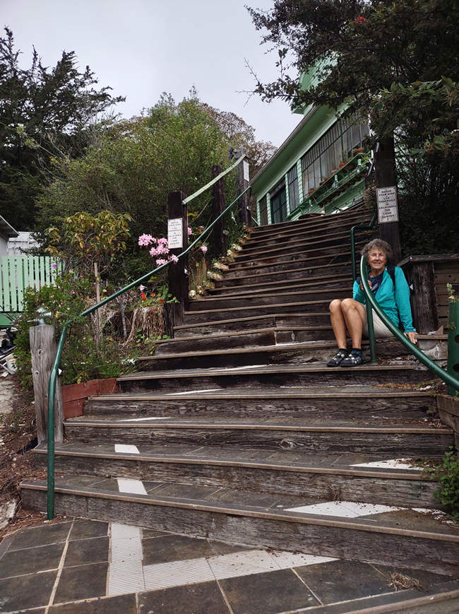
Here we are in Pacifica at Dan's Green House which is about 15 miles north of Half Moon Bay. We will be staying here the next 3 nights in the Northwest Room.
I stayed here in 2018 while taking my mom on her last visit to San Francisco.
Note the many steps. There is another flight to a landing and then another flight inside the house to get to our room. We set about the task of hauling our stuff up the steps.
Each time I came down those steps I was a bit on edge. That is what having 5 falls (3 on foot, 2 on bike) in as many months will do to you. Am I becoming aged and infirm? Or am I already there?
After getting our stuff unloaded we continued north on Highway 1 and then got back on the Sklyline Blvd (SR 35) just south of Daly City. I first heard about Daly City in the mid 1960s. There was a song called "Little Boxes" which was made popular by folk singer Pete Seeger.
The song is a social satire about the development of suburbia, and associated conformist middle-class attitudes. It mocks suburban tract housing as "little boxes" of different colors "all made out of ticky-tacky", and which "all look just the same". "Ticky-tacky" is a reference to the shoddy material supposedly used in the construction of the houses.
Source: WikiPedia
The song was much celebrated by counter cultural types which included many of the Morgantown friends of the Breidings and also us - my father not included.
At the time we thought it was really cool and an important and insightful look into middle class society.
But now that I am older and wiser I see it for what it was - judgmental and denigrating of a class of people that lived differently from us. We were hip, they were straight.
Here a sample of the lyrics to "Little Boxes"
Little boxes on the hillside
Little boxes made of ticky tacky
Little boxes on the hillside
Little boxes all the sameThere's a pink one and a green one
And a blue one and a yellow one
And they're all made out of ticky tacky
And they all look just the sameSource: 1962 Schroder Music Company
Click the play arrow to hear the Pete Seeger's
rendition of "Little Boxes".
Ironically the Breiding family almost ended up living in Daly City as it was one of the places my mom looked at to rent before we found the place in California Street.
Continuing north past Lake Merced, The San Francisco Zoo and the Sunset District we then arrived at the Ocean Beach parking lot. This is where I parked every day on my trip to SF in 2018 and now Betsy and I would do the same.
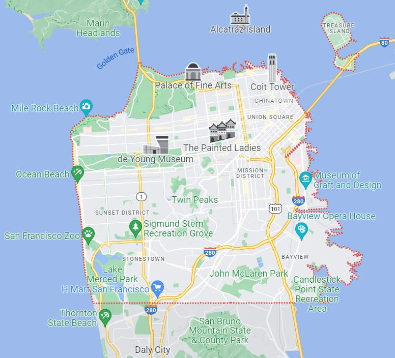
From here we would start our hike along the coast to the Golden Gate Bridge and bus and walk though the Marina District, Pacific Heights, Japantown and what was formerly known as the Fillmore District, now Lower Pacific Heights.
We hope you will join us.
See you next time...
Mike and Betsy
Previous Posts:
California and Oregon Road Trip: Introduction
California: The ERT Begins: Tucson to Buttonwillow
California: Visiting Our Favorite Aussi
