Mike Breiding's Epic Road Trips: Tucson Winter: 2020 - 2021
Hiking and Biking and More
Quick Takes
Just a few snapshots from each event
Sunday, November the 8th
A Morning Stroll in our "Back Yard"
This morning Betsy and I walked out the door at 9:00 for the start of our hike. After about a half mile walk down Circle Z and up Sarasota we were at the trail head. The weather was perfect this morning - in the 50s with predicted highs in the 60s and sunny skies with a light breeze.

Our hike would take us along the south facing flank of Little Cat Mountain, through Starr Pass (aka "The Cat's Crack"), across the Star Valley then along the eastern edge of the valley to a switch backed climb up a ridge where we took a break at the Barney Rubble pic-nic area.
After snacks we hiked back down into the valley, crossed over and then back through the Cat's Crack, along Little Cat, then down to the trail head and back home for a total of 6.5 miles.
As might be expected on a beautiful Sunday morning we shared the trails with a few others. Some hiking and some biking. When passing we always stepped well off the trail if others did not.
Click on the photos below for a larger image.
The hike's beginning.
Here we are on the south flank of Little Cat looking towards Big Cat (aka "Crouching Cat") mountain and The Cat's Crack.
The hike's end.
This is looking west towards Golden Gate Mountain, Gates Pass and Bren Mountian.
Although crispy dry from a summer of endless triple digits and practically no rain the desert has retained its beauty.
Friday, December the 11th 2020
Our COVID Winter - My How things Have Changed
The December 10th online version of azcentral.com reported Arizona is now No. 1 in the nation for COVID-19 spread. The City of Tucson has implemented what seems to me a pointless and ineffectual curfew to help curtail the spread.
On December the 4th the Pima County Board of Supervisors issued a resolution which
"requires everyone to wear masks or face coverings when in public and cannot easily maintain a continuous distance of at least six feet from others. The Resolution also mandates businesses require customers to wear masks.
Violations of the Resolution are enforced as a civil infraction with a fine. Individual violators face a $50 fine and businesses face a $500 fine and possible loss of permit or license to operate."
Although masking up and distancing would certainly be of help in limiting the spread, the compliance and enforcement of this resolution seems to me to be a cumbersome and time consuming process which again seems mostly pointless and ineffectual.
At the state level Governor Doug Ducey apparently feels nothing needs to be done to slow down the spread of COVID in spite of the fact Arizona is now No. 1 in the nation for COVID-19 spread.
More than one Arizona Mayor has asked Mr Ducey to put in place statewide measures to help curb the spread of COVID, but these pleas have fallen on deaf ears.
It appears that anything which will impede business as usual is a no-no and there has been no state wide mandate for masking and no closures of bars and indoor dining areas and there has been no requirements that visitors to Arizona get tested or quarantine upon arrival to try to prevent further spread of the virus. And so the spread continues.
Locally, here in Tucson Estates there are now both residents and staff who have tested positive and so all indoor facilities are closed and only lap swimming is allowed in the pool. Tennis, golf, etc are still permitted which I think is too risky given the laissez faire attitude of some people.
Hiking? Last year Betsy and I were leading 2 to 3 hikes a week with groups of 12. We had regulars we saw every week but there were always new people coming in and out of the hikes. That is one of the reasons I enjoyed leading hikes - meeting all those new people.
My how things had changed for this COVID winter. We are not attending and not leading group hikes and not participating in any other group activities.
And no line dancing and chorus for Betsy which she really enjoyed and really misses. She has been taking some Zoom line dancing classes but they are a bit cumbersome to participate in. But she still enjoys it.
And of course it goes without saying there has been no indoor restaurant dining for us. So far Betsy and I have dined out just once on the patio at the Cup Cafe and I went there for lunch last week with my cycling buddy Jim. But that's it - only twice. Very different from last year when we went out once a week.
We are still going out for groceries but try to time it when there are the least number of people in the stores.
Back to hiking. We are now hiking with just 8 people each week. The same 8 people. Before this was agreed upon we felt we had all vetted each other as it relates to risky behavior like being a participant in any group activities whether indoors or out. We mask up on the trail and also step off the trail as other hikers approach.
By the time April rolls around we may all be sick and tired of each other!
Meet John and Janet - 2 of the 8 hikers we are fortunate to be able get out on the trails with. In the background is Panther Peak in the Tucson Mountains.
We first met John and Janet several years ago at a "Meet the Monument" event at nearby Ironwood National Monument.
J&J had noticed our WV licence plate and as they were originally from the Upper Ohio Valley they stopped to introduce themselves and chat a bit. J&J then started signing up for my hikes hosted via MeetUp.
At some point J&J asked me if I had been up to Panther Peak. I said I had not. Would I like to go? U bet! And that was the beginning of several hiking firsts J&J took me on, as well as nearby Safford Peak (aka Sombrero).
The others being Elephant Head in the Santa Ritas, and more recently they guided Betsy and I us through the maze of trails in the Sweetwater Preserve and the fabuous Cowboy Slickrock of the Golder Ranch area in the far north reaches of the Catalina Mountains.
Recently we met John and Janet for our hike in the Sweetwater Preserve which is just a short drive from our house. I had been there just once before for a short stroll but had not returned. Why I do not know.
The Sweetwater Preserve is a 880+ acre preserve located in the eastern foothills of the Tucson Mountains of Southern Arizona, west of Tucson. Within approximately one-half mile of the Preserve are Saguaro National Park’s Tucson Mountain District, and a biological research preserve owned by the University of Arizona. Tucson Mountain Park is also located a short distance to the south.
The lands that comprise the Sweetwater Preserve were acquired using monies from the 2004 Open Space Bond measure. The community strongly supported acquisition of this property and worked diligently to realize the establishment of this preserve.
County crews and volunteers have built 15 miles of trails in the preserve, which was ranked #4 in the nation in Singletracks.com, an online mountain bicycling magazine. While the trails are enjoyed by equestrians, hikers, dog walkers and trail runners, it is highly popular with mountain bikers, both local and visitors. Trails are suitable for beginner and intermediate level riders.
15 miles of trails on 880+ acres may sound cramped but the gently rolling terrain keeps most users out of sight of each other.
Our hike with John and Janet was 5.5 miles with about 500 feet of total elevation gain. A gentle stroll more than a hike and very relaxing.
Here is a thumbnail image of the hike route. If you click on the image it will take you to the full sized map I made on Google MyMaps.
Click on the photos below for a larger image.
800 hundred acres of now protected Sonoran Desert makes for some beautiful scenery. The summit at the center is Wasson Peak which at 4,688' is the highest point in the Tucson Mountain range.
In spite of one of the hottest, driest summers on record most of the Saguaros we saw were still looking pretty good.
It is not often we come across a barrel cactus this size but we do see them on occasion.
I took this photo in October of 2019 at the intersection of the Yetman and Bowen trails. Sadly this barrel cactus is now no more than a fallen giant.
And there you have it - a quick take and few snapshots of our hike at the Sweetwater Preserve in the Tucson Mountains.
Thanks, John and Janet!
⋄⋄⋄⋄⋄⋄⋄⋄⋄⋄⋄⋄⋄⋄
Wednesday, December the 16th
The Santa Rita Mountains:
8 miles and 3000' of pure hikin' pleasure.
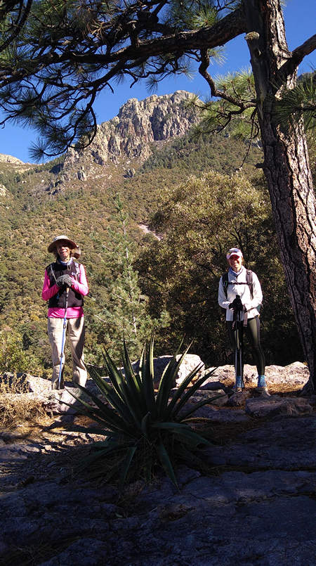
Meet Kathy, Liane and Beth
(2 seniors, 1 junior)
I mentioned previously how over the span of 8 years of leading hikes I had met so many fun and interesting people. Many hikers would join in once and never be seen again, some were in and out of hikes and some became "regulars".
Kathy, Liane and Beth were amongst the regulars and I am glad of it. And last winter the 4 of us decided we would meet once a week for hikes which would take us all to places we had not been before. Lots of fun and lots of exercise! Kathy, Liane and Beth are all stronger hikers than I am so it has at times been challenging for me.
Unfortunately this winter Kathy is not with us (boo-hoo...) but I hope that will change when this crazy COVID time gets back to normal.
Speaking of "challenging". Leave it to Beth to suggest this one: 8 miles and 3000' of elevation gain. And if you click on the above image of the route elevation profile you will see most of that elevation gain was in the first 2 miles. What does that mean? Steep, baby - STEEP! And on top of that it was colder than a witch's titty when we started this hike.
This hike started at the head of Madera Canyon at an elevation of 5400' feet. The Madera Canyon is north facing and so gets little sun in the winter. This combined with the elevation makes it considerably cooler than the Tucson basin. Great in the summer. The winter? - not so much.
Here is a thumb nail view of the hike route. If you want to see the Big Picture you can check out this map I made on MyMaps.
This hike started out on the Old Baldy Trail and then shortly we intersected the Vault Mine Trail which climbs and climbs and climbs... You get the picture.
Beth took the lead on today's hike and set a pace that both Liane and I found quite agreeable.
Oh, did I mention Liane injured her foot hiking just two days prior to this hike? Did that stop her from going? No. And even though it was obvious she was in pain and favoring her left foot the entire hike she complained not once. Me? I wouldn't even have shown up!
All the elevation gain provided us with some fine views. Seen here is the mouth of Madera Canyon, the Tucson basin and the Catalina Mountains.
Here are Liane and Beth at the entrance to (Treasure) Vault Mine for which the trail is named. Copper, zinc, silver, lead, and gold were mined here.
Workings include a shaft and 2 tunnels separated by 80 feet vertically. The tunnels are driven eastward in a ridge that separates the head forks of Agua Caliente Canyon. The lower tunnel is 135 feet long, and from it a 30 foot long crosscut has been driven to the south. The shaft is 100 feet deep and is located 100 feet above the upper tunnel, which is 80 feet long and caved.
It was discovered in 1899 and is (was ?) owned by the Santa Rita Mining Co., of TucsonSource: mindat.org
Beth snapped this picture of Liane and me.
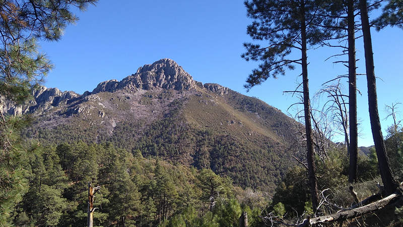
Our first look at Mt Wrightson, aka Old Baldy, the highest peak in the Santa Rita Mountains at 9456'. The second highest peak in the Santa Rita Mountains is Mt Hopkins at 8,553'.
Wrightson and Hopkins were killed by Apache Indians at the Battle of Fort Buchanan.
The battle began on the morning of February 17 twelve miles away from the fort when two surveyors of the General Land Office and a young Mexican boy were attacked. William Wrightson and Gilbert W. Hopkins were traveling from a ranch in the Santa Ritas towards the fort, presently three miles west of Sonoita.
Suddenly, dozens of Apache warriors opened fire with both rifles and bows. All were mounted and so a chase ensued in the direction of Fort Buchanan. The three had nearly made it there when they were overwhelmed and killed; the United States Army reported that they three did not attempt to defend themselves, no gunshots were heard, and Corporal Buckley later said that he did not know that Wrightson and Hopkins were in the area. Mount Wrightson and Mount Hopkins, the two highest peaks of the Santa Ritas, were later named after the men.Source: WikiPedia
Word of Wrightson's demise reached his hometown and was reported in the local paper.
The Cincinnati Enquirer
Cincinnati, Ohio
26 Apr 1865, Wed Page 2
Death of a Former Cincinnatian.
William Wrightson, formerly of this city, where he was one of the proprietors of the Railroad Record for several years, and recently special agent of the Post-office Department in Arizona, came to his death at the hands of the Apache Indians, at fort Buchanan, on the 17th of last February. He had left Tubac to visit this fort, and other localities, in company with G. W. Hopkins, of New York City. The fort (Buchanan) had, but a few moments before their arrival, been captured by a band of these Indians, of which fact the two visitors were not aware. Near the fort they had to pass through a narrow defile, at which point the ambuscaded Apaches shot them down, killing both, their bodies being afterward found pierced with arrows and lance thrusts.Mr. Wrightson was born in York, England; came to this country in 1832, and to this city in 1854; and was, for several years, actively engaged with his brother, T Wrightson, in the publication of the Record.
Source: The Cincinnati Enquirer
The Santa Rita Mountains with Mt Wrightson on the left and Mt Hopkins on the right. Source: WikiPedia
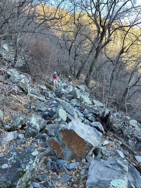
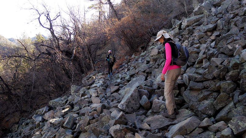
Shot from the Agua Caliente trail this view shows one of several talus piles we saw, some up close and personal.
Talus
An outward sloping and accumulated heap or mass of rock fragments of any size or shape (usually coarse and angular) derived from and lying at the base of a cliff or very steep, rocky slope, and formed chiefly by gravitational falling, rolling, or sliding.Source: U.S. Department of the Interior
Beth shot this photo of Liane and me carefully picking our way through one of the talus piles.
Liane was extra careful because of her injured foot.
The air on the these shady slopes, especially around the talus piles, felt like it was pouring out of a deep freeze.
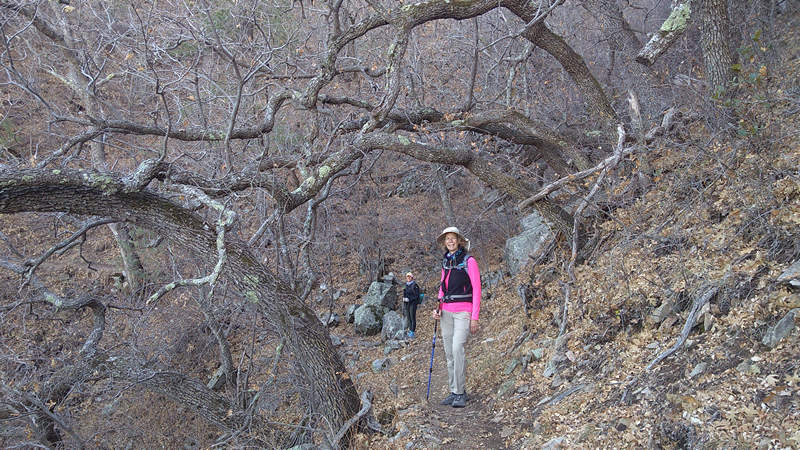
There are eight species of oaks growing in the Santa Rita Mountains. In the lower reaches of Madera Canyon "evergreen" species such as Emory and Silverleaf oaks are common. Up this high the oaks are deciduous which gave it and even more wintry feel.
This lovely, arched specimen is most likely Gambel oak.
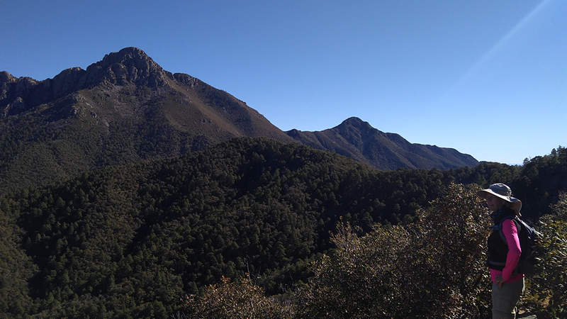
Mt Wrightson, Josephine Peak and Liane.
Up this high the Apache pine is abundant and in places the trail was carpeted with their fragrant needles.
Liane snapped this photo of Beth, Old Baldy and Mt Wrightson. BTW - just a few weeks ago Beth completed her first hike all the way the to summit of Wrightson. Solo.
She was turned back on a previous attempt by frigid temps, howling winds as well as ice and snow.
I have summited Wrightson 3 times and doubt I will do so again.
Our goal all along was to have lunch and take in the view from Rogers Rock. Thankfully there was a little patch of sun which we all enjoyed.
From here it was down Fern Gully to the Pipeline Trail and then to the Super Trail and back to the trail head.
A wonderful, if strenuous and chilly hike. All three of us enjoyed some new trails today thanks to Beth. I wonder what she will come up with next?
Until the next time...
~Mike


