Mike Breiding's Epic Road Trips: July 2021
Four Days Hiking the Highlands of West Virginia
Hikes: Pace Point, Park to Park, Canaan - "Our Refuge" and Yellow Creek Natural Area
Or: Four Days of Rhododendron, Fern and Blueberry Heaven
July 2021
Back around 2008 when Betsy's retirement was just a couple of years away we started talking about what we would like to do with all of that free time. The obvious answers: sleep in when you want, take all the time you want with your morning coffee, read, start and finish personal projects, hike, read, bike, and of course, travel.
One of the things we decided to do once that Retirement Day in 2010 rolled around was visit every State Park and State Forest in West Virginia.
Betsy gets ready for retirement.
Well, once that Big Day in 2010 came and the dust had settled from Betsy's Retirement Party it was now time to plan out our trips to all those places in West Virginia we had neglected for so long. And where did we end up going? San Francisco, Scotland, Spain, Arizona, Michigan, Minnesota, Maine... Get the picture? We just could not seem to get to any of the State Parks or Forests in West Virginia. Now 11 years later we are making some progress on that promise to our selves.
This June we stayed three nights in a cabin in Holly River State Park to celebrate Betsy's 71st birthday and where she enjoyed a swim in her birthday suit. And then this July we stayed 3 nights at the rather decrepit Alpine Lodge in Davis West Virginia.
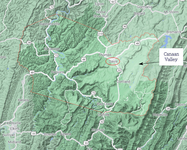
Why Davis? It is in "The Heart of the Highlands" in Tucker County with access to some of the best hiking in the state of West Virginia. And public lands? Oh, yes! Nearby are:
Blackwater Falls State Park 1,679 acres
Canaan Valley State Park 6,014 acres
Little Canaan Wildlife Management Area 3,168 acres
Canaan Valley National Wildlife Refuge 16,628 acres
Spruce Knob-Seneca Rocks NRA 100,000 acres
Monongahela National Forest 919,000 acres
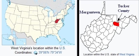
Tucker county WV - "The Heart of the Highlands" where we will be hiking the next four days.
Tucker County is a county in the U.S. state of West Virginia. As of the 2010 census, the population was 7,141, making it West Virginia's second-least populous county. Its county seat is Parsons. The county was created in 1856 from a part of Randolph County, then part of Virginia. In 1871, a small part of Barbour County, was transferred to Tucker County. The county was named after Henry St. George Tucker, Sr., a judge and Congressman from Williamsburg, Virginia.
Source: WikiPedia
Note the population count above is listed at 7,141. Tucker County has lost population over the last 10 years and the current estimate is 6,839.
And it ain't just Tucker County.
West Virginia Has Sharpest Population Decline In U.S., Will Lose A Seat In Congress
According to preliminary data released Monday by the U.S. Census Bureau, West Virginia lost 3.2 percent of its population since 2010 — the highest rate of population loss in the nation. West Virginia now has just under 1.795 million people, according to the 2020 Census.
But - not to worry! Our bloated, billionaire buffoon of a Governor has it all under control.
W.Va. Gov. Wants A Population Boom And A Disney Theme Park. His Plan? Income Tax Cuts
Under (Governor) Justice's plan, all tax filers would see a 60% tax cut on wages and salaries, as well as on Social Security, unemployment and retirement benefits.
But the plan would cost the state more than a billion dollars — or nearly a quarter — of its general revenue budget. To account for that revenue loss, Justice has proposed massive hikes on tobacco, alcohol and soda taxes.
"I really, really believe that there is a real chance of landing real entertainment — landing, you know, the next Disney, the next Dollywood, whatever," he said at a recent event touting the plan." - Governor Justice
But, as they say - I digress...
Let's move on to more pleasant topics.
And so it was on Monday, July 19th we started the drive to Davis to start our Four Days in The Heart of the Highlands.
A direct route to Davis from Morgantown will take the average driver about an hour and 45 minutes to drive the 60 miles. But wait! The direct route? What is that!!?? Our 200 mile route from Morgantown to Davis WV took us about five and a half hours with a goodly number of miles on unpaved back roads. A most excellent drive. But why the round about and out of the way route?
Back in June when we stayed at Holly River State Park we took our roasting skewers along so we could roast some weenies in the fire place. Unfortunately we left the skewers behind when we packed up and headed for home. Now you have to understand, these were not cheap skewers made in China. If they had been they would have stayed where we left them. But our skewers were different and indeed one of a kind.
Our skewers were a gift from our former Hornbeck Road neighbor Charlie Baer (1919-2014). Charlie was on the faculty of WVU and taught the first ecology class at WVU. Charlie worked at Brooks Hall which was adjacent to Hodges Hall which had a maintenance and machine shop in the basement. Charlie was friends with one of the maintenance workers and at some point mentioned he was looking for some hot dog skewers to use at the annual Biology Department picnic. That picnic was to be held at "Baer Bottom" which was at the bottom of a hill where Charlie and his wife Virginia lived. At the "Bottom" there was a nice swimming pond which made it an ideal place to have a summer picnic.
Well, the maintenance worker must have said "I can make you some hotdog skewers" and indeed he did. But not your ordinary skewers! The forked skewers were made from hand brazed stainless steel which Charlie then attached to maple handles. Fancy! And durable and long lasting. And now over 40 years old. So, now you know why we could not leave them behind and went a bit out of our way to retrieve them.
The business end of Charlie's "Baer Bottom" skewer.

When we rolled into Davis it was about 2:30 and we went directly to the hotel to check in.
We got unloaded and re-organized for hiking and then made our way over to Black Water Falls State Park for a short hike.
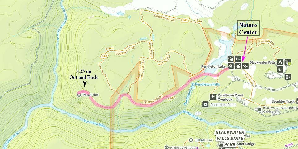
Friends John and Petra had recently been in the area and had suggested a few hikes we might enjoy. One of them was the Dobbin House trail loop which started at the Harold S. Walters Nature Center. After looking at the map we decided that route would be a tad bit long. It was already creeping towards 4:00 which a late start for us. So, we decided on a shorter (3.25 mi) route which would take us out to Pace Point.
Our route to Pace Point
Let's go!
Click on the photos below for a larger image.
19 July 2021
Hike to Pace Point in Blackwater Falls State Park
The first part of the hike was through open fields and we were delighted to see milkweed in bloom. On this warm day the fragrance surrounded us as we stopped to admire them.
This is Pendleton Lake which is a small recreation lake for paddling boats, kayaks and stand up paddle boards. You can see from the shoreline it was a bit on the low side.
As soon as we entered the woods we saw many gorgeous rhododendrons in bloom. This is the native rhododendron of West Virginia which is found throughout the state but reaches its climax of growth in the Highlands. Indeed it can form dense, impenetrable thickets which the early explorers referred to as rhododendron or laurel "hells". One of the common names for this rhody is "Big Laurel" and the Latin binomial refers to it's size as well - Rhododendron maximum.
The lovely and delicate New York fern typifies what most people think of as "fern like".
Ferns, rhododendrons and the lovely call of the Hermit thrush,
could it be we are in "Almost Heaven" ?
And here we are at Pace Point which overlooks the beautiful Blackwater River Canyon. If you click the above for a larger image you will see a break in the tree line midway down the canyon slope. This is the old rail road corridor which was used in the late 1800s to haul coal and lumber through the canyon. It is now a recreation corridor used for biking and hiking. The 10 mile Blackwater Canyon Rail-Trail starts just outside of Thomas and ends in Hendricks.
After enjoying the view for a bit we headed back to the car and then had a nice Happy Hour and take out supper from Sirianni's.
It was early to bed that night (and every night) for tomorrow we have our Big Hike and must be up early, fed and ready to go.
Bird List for Hike to Pace Point: 3.25 miles
19 July 2021
Robin
Indigo bunting
Chickadee
Nuthatch
Acadian flycatcher
Crow
Wood thrush
Hermit thrush
Swainson's thrush
Rufous-sided towhee
Scarlet tanager
Black-throated blue warbler
House wren
⋄⋄⋄⋄⋄⋄⋄⋄⋄⋄⋄⋄⋄⋄
Click on the photos below for a larger image.
20 July 2021
The Big Hike: Canaan to Davis via the Allegheny Trail
Previously I mentioned John and Petra. In July of 2018 we joined them in Blackwater Falls SP for several days of hiking and paddling.
On Day 1 Petra and Betsy dropped John and I at the north end of the Blackwater Canyon Rail-Trail and we then walked the 10 miles to Hendricks where Petra and Betsy picked us up.
On Day 2 Betsy and Petra dropped John and I off at the trailhead for the Allegheny Trail where it crosses Back Hollow Road at the southern end of Canaan Valley. We then hiked north to Blackwater Falls which is about 10+ miles. This is locally know as the "Park to Park Hike". It was a beautiful hike and I knew I would want to come back with Betsy sometime so she could enjoy it as well.
And this was the main focus of the trip to the Heart of the Highlands. To hike that same trail again. But, we would only have one vehicle and so we would have to find someone to pick us up at the northern end of the hike and then drop us off on the south end which would again be Back Hollow Road. I started out by contacting the folks at the Alpine Lodge and they said they would ask around. But, nothing came of that and the time was getting close. I had ordered a trail map for the "Heart of the Highlands" which was the area we would be hiking in. I contacted them and the person who had taken my map order and expedited the delivery said he could pick us up at our end point and drop us at our starting point. That person was Cory Chase, the son of Chip Chase and Laurie Little who own and operate The White Grass Ski Touring Center and White Grass Cafe in Canaan Valley.
The Heart of the Highlands Trail System project will connect the non-motorized, multi-use trail systems of five land management agencies in Tucker County, West Virginia into a comprehensive, landscape oriented, environmentally sustainable, multi-use trail system that is accessible to the public.
The first phase of the Heart of the Highlands Trail System is a 20+ mile core loop that will connect the partner properties: Blackwater Falls State Park, Canaan Valley National Wildlife Refuge, Canaan Valley State Park, Little Canaan Wildlife Management Area, Monongahela National Forest, and National Youth Science Foundation. Connecting trail segments will be established and existing trails improved to create the core loop and link the public lands in and around Canaan Valley to each other and to the Town of Davis. Private property partnerships will also be considered to connect and open trails to the public. Over half of this core loop trail is already on the ground as existing trails.
And so it was, Cory met us at the Davis trailhead where we left our car and the drove us south to the Allegheny trail where it crossed Back Hollow Road. It was about 8:30 when we hit the trail.
Now that we have (more than enough) background let's get started.
We weren't on the trail for more than 5 minuted when we spotted this - bear scat. This made Betsy nervous and me hopeful. But, we never saw Bruno or any more bear sign.
It was a cool and foggy morning and we were hiking through beautiful uncut meadows on both sides of the trail.
All the asters, goldenrods and grasses had been be-jeweled with many small water droplets.
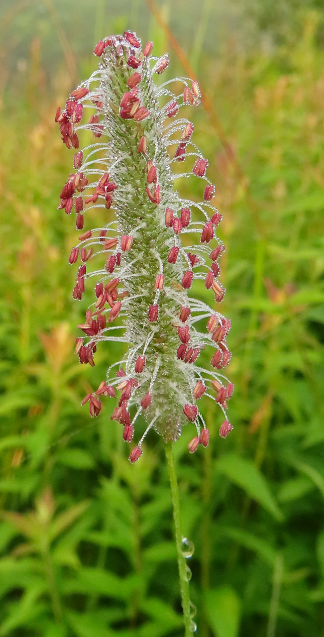
This beautiful grass may be Timothy (Phleum pratense).
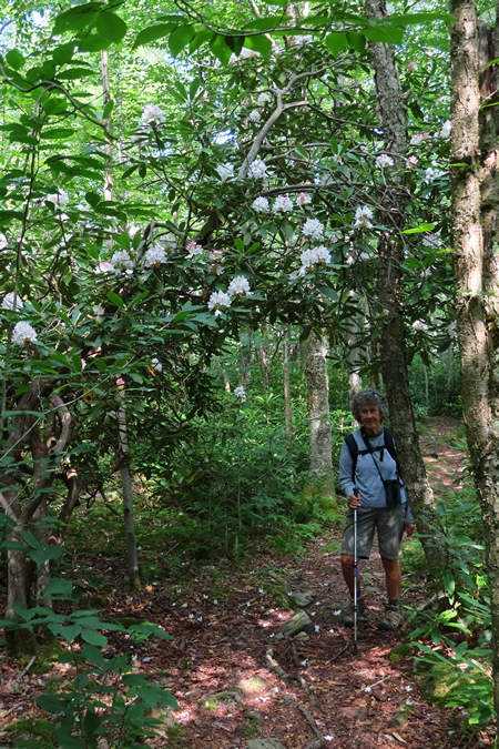
We are now about to head into the woods where we would see mile after mile of rhododendrons in full and glorious bloom.
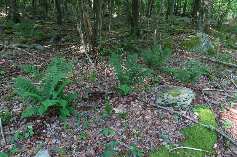
Ferns, lycopodiums, moosewood - what's not to love!?
In some of the open area we saw numerous web traps. Here this little fella sits at the top of his web tunnel waiting for a snack to get ensnared.
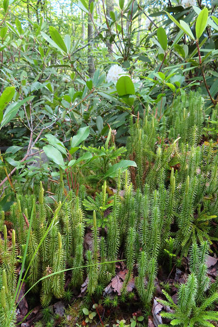
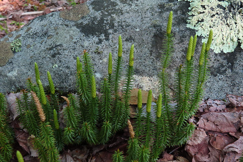
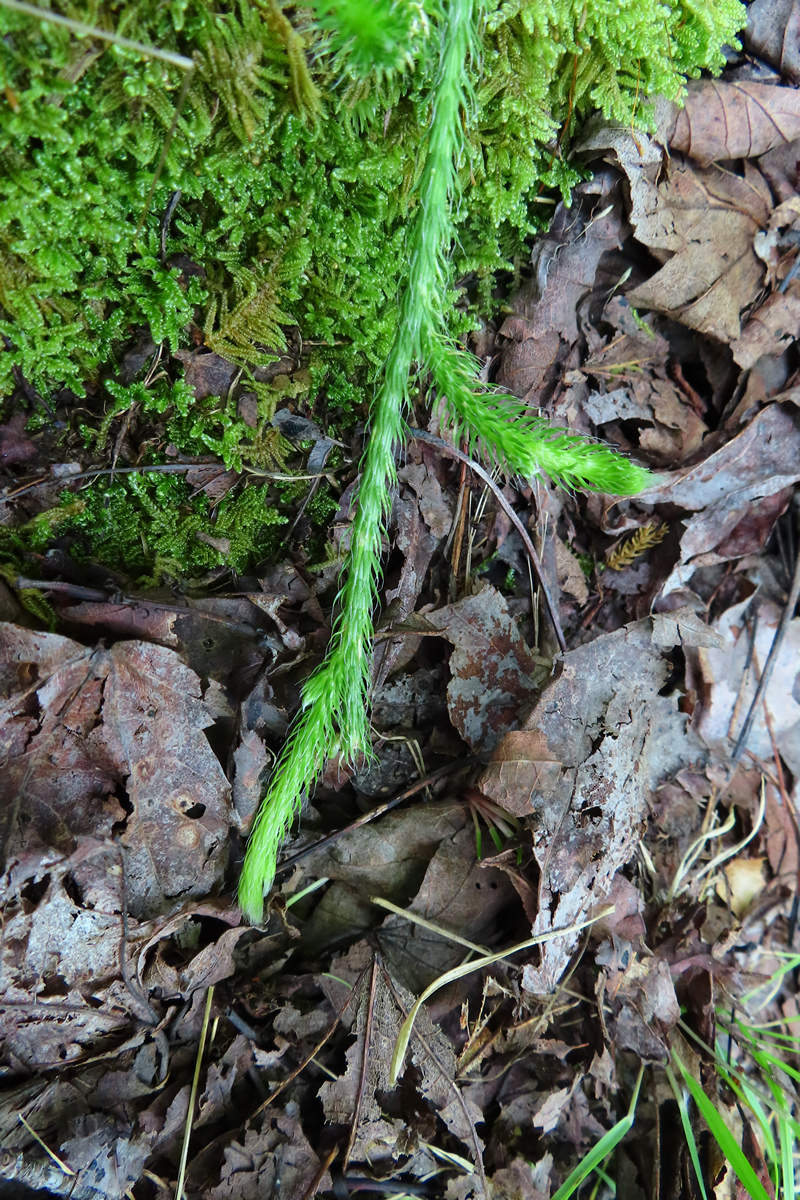
Meet Spinulum annotinum aka Stiff or Interrupted clubmoss. The terminal cone like structures are where the spores develop. We saw large areas of forest floor carpeted with this and other species of clubmosses. Beautiful...
Spinulum annotinum, synonym Lycopodium annotinum, known as interrupted club-moss, or stiff clubmoss, is a species of clubmoss native to forests of the colder parts of North America (Greenland, St. Pierre & Miquelon, all 10 provinces and all 3 territories of Canada, Alaska, and mountains of the contiguous United States), as well as Asia (China, Russia, Japan, Korea, Nepal, Assam), and most of Europe. The genus Spinulum is accepted in the Pteridophyte Phylogeny Group classification of 2016 (PPG I), but not in other classifications, which submerge the genus in Lycopodium.
Spinulum annotinum is a common and widespread club-moss spreading by means of horizontal stems running along the surface of the ground. It is usually unbranched or sparingly branched, each branch containing a cone at the top. Leaves have minute teeth on their edges.
Source: WikiPedia
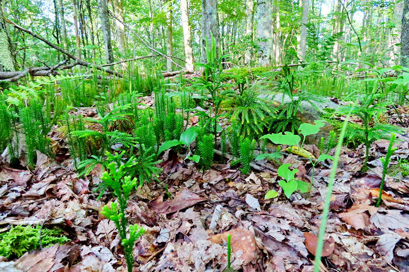
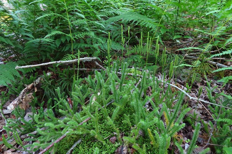
Here we can see Stiff Clubmoss and a few plants of the Tree Clubmoss.
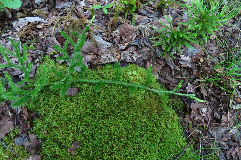
Here we see Lycopodium clavatum or stag's-horn clubmoss, or running clubmoss or running pine. Common names get confusing. Regardless "run" it does - all over the forest floor, over rotting logs up and over boulders and even sometimes up the trunks of trees.
Again, the spores are born in the terminal "cones" which are shaped similarly to a candelabra.
Click the photo for closer look at this interesting fella.
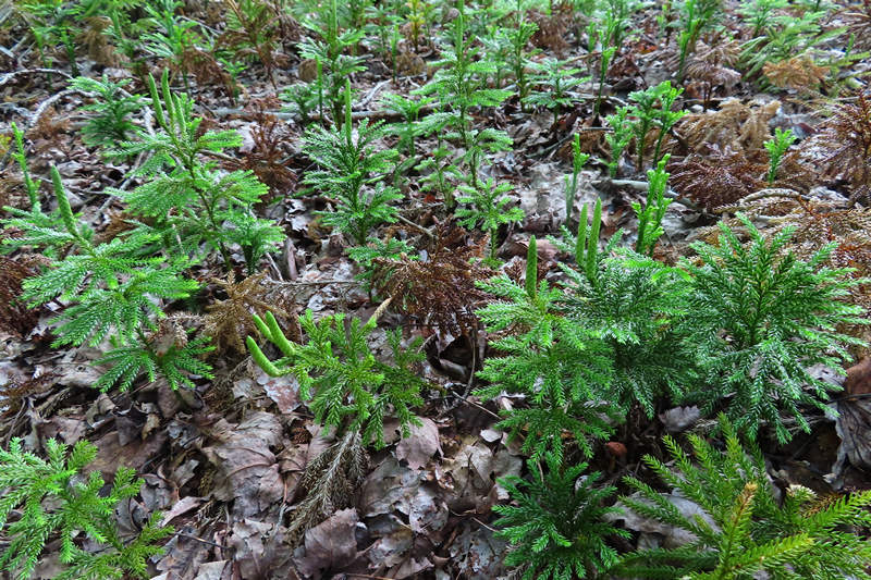
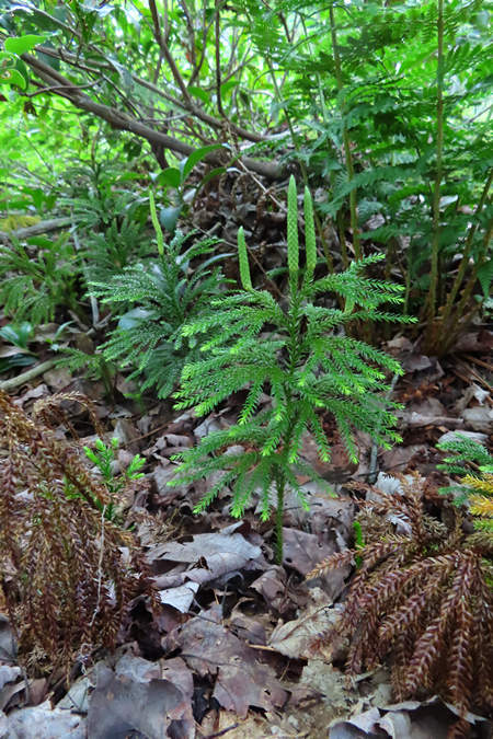
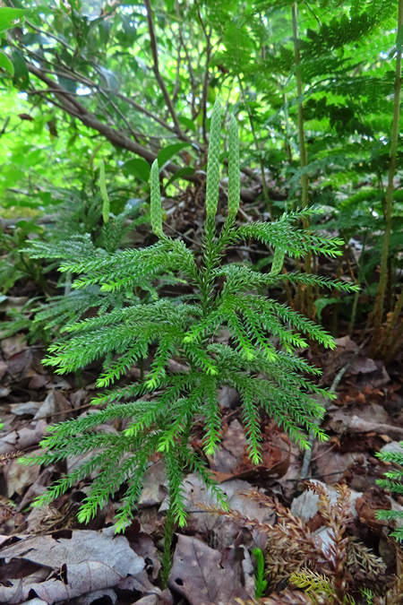
Here we have the tongue twisting Dendrolycopodium or tree clubmoss. A very appropriate name for this plant as large stands of it resemble a miniature forest.
The brown plants are the remains from the previous year's growth.
The terminal "cones" are called strobili which contain the sporangia which inturn contain the spores.
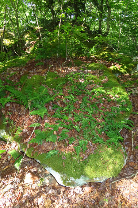
A rather poor shot of some Intermediate wood ferns - Dryopteris intermedia of which we saw thousands on this hike.
Here we have the Bracken fern. More than any other fern this one gets around.

Look at all them dots! Is there anywhere the Bracken does not grow? The map is from the paper: Worldwide relationships in the fern genus Pteridium (bracken) based on nuclear genome markers which is a must read if you fancy the Bracken.
This is a rather poor shot of the Rock or Common Polypody, Polypodium virginianum. Although almost always found on rocks it can sometimes be found growing on the ground or on mossy tree trunks. Click it to get a better look.
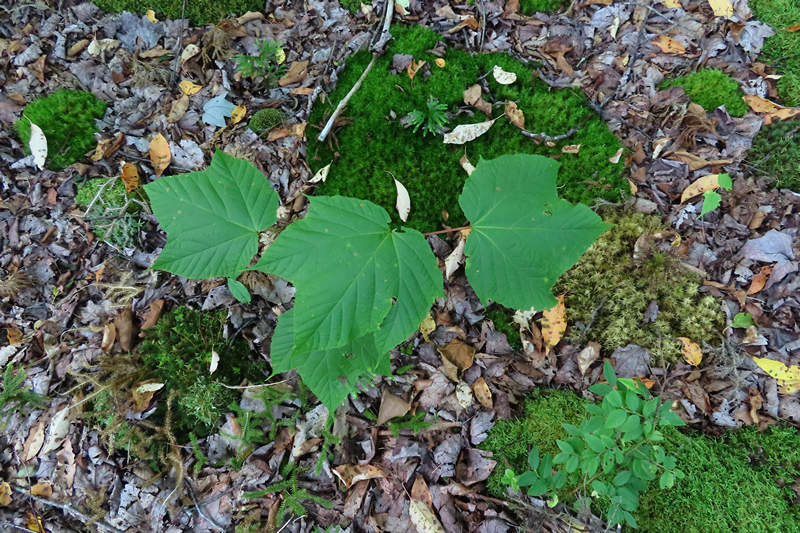
Yes, it's true - we did see more than ferns and clubmosses on this hike. Here we have a plant of Acer pensylvanicum also known as the striped maple or moosewood, the latter name alluding to its propensity to grow in the far north and the former one because of the white stripes which develop on older trees.

I took this photo in 2007 which shows the samaras and the newly unfolding leaf of the Moosewood. I only recently found out maple seeds are edible and apparently quite tasty and nutritious. See: Samaras: Maple’s Other Delicacy.
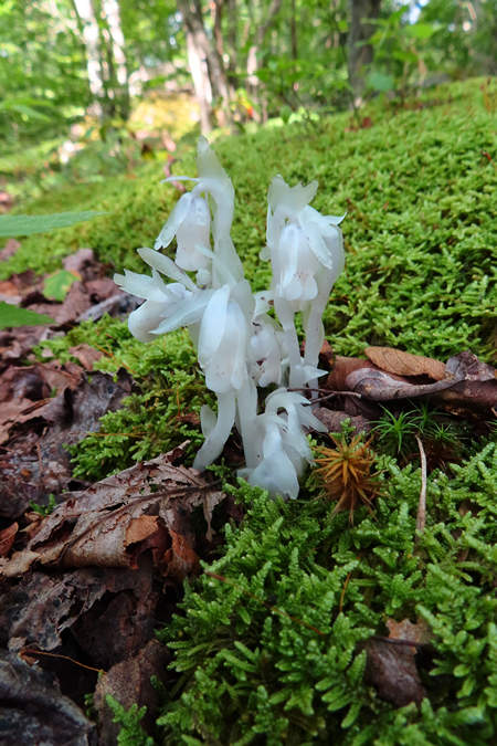
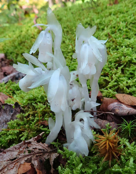
Here we have some Ghost Pipes - Monotropa uniflora. We saw but a few of these interesting plants but sometime come across stands where there are as many as 50 plants. Quite a beautiful sight.
Unlike most plants, it is white and does not contain chlorophyll. Instead of generating food using the energy from sunlight, it is parasitic, and more specifically a mycoheterotroph. Its hosts are certain fungi that are mycorrhizal with trees, meaning it ultimately gets its food from photosynthetic trees. Since it is not dependent on sunlight to grow, it can grow in very dark environments as in the understory of dense forest. It is often associated with beech trees.
Source: WikiPedia
A closer look.
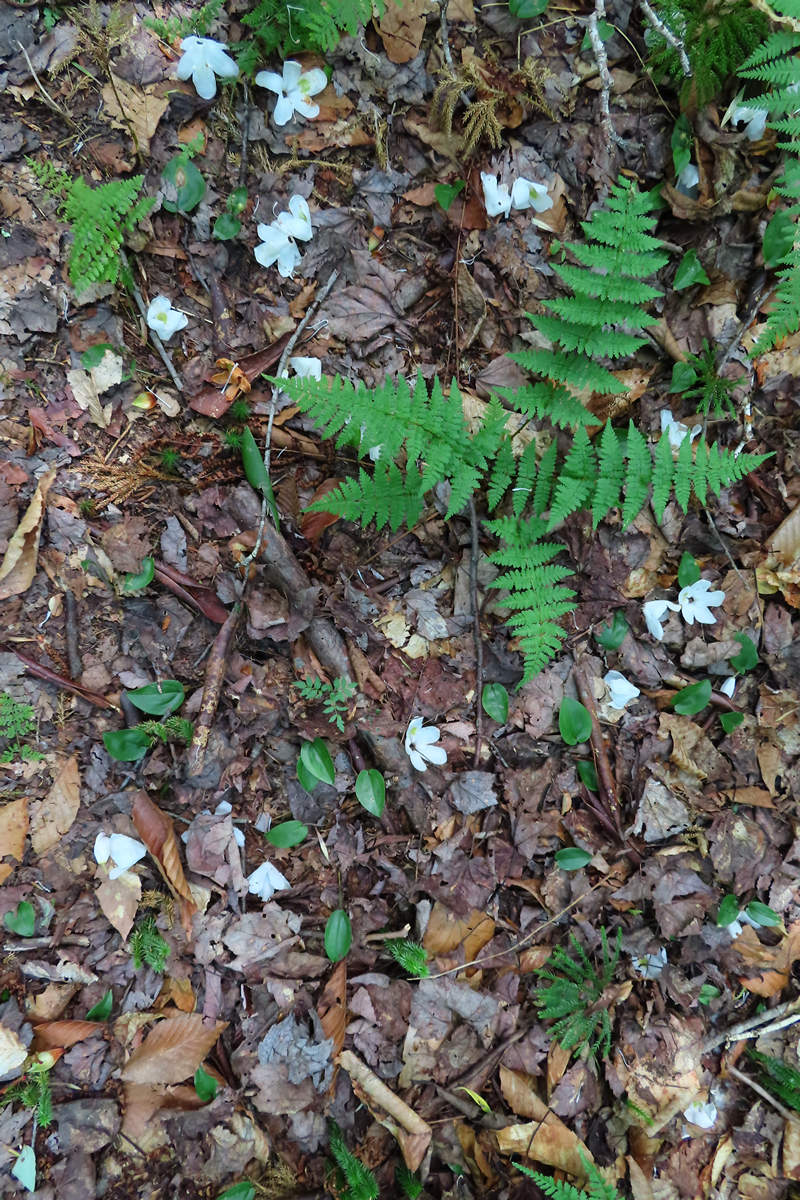
Here we have the fallen leaves of birch, beech and maple trees and the fallen flowers of one of the many Rhododendron maximum we saw. The rhodies sometimes formed corridors or tunnels they were so thick.
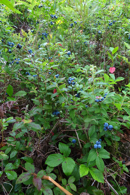
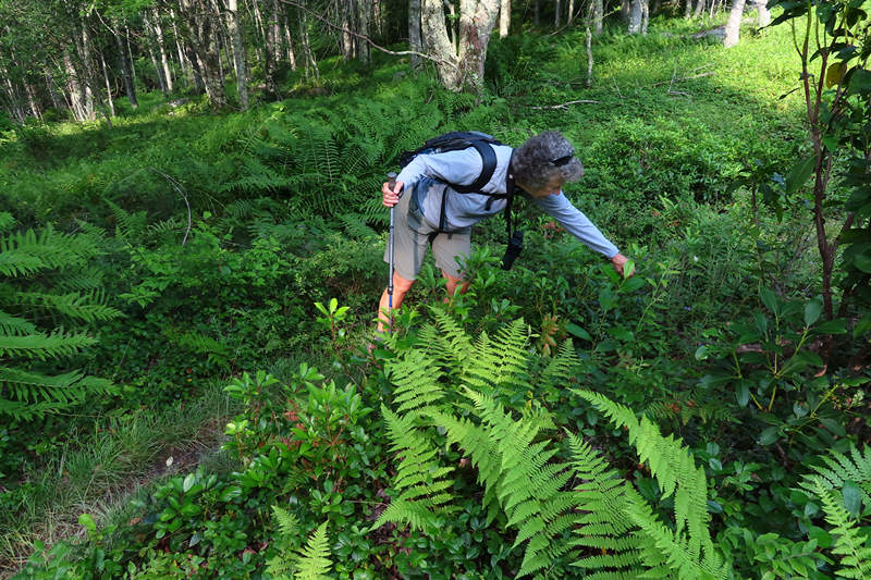
As luck would have it the blueberries were at their peak of ripeness. We ate and ate and ate and ate... It was hard to stop.
Pickin' and a grinnin' !
Delish!
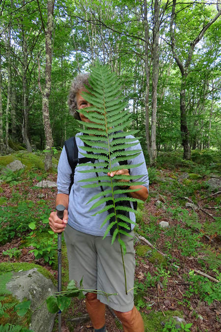
We saw many fine specimens of the Cinnamon Fern - Osmundastrum cinnamomeum.
This fern can grow up to 6 feet tall and form dense colonies when conditions are favorable.
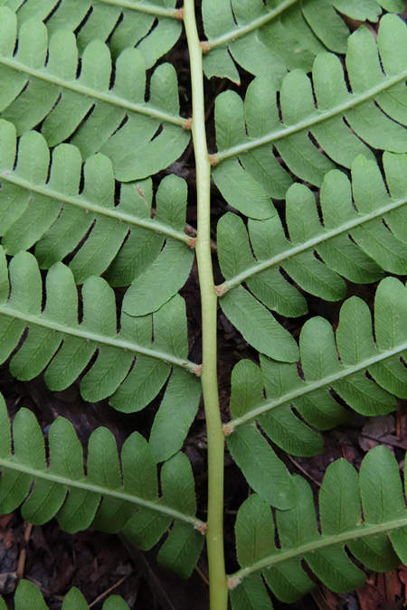
If you are confused about whether you are seeing Cinnamon fern or Interruped fern simply look for the wooly tufts on the lower surface of the frond of the Cinnamon fern where the pinnae join the rachis.
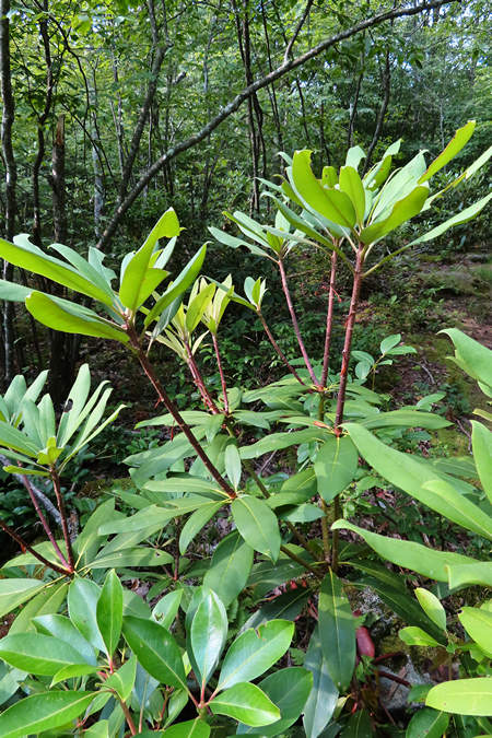
Not only were the rhodies blooming well they were growing well. That is about a foot of new growth you are looking at.
The floral display was never ending, but our hike soon would be. Eventually we arrived within the boundaries of Blackwater Falls State Park where we picked up the Yellow Birch trail which took us to the River Road Trail and back to our parking spot just outside the town of Davis.
We had been hiking for 7 hours and covered nearly 13 gorgeous miles. Well, almost. The last 3/4 of a mile were out in the hot sun and took us past the Davis sewerage treatment plant. Pee-U! Not the most scenic end to our hike but we did see lots of milkweed in full bloom and found some delicious black raspberries to snack on.
When we got back to the hotel we enjoyed a leisurely Happy Hour but soon we were thinking about supper. Betsy drove down to Sirianni's for some take out but got a surprise. CLOSED! Everthing was closed. It seems most places don't bother staying open on Wednesday or Thursday and some places are only open on Friday and Saturday.
So we ended up with chicken tenders and pasta salad (from the grocery store)the latter of which I could not gag down. Times are tough.
The hotel had no microwave but it did have a TV so we amused ourselves by watching some of the movie "Robin Hood" with Russell Crowe, Cate Blanchett, Max von Sydow, William Hurt and directed by Ridley Scott. Even with that cast and director I had a tough time staying awake.
⋄⋄⋄⋄⋄⋄⋄⋄⋄⋄⋄⋄⋄⋄
Click on the photos below for a larger image.
21 July 2021
Short Strolls in Canaan Valley National Wildlife Refuge
There have been thousands of pages written about Canaan Valley but this extract from WikiPedia will give you a quick read so you will understand why Canaan Valley is so unique.
Canaan Valley is a large bathtub shaped upland valley in northeastern Tucker County, West Virginia, USA. Within it are extensive wetlands and the headwaters of the Blackwater River which spills out of the valley at Blackwater Falls. It is a well-known and partially undeveloped scenic attraction and tourist draw. Since 1994, almost 70% of the Valley has become the Canaan Valley National Wildlife Refuge, the nation's 500th National Wildlife Refuge, with Canaan Valley Resort State Park and Blackwater Falls State Park nearby.
The Valley, nestled among the higher backbone ranges of the Allegheny Mountains, is about 13 miles (21 km) long and 3 miles (4.8 km) to 5 miles (8.0 km) wide. It is defined by Canaan Mountain to the west and Cabin Mountain to the east. The northern half of Cabin Mountain is part of the Eastern Continental Divide.
The Valley encompasses approximately 25,000 acres (although the greater Valley ecosystem is sometimes considered to consist of about 36,000 acres).
The average valley floor elevation is 3,200 feet (980 m) above sea level, making it the highest sizable valley east of the Mississippi River.
The surrounding mountains extend upward an additional 1,250 feet (400 m) to 4,450 ft. (1,356 m) at the summit of Weiss Knob on the southeastern rim of the valley.The Blackwater River originates in the southern part of the Valley. The Falls of the Blackwater represent part of a water gap through which the river exits the Valley between Brown and Canaan Mountains before cascading through Blackwater Canyon.
Canaan Valley shares much of the plant and animal life characteristic of the rest of the state, but its 40 botanical communities also include species otherwise found only in sub-arctic bogs and conifer forests much further north.
It has been described by ecologists and conservationists as "a bit of Canada gone astray".Over 580 plant species have been documented in the Valley, notably various mosses, sedges and heathers, the large cranberry and the Canadian blueberry. Also present are the sundew, marsh marigold, jack-in-the-pulpit, starflower and Canadian lily-of-the-valley. Late August experiences impressive blooms of cotton grass, a sedge otherwise found mostly in Alaska and Canada.
Source: WikiPedia
The day after our Big Hike we decided to take a few short strolls on the trails in Canaan Valley National Wildlife Refuge.
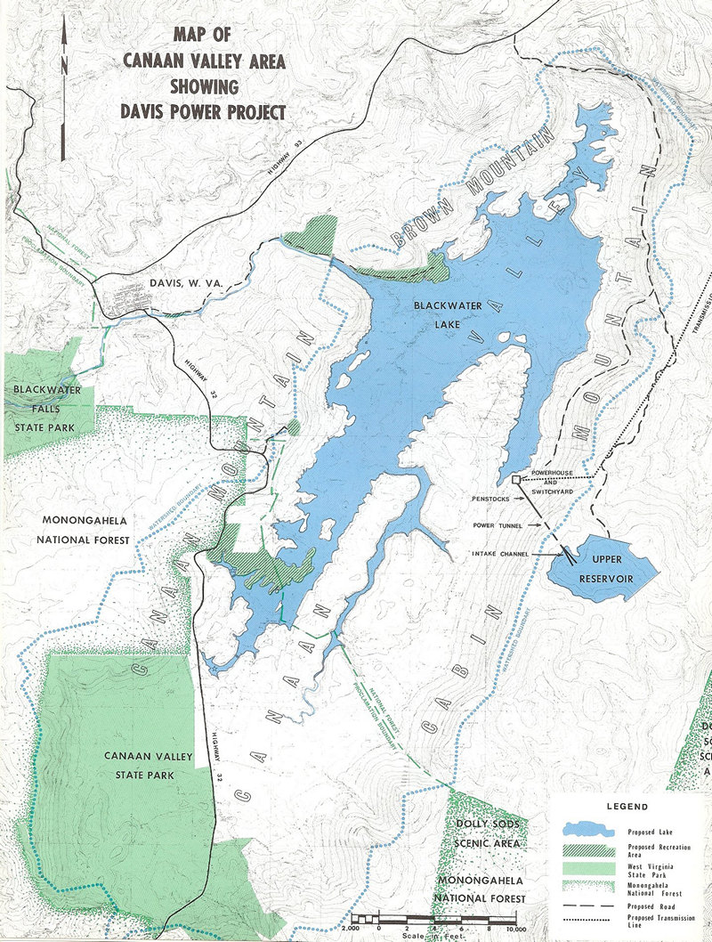
Back in 1970 the Refuge did not exist and if Allegheny Power had been successful with their plan the Valley would not even exist as we know it today and the generations of settlers and long time residents knew it.
In 1970 Allegheny Power System proposed flooding most of the valley to create a 7,000-acre lake which we be used for the creation of a pump storage electrical generation facility to feed ever expanding need of the north east - not West Virginia.
Source: energy.gov
Allegheny Power proposed an open loop pump storage for electrical generation with a smaller storage reservoir being built on Cabin Mountain. As you can see from the promotional map below most of the Valley would have been flooded.
This reservoir would have displaced farms, businesses and home and destroyed a unique eco system forever. Fortunately that did not happen.
Although some were in favor of the pump storage project others were not.
A decades long battle ensued.
Eventually the Army Corp of Engineers denied Allegheny Power a 404 permit which was needed to proceed with the project.
Section 404 of the Clean Water Act (CWA) establishes a program to regulate the discharge of dredged or fill material into waters of the United States, including wetlands.
Proposed activities are regulated through a permit review process. An individual permit is required for potentially significant impacts. Individual permits are reviewed by the U.S. Army Corps of Engineers, which evaluates applications under a public interest review, as well as the environmental criteria set forth in the CWA Section 404(b)(1) Guidelines, regulations promulgated by EPA. Some states have assumed this permitting authority and regulate these activities.
Source: epa.gov
Now that the Davis Power Project was officially dead there was a movement to permanently protect as much of Canaan Valley as possible by the establishment of a National Wildlife Refuge.
Founded by President Theodore Roosevelt in 1903 and administered by the U.S. Fish and Wildlife Service, the National Wildlife Refuge System is a diverse network of lands and waters dedicated to conserving America’s rich fish and wildlife heritage.
Source: U.S. Fish and Wildlife Service
The campaign went on for years and in 1994 the Canaan Valley National Wildlife Refuge was established. This was the 500th Refuge in the national system.
On August 11, 1994, with the purchase of 86 acres the refuge was established. With the purchase of approximately 12,000 acres in 2002, the refuge grew to 15,245 acres in size. The refuge currently is approximately 17,000 acres.
A patchwork of 23 wetland types, including bogs, shrub swamps and wet meadows carpet the valley floor. At about 8,500 acres, this is the largest wetland complex in the state of West Virginia, and is a regionally significant wetland complex within the southern Appalachians.
Here are a few sources if you want to learn more about the struggle to save Canaan Valley.
The Canaan Struggle - The Washington Post
Fighting to Protect the Highlands: The First Forty Years of the West Virginia Highlands Conservancy by Dave Elkinton
I took no photos on our two short strolls but I hope to remedy that next summer.
⋄⋄⋄⋄⋄⋄⋄⋄⋄⋄⋄⋄⋄⋄
22 July 2021
Our Hike to Moon Rocks in the Yellow Creek Preserve
Just a few miles outside the town of Davis is an area which was ravaged by surface mining and nearly 20 years of destructive off road vehicle use. For all those years Monongahela Power company, which owned the property allowed the "Blackwater 100" an off road race which destroyed fragile wetlands and ruined everything in its path. Check out some of these images to get an idea of the type of damage which was done.
In September of 2019 the West Virginia Land trust purchased this area.
The Yellow Creek Natural Area is 860 acres in Tucker County that adjoins the Canaan Valley National Wildlife Refuge and Little Canaan Wildlife Management Area. The property is named after a tributary of the Blackwater River that flows through the property. The property also includes Moon Rocks, a rock formation that is a popular destination for hikers and mountain bikers.
The property contains 4+ miles of the Moon Rocks-Hoodoo Rock loop trail, and links to 20+ miles of the Heart of the Highlands Trail System. Trail access can be made from the parking area at the National Youth Science Foundation building off Appalachian Corridor H just north of Davis, or from Camp 70 road at the south end of the Tucker County town.
Source: West Virginia Land Trust
Ever since hearing about the "Moon Rocks" I was intrigued and wanted to visit the area. And for our last hike (5.6 miles) we decided on the Yellow Creek Natural Area.
Click on the photos below for a larger image.
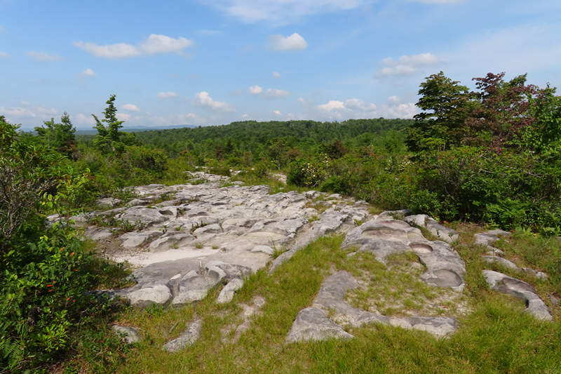
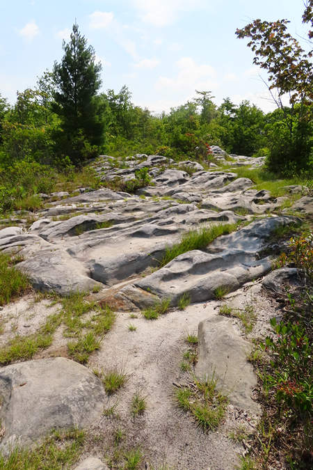
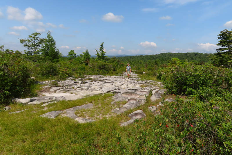
Here we are - on the moon!
I found this exposed rock quite interesting and wondered why it was exposed. Ashton Berdine, the West Virginia Land Trust’s land program manager provides the answer.
It wasn’t a unique geological process that created Moon Rocks.
It’s an artificial sandstone pavement barren,” he said. “It’s a relic of the Blackwater 100,” an annual off-road race, first for motorcyclists, later for ATV riders, that ran from 1975 to 1993, he said, when the land was owned by Monongahela Power.The thin layer of plant-supporting soil atop the rocks was scoured away during the 18-year run of “America’s Toughest Race,” as the event was known to motor sports enthusiasts.
Source: www.wvgazettemail.com
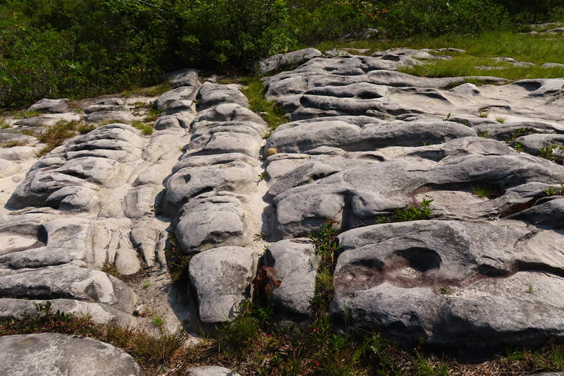
But what caused all the cracks and pot holes in the sandstone? Science to the rescue via Tom Kammer - Emeritus Professor of Geology at WVU.
I have not seen these rocks myself, but based on photos and the geographic location, this is a sandstone deposited by rivers during the Pennsylvanian Period (300-320 m.y. ago) with a high quartz grain content as you indicated. Below are a couple more photos I found on the internet. From them I conclude that the sandstone is flat lying and is crisscrossed by rectangular joints where the rock is fractured.
These rectangular joints allow water infiltration and are weathering to form the linear patterns. The rectangular joints/fractures were formed during the original uplift of the Appalachian Mountains during the Permian Period when Africa collided with North America. The stress field from the plate tectonic collision usually forms fractures at right angles to each other. The joints weathered when they were exposed during the Pleistocene Period, likely within the last million years.The pothole weathering is more challenging to explain. They look like potholes that form in sandstones along a river bed where smaller rocks roll around in the potholes scouring them out. You can see active potholes in the Youghiogheny River at Ohiopyle, for example. But the Moon Rocks look to be on high ground rather than along a river bed. The potholes have formed between the joints, rather than spanning the joints.
If they formed by flowing water, the potholes should be more likely to form in the zone of weakness along the joints. But they are in blocks between joints. I suspect the potholes formed by chemical weathering when the rocks were covered by soil.
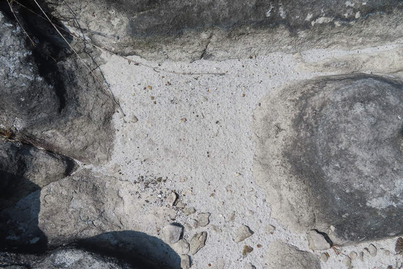
If the sandstone has calcite cement (very likely because of how it is weathering and the white color), the humic acids from the overlying soil could have dissolved the calcite as the acid slowly migrated through the sandstone in a spherical front. The sand grains would remain in place until the soil was eroded away. Then the uncemented grains would be washed out of the spherical area where the cement between the grains was dissolved. Loose sand is still visible as the likely calcite cement is still dissolving.Source: WikiPedia
Thanks, Tom!
Here is some of the loose sand Tom mentions above.
One last shot of the Rocks before we headed down the hill.
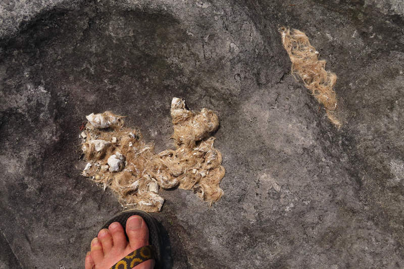
On the way down we saw this. I am pretty sure it is coyote scat. Coyotes have a habit of pooping on raised rocks, sidewalks and in the middle of trails. It is a way of marking their territory. Also, there was a large amount of hair/fur and some seeds which is very typical of what one might see in coyote scat.
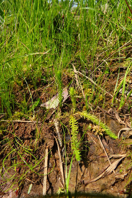
At the bottom of the slope was a small cotton grass bog where I found the itty-bitty bog club house moss (Lycopodiella inundata).
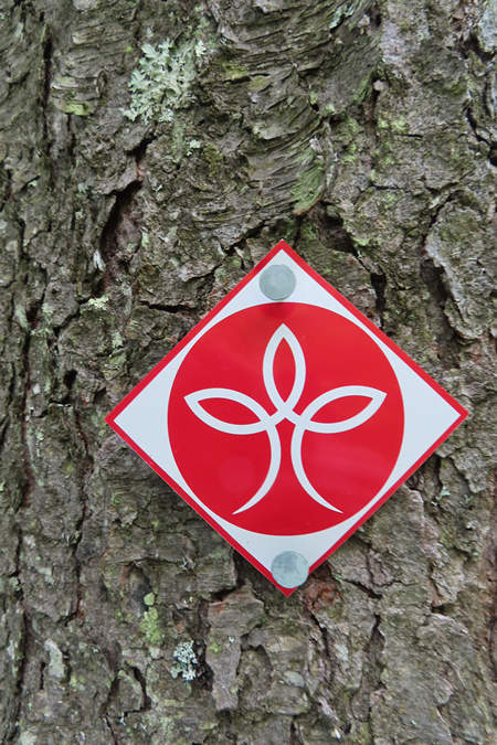
The trails were well marked with these WV Land Trust medallions.
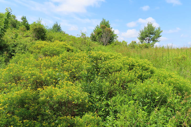
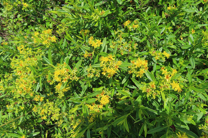
We saw the shrubby St John's wort in several places along the trail.
(Hypericum perforatum), is important in herbalism. The common name stems from the fact that various European species flower around June 24, which is the feast day of St. John the Baptist; “wort” derives from an Old English word for herb or plant.
Source: www.britannica.com
As with our Big Hike we found tons of ripe blueberries and ate our fill and Betsy was able to pick enough to add to her zucchini bread she made upon our return home.
And there you have it - our "Four Days Hiking the Highlands of West Virginia". Maybe next summer we will make it 5, or 6 or...
See you next time...
Mike and Betsy

