Mike Breiding's Epic Road Trips: August 2023
Colorado
Hiking the Rocky Mountain Area
August 2023
Colorado - Hiking the Rocky Mountain Area
For 12 years Betsy and I have been leading winter hikes in the Tucson area. During those years we have met hundreds of people on our hikes, some of whom have become good friends. One of those people is Priscilla. She became one of our "regulars" and at some point we started socializing outside of the hiking circle.Priscilla became one of our favorite people to hang out with and so when she told us she was moving we were bummed out. BUT - she was moving to the Boulder, Colorado area and so could continue her hiking and more.
We kept in touch with Priscilla and every once in a while she would encourage us to visit. Now, 3 years later we are finally doing just that. So, on this trip Priscilla will be our hostess, hiking guide, chauffeur and once again a Happy Hour buddy.
And as a bonus we will be visiting Heidi and Tom in Colorado Springs.
Click on the photos below for a larger image.

This trip started in Pittsburgh on Saturday the 12th of August. We drove to visit old friends (and I do mean old!) Carol and Fred. I originally met them through their son Chris when he was a camper in Oglebay Institute Mountain Nature Camp at Terra Alta WV. I was on staff there at the time and I think it was in 1978. At some point I met Chris's parents (Carol and Fred) and the rest is history.
We had a nice visit with Carol and Fred which of course included Happy Hour and then a lovely dinner.
It was early to bed for us as we had to rise and shine at 3am to get to the airport in plenty of time.
08/13/2023 04:56 AM -- Location of photo 40.496670° N, 80.244994° W

Ahhh... the joys of flying.
We arrived at the Denver airport without incident at about 7:00 am, got our luggage and then called Priscilla who was waiting for us in the cell lot.
She was there in a flash and we were soon on our way to her place to chill a bit and get organized for our first outing.
Betsy and I live at 1200' in Morgantown WV, Boulder sits at 5,430' and we would be going on hikes later in the week that would be in the 7000'+ range. Knowing that, Priscilla thought it would be best if we spent the first two days in the Boulder area to get acclimated.
08/13/2023 11:05 AM -- Location of photo 39.978706° N, 105.275530° W

Here we are in the NCAR hiking area. That stands for National Center for Atmospheric Research which has a facility there. There is also a trailhead there. In fact we are finding out there are trailheads everywhere.
08/13/2023 11:06 AM -- Location of photo 39.978532° N, 105.275674° W

This is another one of the trails. That would be a fun one to check out.
08/13/2023 11:06 AM -- Location of photo 39.978532° N, 105.275674° W

Priscilla had a couple of "break-in" trails for us. This is the one she chose for this morning. It was a stroll, not a hike and a way for us to test out the elevation and get the lay of the land.
08/13/2023 11:07 AM -- Location of photo 39.978502° N, 105.275827° W

The obligatory trail map shot.
08/13/2023 11:08 AM -- Location of photo 39.978379° N, 105.276030° W

And here are the gorgeous Flatirons. To me these striking, slanted, reddish-brown sandstone formations looked like they were erupting out of the earth and about to become airborne. The photo does of poor job of representing them - it was overcast and everything looked a bit drab - but still beautiful.
08/13/2023 11:10 AM -- Location of photo 39.977539° N, 105.276568° W

The well delineated line is one of the fire lines for the NCAR fire which forced the evacuation of 18,000 people. That fire occurred March of 2022 on the heels of the Marshall fire which was started on December 30, 2021. That fire burned 6000 acres and caused about $2 billion in damage. The fire killed two people and became the most destructive fire in Colorado history in terms of buildings destroyed.
08/13/2023 11:27 AM -- Location of photo 39.977550° N, 105.276755° W

Denver, which is 25 miles from Boulder has had some serious air pollution problems as shown here. In 2022 Denver ranked as the 7th most polluted city for ozone pollution.
08/13/2023 11:35 AM -- Location of photo 39.978209° N, 105.275148° W

The main entrance to the National Center for Atmospheric Research.
08/13/2023 11:38 AM -- Location of photo 39.979281° N, 105.274747° W

The facilities map for the National Center for Atmospheric Research.
Next stop: Boulder Falls
08/13/2023 12:18 AM -- Location of photo 40.005519° N, 105.406573° W

As one might expect Boulder Falls is a very popular spot for tourists and locals alike. Boulder Falls is located 11 miles west of Boulder, on the north side of Boulder Canyon and sits at about 7000'.
08/13/2023 12:19 AM -- Click/Tap for location of photo 40.005593° N, 105.406399° W

Priscilla took this shot for us. Thanks!!
Next stop: Coal Creek Trail
08/13/2023 02:25 PM -- Location of photo 39.980797° N, 105.095210° W

Just one mile from Priscilla's place is the Coal Creek Trailhead. I was unaware this area was at one time a top producer of coal. The trail meanders along Coal Creek and is a very popular walk, biking and jogging trail.
08/14/2023 07:06 AM -- Location of photo 39.987992° N, 105.086268° W

I came across this book on ThriftBooks.com and we got a copy for Priscilla. I found it to be one of the better local floras I have ever had my hands on.
Next stop: Eldorado Canyon
08/14/2023 09:27 AM -- Location of photo 39.929609° N, 105.287247° W

Today Priscilla has chosen the Rattlesnake Gulch and Fowler Trails in Eldorado State Park. This was to be a fabulous hike with 4.5 miles of glorious scenery.
08/14/2023 09:29 AM -- Location of photo 39.929725° N, 105.286524° W

Down there somewhere is South Boulder creek - a beautiful and crystal clear creek with lots of tumbles and whitewater. The thumb in the upper left is mine.
08/14/2023 09:35 AM -- Location of photo 39.930006° N, 105.282937° W

That is one hell of a talus field! I can't image what it took to clear this area for the trail.
08/14/2023 09:35 AM -- Location of photo 39.930006° N, 105.282937° W

08/14/2023 09:36 AM -- Location of photo 39.930100° N, 105.282681° W

This shot is representative of the scenery we would see thoughout the hike.
08/14/2023 09:37 AM -- Location of photo 39.930100° N, 105.282681° W

Eldorado State Park is a very popular climbing area. This spot starts the descent to the "Bastille" and the Bastille Crack - one of the most famous climbs in Colorado and Eldorado Canyon.
08/14/2023 09:41 AM -- Location of photo 39.930040° N, 105.280488° W

We saw a lot of this sumac. Which species? Unknown to me.
08/14/2023 09:43 AM -- Location of photo 39.930345° N, 105.281298° W

On the left Betsy and Priscilla head 'round the bend to the next spectacular view.
08/14/2023 09:47 AM -- Location of photo 39.929635° N, 105.284472° W

I was hoping to see some ferns on this hike. This may be one of the Woodsias.
08/14/2023 09:50 AM -- Location of photo 39.929605° N, 105.286678° W

"A picture is worth..."
08/14/2023 09:52 AM -- Location of photo 39.929446° N, 105.287823° W

Just a short ways up the Rattlesnake Gulch Trail we intersected the Fowler Trail which we hiked on for a bit before tuning back and staring the climb up the Rattlesnake Gulch Trail. This trail would take us to the site of the Crags Hotel ruin and then to our turnaround point - the Continental Divide overlook.
08/14/2023 10:06 AM -- Location of photo 39.927279° N, 105.291782° W

About half way up we came across a rather large concrete conduit which came out of one side of the mountain and reentered on the other side. The port was about midway.
08/14/2023 10:12 AM -- Location of photo 39.927112° N, 105.292045° W

This is looking down the conduit to where it entered the mountain side.
08/14/2023 10:10 AM -- Click/Tap for location of photo 39.927149° N, 105.292218° W

Photo by Priscilla.
08/14/2023 10:11 AM -- Location of photo 39.927155° N, 105.292130° W

Through this vent you could feel the movement of air and hear the sound of running water.
08/14/2023 10:11 AM -- Location of photo 39.927148° N, 105.292182° W

This conduit was built in 1939 to move water from the west slope to the valleys on the east side of the mountains.
08/14/2023 10:16 AM -- Location of photo 39.927491° N, 105.291555° W

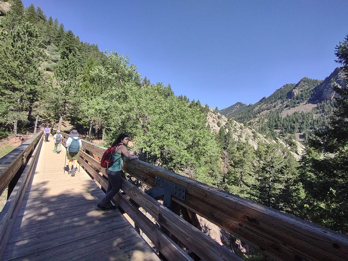
Crossing the bridge we continued up and up and up...
08/14/2023 10:16 AM -- Location of photo 39.927581° N, 105.291677° W

08/14/2023 10:47 AM -- Location of photo 39.923766° N, 105.292856° W

08/14/2023 10:54 AM -- Location of photo 39.926676° N, 105.294771° W

Here is our turnoff and we were soon at the ruins of the old Crags Hotel and then on to the Continental Divide Overlook.
08/14/2023 10:56 AM -- Location of photo 39.926676° N, 105.294771° W

Click on the photo to read more about the Crags Hotel.
08/14/2023 11:09 AM -- Location of photo 39.927169° N, 105.298036° W

We are getting close now...
08/14/2023 11:15 AM -- Location of photo 39.927995° N, 105.298055° W

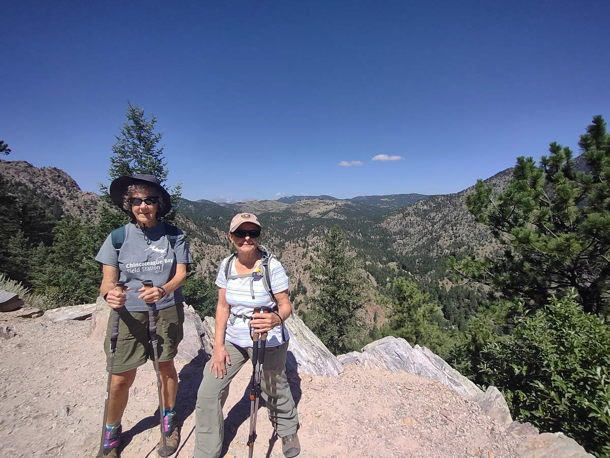
And here is the Continental Divide Overlook. Off in the distance we could see snow on some of the peaks.
08/14/2023 11:39 AM -- Location of photo 39.926864° N, 105.292828° W

It's time to head back down and check out the visitors center - but first a few parting shots.
08/14/2023 11:47 AM -- Location of photo 39.927574° N, 105.291867° W

We took a look around the visitors center and then went looking for a place to have our lunch.
We found one.
08/14/2023 12:24 AM -- Location of photo 39.930209° N, 105.293877° W

We don't often get to have our lunch in a spot like this.
08/14/2023 12:27 AM -- Click/Tap for location of photo 39.930015° N, 105.293705° W

After the hike my feet were hot and a bit cranky but lunch in the cooling waters of the creek set everything to rights again.
After we left Eldorado State Park we made a brief stop at The Colorado Chautauqua. It is at the foot of Boulder's Flatirons and yet another place to launch a hike or just enjoy the old buildings or take a snooze in the expansive greensward.
Priscilla then started the drive back and there were two stops to refuel: one for gas and one for red wine.
Thank you Priscilla for a fab day!!
See you next time...
Mike and Betsy