Part 1 - New York
Visiting Debbie and hiking at Thacher State Park
When we received our invitation to Tom and Hanna's wedding it seemed like the perfect opportunity to finally take a look at New England something we had talked about for years.
So out came the maps and the guide books and we began the planning process for our first New England Road Trip.

We arrived at Deb's on Thursday and on Friday we went for a hike at Thacher State Park.
On a previous visit we had hiked the Indian Ladder Trail which has some amazing water falls and great panoramic vistas from atop the Helderberg Escarpment. We opted for the same hike this time. Highly recommended.
John Boyd Thacher State Park is a state park located 15 miles (24 km) southwest of Albany New York near Voorheesville in Albany County on State Route 157. Located mostly atop the Helderberg Escarpment the park has several hiking trails that offer panoramic views of the Green Mountains in Vermont and the Hudson Valley.
The history of the park area dates back around 400 years to a time when the trail now known as the Indian Ladder Trail was used by the Mohawk Iroquois Indians to reach the trading post run by Henry Hudson.
It was here that in 1777 at a spot known as Tory Cave Jacob Salsbury found refuge from settlers during the Burgoyne Invasion.
The region is very well drained as all surface water runs into the limestone making it an infertile area for farming. There are some fertile areas along the streams and Dutch settlers were brought in to the region by Patroons to whom they paid heavy rents until they freed themselves of the burden through the so called Helderberg War (also called the Anti-Rent War) of 1839.
Source: WikiPedia
On Saturday morning we said our farewells to Deb and started the four hour drive north to Peacham VT. Yes today was the Big Event - Hanna and Tom's wedding!

The wedding and reception were at a scenic hilltop farm.

A limo was provided for the guests to get to the hilltop meadow where the wedding and reception took place.

The wedding party also made good use of the limo. Note the umbrellas. As if planned it started to rain 15 minutes before the ceremony. The rain continued throughout the evening.

Hanna and her dad start their way down the "aisle".
Although there was continuous rain throughout the ceremony no one seemed to mind.

After the wedding the party began!

As you can see the rain did not dampen anyone's spirit.

There was dancing and more dancing!

From atop the hill there was a view of the distant mountains. On this misty evening we had to take that on faith.

The Bride and Groom share a dance.

As do Hanna and the father of the Bride.
There was much dancing eating and drinking and the revelry went on long after Betsy and I turned in. We had a hike planned for the morrow and we knew we should get a little shut-eye.

When I asked Sandra for a hike suggestion for the area she suggested this one the South Trail to the summit of Mount Pisgah.
We arrived to an empty parking lot at the trail head. However things got busy by the time we were heading back down the mountain.

The Vermont woods were lush wet and beautiful.

Here is a fern I don't see everyday - the Long Beech fern (Phegopteris connectilis).

The Beech fern species I am used to seeing back home is Broad Beech fern (Phegopteris hexagonoptera). It differs from the Long Beech fern in that it has leafy tissue along the rachis between the last two sets of pinnae.
As you can see in the photo above the Long Beech fern lacks this connective tissue. Additionally the Long Beech Fern is more common in the northern areas of the U.S and Canada. But it does occur in the higher elevations of such states as PA WV OH and others.
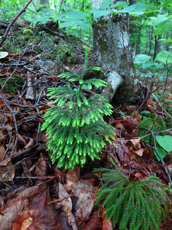
We saw some nice plants of the Tree Clubmoss (Lycopodium dendroideum) still showing the bright green growing tips.
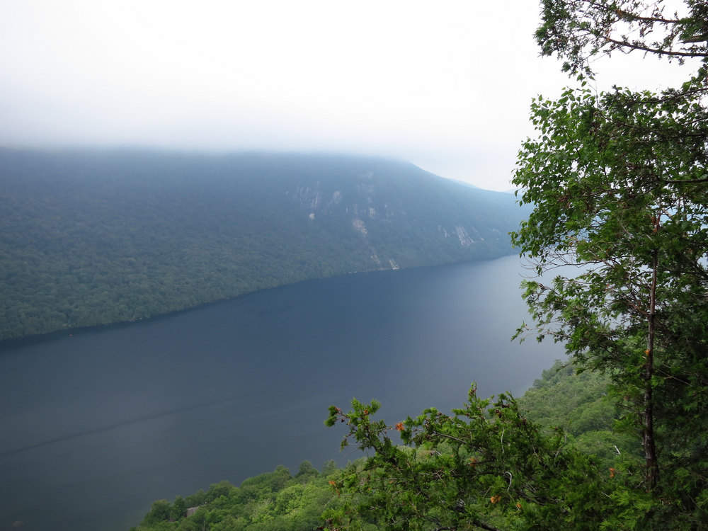
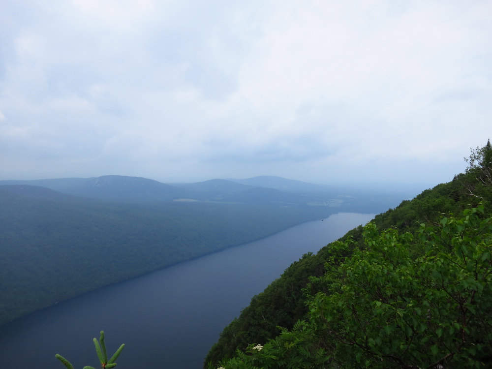
I won't say the rainy misty weather spoiled our views but it certainly limited the sight distance. This is Lake Willoughby which is on the west side of Mount Pisgah.
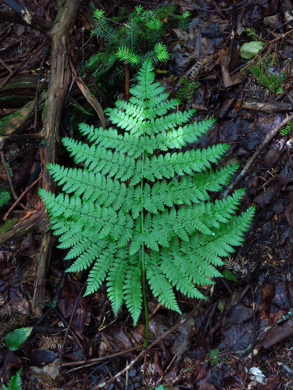
I am calling this fern Mountain Woodfern (Dryopteris campyloptera). This is based on my superficial examination of it while in the field. Mountain Woodfern occurs in half a dozen of so counties in West Virginia and I have seen plants of it on Dolly Sods.
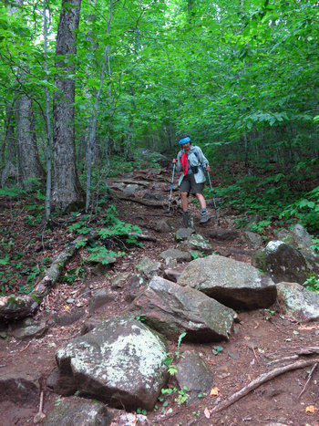
On our way back we picked our way carefully down the rocky trail.
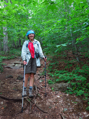
The steep climb along with the muggy warm weather made this a "two bandana" hike. (Betsy used them as sweat bands.)
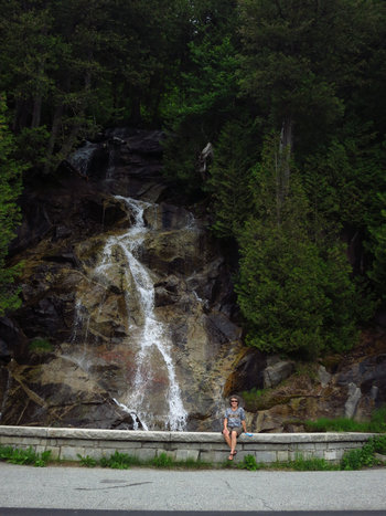
After the hike we passed by this nice falls and got out for a look-see. This was right along the lake road. As we passed the north end of the lake we saw a nicely developed beach with lots of people out enjoying a dip.
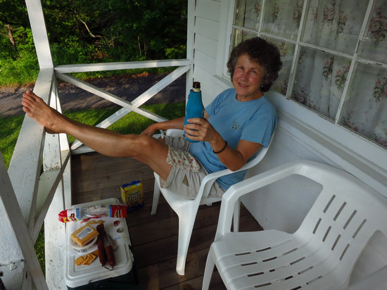
The best part of any hike! Post hike beer and munchies.

The crackers smoked Gouda and chorizo from our Spain trip hit the spot.
Part 2 - Maine
Acadia National Park: Sand Beach, Cadillac Mt and a Lobster Feast
We got an early start for our drive to Bar Harbor ME the gateway to Acadia National Part. It was just barely light and the cloudy rainy weather had stayed overnight.
I had planned our route using Google maps. The route was about 260 miles and took us close to 7 hours including stops. Longer than I had hoped for.
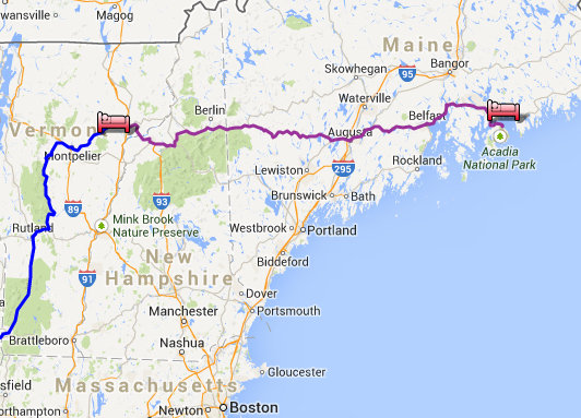
The purple line is our route from Peachum - the site of Hanna and Tom's wedding to Bar Harbor Maine.
Acadia National Park is a National Park located in the U.S. state of Maine. It reserves much of Mount Desert Island and associated smaller islands off the Atlantic coast. Originally created as Lafayette National Park in 1919 the oldest National Park east of the Mississippi River it was renamed Acadia in 1929.
The area first was inhabited by the Wabanaki people.In the fall of 1604 Samuel de Champlain observed a high-notched island composed of seven or eight mountains rising to bare-rock summits from slopes of birch fir and pine. Over four centuries later the area remains essentially the same.
The landscape architect Charles Eliot is credited with the idea for the park. George B. Dorr called the "father of Acadia National Park," along with Charles's father Charles W. the president of Harvard supported the idea both through donations of land and through advocacy at the state and federal levels. It first attained federal status when President Woodrow Wilson established it as Sieur de Monts National Monument on July 8 1916 administered by the National Park Service. On February 26 1919 it became a national park with the name Lafayette National Park in honor of the Marquis de Lafayette an influential French supporter of the American Revolution. The park's name was changed to Acadia National Park on January 19 1929 in honor of the former French colony of Acadia which once included Maine.
From 1915 to 1933 the wealthy philanthropist John D. Rockefeller Jr. financed designed and directed the construction of a network of carriage trails throughout the park. He sponsored the landscape architect Beatrix Farrand with the nearby family summer home Reef Point Estate to design the planting plans for the subtle carriage roads at the Park (c.1930). The network encompassed over 50 miles (80 km) of gravel carriage trails 17 granite bridges and two gate lodges almost all of which are still maintained and in use today. Cut granite stones placed along the edges of the carriage roads act as guard rails of sort and are locally known as "coping stones" to help visitors cope with the steep edges. They are also fondly called "Rockefeller's teeth".
Source: WikiPedia
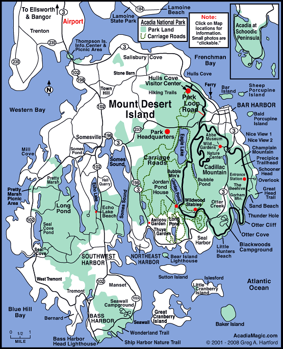
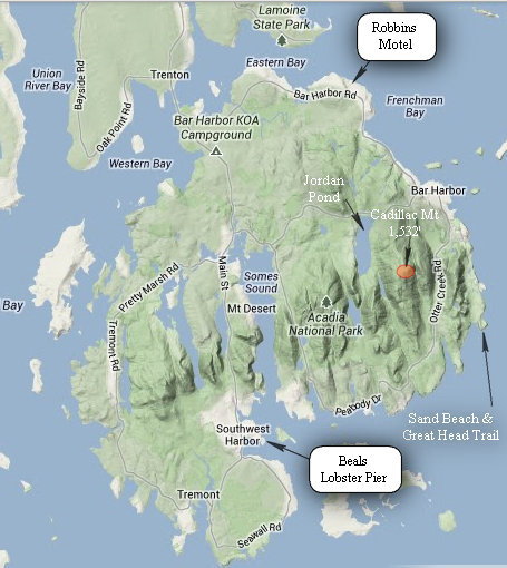
Here is a map (© 2006 - 2011 Greg A. Hartford) which will help get you oriented.
Note: The carriage roads are marked but hiking trails are not.
For a fully interactive Acadia National Park Map with area links see AcadiaMagic.com.
The Acadia NP area can be an expensive place to stay and you could spend as much as you wanted to. But to spend as little as you wanted to is another story.
While scouting for places to stay in the area I came across the Robbins Motel. They bill themselves as "The Bar Harbor No Frills Option". They are no frills but the price matches: 45 bucks a night during the month of June. And that is for a double! After reading the reviews it was a no brainer to get our room here.
My only complaint was its close proximity to the busy Rt 3 - the main road into Acadia NP and Bar Harbor proper. If the noise had been mainly from passenger cars it would have been tolerable. But the noise from all the heavy trucks and obnoxious Harleys made it impossible to do anything but close the windows and turn on the A/C.
Next time Betsy gets to pick the hotel.
We checked in and then got to the more important things like food. Not wanting to spend a fortune for lunch we hoped to find someplace "cheap".
Luckily we did - Peppers Pizza and Subs which was just down the road from the hotel.
We ordered a couple subs and cokes to go. We rarely have soft drinks but we both needed a lift at this point and hoped all the caffeine and sugar would do the trick. It did help. And the fact we only have soft drinks several times a year made it seem like a treat.
There were picnic tables next to the place but we decided on waterfront dining instead.
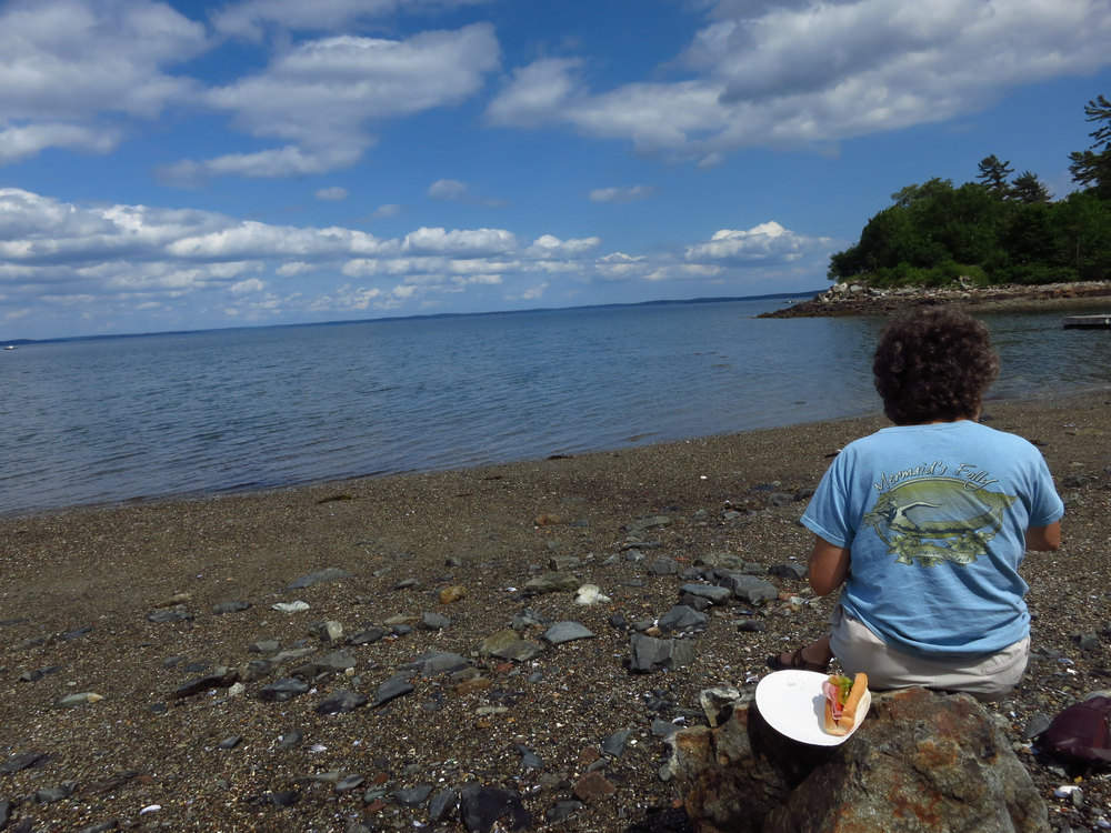
Not the most comfortable seating it the world but the view was hard to beat. Finally we had left the rain and dreary weather behind.
After our lunch we were ready to go for hike and do a little exploring.
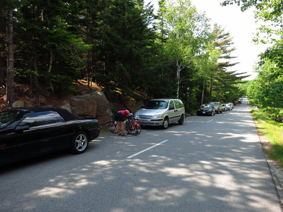
We had left the cool drizzle of Vermont and traded it for surprisingly warm temps especially when you consider how far north we were and the fact we were out on an island. Because of the weather a trip to the beach sounded pretty good. Of course a lot of other folks had come up with this idea as well and that resulted in all the beach parking lots being full. So we parked along the road with the rest of the folks who got there late like us.
Note the cyclist on the left. When we passed them I could see they guy working with a chain tool. I asked if they had everything they needed and he assured me they did. They were ferriners judging by the accent.

This Google terrain map shows Sand Beach and some of the other areas we visited while at Acadia.
Sand Beach in Acadia National Park is nestled in a small inlet between the granite mountains and rocky shores of Mount Desert Island. This gorgeous 290 yard long beach is one of the most popular points of interest on the island.
The thousands of years of pounding surf created a beach that is largely comprised of unique sand of shell fragments. The ocean temperature rarely exceeds 55 degrees in the summer and there is approximately one half cup of salt per gallon of ocean water.
Source: © 2006 - 2011 Greg A. Hartford
And speaking of maps - in order to better navigate the auto roads carriage roads and hiking trails we purchased a copy of 'Complete Hiking Trail & Carriage Road Map' published by 'Friends of Acadia'. Big mistake.
It may be "complete" but it is at the top of my list for one of the ugliest maps I have ever tried to use. The level of cartographic design shows it was obviously made by a non-user. The line weights and colors on this maps are so hard to distinguish it made our eyes go buggy. And the labelling and symbology leave much to be desired as well.
We bought the map at the National Park visitors center. They had several other maps to choose from. Surely any other map would have been more user friendly than this one.
I Googled "Complete Hiking Trail & Carriage Road Map". I found it interesting not even the Friends of Acadia web site mentions or offers this map for sale. Nor is it available from any other seller I could find on the web. I think I know why.
Don't buy this map. In fact if someone gives it to you get a better on.
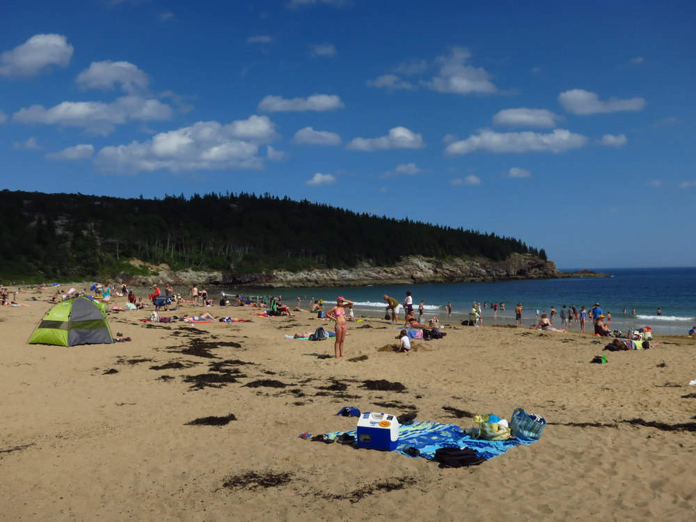
Our first look at the beach. Now we know why all them cars are parked there!
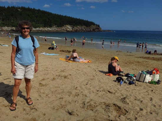
Finally we get to see the "The rockbound coast of Maine".
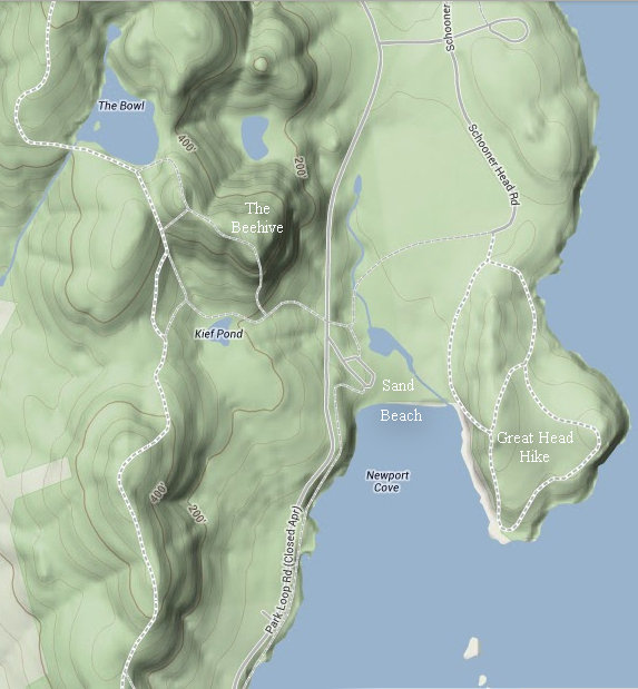
A closer look at the terrain in the area of Sand Beach. The "Beehive" trail is a very popular hike as is the Precipice Trail. Both were closed to protect the Peregrine Falcons nesting there. The Flying Mountain and Jordan trails at Valley Cove and Jordan cliffs were closed as well.
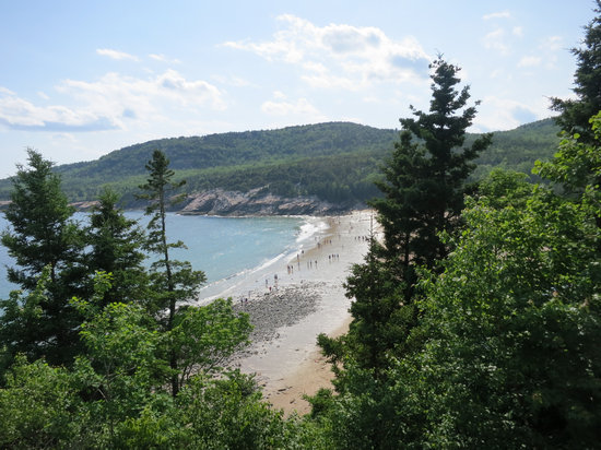
It did not take us long to get enough elevation for a bird's eye view of Sand Beach.
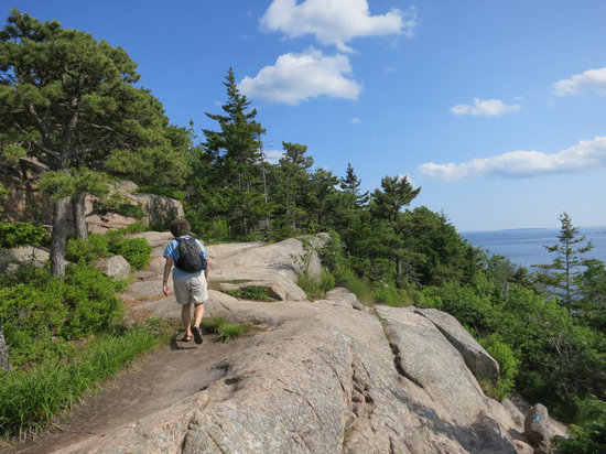
The hike crossed the granite which was peppered with dwarf Pitch Pine (Pinus rigida) and Red Spruce (Picea rubens).
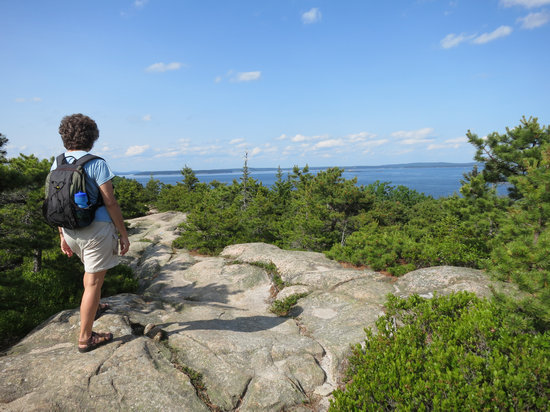
The views just kept getting better and better.
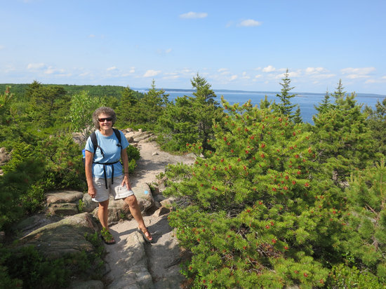
We were mighty happy to see some sunshine!
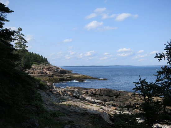
Although once upon a time Betsy had been up this way with Debbie this was my first look at the coastline which has graced a thousand calendars.
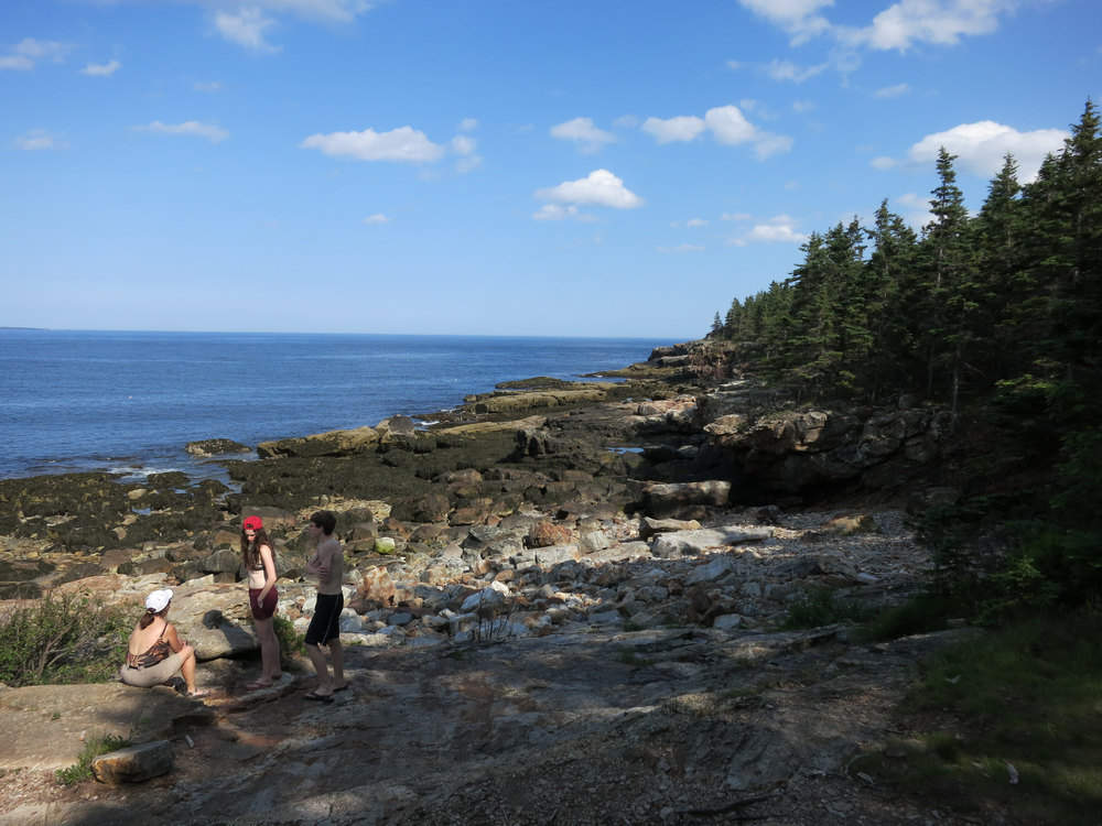
There was an unmarked spur trail which went down to the beach. Talk about rocky!
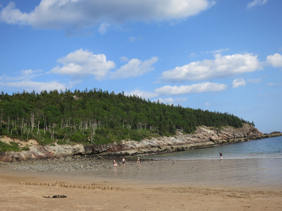
When we got back from our hot and sweaty hike Betsy was ready for a dip.
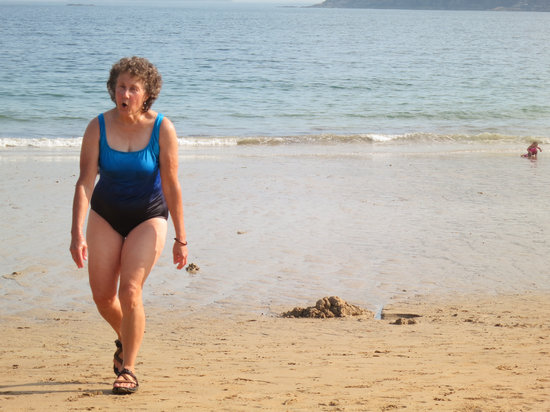
Coooooold!!!!
After departing Sand Beach we continued on the Park Loop road to Jordan Pond where we took a short hike.
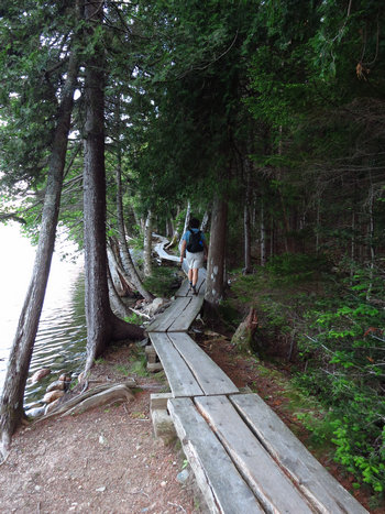
I don't know how many miles of boardwalk there are around Jordan Pond but we walked for about an hour and never saw the end of it.
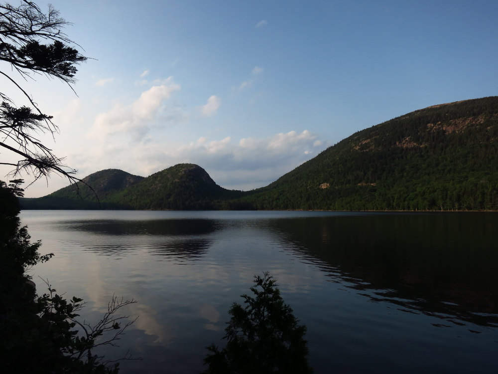
How many millions of years did it take to so gracefully sculpt these mountains of granite?
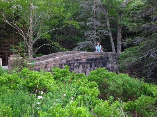
Acadia is renowned for its fine stonework the hallmark of a bygone era. This little bridge spanned the outflow of Jordan Pond.
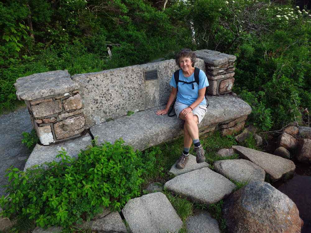
This pond side bench was certainly built for the ages.
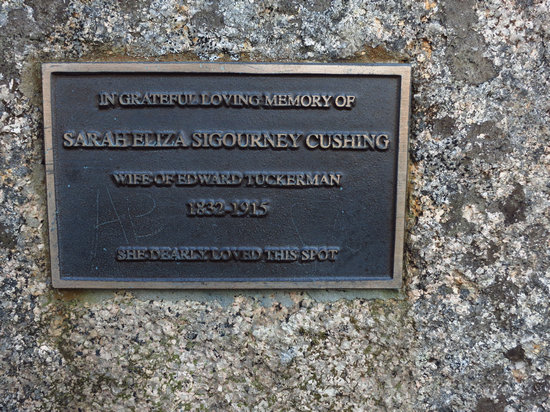
About this time (1913) a granite bench and commemorative plaque honoring Sarah Cushing was placed on the shore of Jordan Pond not far from the Jordan Pond House. No documentation has been found about this commemorative bench.
Source: wwww.archive.org
Sarah was married to a fellow by the name Edward Tuckerman who preceded her in death.
Edward Tuckerman (Boston Massachusetts December 7 1817 - March 15 1886) was an American botanist and professor who made significant contributions to the study of lichens and other alpine plants. He was a founding member of the Natural History Society of Boston and most of his career was spent at Amherst College. He did the majority of his collecting on the slopes of Mount Washington in the White Mountains of New Hampshire. Tuckerman Ravine was named in his honor. The standard botanical author abbreviation Tuck. is applied to species he described.
Source: WikiPedia
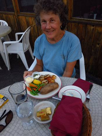
We finished off a busy day with a relaxing and belated birthday dinner at the Chart Room.
Betsy had "Deep Sea Scallops Char broiled for a most distinct and unique flavor $20.95" washed down with a pint of Long Trail Ale.
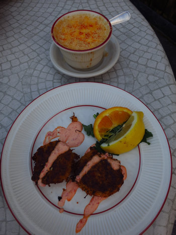
I had two appetizers:
"Clam Chowder Creamy New England Style — the in-house favorite $5.25"
and "Fresh Maine Crab Cakes with a Roasted Red Pepper Sauce $8.95".
True to character I accompanied my dinner with two (or was it three) Bud Lites.
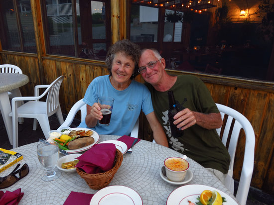
Well fed and watered we then headed to our room at the Robbins Motel.
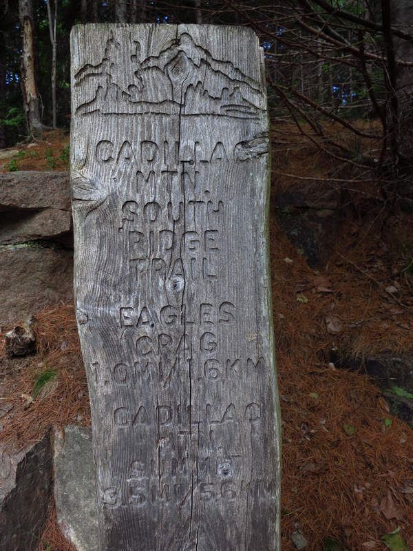
The next morning after a ridiculously overpriced and very average breakfast at the Acadia Cafe we went in search of the trailhead for the south ridge trail to the summit of Cadillac Mountain.
It was not easy to find as there is no defined parking lot and the grey trail marker shown above is very tricky to see from the road.
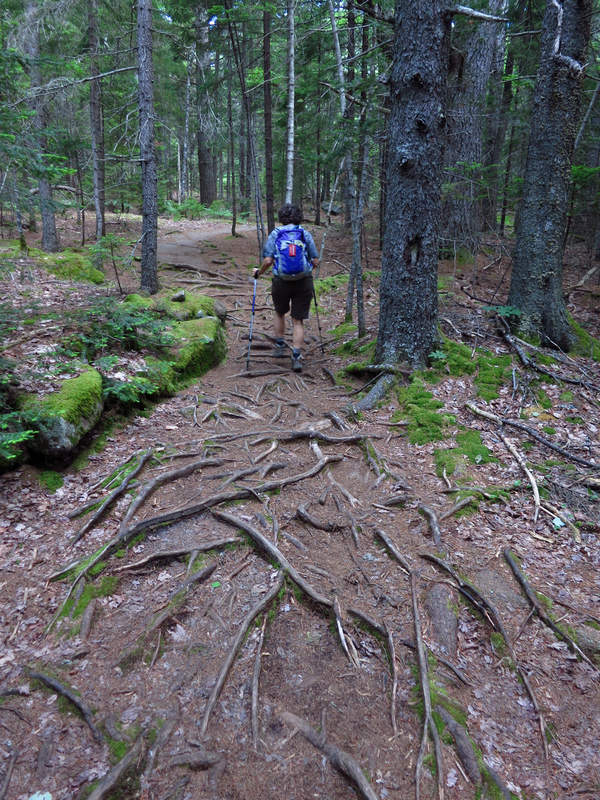
If this is not evidence of a well travelled AKA (over used) trail I don't know what is! This shady section of trail did not last long and we later missed the cool damp shelter of the Red Spruce.

When I first saw this I thought: "How strange they paved part of the trail". Of course it was the granite showing through the thin topsoil.
From its start the trail climbs gradually until after about a mile we reached it's intersection with the Eagle's Crag Trail. The trail marker pointed us straight ahead. But on the advise of Dolores Kong and Dan Ring's "Hiking Acadia National Park" we turned right onto the Eagle's Crag Trail. We were mighty glad we did!
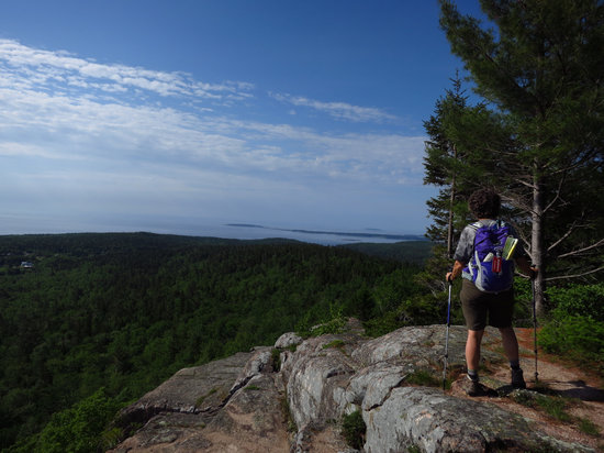
Eagle's Crag Trail climbed sharply and brought us out to the edge of a granite bluff where we had unhindered views to Acadia's eastern peaks — Huguenot Champlain Beehive and Gorham. We could also see Frenchman Bay and Schoodic Point. Otter Creek Valley lay below us as well as and Otter Creek Cove and Otter Point. Wow...
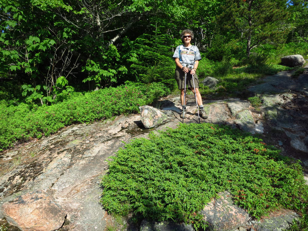
Here Betsy stands next to a plant I first saw nearly 30 years ago in the garden of Charley and Ginny Baer. They both had a keen interest in botany and Charley (Professor Emeritus Charles H. Baer - WVU) was a trained plant ecologist. They had been up to Acadia and brought back with them a small specimen of this plant Juniperus horizontalis. Knowing my interest in both native plants and horticulture Charley showed it to me and told me there was a horticultural variety known as "Bar Harbor Juniper".
As it turns out that is not the only cultivar of Juniperus horizontalis.
Well over 100 different cultivars have been selected for use as ornamental plants in gardens their strictly prostrate growth habit being valued for ground cover. Popular examples include 'Bar Harbor' 'Blue Acres' 'Emerald Spreader' 'Green Acres' and 'Wiltonii' ("Blue Rug Juniper"). Many of the most popular cultivars have strikingly glaucous foliage while others are bright green yellowish or variegated.
Source: WikiPedia
Junipers comes in many shapes and sizes. From the prostrate Juniperus horizontalis to the stately size of (Juniperus deppeana) the beautiful Alligator Juniper.
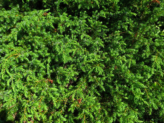
A closer look at the leaves of Juniperus horizontalis.
The needle-leaves of junipers are hard and sharp making the juvenile foliage very prickly to handle. This can be a valuable identification feature in seedlings as the otherwise very similar juvenile foliage of cypresses (Cupressus Chamaecyparis) and other related genera is soft and not prickly.
Source: WikiPedia

This was an amazing sight to me. Large areas of granite covered by Juniper Jack Pine Labrador Tea and Red Spruce.
Considering the lowest recorded temperature was 21°F in 1994 one has to wonder how these plants can survive in such an exposed location.
Eventually the trail turned to the east again to rejoin the main trail to Cadillac Mountain. For a short time we entered back into some shrubs and trees and that was to be our last bit of shade for many hours.
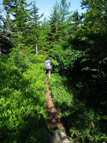
The low shrub Betsy is hiking through is Sheep Laurel (Kalmia angustifolia).
This was the first time I had seen it in the wild.
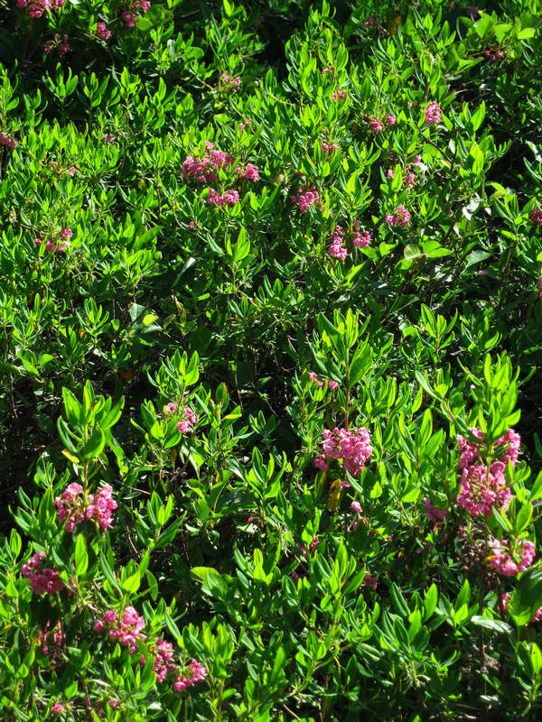
We saw lots of Sheep Laurel in full bloom.
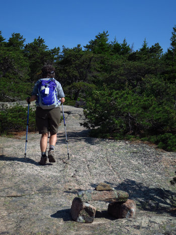
photo0000056.jpg
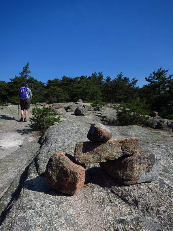
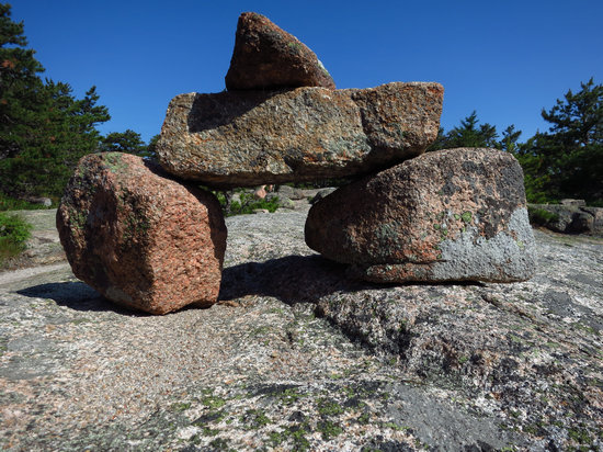
When hiking across the granite balds we seldom saw a visible or defined trail. Without these carefully place "Bates cairns" we would have ended up wandering all over the place.
In the early 1900s Acadia trail builder Waldron Bates introduced what we now call the Bates cairn (at left0. The Bates cairn consists of two large base stones supporting a mantel between them. A fourth rock known as the pointer rock rested on top and along with the base stones pointed in the direction of the trail. Sometimes two layers of base rocks were used to gain height for added visibility.
Source: American Trails
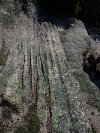
We saw a lot of these marking in the granite surface. I assumed they were glacial striations.
Glacial striations are scratches or gouges cut into bedrock by glacial abrasion.
Glacial striations are usually multiple straight and parallel representing the movement of the glacier using rock fragments and sand grains embedded in the base of the glacier as cutting tools. Large amounts of coarse gravel and boulders carried along underneath the glacier provide the abrasive power to cut trough-like glacial grooves and finer sediments also in the base of the moving glacier further scour and polish the bedrock surface forming a glacial pavement.Most glacial striations were exposed by the retreat of glaciers since the Last Glacial Maximum or the more recent Little Ice Age. As well as indicating the direction of flow of the glacial ice the depth and extent of weathering of the striations may be used to estimate the duration of post-glacier exposure of the rock.
Source: WikiPedia

Without this brush pile here as a deterrent one could easily mistake this open section for the actual trail.
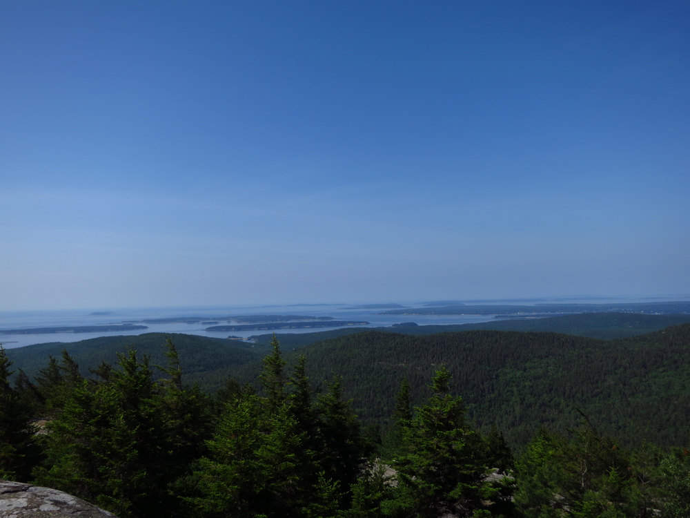
As we hiked across the granite bald the views really opened up.
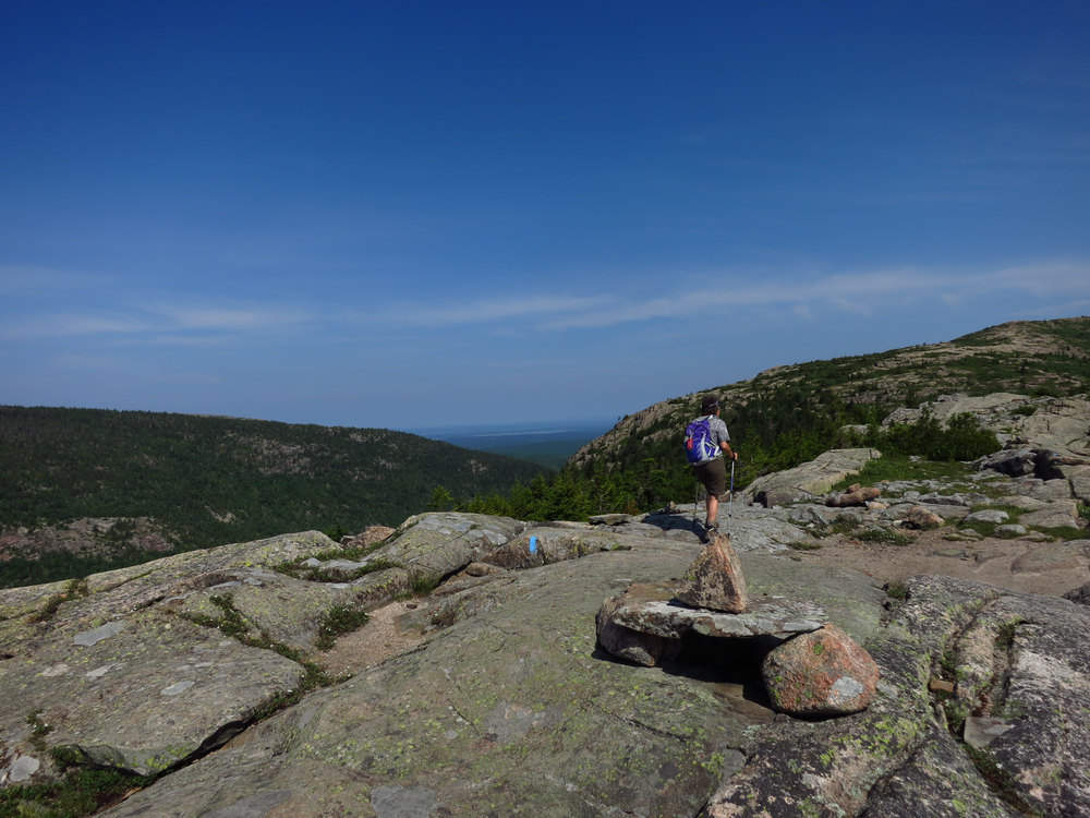
We were very glad for the Bates Cairns and they kept us on the right track.
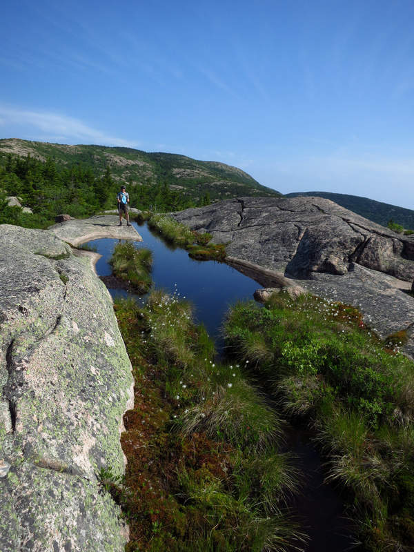
What a lovely spot this was and totally unexpected - a bog in a depression in the granite. A vernal pool? Maybe. But judging from the plant species and numbers I bet it has water year round.
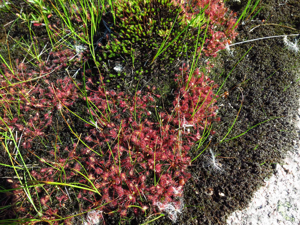
There were some beautiful plants of Sundew (Drosera rotundifolia). It is a carnivorous plant.
The plant feeds on insects which are attracted to its bright red colour and its glistening drops of mucilage loaded with a sugary substance covering its leaves. It has evolved this carnivorous behaviour in response to its habitat which is usually poor in nutrients or is so acidic nutrient availability is severely decreased. The plant uses enzymes to dissolve the insects – which become stuck to the glandular tentacles – and extract ammonia (from proteins) and other nutrients from their bodies. The ammonia replaces the nitrogen that other plants absorb from the soil.
Source: WikiPedia
Also in this little bog were Cotton Grass (Eriophorum tenellum) which grows in the mountains of West Virginia along with Sphagnum and other species of mosses.
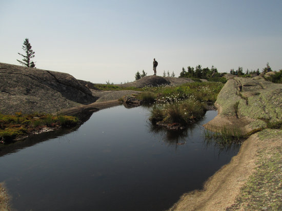
Betsy took this picture of me and really likes it. I think it is because I am so far away she can't tell it's me. Regardless - Nice shot Betsy!
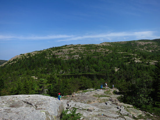
Just past the crest of the ridge and beyond the pool we started to drop down to "The Featherbed" which is a small pond which is formed from a glacial cirque.
A cirque (from a French word for "arena") can be a corrie (from Scottish Gaelic coire meaning a pot or cauldron) or cwm (Welsh for "valley") which have an amphitheatre-like valley head formed at the head of a valley glacier by erosion.
The concave amphitheatre shape is open on the downhill side corresponding to the flatter area of the stage while the cupped seating section is generally steep cliff-like slopes down which ice and glaciated debris combine and converge from the three or more higher sides.
Source: WikiPedia
As to the name "The Featherbed" I could find no information on the origin or reason for the name.
The four hikers in the above photo were a family from Michigan. They had two teenage kids with them who were well behaved quiet and interested in their surrounding. Nice to see that.
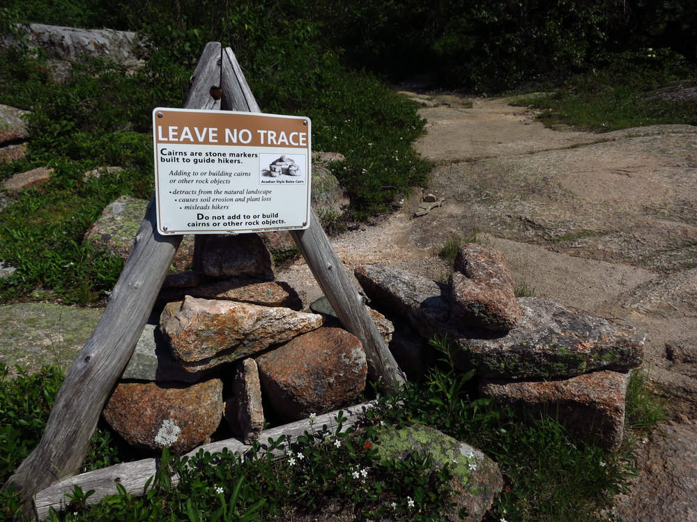
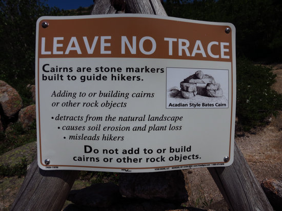
A friendly reminder.
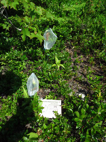
These Lady slipper orchids had their flower heads bagged. Must have been some sort of pollination or seed study going on.
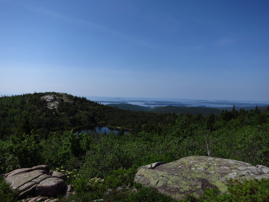
As we climbed the slope above the Featherbed we got more good views of the ocean and islands.
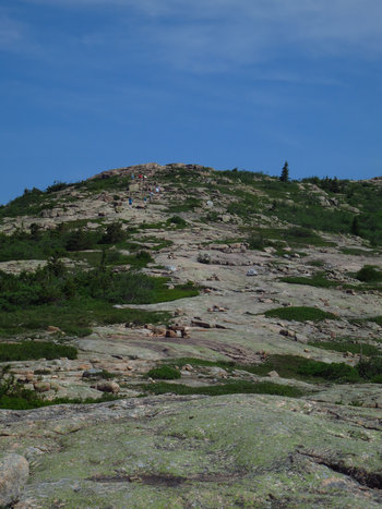
We are on the home stretch now and as you can see we have plenty of company. By now it was really heating up.

I don't think this sign post is going anywhere!
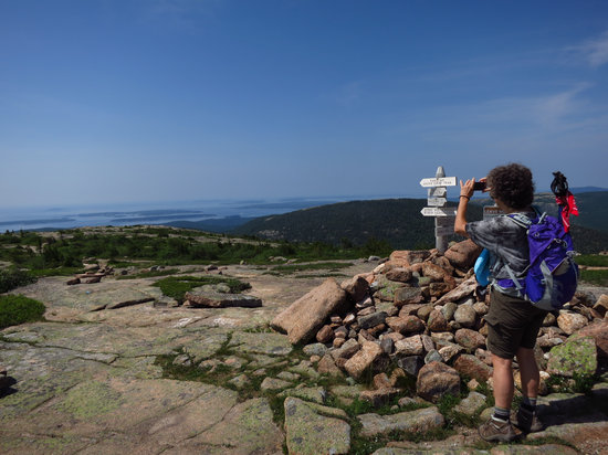
What a view...
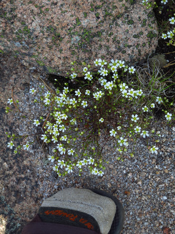
I don't know what these little cuties were. Do you? They were scattered about the upper reaches of the trail.
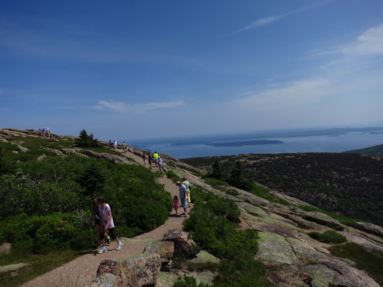
And here we are at the summit along with 100s of others. Of course they drove up.
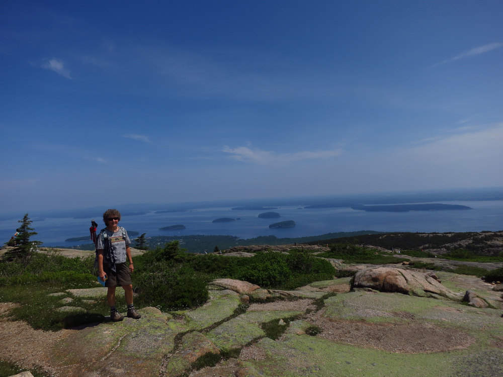
"I can see for miles and miles..."
We walked the loop trail at the top and tried to find some shade to take a short break. There was no such thing up here. After snacks and refilling our water bottles we started on the 4 mile hike back to our starting point.
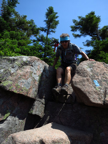
There were a couple tricky places like this where you had to be careful not take a fall.
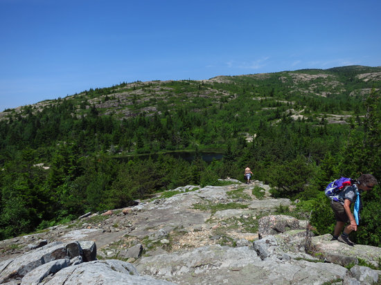
We passed the Featherbed again as well as a steady stream of hikers on their way up and on their way down.
By now it was mid-afternoon and the unrelenting sunshine and high temps had really heated up the granite. It was like walking through a furnace and became a bit of a forced march. But it was mostly down hill and we were soon back at the car and ready to enjoy the breeze through the windows on the drive back to the hotel.
After we got cleaned up and rested up the search for dinner started. We browsed the web went through the brochures and nothing really stood out for us.
Then Betsy remembered a place we might try to find. When her sister and brother-in-law had been up this way they stumbled a cross a place which really stood out -Beal's Lobster Pier. Perfect considering that is the family name: Charlotte and Betsy Beal!
It was down in Southwest Harbor an area we had not yet been to. Betsy gave her sister a quick call for more details and we verified they would be open and then we were our way.
Next stop: Lobster Feast!

When we arrived we saw the competition. Looks like we had better hang on to our lobsters...
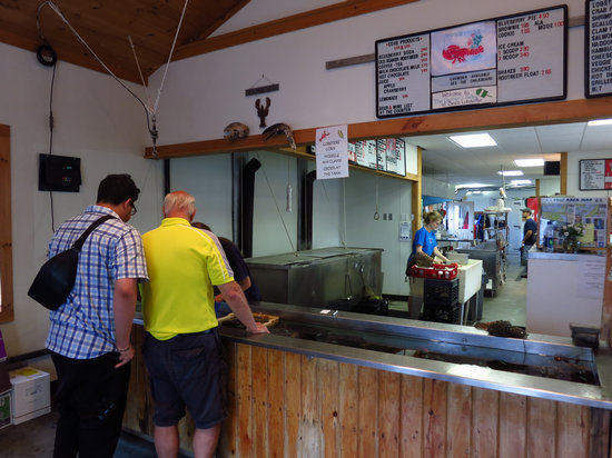
These two guys were looking over all the goodies in the tank and picking out the lobsters they wanted.
We had never been to a place like this before but luckily for us we got in line behind one of the regulars (Jack) and he gave us the lowdown on ordering.
This was the first place to order: lobsters corn mussels and clams. Then you went on to the register and there you ordered your side dishes and drinks.
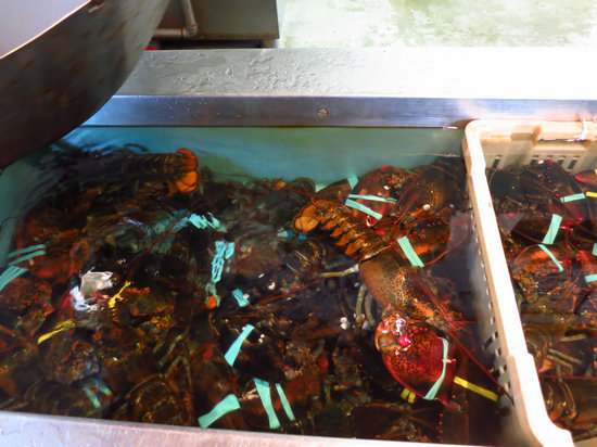
Here is out dinner. Now... which one. Actually we just told her to fill our order the same as Jack's. That way we got the price break for the under 2 pounders.
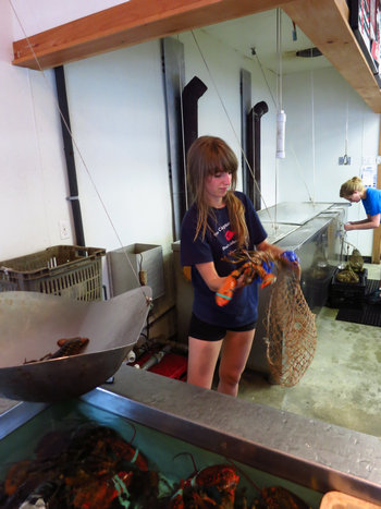
Our dinner was weighed and recorded.
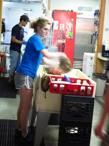
Then bagged up for boiling.

Here comes someones dinner. Out of the bag and ready to eat.

The misery...

Betsy got a big one!
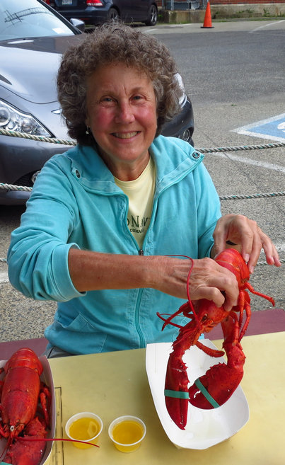
It is easy to see what makes this gal happy.
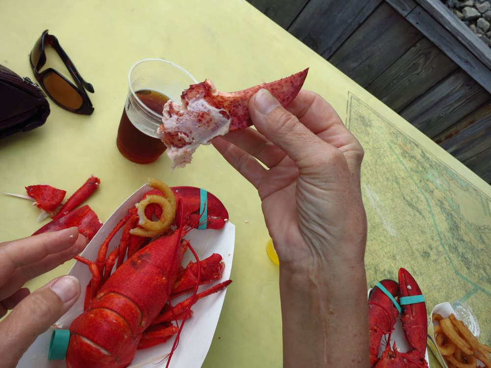
Now the "work" begins.
An interesting side bar - it seems the lobster did not always have the reputation it has today.
Some accounts such as that in Mark Kurlansky's book Cod say that early New Englanders did not want to eat lobsters even though "the waters were so rich in lobsters that they were literally crawling out of the sea and piling up inhospitably on the beaches." (p. 69)
It was said that lobsters were considered a food fit only for poor. Evidently New Englanders eventually developed a taste for it.
Source: ©2013 About.com
"The American lobster (Homarus americanus) is today on of the more expensive food items on the market owing to the difficulty of obtaining sufficeint quantities to meet the demand. But when the first Europeans came to America the lobster was one of the most commonly found crustaceans. They sometimes washed up on the beaches of Plymouth Massachusetts in piles of two feet high. These settlers approached the creatures with less than gustator enthusiasm but the lobsters' abundance mande them fit for the tables of the poor...
In 1622 Governor William Bradford of the Plymouth Plantation apologized to a new arrival of settlers that the only dish he "could presente their friends with was a lobster...without bread or anyhting else but a cupp of fair water." Lobsters in those days grew to a tremendous size sometimes forty or more pounds...The taste for lobster developed rapidly in the nineteenth century and commercial fisheries specializing in the crustacean were begun in Maine in the 1840s thereby giving rise to the fame of the "Maine lobster," which was being shipped around the world a decade later.
In 1842 the first lobster shipments reached Chicago and Americans enjoyed them both at home and in the cities' new "lobster palaces," the first of which was built in New York by the Shanley brothers...Diamond Jim Brady thought nothing of downing a half-dozen in addition to several other full courses...By 1885 the American lobster industry was providing 130 million pounds of lobster per year. So afterward the population of the lobster beds decreased rapidly and by 1918 only 33 million pounds were taken."
Source: Encyclopedia of American Food and Drink John F. Mariani [Lebhar-Freidman:New York] 1999 (p. 186)Source: © Lynne Olver 2004
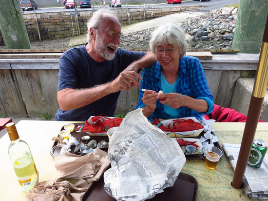
This is Jack the fella that helped us order and his wife Cri. They have been summering up here in Acadia for many years and Beal's is one of their regular haunts.
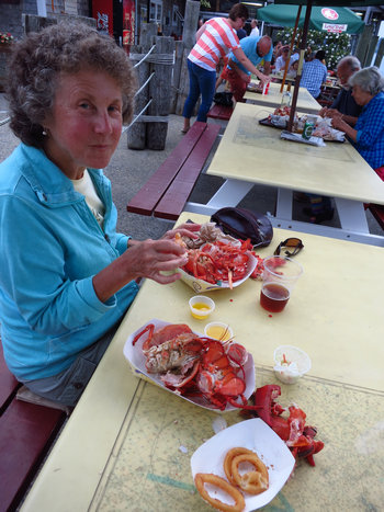
Looks like Betsy is making some progress.
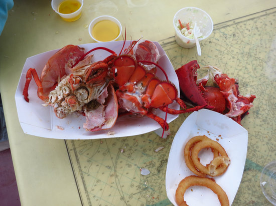
The aftermath...
Although I really enjoyed the unique experience and local color I have to say I was not that enamored by the taste of the lobster. No doubt those who soak the lobster meat in butter might find it tasty but - like my corn-on-the-cob I ate my lobster naked. It was a bit on the bland side me thinks. But what a fun experience!
And that as they say is that. The close of another full and fun day.
Part 3 - Maine
Acadia National Park: Cycling the Carriage Roads
I am not sure when or under what circumstance I first heard about Acadia National Park. But I do remember the first time I ever heard about the Carriage Roads. It was Patty and Karl who had just returned from a trip up that way.
They we so enthusiastic and effusive when talking about Acadia we knew it was someplace we had to go.
That was at least 15 years ago. What took us so long...?
Well better late then never and today would be our day to ride those Carriage Trails.
As was mentioned previously we were not too happy about the breakfast we had the previous day at the Acadia Cafe. So we asked around and were told about Jordan’s Restaurant on Cottage Street. This proved much more to our liking. Although only a bit less expensive than the Acadia the food was better and atmosphere much more interesting and comfortable. And they had a small pocket book for sale on the carriage roads which we purchased and perused over breakfast.
Thus fortified we drove down to the Eagle Lake access area.
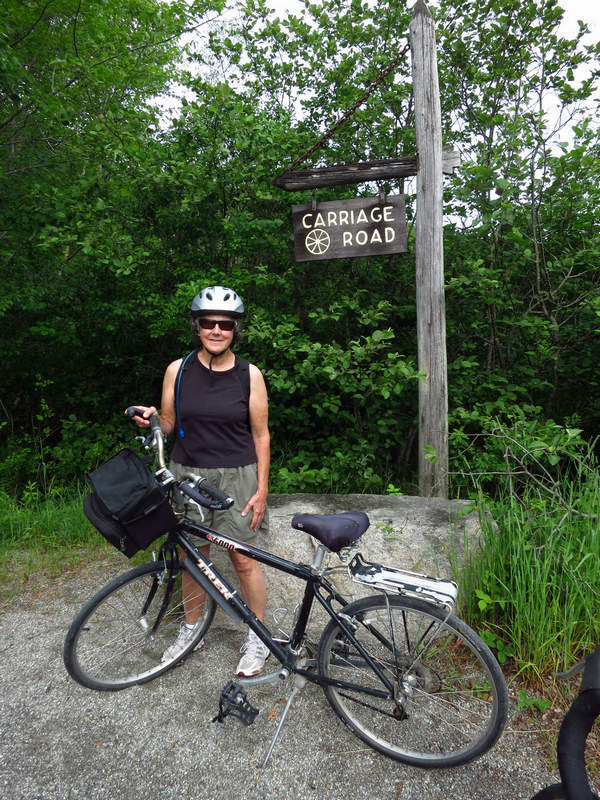
Ready to roll!
Between 1913 and 1940 John D. Rockefeller Jr. financed and directed the construction of 57 miles of Carriage Roads for the use of hikers bikers horse riders and horse-drawn carriages on the island. This diverse network of woodland “broken-stone” roads is free of motor vehicles. There are 45 miles of roads within Acadia National Park and some of these allow for cross-country skiing and limited snowmobiling.
Granite was quarried from Mount Desert Island by the road crews for the needed road material and bridge facing. Landscapers tastefully utilized native vegetation such as ferns and wild blueberries.
There are many locations such as Eagle Lake and Jordan Pond where you can park your vehicle and go for a walk on the roads. You may even choose to take a horse-drawn carriage ride through Wildwood Stables an authorized vendor accessed from the Park Loop Road. For those who want to bring their own horse stall rentals are available.
Source: © 2006 - 2011 Greg A. Hartford
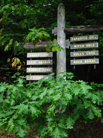
To say the Carriage Roads are well signed is an understatement. But the sign booklet still did not keep us "The Spacially Challenged Ones" from getting confused and turned around on several occasions.
The signs on the left point to our first destinations: Duck Brook and Witch Hole. AKA the Witch Hole Loop.
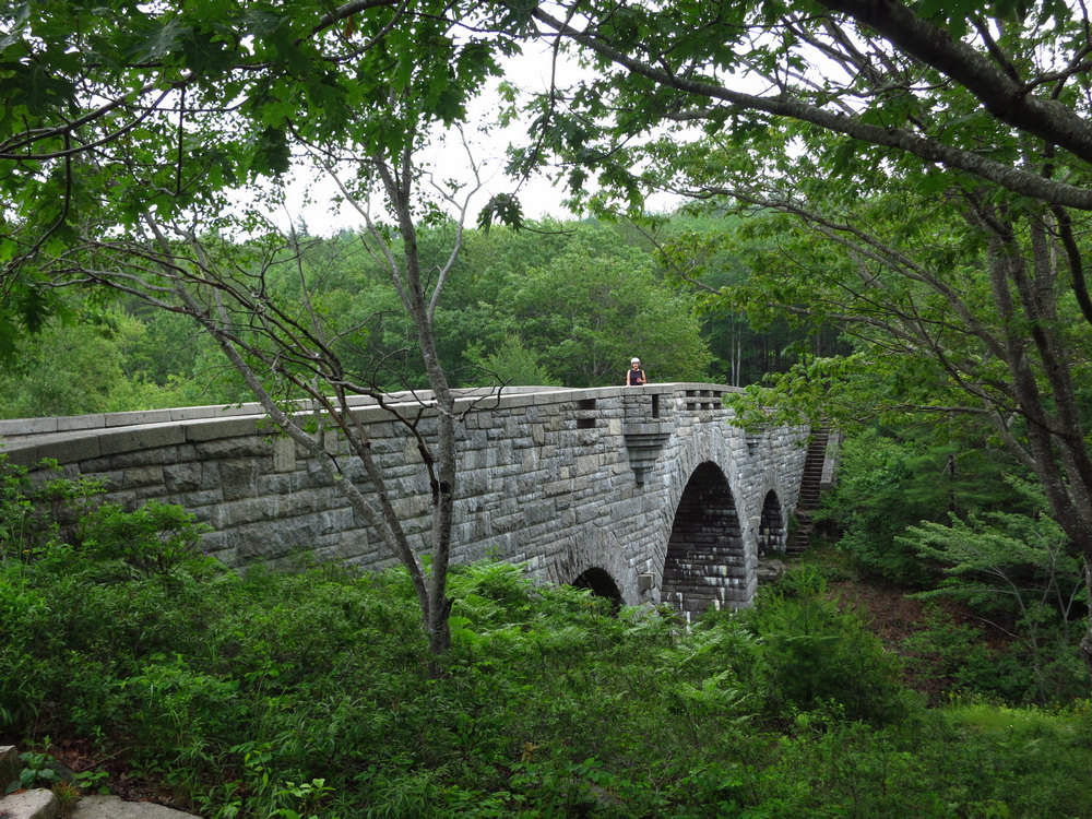
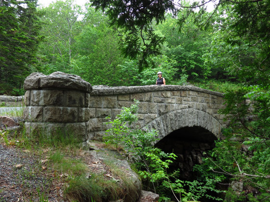
Acadia is famous for its stonework and it is easy to see why.
This is the Duck Brook Bridge. It was completed in 1929. This beautiful three arch bridge is 200' long and has a central 30-foot span which is flanked by smaller 20 foot spans.
Some bridge anatomy:
Ashlar: Rectangular blocks with no set dimensions
Voussoirs: Wedge-shaped stones creating the decorative arch of the bridge
Coping Stones: Used in the top rail
Abutments: Side walls or pillars of bridge built into the landscape
Capstone: Top rock on abutments of the bridge deck
Keystones: Final piece placed during construction of an arch
Rubblestone: Broken stone of irregular size shape and texture
Want to know more? There is some excellent info here:
The Bridges of Acadia National Park and Mount Desert Island.
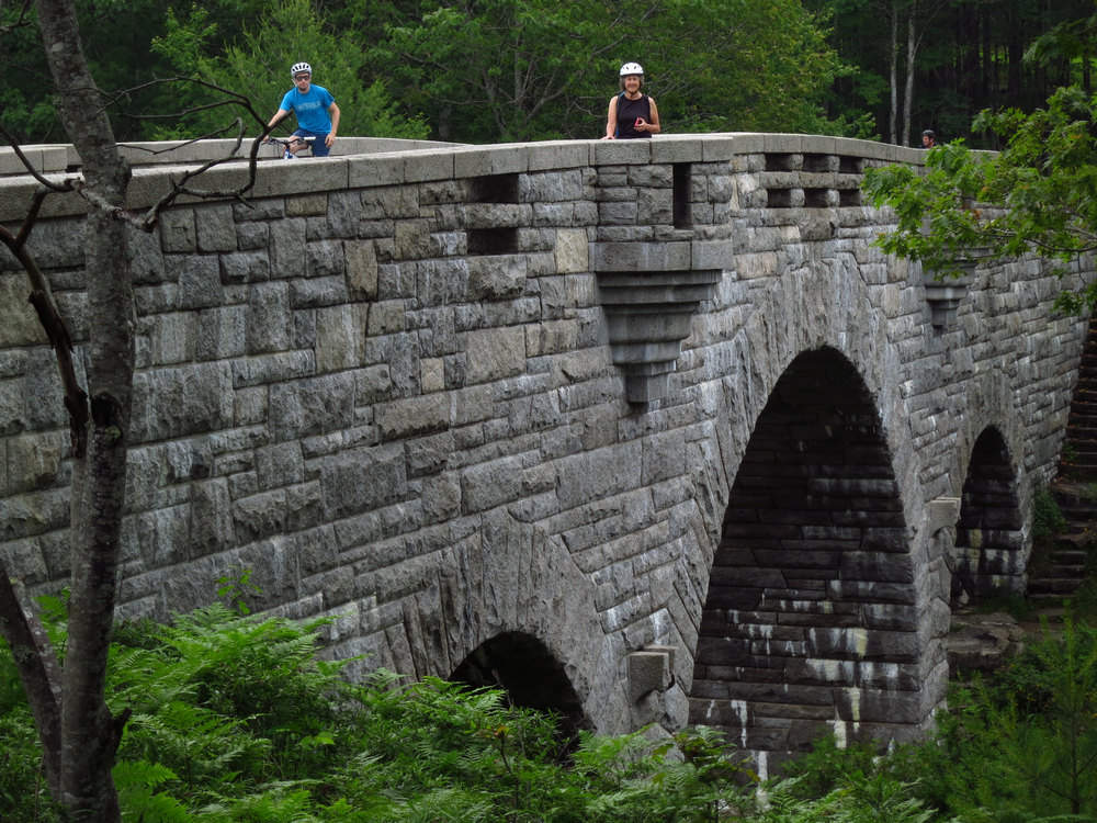
This parapet reminded me of some of the castles we had seen in Scotland and Spain just a month earlier.
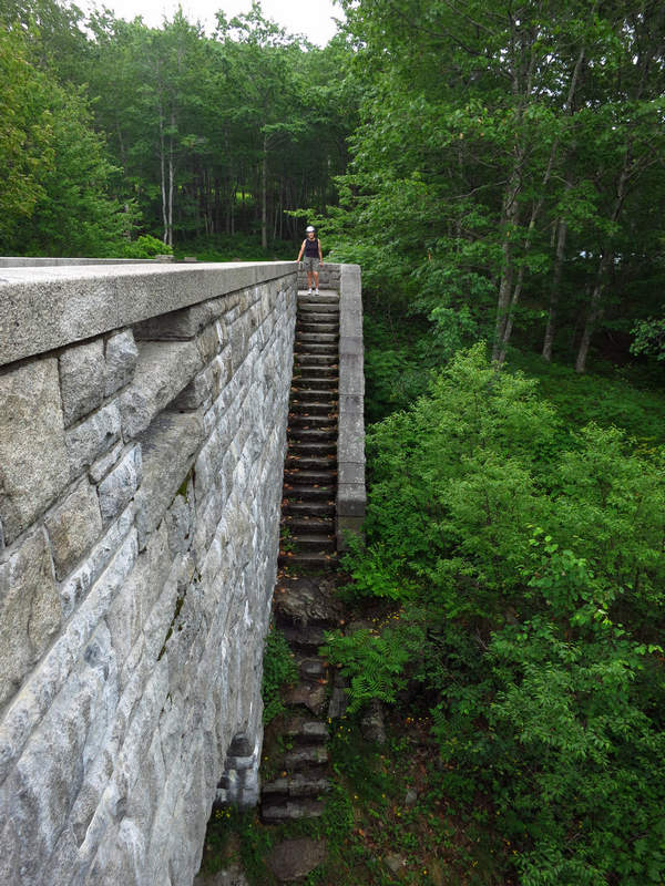
It is easy to picture a lady or gentleman dressed in their best and out for a Sunday outing carefully making their way down to the waters edge.
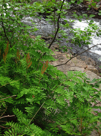
Along the banks of Duck Creek I saw many nice specimens of the Royal Fern (Osmunda regalis).
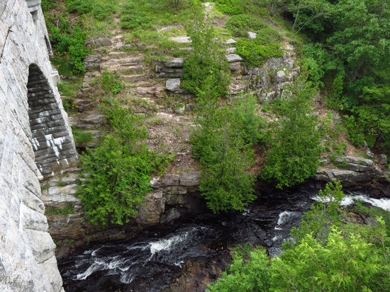
I look down into the clear cool water.
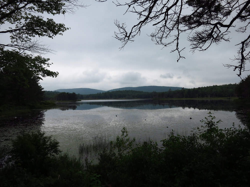
This is Witch Hole Pond. Pretty spot.
There are some much better pictures of Witch Hole Pond. I have yet to find a referece for its name.
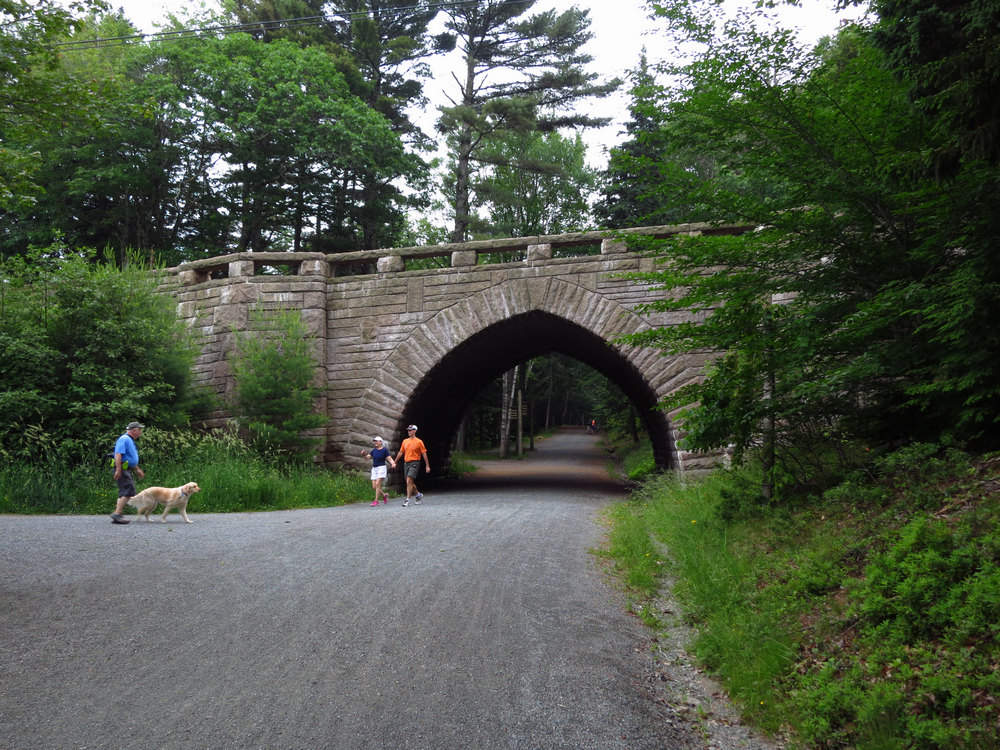
After completing the Witch Hole Loop we were now back where we started. Route 233 is bridged here.
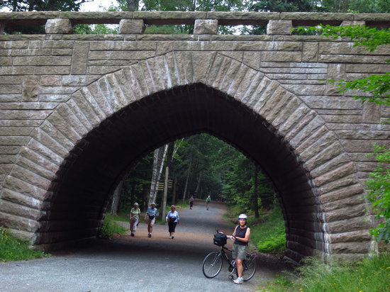
That stonework! I cannot not imagine doing all that hand work.
I took no notes of our route and after this point my memory fails me. But I think we unknowingly picked one of the hilliest routes possible.
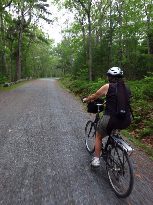
By now it was completely overcast and misty. It became more so as the ride went on.
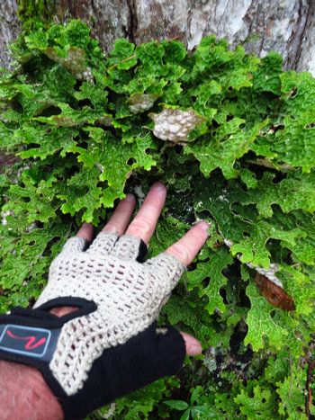
We stopped for a rest on one of the hills and spotted this beautiful foliose lichen growing on the base of one of the trees. This may be a species related to the Tree Lungwort (Lobaria pulmonaria).
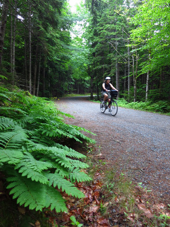
There was a long down hill at "Seven Bridges" which we flew down!
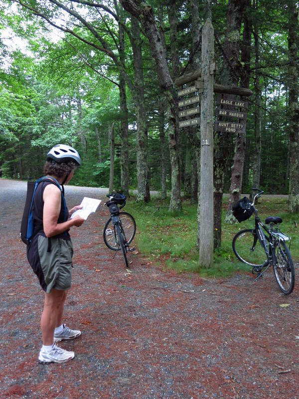
"Hmmm... where the **** are we?!

Aunt Betty Pond? I sure don't remember now.

Here we are climbing up to the ridgetop in rain and a fierce wind. You can see from the one sided Pine there is lots of wind up here. What started as a warm and muggy ride was now wet and cold.
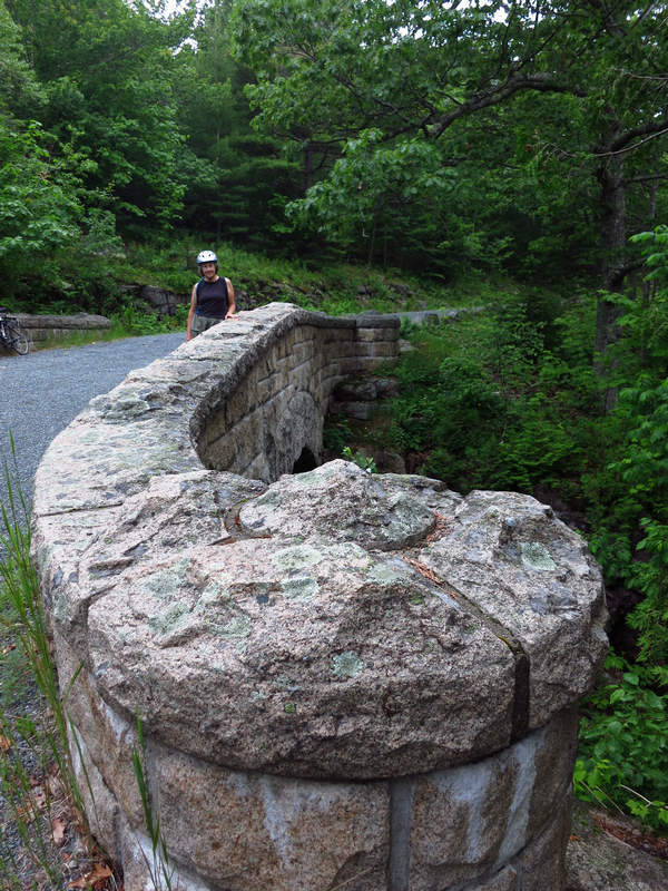
I have no clue what this bridge is named but it is sure a pretty one. I love those curlicues.
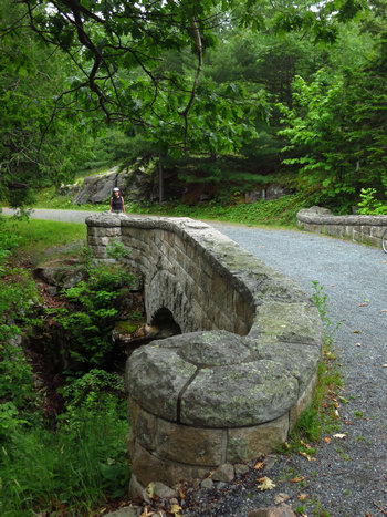
From this perspective you can see the road is now heading down hill. This would be our final decent down to Eagle Lake and then back to the car.
About the time we got down to Eagle Lake I noticed something odd familiarly so with my bike. I stopped on the side of the road to have look. Sure enough flat tire - or nearly so.
We were only two miles or so from the car so rather than change out the tube I decided to pump it up best I could and then peddle like hell to the car.
I got it pumped up and while removing the pump I broke the valve stem off. No getting that tube pumped up again!
I jumped on my trusty steed and peddled like a maniac and made it back to the car before it went completely flat. Whew! Betsy rolled in a bit later and we were both pretty pooped.
On the way back we stopped at the Hannefords for some supper grub: sushi bow-tie pasta salad and other assorted goodies.T hen it was back to the hotel for some R&R sorting and packing. On the morrow we would be heading north to Old Town.
Part 4 - Maine
A Hippie Reunion at Sunkhaze
On a cold winter morning in March of 1968 my mother Jane Rector Breiding Donaldson fled to San Francisco with her 4 sons Sutton, Michael, Wayne, and Bill and one of her two daughters Susan. Oldest of the clan Joan, was to join us later that year.
The first place we called home was a residence hotel somewhere in the Tenderloin. It was all my mom could find after landing in San Francisco with 5 kids in tow. The place was near the YMCA. That's about all I remember of the place.
At some point my mom somehow managed to not only find a job to support her family but she found us decent and relatively safe housing as well. This was no easy task on a secretary's salary in San Francisco. At that time we were situated on California Street between Fillmore and Steiner Street. Sister Susan also found work and rented her own studio apartment just around the corner.
Later we all moved to 2381 Bush Street which sat on the edge of what was then called "The Fillmore Ghetto" a black slum. It was here we stayed until March of 1972 when we returned to our beloved West Virginia.
During those years in "The City" much dope was smoked much acid dropped and much music listened too. And many people came and went at 2381 Bush Street.
One of those people was an 18 year old drifter by the name of Steve Lyon. How it was Steve found us I do not know. But find us he did and it took no time at all until he was one of the family.
Steve came and went and truthfully I didn't think much about it. I just assumed he was groovin' and trippin' with some other folks.
When he was back at 2381 it was like he was never gone. He dovetailed so naturally into life at 2381 and the "Bush Street Compound" it was as if he had always been a part of our life.
But things are not always as they seem especially to a 16 year old kid from West Virginia.
And so it was quite a surprise to me when I found out just recently when Steve was not bedding down at 2381 and enjoying the warmth good food and music which we always had he was huddled behind some bushes at a local park and making his bed on the bare ground.
In fact one of his regular spots was 4 blocks away at Alta Plaza park.
Finding this out was a bit of a shock because it meant Steve was out there and vulnerable to all manner of things. But I was never aware of it - until now.
Four years went by and some of the Breidings left San Francisco some stayed.
Some of us had been stricken by Back to the Land Fever and drove east to the far away mountains of Southern West Virginia.
But what happened to Steve Lyon that layer of floors and builder of lofts?
Where did that easy going likeable and unassuming young man end up?
Now 40 years later we shall now find out...
But before this Reunion can occur we need to drive north a bit.
We left Bar Harbor early enough to want to get some breakfast on the road. We exited I-95 at Orono hoping to find a bite to eat. What we found was a ghost town. We passed over the Penobscot River and somehow completely missed the downtown area and ended up on the outskirts of town in no time. We turned around thinking we would just get some grub at a super market we had passed on the way through.
When we pulled into the parking lot of the Thriftway Food Center we thought it was closed. Not one car in the parking lot and we could not discern whether there were any lights on inside or not. Betsy got out to check and then came back to tell me the place was indeed open for business.
We walked up and down every isle and saw no signs of life. Then finally we saw a fella who was obviously a store employee. We were not too thrilled with the food selection so we asked him if there was any place we might get breakfast.
His answer was a longwinded diatribe about a particular restaurant which had really great breakfasts. Unfortunately he wrapped up his spiel with saying the place was now closed. Great. Thanks. Big help.
But he did say he thought a place up the street served breakfast. It was mainly a Pizza joint but he said we might try it.
Oh by the way - the reason for the empty store and ghostly appearance of the town? It seems the University of Maine which is located in Orono was on summer break and the place had emptied out.
Following the directions he gave we us we were at Pat's in under two minutes.
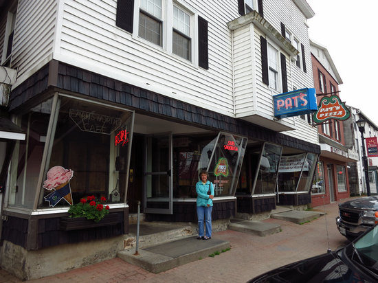
Little did we know we had been steered to what can certainly be considered an institution in the state of Maine.
Pat's Pizza now has thirteen locations through out the state of Maine but it came from a humble beginning.
C.D. "Pat" Farnsworth opened Farnsworth's Cafe in Orono Maine in July 1931. Pat's dream was backed by $175.00 long hours and hard work. Because of his efforts Pat saw the cafe which originally sold ice cream and confections become a full service restaurant. In 1953 Pat added pizza to his menu. The fresh dough pizza topped with a special sauce developed by Pat and his wife Fran were an instant success. Pat's change in the menu transformed Farnsworth Cafe into Pat's Pizza.
Over the years Pat's Pizza has become a favorite of University of Maine students. In fact it has been said that an education at the University is not complete without a Pat's Pizza. Today Pat's Pizza is enjoyed not only in Orono but also in Augusta Auburn,Yarmouth Sanford Scarborough North Windham Ellsworth Lincoln Hampden Bethel Presque Isle Sanford and our newest location in the Old Port of Portland Maine. All of Pat's Pizza Restaurants offer friendly casual and affordable dining for the entire family.
Pat Farnsworth passed away on February 3 2003 at the age of 90. His work ethic and philosophies live on in each location.
Source: Pat's Pizza
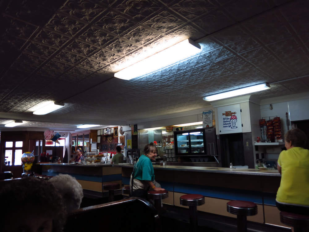
The dark shot on the inside of Pat's Pizza does not show much. But it does show the "dumbwaiter" next to the pie case. Our breakfast arrived via this devise. I have not seen one for quite a while let alone actually see one in use.
Not knowing when or where our next meal might come from we both had a full breakfast with coffee and juice for the total budget busting price of eleven bucks. My kinda place.
Now we see where Steve has been for the last 40 years.
When Steve departed San Francisco in the early 70s he ended up in Northern California living on a commune. After spending some time there he decided this was how he wanted to live.
Somehow he ended up in Maine and there he purchased 350 acres as his homestead and business site. He and his partner and wife Shannon then commenced to develop a 165 acre blueberry farm and they have been in business ever since.
It should be noted these are not the highbush blueberries most of us are used to but rather the "lowbush" blueberries which are actually native species which grow wild in the area. Thus the full name of the company: "Sunkhaze Wild Blueberry Farm". The "sunkhaze" part is derived from Penobscot language and means something like "where the water appears". This alludes to a confluence of two rivers/streams which were hidden from view by a sharp bend. At least that is how I remember it.
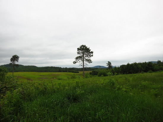
This is the view we saw when we drove on to the farm: rolling fields of lowbush blueberries.
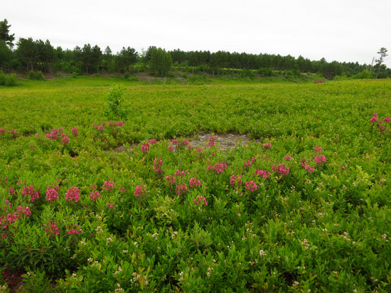
A closer look at one of the fields. The blooming plant in the foreground is Sheep Laurel. This is the same plant we saw earlier in the week at Acadia National Park.
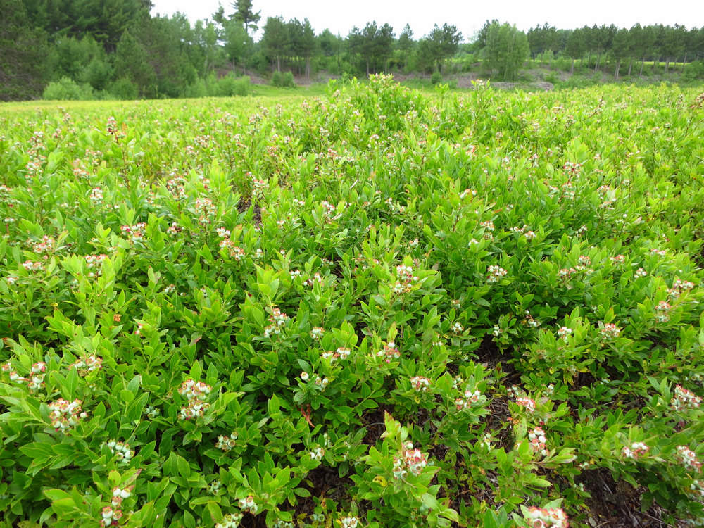
Here you can see the ripening fruit on the blueberry plants. These plants are usually about 12-16" in height which makes picking them "stoop labor". The berries were harvested using hand "rakes". A slow and tedious process.
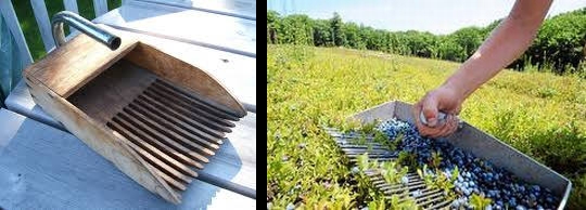
Here we see and old style wooden rake and the modern version made out of aluminum. The ongoing difficulty of finding people to hand rake finally led to Sunkhaze switching over to mechanical harvesting.
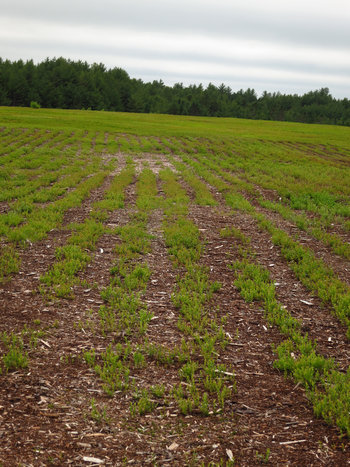
One thing I found out about Steve - he is a hardworking entrepreneur. You will note here the blueberry bushes are in well defined rows which are equally spaced. This is from Steve selling another product: blueberry turf or sod. The continuous blocks of plants are cut into strips then chopped into manageable size blocks which are then loaded up and delivered to the job site for planting. Apparently there are some folks in the wealthy areas of Kennebunkport who like the idea of using this as a "green" lawn.
As with berry harvesting Steve rotates the sod harvesting. He pointed out since the blueberries have a stoloniferous root system the harvested rows will fill back in about 3 years. They are then ready again for sodding or fruit production.
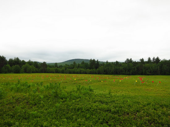
Sunkhaze has been a "cooperator" with the University of Maine for many years. The flagging in this field is where a research project is ongoing.
Betsy and I both got the ten dollar tour of the farm and wood and now it was time for some grub!
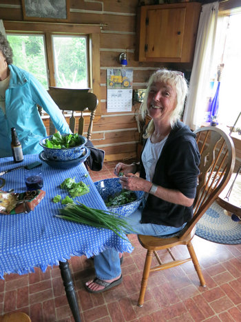
Steve and Shannon are off the grid and that includes having no refrigerator. They have a nice garden and also can up venison and moose.
Here Shannon had just returned from the garden with some goodies for a salad - something Betsy and I had both been craving. She served this up with local salmon and spuds and we had quite the feast.
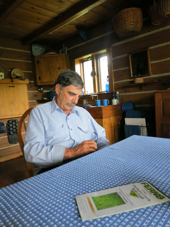
As you can imaging after 40 years Steve and I had a lot of catching up to do. Boy do I wish I had had a tape recorder running! I have already forgotten much of the hours long conversation about the people places and happenings of those bygone days of our youth in San Francisco.
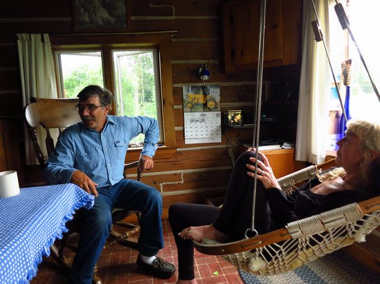
On more than one occasion Steve got a bit animated when recounting a few "Tales of the City". What fun!
After much tale telling it was off to bed. We had our own cozy little "camp" to stay in. This is where some of the harvesters would stay when the season was in.
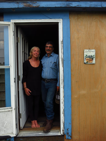
Home Sweet Home
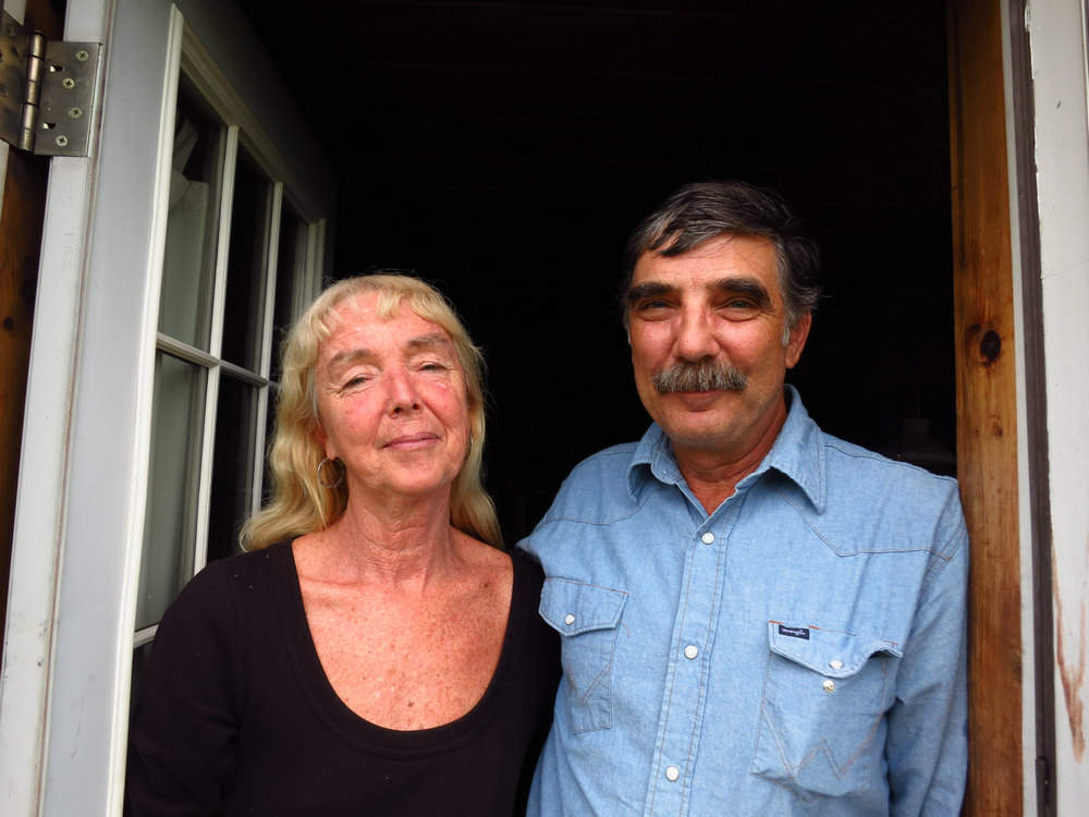
photo0000122.jpg
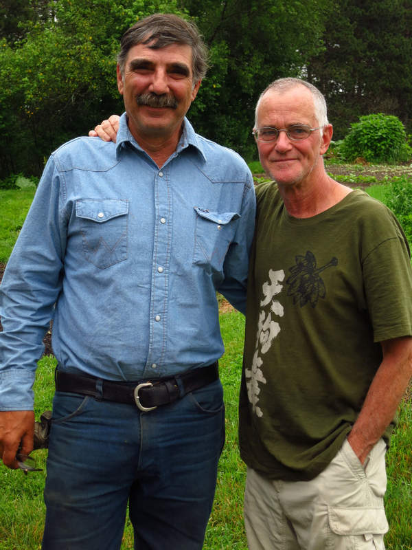
Here we are 40 years later and we haven't aged a bit!
All the reminiscing with Steve and being quizzed by Betsy and Shannon brought back a huge flood of memories to say the least. It was wonderful to finally meet Shannon and to see Steve was still pretty much the same way I remembered him - except without the hippie hair.
Hopefully it will not be another 40 years before our next Hippie Reunion.
Part 5 - Good-bye to Maine
And Fun with Jenca
Christmas 2011 was a day of firsts: My first hike with the Tucson Hiking MeetUP Group the first time I met Bill Carter the first time I hiked to Bridal Wreath Falls and the first time I met Jenca.
Jenca is one of those people you are instantly glad you met genuinely friendly and likable and a fun loving hiking companion. We hit it off instantly. By the end of the hike I felt like we were old chums.
If memory serves me well (which it seldom does) I did not see Jenca again until the following Christmas when Betsy and I returned to the Tucson area. But even prior to seeing her she noticed I was back in town and sent me a greeting via the MeetUp group: "Welcome back to cactus country Mike". That made me feel glad to be back.
During our stay in 2012/13 Jenca and I would sometimes end up on the same hikes. As time went on we got better acquainted. She told me she was looking for jobs in other areas and was excited about an opening in Boston.
Then one day an excited and effusive email came across my desk: It was Jenca shouting to the world she had been hired by a firm in Boston and was soon to be moving east.
Talk about being happy and sad! I hated the idea of not having Jenca around anymore but I was mighty glad she was off to greener pastures and some new adventures.
We said our final farewells to Jenca at her going away party. A number of folks brought gifts for her as mementos of her time in Cactus Country. One of those gifts was a Cactus dish garden - her cactus family.. After a really groovy going away party Jenca was on the road to BeanTown. She sent out a trip report which really caught the spirit of her journey east. That report is here and fun to look at. She also sent some photos of her new place in North Billerica which is 25 miles north of Boston proper. She had found a place right along the Concord River and would be able to sit in her living room and watch the water and the wildlife go by. Nice...
Once Jenca was settled in we warned her we might show up on her door step. And sure enough we did.
And so when we said good-bye to Steve Shannon and Sunkhaze we started our drive south to Jencaville.
Jenca had mentioned in an email she would have a nice traditional lunch for us when we got there and she made good on her promise.
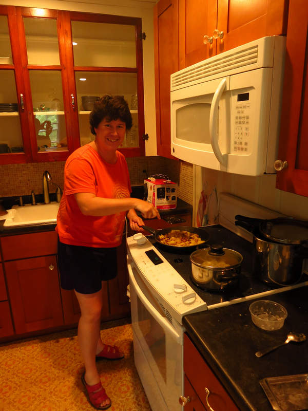
I love having someone else do the cookin'!

Sauerkraut fried potatoes and kassler.
Now that is what I call a hearty lunch!
Kassler or Kasseler in German cuisine is the name given to a salted (cured) and slightly smoked cut of pork. Pork necks and loins are the most often used cuts although ribs shoulders and bellies can also be used. It is often served with sauerkraut and mashed potatoes.
In addition to pork chicken prepared 'Kasseler' style is available at some butchers.
It is unclear where the name comes from. It is often said that the name derived from a Berlin based butcher called Cassel who prepared the cut in the late 19th century. However records of the town's inhabitants show that in the 19th century no one called Cassel or Kassel was living in Berlin. Likewise it is not possible to prove that Kasseler comes from the German town Kassel. [1]
In Finland pork neck of any type is called kassler.[2]
A similar dish hamburgerryg is eaten in Denmark. In this variation the meat is not smoked but only boiled. It is often served with a glace of either honey or mustard.
Source: WikiPedia
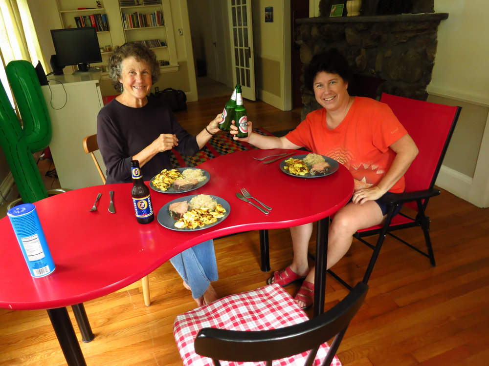
Now tell me - how could you have a meal like this without beer!?
Needless to say after a meal as filling as that we all felt the need for a little exercise.
We decided to go local rather than drive somewhere and Jenca took us on a nice walk consisting of country roads and local trails.

We saw this house from one of the trails. I love that front yard.
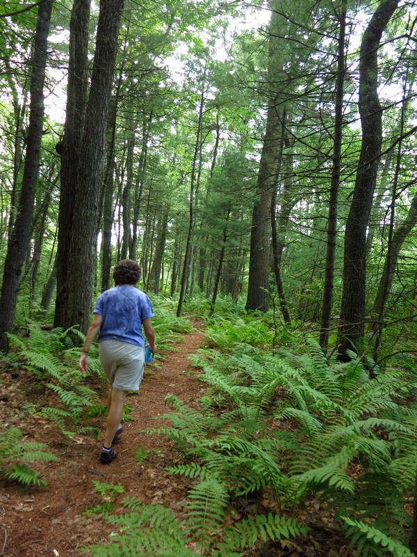
As you can see the woods were lovely and lush. What you cannot see are the clouds of mosquitos! We soon found out the skeeters liked the shady woods as well.
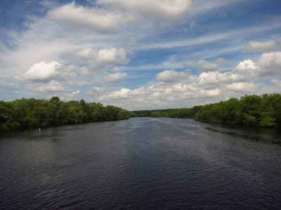
The lovely Concord River as seen from a bridge not too far from Jenca's.
When we got back from our hike we talked about what to do the next day. Betsy had some long time friends in Boston so she made plans to visit them.
Jenca and I decided to go hiking and we chose Mount Monadnock which was about 45 minutes away in New Hamphire.
Mount Monadnock or Grand Monadnock is a mountain in the New England state of New Hampshire known for its presence in the writings of Ralph Waldo Emerson and Henry David Thoreau. It is the most prominent mountain peak between the White Mountains of New Hampshire and the Massachusetts Berkshires and is the highest point in Cheshire County New Hampshire. It has long been known as one of the most frequently climbed mountains in the world.
At 3,165 feet (965 m) Mount Monadnock is nearly 1,000 feet (300 m) higher than any other mountain peak within 30 miles (48 km) and rises 2,000 feet (600 m) above the surrounding landscape. Mount Monadnock 62 miles (100 km) northwest of Boston and 38 miles (61 km) southwest of Concord is located within the towns of Jaffrey and Dublin New Hampshire.
The term "monadnock" has come to be used by American geologists to describe any isolated mountain formed from the exposure of a harder rock as a result of the erosion of a softer rock that once surrounded it (a landform termed inselberg elsewhere in the world).
Monadnock's bare isolated and rocky summit provides expansive views. A number of hiking trails ascend the mountain including the 110-mile (180 km) Metacomet-Monadnock Trail and the 50-mile (80 km) Monadnock-Sunapee Greenway
It remains clear largely because of fires set by early settlers. The first major fire set in 1800 to clear the lower slopes for pasture swept through the stands of virgin red spruce on the summit and flanks of the mountain. Further fires and hurricane damage left the forests a tangle of fallen timber. Between 1810 and 1820 local farmers who believed that wolves were denning in the blowdowns set fire to the mountain again. The conflagration raged for weeks destroying the topsoil and denuding the mountain above 2,000 feet (610 m).
Source: WikiPedia
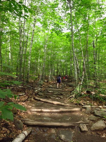
Here we are at the start of the trail. There are a number of routes to the summit. We decided to take the White Dot and White Cross trails which totaled 4 miles round trip. The mileage does not tell the whole story though. This is one of the steepest routes up and there are 1800' of elevation gain in just 2 miles. Whew!

I couldn't resist this photo op.
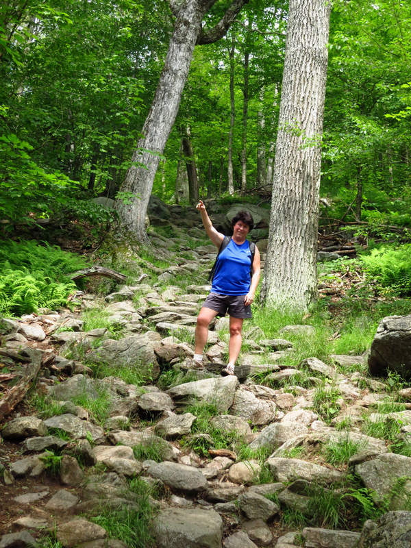
Onward and upward!!
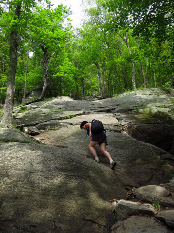
There were several places like this which required a little bouldering. There were a few rock scrambles as well. Very different from what I am used to back home in West Virginia.
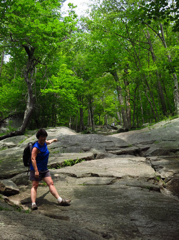
C'mon Mike - thata way!!
Jenca was very patient and encouraging. I was struggling. I had to stop a lot to catch my breath. It was very humid and unseasonably warm. And my respiratory ailment was making me a bit short winded.
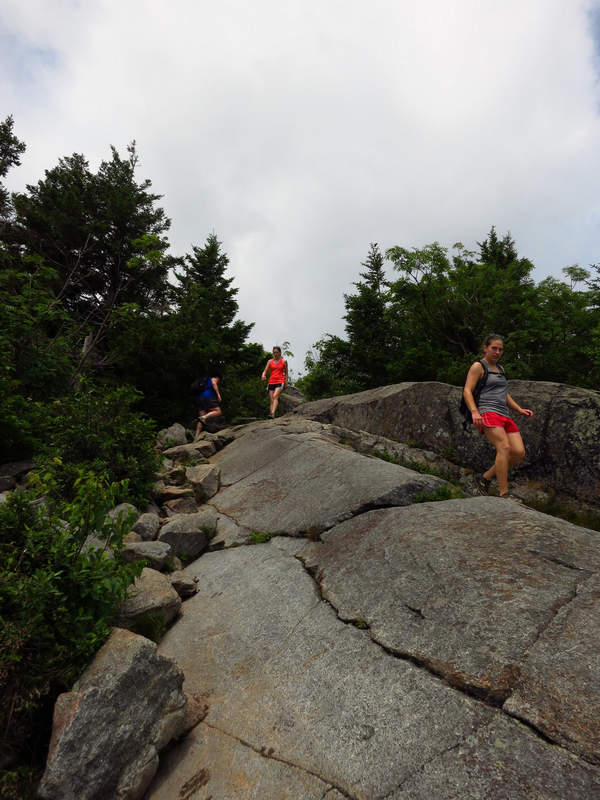
It was interesting watching people choose their routes on sections like this one.

Mega cairn! No missing this one.
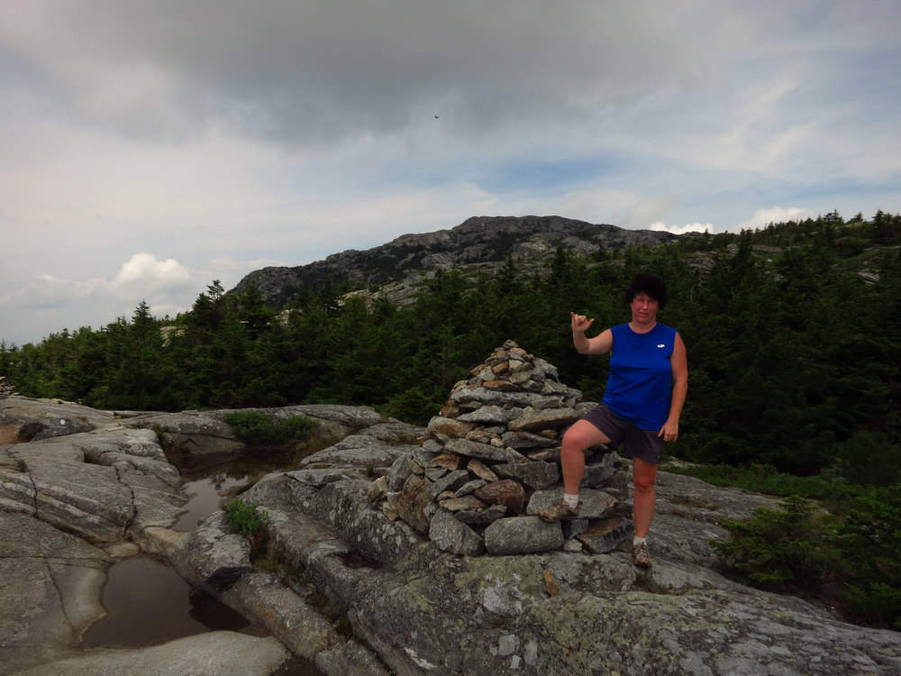
Not sure what the finger gesture means. Perhaps it is German for "You are such a cute guy!"
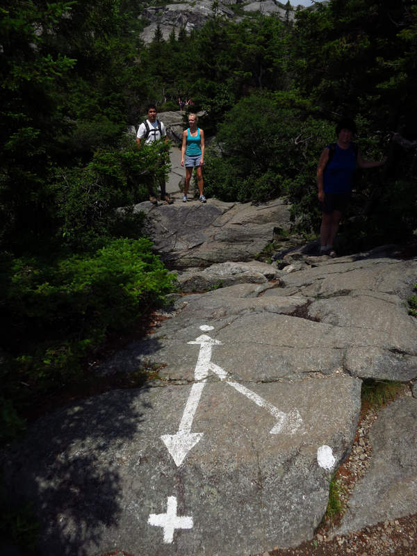
Here we are at the intersection of the Dot and Cross trail. This is near the summit. YES!! On the return trip we took the Cross Trail.
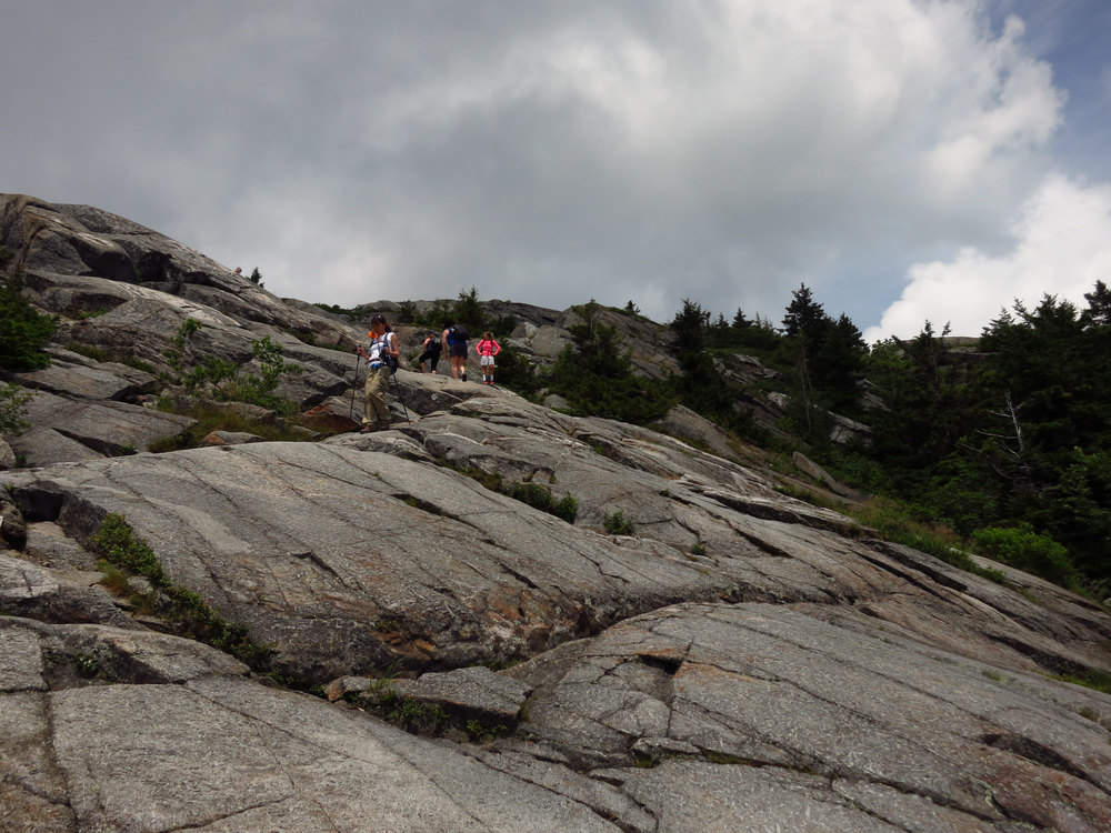
This granite bald reminded me of some places in the Sierra mountains of California
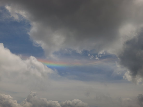
This rainbow in the clouds caused quite a stir and everyone was snapping shots of it. This was new to me. When Betsy looked at the photo she suggested it might be a Sun Dog. I think she was righ. As ususual...
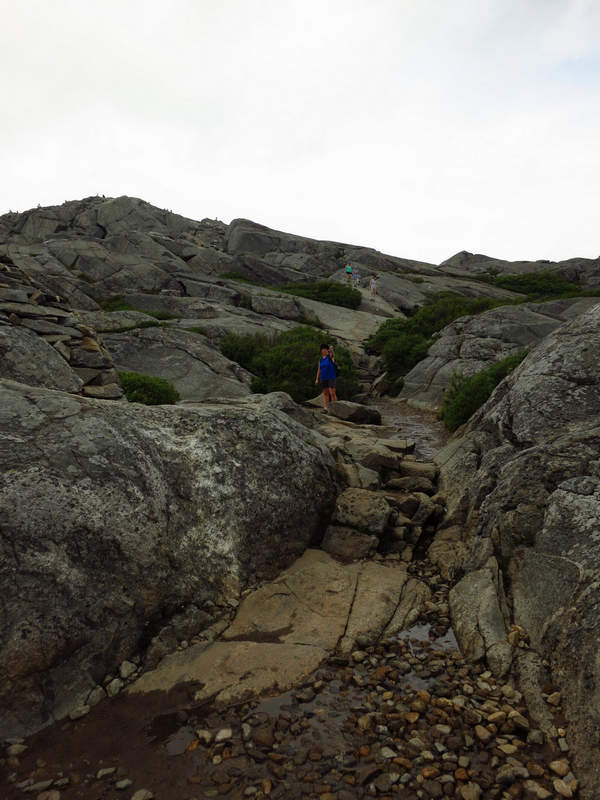
"C'mon Mike - we are really close now!"
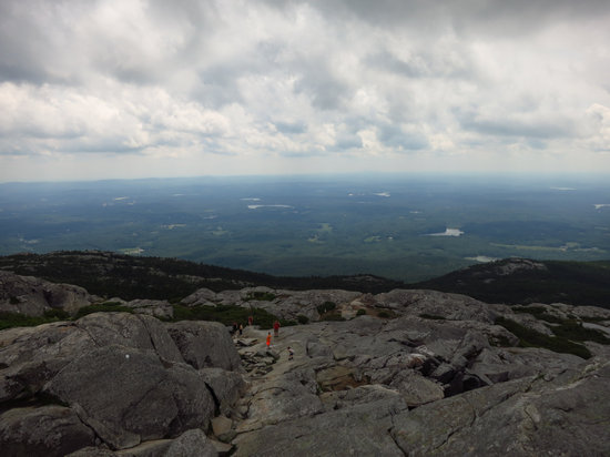
It was a bit hazy but the views were still mighty impressive.
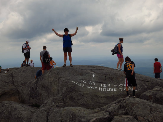
We made it! - thanks to Jenca.
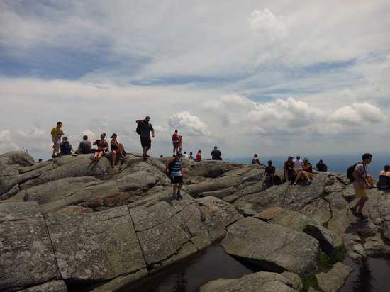
To say this is a popular hike is an understatement. The summit was like an ant's nest and there were people constantly coming and going. Quite the mob scene.
We took a short break and I ate everything I had with me. It was barely enough. We then started our descent back to the parking area where we both doused ourselves in the cool water from the spigot near the rest rooms. Man did that feel good.
When we got back Betsy and Jenca went out to pick up a pizza for dinner. Then it was lounging around for Betsy and I and for Jenca a bit of work on the computer.
Monday morning: a work day for Jenca and departure day for us. We said our good-byes and were on the road at 7:00am. Thanks Jenca!
Our next planned stop was a place I heard about many times over the years - Bartholomew's Cobble in the Berkshires.
The cobbles consist mostly of quartzite and marble whose alkaline soil supports an unusual array of flora - you'll find one of North America's greatest diversities of fern species here. The reservation also boasts one of the largest Cottonwood trees in the state. It's this amazing diversity that led to the Cobble's designation as a National Natural Landmark in 1971.
But it was not to be. About an hour west of Boston we hit rain and by time we got to Sheffield it was pouring with no sign of letting up. The Cobble would have to be another day.
We drove on not sure how far we would get that day. We ended up staying over at State College PA. Betsy had found a $120 hotel room for 70 bucks so we decided to splurge.
The next day we had about a five hour drive to get home. And that was that - the official end of our New England odyssey.
Until next time...
Mike and Betsy