June 3rd
For the last 15 years Professor Jerry Coleman of Montgomery County Community College has been offering a class titled Field Biology of West Virginia.
The focus is on the ecology and biodiversity of the Central Appalachians, and introducing the students to a large diversity of issues (and jobs) in applied environmental protection fields. This includes but is not limited to: water quality monitoring and restoration, coal mining and post-mining land reclamation, the diverse land and water impacts of environmental tourism, soil science, forestry, wildlife management and land management policy decision-making.
In years past the first week of the field camp was set up at Chestnut Ridge Park in Monongalia County. The second week the group sets up a base camp at Seneca Rocks in Pendleton County. Every year Jerry invites me to join them. This year I decided to.
Here are some photos of that interesting and fun time spent with Jerry and his students.
Click on the photos below for a larger image.

I arrived at Yokum's Campground around 3:30 on Tuesday the 3rd. Jerry and the class had not yet arrived. I unloaded and then drove the short distance over to the parking area which serves as the trailhead for the hike up to the observation platform on Seneca Rocks. I have been to Seneca Rocks before both as a hiker and a rock climber. The latter was short lived, the former is life long.
Seneca Rocks is a large crag and local landmark in Pendleton County in the Eastern Panhandle of West Virginia, USA. It is the only "true peak" — a peak inaccessible except by technical rock climbing techniques — on the East Coast of the United States. One of the best-known scenic attractions in West Virginia, the sheer rock faces are a popular challenge for rock climbers.
Seneca Rocks is easily visible and accessible along West Virginia Route 28 near U.S. Route 33 in the Spruce Knob-Seneca Rocks National Recreation Area of the Monongahela National Forest.
Seneca Rocks and nearby Champe Rocks are the most imposing examples in eastern West Virginia of several formations of the white/gray Tuscarora quartzite. The quartzite is approximately 250 feet thick here, located primarily on exposed ridges as caprock or exposed crags. The rock is composed of fine grains of sand that were laid down in the Silurian Period approximately 440 million years ago, in an extensive sand shoal at the edge of the ancient Iapetus Ocean. Eons of geologic activity followed, as the ocean slowly closed and the underlying rock uplifted and folded. Millions of years of erosion stripped away the overlying rock and left remnants of the arching folds in outcrops such as Seneca Rocks.
Source: WikiPedia

I had no sooner started my hike to the top when I got distracted by this nice stand of Maidenhair Fern (Adiantum pedatum).

I saw many nice specimens of the Marginal Wood fern (Dryopteris marginalis) on the hike up the mountain side.

Here is the observation platform at the top. There used to be nice interpretive sign here but years ago it was badly vandalized. It was then removed and never replaced.

The views from the platform are quite expansive.


The visitors center for the Spruce Knob-Seneca Rocks National Recreation Area can be seen just about center-right and below the extended branch.
Encompassing 100,000 acres, the scenic Spruce Knob-Seneca Rocks National Recreation Area (NRA) contains the highest peak in West Virginia, some of the best rock climbing on the east coast, outstanding views and a chance to enjoy America's great outdoors.
Congress established the Spruce Knob-Seneca Rocks National Recreation Area in 1965. This area is unique because it was the first NRA to be designated in the USDA Forest Service.
Source: USFS

There is a side trail which leads to the cliff edge. Some people get into trouble by taking this trail.


On the way back down I spotted this interesting burl on a Chestnut oak (Quercus prinus).
A burl (American English) or bur or burr (used in all non-US English speaking countries) is a tree growth in which the grain has grown in a deformed manner. It is commonly found in the form of a rounded outgrowth on a tree trunk or branch that is filled with small knots from dormant buds.
Source: WikiPedia

This root section had become exposed during trail construction and also from erosion. It was wounded by construction equipment and has started to heal over by forming a callus.

Here is a close up of the wood which the callus is growing around. I could not help but wonder what would cause the wood to grow in such a strange and beautiful pattern.

Another fern I spotted was the Rattlesnake fern (Botrypus virginianus).
This plant has long been included in the genus Botrychium, but is unique within the genus because of chromosome number and other signatures, including the inclusion of presumed mistletoe dna within its mitochondria. Recent research has established that this plant is sister to all other Botrychioid plants, including both the genus Botrychium sensu strictu, and the genus Sceptridium, with the exception of a single known species, previously included in Botrypus, which is B. strictus. That plant was shown to be sister to all other Botrychioids, including B. virginianus, so must be segregated in its own genus.
Source: Rattlesnake fern

Upon my return from the hike I could not resist another shot of the Rocks. The setting sun would soon be giving it a nice glow.

Here is the view of the Rocks from the campground. Not too shabby. The shelter seen here is where I cooked my meals. I had paid for a site with electricity but it was out of commission.

It was around 5:30 now and Jerry and students had arrived. Soon they would be on their way up to the top themselves. Jerry and I hung out at camp and by the time the students had returned to camp to eat supper I was ready to crawl into my bed roll.
June 4th
This morning we were on the road to the Sinks of Gandy by 8am. There we would meet geologist Barnes Nugent.

I spotted this barn on the way to the "Sinks" and had to get a shot.
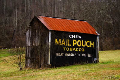
Copyright © 2004-2014 ForestWander.com
This is normally what you would see on country barns around West Virginia.

When we arrived at the Sinks we parked in a pullout along the road. This is the view we saw across from the parking area. Under that small hill is the cave known as "The Sinks of Gandy".

Here, Barnes Nugent geologist with the West Virginia Geological and Economic Survey explains the process of orogeny, speleogenesis, karst, asymetrical anticlines, synclines, isopach maps and all manner of other interesting things.

After his intro Barnes passed out these souvenir post cards to everyone.

Afterwards the students studied some handouts and contemplated the meaning of orogeny. Then it was off to the cave entrance.

While Barnes outfitted everyone with bump caps and lights, I slipped into the adjacent woods and snapped a few shots of these interesting limestone boulders.

At one time the entire area looked like this. But the trees were many feet in diameter.

Walking through classic karst topography everyone headed down the pasture to the cave.

This unidentified plant had numerous spittle bugs on every stem.
Spittlebugs occur throughout the U.S. and can at least occasionally be found on almost any plant. Adult spittlebugs are inconspicuous, often greenish or brownish insects, about 0.25 inch long. Immature spittlebugs are recognized by the frothy white mass that nymphs surround themselves with on plant tissue where they feed.

The Bluets (Houstonia caerulea), long past flowering in the Morgantown area were looking pretty good at this elevation of nearly 3500'.

Previously Barnes had mentioned there were sinkholes in the pasture and here everyone takes a look while he explains how they were formed.
These open pastures were formerly forested, but the alkaline limestone neutralizes the soil acidity or "sweetens the soil". This allows grasses such as non native Kentucky Bluegrass to thrive and the ongoing grazing keeps these meadows open.
The same isn't true where the more acidic sandstone is on or near the surface. The grasses do not thrive and the open areas will revert to shrubs and trees.

This long shot shows the gaping hole which is the entrance to the Sinks of Gandy.

With Barnes leading the way everyone gets ready to "git down and git dirty".

Here Jerry gives everyone a few last minute pointers before they go underground.

I asked everyone to gather for a shot before they went in.


The last two disappeared and I then set about on a wander looking for interesting and rare plants.
In the late 1880s David Hunter Strother using the pen name Porte Crayon wrote popular accounts of his exploration and adventures in the mountains of West Virginia.
Here is some of the account of his trip to the Sinks.
We entered a glade of singular beauty, hemmed in between a steep and rugged hillside and a savage forest of dark-browed hemlocks. It lies soft and smiling as the ornamental grounds around some sweet cottage home; the turf, green and smooth as a velvet carpet, dotted over with blossoming thorns; while through the midst winds the sparkling amber-tinted stream of Gandy. Looking up the glen, the vista is bright as fairyland, ending with a distant glimpse of the blue hills.
Turning downstream, a grim menacing cliff rises athwart the glen, closing it suddenly and shocking you with its unexpected propinquity. At its base is an arched opening fifty feet wide by about twenty feet in height – a gaping mouth which swallows the little river at a gulp. There is no gurgling nor choking, but the stream glides in gently and lovingly, like a young snake running down its mother’s throat to sleep.
Since Gandy left her mother fountains her course has been exceptionally bright and beautiful. Unshadowed by gloomy forests, unvexed by ugly driftwood, the gay brunette has leaped and danced through sun-lit glades, just teased enough by moss-clad rocks and picturesque roots to make her laugh and show her dimples to advantage.In the midst of her joyous life suddenly the dark cavern yawns before her like the jaws of death. Without a doubt or shudder, like an unconscious child she enters the untried mysteries of the hidden world.

Source: David Hunter Strother under the pen name of Port Crayon

After wandering around and through a red spruce thicket I made my way back up to the parking area. Somewhere under these two knobs are the intrepid explorers.

While walking through the pasture I came across this sinkhole.

The limestone can be seen here. A look down in showed all in darkness.
Jerry later told me this is actually the exit chimney of another nearby explorable cave called Stillhouse Cave. The cave has been thought to gotten it's name because moonshine or "corn likker" was made in the cave during prohibition.

In and of themselves cattle will not cause much damage to pastures. But when more head are run than the land can tolerate it ends up looking like this.

This nasty bit of erosion was centered around a small spring.

Contented cows. What a nice spot to spend the day munching on fresh, green grass.

I was up pretty high on the knob and views were gorgeous.

Eventually I spotted the cavers making their way back across the pasture. I had intended to meet them at the cave exit but I missed the opportunity.
Once everyone was back we loaded up and made the twisty-turny 14 mile drive up to Spruce Knob, the highest point in West Virginia.

Here we are atop the viewing platform at Spruce Knob. Elevation 4,863 feet.

We then took a trail to this rocky view point below the observation tower. Here, Barnes explained some of what we were seeing. This included pointing out the Ridge and Valley province to the east and Appalachian Plateau to the west.
Here are a couple of maps to help illustrate what we discussed.


Jerry Coleman - Mountain Man

It was cool and breezy up on top of the Knob. The air was unusually clear and we could see many miles in all directions.

We thought this unusual rock formation looked like a turtle.
We stayed up on top for about an hour, talking, working on journals and just relaxing and taking in the view. Then it was back to camp for a refreshing dip in the river.

Ahhhh...! That water was wonderful. I felt hot and clammy but just a few minutes in these cooling waters made all the difference.

While the others frolicked in the water I amused myself by taking a few snaps.

A few more splashes and then it was back to the campsite for supper.
June 5th

My camp site was only a few feet from the river and I wandered down each morning with my coffee to enjoy the burbling water.

I was up early enough to get some shots as camp awoke. There was an interesting mish-mash of tents.

"Necessity..."

A previous camper had left this interesting fire ring for Jerry's enjoyment.

Jerry, along with everyone else (well, almost...) was up and busy getting ready for another full day.

Camp life - Gotta Love It!

The Breakfast Club.


There was an entire van dedicated to hauling camp equipment and food.
After breakfast we headed north to the Canaan Valley National Wildlife Refuge for exploration and service projects.
The Canaan Valley National Wildlife Refuge (CVNWR) in Tucker County, West Virginia, was the 500th National Wildlife Refuge (NWR) to be established in the United States. The refuge preserves a moist valley with unique wetlands and uplands at a relatively high elevation in the Allegheny Mountains. It is administered by the U.S. Fish and Wildlife Service (USFWS).
Advocacy for the establishment of a wildlife refuge in Canaan Valley began as early as 1961. In the 1970s, environmental and citizens' groups battled with Allegheny Power Systems (APS), which had owned more than 13,000 acres (53 km2) of Canaan Valley since 1923, over construction of a long-anticipated hydroelectric facility that would have flooded about a quarter of the valley. In 1977, the Federal Power Commission issued a license to APS for construction of a pumped storage hydroelectric project, formally known as the Davis Power Project. However, the following year the Project was denied a Clean Water Act permit by the U.S. Army Corps of Engineers. The Corps' decision cited adverse impacts upon the Valley's wetlands, a relatively new concept at the time.
Source: WikiPedia

This shot was taken after our orientation at the refuge HQ. From HQ we headed over to a patch of woods to hunt down and pull Garlic mustard (Alliaria petiolata) plants.
Garlic mustard is one of the oldest discovered spices to be used in cooking in Europe. Evidence of its use has been found from archeological remains found in the Baltic, dating back to 6100-5750 BP.
Like most invasive plants, once it has an introduction into a new location, it persists and spreads into undisturbed plant communities. In many areas of its introduction in Eastern North America, it has become the dominant under-story species in woodland and flood plain environments, where eradication is difficult.
The insects and fungi that feed on it in its native habitat are not present in North America, increasing its seed productivity and allowing it to out-compete native plants.Source: WikiPedia

Photo source: Red Bucket Farm
Left unchecked here is what a once biologically diverse forest understory can turn into - a garlic mustard "desert".

While wandering around pulling the pesky plants I spotted this Blue columbine (Aquilegia spp.).
Although not native it is considerably less obnoxious than Garlic mustard


After the garlic mustard reduction Jerry took us over to a deer exclosure which a previous class had helped build. Jerry asked the students to look around and then point out the differences in the vegetation from within and outside of the exclosure.
A deer exclosure is an area of forest enclosed by a tall fence. Deer cannot get into this area to browse, so the deer exclosure vegetation can be compared over time with the vegetation outside the exclosure to measure the effect of deer on forest vegetation.
Source: Friends of Sligo Creek

Then it was a walk along one of the boardwalks. Part of the boardwalk was a another service project by a previous class.

Here, AmeriCorps member Rachel and Jerry explain the geology, biology and history of Canaan Valley.
There was more fun in store for everyone when we got to our next service area. It seems a flood had washed a foot bridge several 100 feet down stream and it needed to be extricated from the stream and the hauled back up to the crossing.

Guided and encouraged by two CV NWR employees, everyone (except me) dove in to lend a hand.

This grade beam had to be muscled out of the way first so as not to impede progress. Heavy lifting!

Make room! Make room!

One of the problems with moving the bridge can be seen here. It is upside down and had taken on water. This made it extremely difficult to raise it high enough to drain. But - the moving crew was about to "Gitter Done!"

Ready? Set? GO!!!!


Almost there...

Mission accomplished! Now it must be drug/carried through the brush up to the crossing site.

Grunt - Groan - Push - Twist - Cajole... Dangit bridge - MOVE!

A few Brookside alder had to be removed to facilitate removal of the bridge. Not to worry - they will resprout in no time.

There was nothing to stop the moving crew now!


A short breather and then the crew was back in action.


Another short breather before the final push.

Success! From here on out the CV NWR crew would finish the final placement of the bridge.

Well done...
After all that hard work it was time for the reward.

And here it is - the cooling waters of Red Creek situated near Laneville. This was on our way up to the final destination of the day - Bear Rocks on Dolly Sods.


Now Jerry will demonstrate why we stopped here.

"Hmmmm... let me see now. What is the best way to approach this?"

"This should be it!"

Wheeeee!!!!

This is nature appreciation to be sure.

I took a few snaps of my new friends so they could show their friends back home what West Virginia is all about.


Testing the waters...

And, awaaaaaaaaaaaay we go!

Pretty soon everyone was joining in on the fun.


One final run and then it was back to the van and up to the Sods

This is Bear Rocks of Dolly Sods. Once again, we had amazing views comparable to what we saw up on Spruce Knob.
Bear Rocks is a remarkably scenic, windswept summit atop one of West Virginia's highest mountains. It is perched on a ridge of sandstone cliffs and is a rock outcropping on the Allegheny Front with a 2,000 to 3,000-foot (600 to 1,000 m) drop below that forms the Eastern Continental Divide. To the east, looking out over the South Branch of the Potomac River, which drains into the Atlantic Ocean via the Chesapeake Bay, there are breathtaking 35-mile (56 km) views where seven mountain ridges are visible on a clear day extending into Virginia. On the clearest days you can see Hawksbill Mountain and Stony Man, the highest peaks in Shenandoah National Park. To the west, water drains into Dolly Sods towards Red Creek, which eventually flows to the Gulf of Mexico via the Dry Fork River, Black Fork, Cheat, Mongahela, Ohio and Mississippi River.
Source: WikiPedia

This had to be the clearest I had ever seen the view from up here on Bear Rocks.

"Flag Spruce" can be seen all over Dolly Sods.
These conifers are constantly flailed with a westerly wind. This stunts and dwarfs the branch growth on that side. If you inspected the lowest branches which are out of the wind you'd find them to be several times the length of the branches which are exposed to the constant wind.
Dolly Sods is a rocky, high-altitude plateau with sweeping vistas and lifeforms normally found much farther north in Canada. To the north, the distinctive landscape of "the Sods" is characterized by stunted (“flagged”) trees, wind-carved boulders, heath barrens, grassy meadows created in the last century by logging and fires, and sphagnum bogs that are much older. To the south, a dense cove forest occupies the branched canyon excavated by the North Fork of Red Creek.
The extensive high areas in Dolly Sods and Flatrock-Roaring Plains were once mostly covered by dense, ancient red spruce and eastern hemlock forest. The trees were 60 to 90 feet (27 m) tall (18–27 m) and some measured at least 12 feet (370 cm) in diameter. The greatest stand of red spruce in the world, in terms of size and quality, could be found along the upper Red Creek. The largest recorded tree ever cut in West Virginia was a white oak, harvested in this region. Nearly as large as a Giant Sequoia, it was probably well over 1,000 years old and measured 13 feet (4 m) in diameter at a height of 16 feet (5 m), and 10 feet (3 m) in diameter 31 feet (9.4 m) above the base. We will probably never know how large the biggest trees in West Virginia were because most cuttings were not documented. Centuries of accumulated needles from these trees created a blanket of humus (soil) seven to nine feet deep.
Unfortunately, however, the humus covering the ground dried up when the protective tree cover was removed. Sparks from the locomotives, saw mills and logger's warming fires easily ignited this humus layer and the extensive slash — wood too small to be marketable, such as branches and tree crowns — left behind by loggers. Fires repeatedly ravaged the area in the 1910s, scorching everything right down to the underlying rocks. All insects, worms, salamanders, mice and other burrowing forms of life perished and the area became a desert. The destruction was extraordinary.
.
The complete clearcut of this ecologically fragile area, followed by extensive wildfires and overgrazing, exacerbated by the ecological stresses of the elevation, have prevented quick regeneration of the forest which has taken decades to recover. The Monongahela National Forest was created in 1915, largely motivated by a desire to mitigate the sort of wholesale destruction that had swept over the Sods. In 1916 most of Dolly Sods was purchased by the federal government for the MNF from the Bridges EstateSource: WikiPedia
This part of West Virginia is referred to as the Birthplace of Rivers. Not mentioned above are the devastating floods which occurred in Pittsburg PA because of this clear cutting and burning. This was another motivating factor in the establishment of the Monongahela National Forest.

This map clearly shows the watershed area which feeds the Monongahela River which has it's terminus in Pittsburgh. This is helpful in understanding why deforestation in the central highlands of West Virginia caused massive flooding in far away Pittsburg PA.

Everyone was enjoying the view. This you will not see in the Philly area!

After this shot I said my farewells and walked back to the van.

On our way across Dolly Sods we had noticed hundreds of plants of the Roseshell azalea (Rhododendron prinophyllum)


As I made my way off the Sods I entered a lush, green tunnel of trees. Soon I would be back at camp and later enjoying everyone's company and the glowing warmth of the campfire.
June 6th

My last look at Seneca Rocks after saying my farewells to everyone. Now it was on to the megalopolis of the greater Washington DC area.
Thanks to everyone for a great time!!!
Post Script:
I have known Jerry Coleman for nearly 20 years, but I have spent very little time with him when he had his teacher's "hat" on.
And I have had the pleasure and privilege of being in the field with a number of outstanding environmental and natural history teachers, my dad being one among them.
Now Jerry has joined those ranks and I do not say this lightly or without due consideration.
It is now very obvious WVU's loss was MCCC's gain.
'Till next time...
~Mike