Mike Breiding's Epic Road Trips ~November 3rd 2019~
Catalina Mountains
Coronado National Forest
Prison Camp to Sycamore Canyon Hike and
Facimile of USFS brochure and PDF of "Catalina Prison Camp history" Summary
Tuesday 3 November 2019
PART I: Hike From the Catalina Prison Camp to Sycamore Canyon
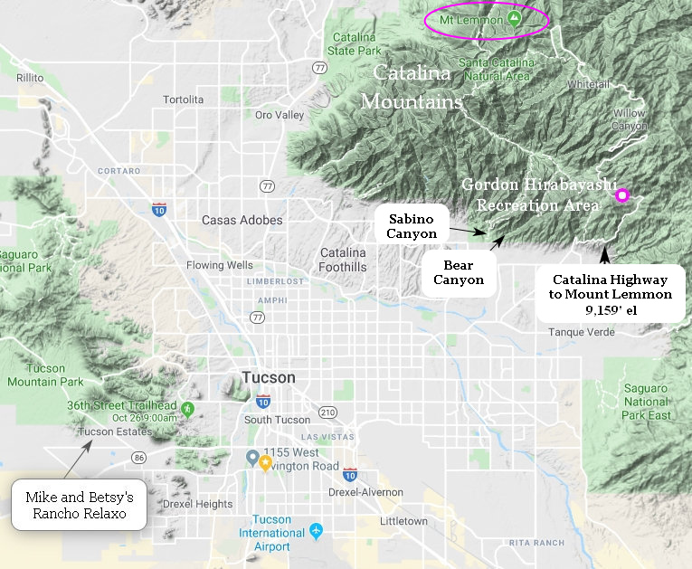
Click the map for the big picture.
On February 8th of 2012 I led my first group through what remains of the Catalina Prison Camp and into Sycamore Canyon. This made today's group the 7th. Most of the group were new to the area and new to Betsy and me.
The hike started at the car pooling location - Le Buzz, a local coffee shop and cafe where lots of cyclists and some hikers assemble before starting out for the day's activity.
Once all the hikers had arrived we car pooled up the Catalina Highway to the starting point for our hike.
Construction on the Catalina Highway began in 1933, owing in large part to the efforts of Frank Harris Hitchcock, former Postmaster General of the United States. In order to create a route to the popular destinations at the summit of Mount Lemmon, Hitchcock spearheaded the effort to bring together the funds and resources to construct an improved road to Summerhaven and nearby facilities. As a part of the effort, a federal prison camp was established at the foot of the mountains specifically to supply labor for the construction of the highway.
During World War II, the camp was converted into an internment camp named the Catalina Honor Camp, and the internees were forced to work on construction of the roadway. One of the Japanese American prisoners at the camp, Gordon Hirabayashi, was later honored in 1999 when the site of the Honor Camp was converted into the Gordon Hirabayashi Recreation Area.The highway would not be completed until 1950, 17 years after it began. Upon its completion, the highway was named after Hitchcock, who had died in 1935.
Source: WikiPedia
Here is our Hiking-Tucson MeetUP group in front of a brand new sign which I had not seen before. Snazzy. This location is also where we park even though it is a bit of a walk to the trailhead. Why? There is no fee to park at this lot. As part of a legal settlement concerning parking and use fees the USFS had to provide fee free parking for the users of the Arizona Trail which is what we will be hiking on today.
Source: DesertUSA.com
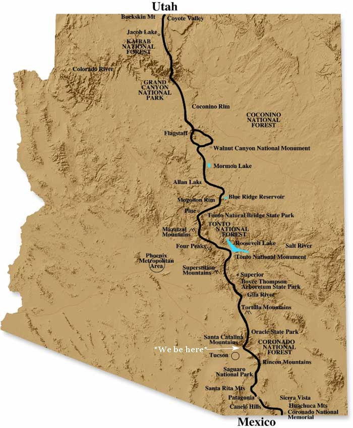
The Arizona National Scenic Trail is a National Scenic Trail from Mexico to Utah that traverses the whole north–south length of the U.S. state of Arizona. The trail begins at the Coronado National Memorial near the US–Mexico border and moves north through parts of the Huachuca, Santa Rita, and Rincon Mountains. The trail continues through the Santa Catalina north of Tucson and the Mazatzal Mountains before ascending the Mogollon Rim north of Payson, eventually leading to the higher elevations of Northern Arizona and the San Francisco Peaks. The trail then continues across the Coconino Plateau and in and out of the Grand Canyon.
The Arizona Trail terminates near the Arizona-Utah border in the Kaibab Plateau region. The 800-mile (1,300 km) long Arizona Trail was completed on December 16, 2011. The trail is designed as a primitive trail for hiking, equestrians, mountain biking, and even cross country skiing, showcasing the wide variety of mountain ranges and ecosystems of Arizona.Source: WikiPedia
While walking to the trail head there was constant traffic back and forth to the campground which is usually closed this time of year.
This is why there was so much traffic. Some kinda bike event. It looked like a commercial tour company based on the transport and support vehicles. Busy, busy, busy!
Now we are away from the busyness and would not see another person until near the end of the hike. Note the sign on the right.
I did not remember seeing these signs before either. They look as close to indestructible as signage gets.
At this point we started up what is an old road bed which climbs up to Shreve saddle and now serves as a corridor for the Arizona Trail.
The photo above was taken at Shreve Saddle which is named for Forrest Shreve – a botanist who moved to Tucson in 1908 and worked at the Carnegie Institution’s Desert Laboratory.
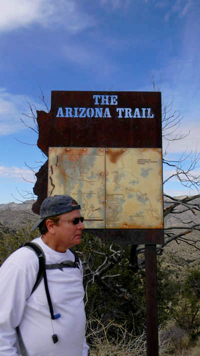
Photo: Roger Nordby (2012)
In 2012 this sign was still on Shreve Saddle. It is no longer there.
Although I don't prohibit children on my hikes I always hope we don't end up with any. However this youngster was a model hiker and I am glad now her mom brought her along.
At this point we left the old roadway and descended into the canyon on a switchbacked and staired single track.
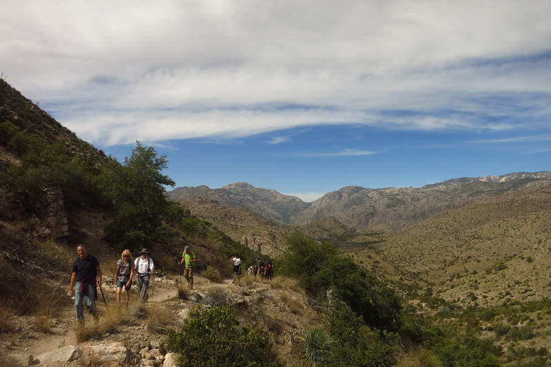
When I was here in 2012 and saw this view for the first time I was a bit taken aback by the expansive beauty of it all.
As mentioned this hike is on part of the Arizona Trail which passes through areas burned by the Aspen Fire in 2003. It burned 84,750 acres of land, and destroyed 340 homes and businesses of the town of Summerhaven.
Although it is in a state of recovery the area still provides some really nice views of the basin and surrounding mountains. Some nearby ruins of the historic Prison Camp are now more visible.
On the way down there are still numerous stone supports which were used to support the water line from the Sycamore reservoir to the Prison Camp.
This burned out manzanita seems to be barely hanging on to life.
Slowly, slowly, slowly this Point leaf manzanita (Arctostaphylos pungens) is healing. Manzanitas have copious bell shaped pink to white flowers in winter which produce small persistent red fruits by spring/early summer.
The word manzanita is the Spanish diminutive of manzana (apple). A literal translation would be little apple. The name manzanita is also sometimes used to refer to species in the related genus Arbutus, which is known by that name in the Canadian area of the tree's range, but is more usually known as madroño, or madrone in the United States.
Source: WikiPedia
By now we are getting a good look at Sycamore canyon. At the base of the cliff is the dam which was used to pool water for use at the Catalina Prison Camp. It is also where we will have a break before turning back and heading back up to Shreve Saddle.
At this point we have intersected the old road bed again and now make a rapid descent to the valley floor.
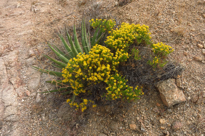
We saw some fine specimens of turpentine bush (Ericameria laricifolia) in bloom.
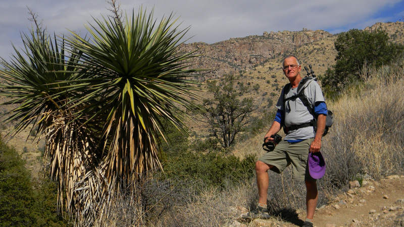
Photo: Roger Nordby (2012)
I have always admired this stately Banana yucca but unfortunately it has since fallen.
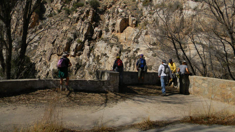
Photo: Roger Nordby (2012)
Our turn around spot and rest stop is the slab of what was originally the pump house. From here the water was pumped up and over Shreve saddle to the Prison Camp.
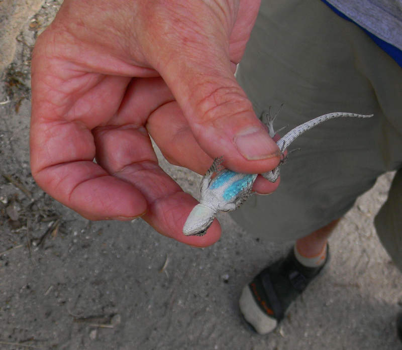
Photo: Roger Nordby (2012)
7 years ago I was still quick enough to capture a lizard now and again. I think this is a Western Fence Lizard (Sceloporus occidentalis).
After our break we headed back up the trail. It had warmed up by now and the steeper sections had everyone huffin' and puffin'.
The last shot of the day: turpentine bush and yucca.
GPS data for the Gordon Hirabayashi Recreation Area to Sycamore Dam hike is here.
Ok! On to Part II.
Gordon Hirabayashi Recreation Area
Catalina Mountains - Coronado National Forest
Several years ago the US Forest Service web address was modified by changing fs.gov to fs.usda.gov in effect making the Forest Service digitally subordinate to the US Department of Agriculture.
Apparently the IT people who implemented this change could not quite figure out how to update links with the addition of "USDA" to the web address.
The result? Pages formerly available at fs.gov could no longer be accessed at fs.usda.gov.
The USFS web page for the Gordon Hirabayashi Recreation Area was one of the victims of this sloppy and inept transition from "fs.gov" to "fs.usda.gov".
When I found this out I took it upon myself to scan the USFS "Gordon Hirabayashi Recreation Area" brochure and post it here along with this PDF of additional information.
Below is all that remains of the USFS information about Gordon Hirabayashi. If you want detailed info about Gordon Hirabayashi and an interesting read visit this page at densho.org site.
The name Prison camp came from the Federal Honor Camp begun in 1937 to house federal prisoners supplying labor to build a road providing access into the Santa Catalina Mountains. Prisoners had been convicted of federal crimes ranging from immigration law violations to tax evasion to bank robbery.
During World War II, many of the prisoners were conscientious objectors whose religions prohibited them from serving in the military. Some were Japanese Americans protesting the “Japanese American Relocation,” the largest forced removal and incarceration in U.S. History. After the Japanese Navy attacked Pearl Harbor in 1941, over 100,000 Japanese Americans, many American Citizens, were imprisoned in crowded internment camps for fear they would conduct espionage and sabotage along the west coast.
Gordon Hirabayashi was a senior at the University of Washington in 1942. He challenged the constitutionality of internment based on race or ancestry. He turned himself in to the FBI rather than report for relocation. He was convicted and sentenced to serve at the honor camp in the Santa Catalina Mountains.
In 1987 Hirabayashi’s case was overturned. A federal commission determined that the internment had been motivated by racial prejudice and wartime hysteria. In 1988 the Civil Liberties Act was signed by President Ronald Reagan, which acknowledged the injustice and apologized for the internment.
In 1999 the Coronado National Forest renamed the site in honor of Dr. Hirabayashi and the other resisters of conscience who were imprisoned there. Dr. Hirabayashi and others attended the dedication ceremony.
Source: USFS
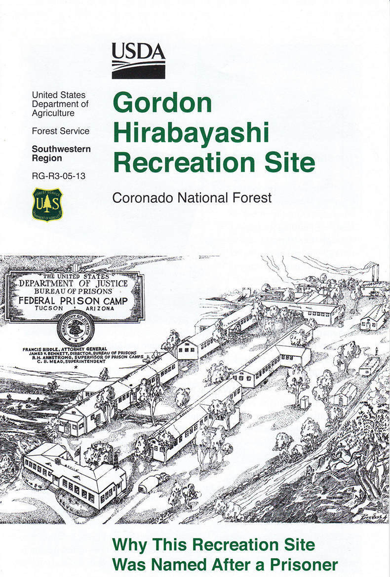
Page 1
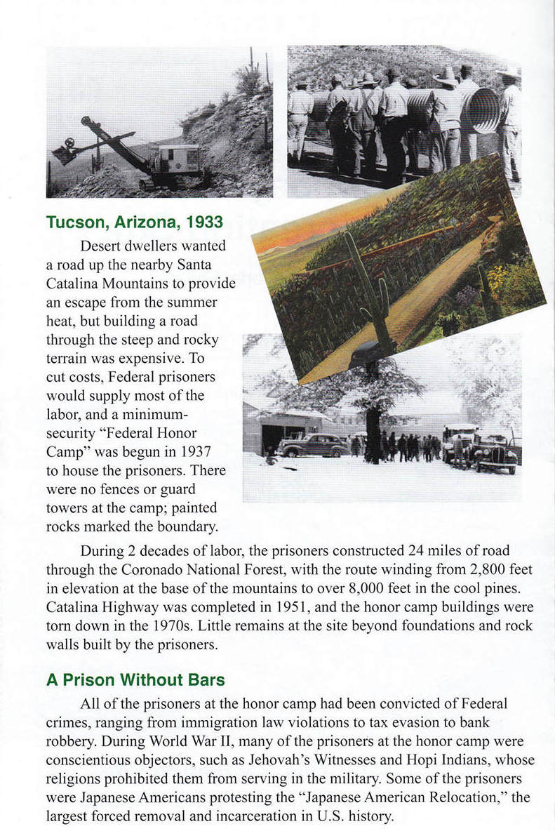
Page 2
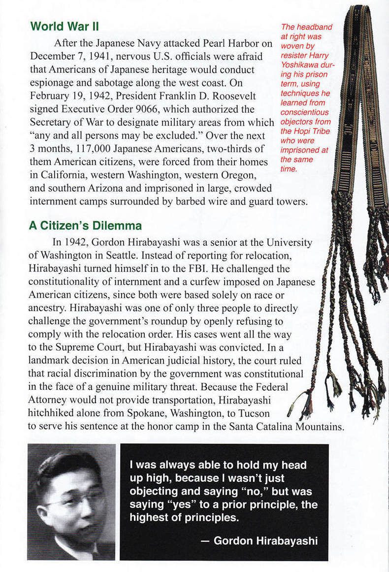
Page 3
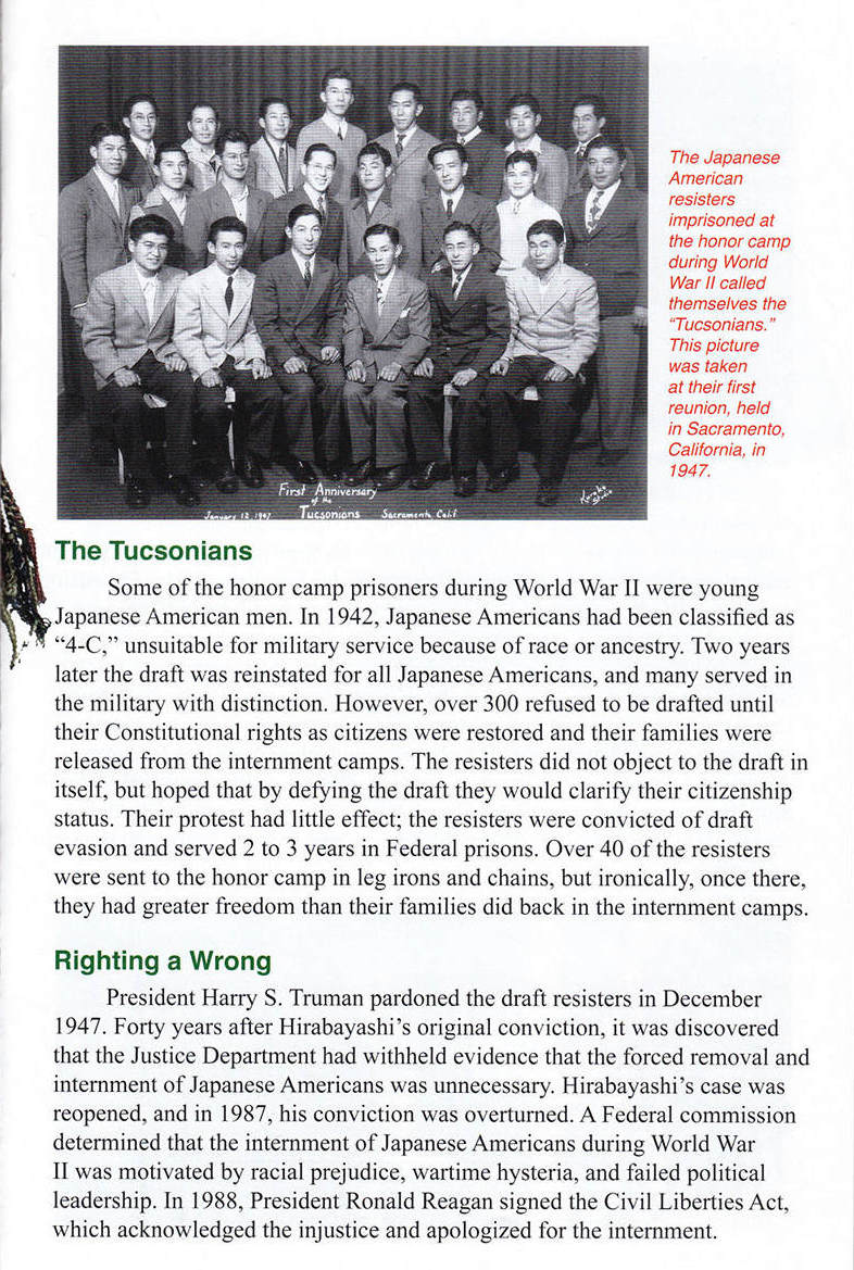
Page 4

Page 5
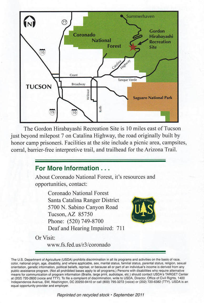
Page 6
~~~ Bonus Photo ~~~

Betsy was the envy of all the ladies (and some of the men)
at the Tucson Estates Halloween Party.
