Mike's Epic Road Trips: October 2021 - Morgantown to Tucson
Through the Lush Appalachians to the Gulf Coast and on to South Central Texas
Post COVID
Almost Back to Normal
October 2021
Morgantown to Tucson
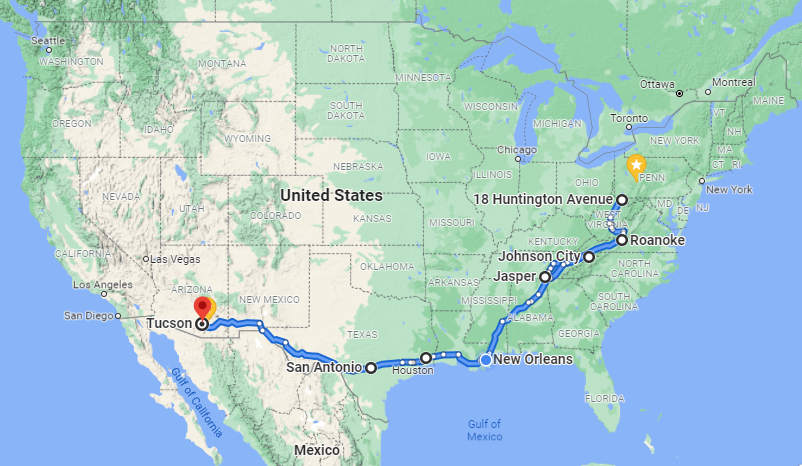
The migration routes Betsy and I chose this year were very different from each other. Departing Morgantown on October the 1st Betsy decided on a more or less direct route and except for a short stay in Roswell to visit family she stopped only at the hotels she had chosen.
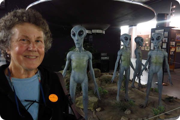
Betsy with her kin in Roswell NM
If you click on the map below you will see Betsy did take the scenic route I suggested from Texarkana to Las Cruses before getting back onto the Interstate.
I on the other hand decided to do some visiting along the way: Chuck in Roanoke VA, JB in Johnson City TN, Bob and Carol in Jasper TN, Tony and Donna in New Orleans and Geary and Sue in San Antonio.
This was much more interstate driving than I like but I did not want to take to long to get back into the loving arms of my Betsy. By the time I left Morgantown October the 5th Betsy was already in Tucson so I was motivated to keep moving.
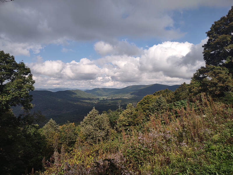
The route to my first stop in Roanoke was quite scenic and took me through the heart of central West Virginia and into the Greenbrier Valley and then finishing up with scenic Route 311 which took me through the mountains of Alleghany County, VA, Monroe County WV and then Craig County VA. A beautiful drive and one worth taking if you are in there area. This route took me Paint Bank VA and up and over Potts mountain where there is a pull off with a beautiful view.

The view from the Route 311 Potts Mountain Wayside looking north.
⋄⋄⋄⋄⋄⋄⋄⋄⋄⋄⋄⋄⋄⋄
06 October 2021
Checking in at Chuck's and a Hike in the Misty Mountains
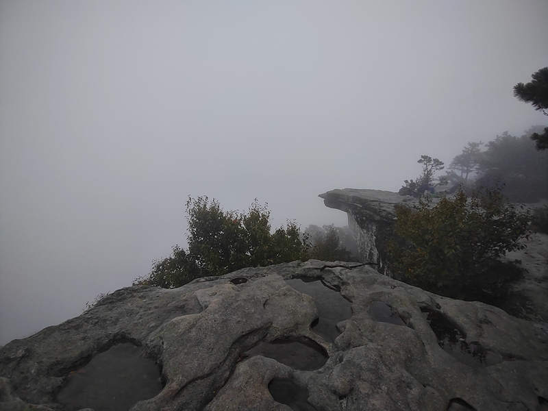
I rolled into Chuck's place in Roanoke just in time for a nice Happy Hour on his front porch. We had some catching up to do and also some planning for the next days hikes which would take us up to McAfee Knob (3,171' el). The weather did not look too promising but we decided to go - rain or shine. The hike would be a 8.0 mile out and back with 1,811' of elevation gain.
Chuck and I also had a conversation about where and under what circumstances we first met. Neither of us could remember but we both agreed it was related to a trails project in either Morgantown or Davis WV back the late 80s or early 90s.
Click on the photos below for a larger image.
We arrived at the trail head parking area around 8:00. The Appalachian Trail (AT) crosses Route 311 at this point and our hike started on the other side of the road. What looks likes a pile of trash is actually a water cache for through hikers on the AT.
Although it was not raining the water dripping from the leaves at times made it feel like it was. As you can see we are in some low clouds and would be for the entire hike.
My fearless leader. Chuck had just hiked this route the week before and I really appreciated him getting back out again so soon.
Our route was partly on the AT and partly on an old fire road which to me looked like a former rail corridor.
Off we go!
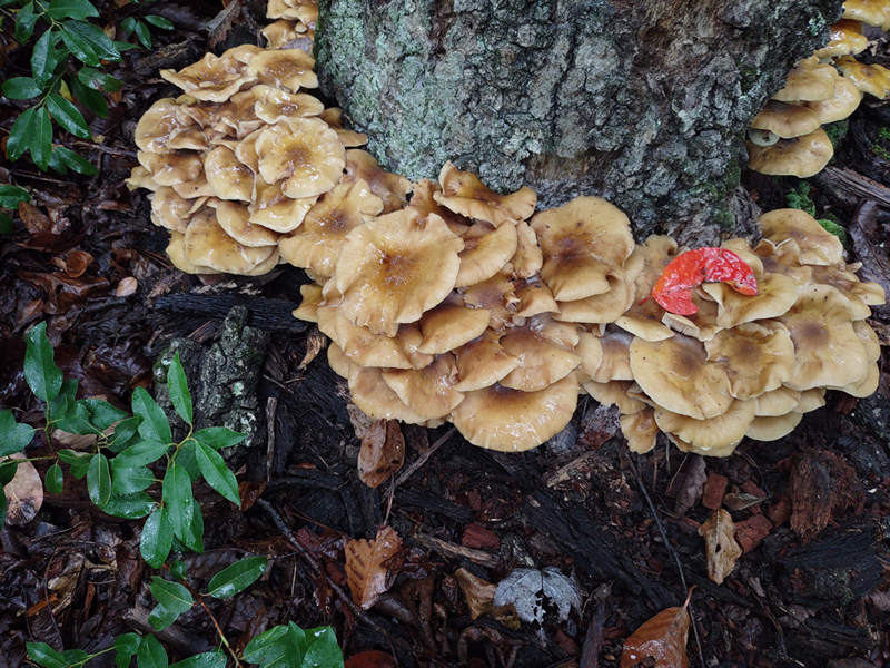
A rather drearly looking scene and the Jack-o'-Lantern mushrooms made a nice splash of color.
We also spotted this small Sulphur fungus also known as "Chicken of the woods" because of it's meaty texture. It is quite tasty when fried up in butter but then most things are.
Laetiporus sulphureus is a species of bracket fungus (fungi that grow on trees) found in Europe and North America. Its common names are crab-of-the-woods, sulphur polypore, sulphur shelf, and chicken-of-the-woods. Its fruit bodies grow as striking golden-yellow shelf-like structures on tree trunks and branches. Old fruitbodies fade to pale beige or pale grey. The undersurface of the fruit body is made up of tubelike pores rather than gills.
Source: WikiPedia
There were some sections of the trail which reminded me of the "Rock City" trail at Coopers Rock State Forest just outside of Morgantown.
Chuck spotted this dew bespangled spider web so I grabbed a shot also.
We saw a lot of sourwood trees which always have brilliant fall color even on this rather dark and cloudy day.
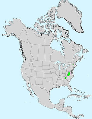
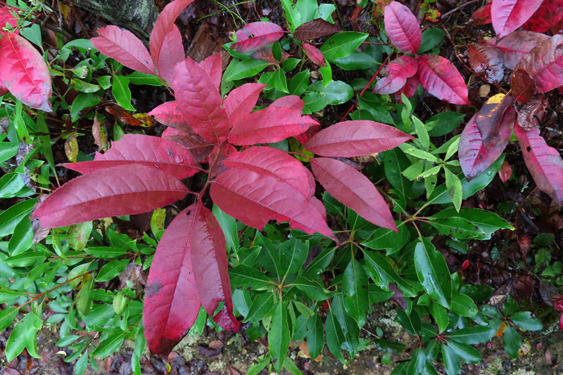
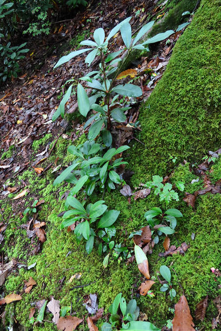
Here is a shrub I was not familiar with. I knew it was in the family Ericaceae or heath family but that was all I could figure out. As it turned out it is mountain fetterbush. As you can see from the range map below the mountain fetterbush is restricted to a very small area of the US and although we saw a good bit of it I would certainly call it "rare".
Range of Pieris floribunda
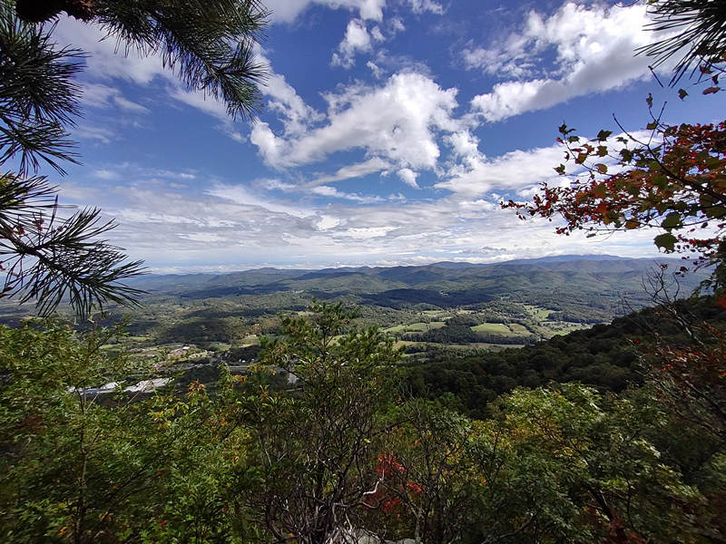
Here we are! The summit! What a view!
Below is what it looked like the week before when Chuck was here.
Photo: Chuck Coole
Yes, it's true - Chuck sometimes has his head in the clouds.
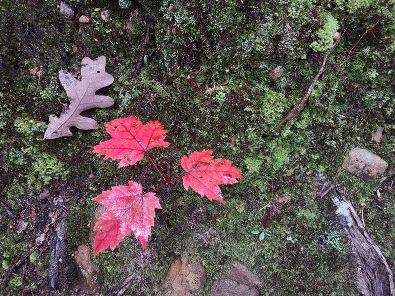
The fall color was starting up nicely and this sugar maple seedling was looking pretty good.
This pincushion moss was looking nice and fresh on this cool and damp day,
This mushroom I do not know the name of but I am sure Ryan T does.
A dang near psychedelic looking maple and a very interesting color pattern.
And that is the last shot for this wonderful hike to a spot that is claimed to be the most photographed location on the 2,190 miles of the Appalachian Trail. I am looking forward to coming back next spring with me Darlin' Wife when the Pieris is in bloom and the birds are singing their hearts out.
After the hike Chuck took me on a short driving tour of the area then it was back to his place for Happy Hour and dinner.
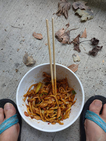
We opted for "Chinese" take out. This shot reminded of when Anthony Bourdain said something like: "Chinese food gets shinier the further east you get". Yep. Oily, salty, sweet and spicey.
Wisely Chuck ate only half of his but I decided to finish mine off. Burp. I won't order that again.
The next morning Chuck and I both packed up and he headed north to the Finger Lakes region and I headed south to Johnson City.
Chuck! Thanks for a swell time.
⋄⋄⋄⋄⋄⋄⋄⋄⋄⋄⋄⋄⋄⋄
07 October 2021
Hiking
Buffalo Mountain Park and Visiting JB
The driving time from Roanoke to Johnson City is about three hours and since I got an early start it would leave time for a hike before checking in a JBs place. When looking over the maps I noticed Buffalo Mountain Park just to the south of Johnson City and when I checked AllTrails I found White Rock Loop which it listed as a 5.1 mile loop with 1,354 ft of elevation gain. Perfect. So, I headed straight there from Roanoke and with the help of Google navigation I arrived at the trail head without a hitch.
When I first arrived I sensed something a bit curious about some of the people wandering about and waiting in cars and then a fellow drove by with mood music playing and looked out and gave me a warm smile. I was later to find out this was a well known hook-up spot for men and as I discovered later, for men and women as well. What a place for a romantic interlude - a public parking lot.
My first step was the info kiosk which unfortunately had no trail maps so I used AllTrails to conirm I stayed on the right track.
Buffalo Mountain Park is a 725-acre natural resource area obtained in 1994 through a land swap with the U.S. Forest Service. The park is located on the north slope of Buffalo Mountain and consists of steep topography and densely forested land. The park functions as a nature preserve primarily for hiking, picnicking, and nature programs. Park Hours (weather permitting): 7 a.m. – sunset (summer) 9 a.m. – sunset (winter)
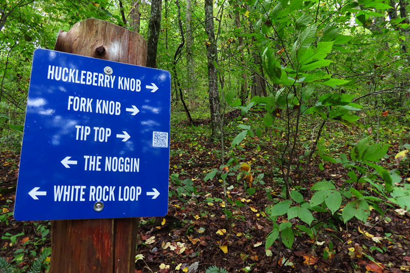
For the most part the trail intersections were well signed.
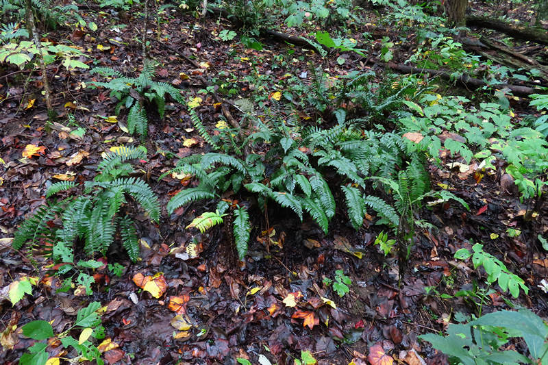
The steeply wooded slope was covered with Christmas ferns.
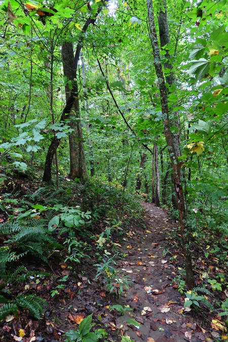
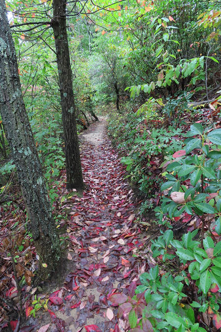
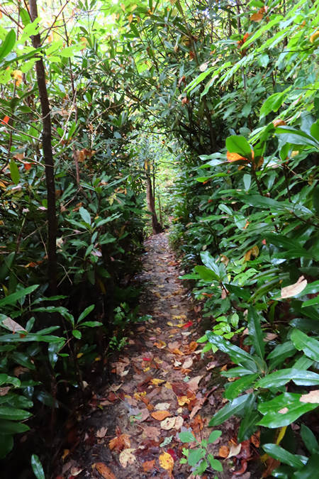
The trail for most of it's length was narrow single track which made for a very intimate hiking exsperience.
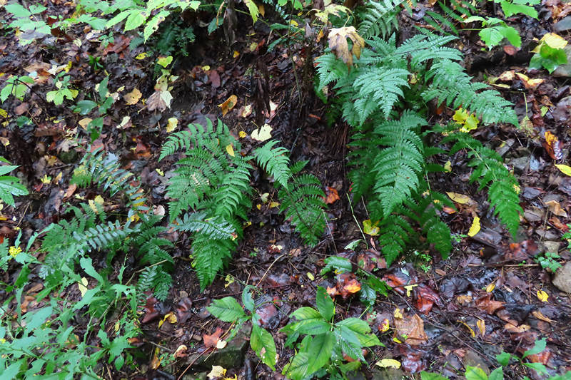
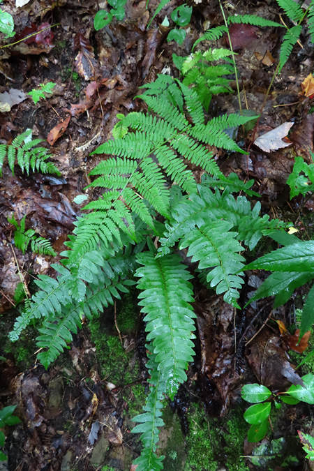
Here we see Christmas fern and also marginal and intermediate wood fern.
Here a Lady Fern embraces her fellow frond fondler.
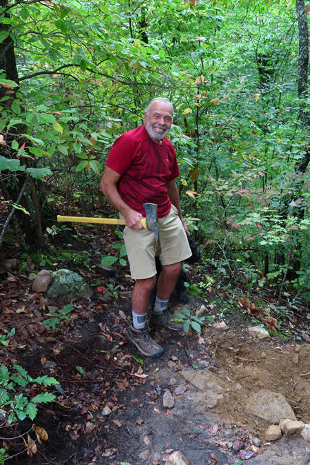
Here is one of the few people I saw on this hike. I stopped and chatted with this fellow for a bit and found out he had been doing volunteer trail work at Buffalo Mt for 15 years. Right on - brother!
Another beautiful section made narrow out of necessity on these steep slopes.
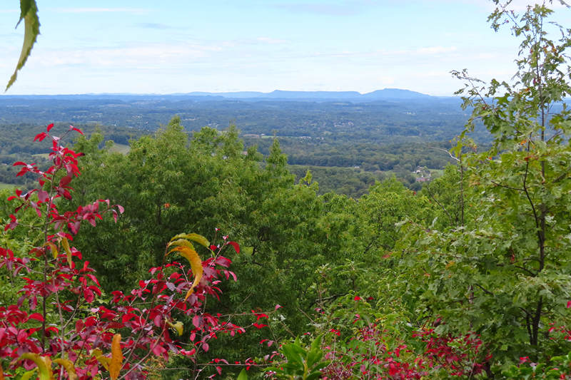
As I gained elevation I started to get some nice views. I could not help but wonder what the long ridge line was named. Had I remembeded to whip out my phone and fire up my PeakFinder app I would have found out. But, I never remember to use the dang thing.
Fodderstack Mt is furthest south (left), and then Chimneytop is to the northeast if it. ~JB
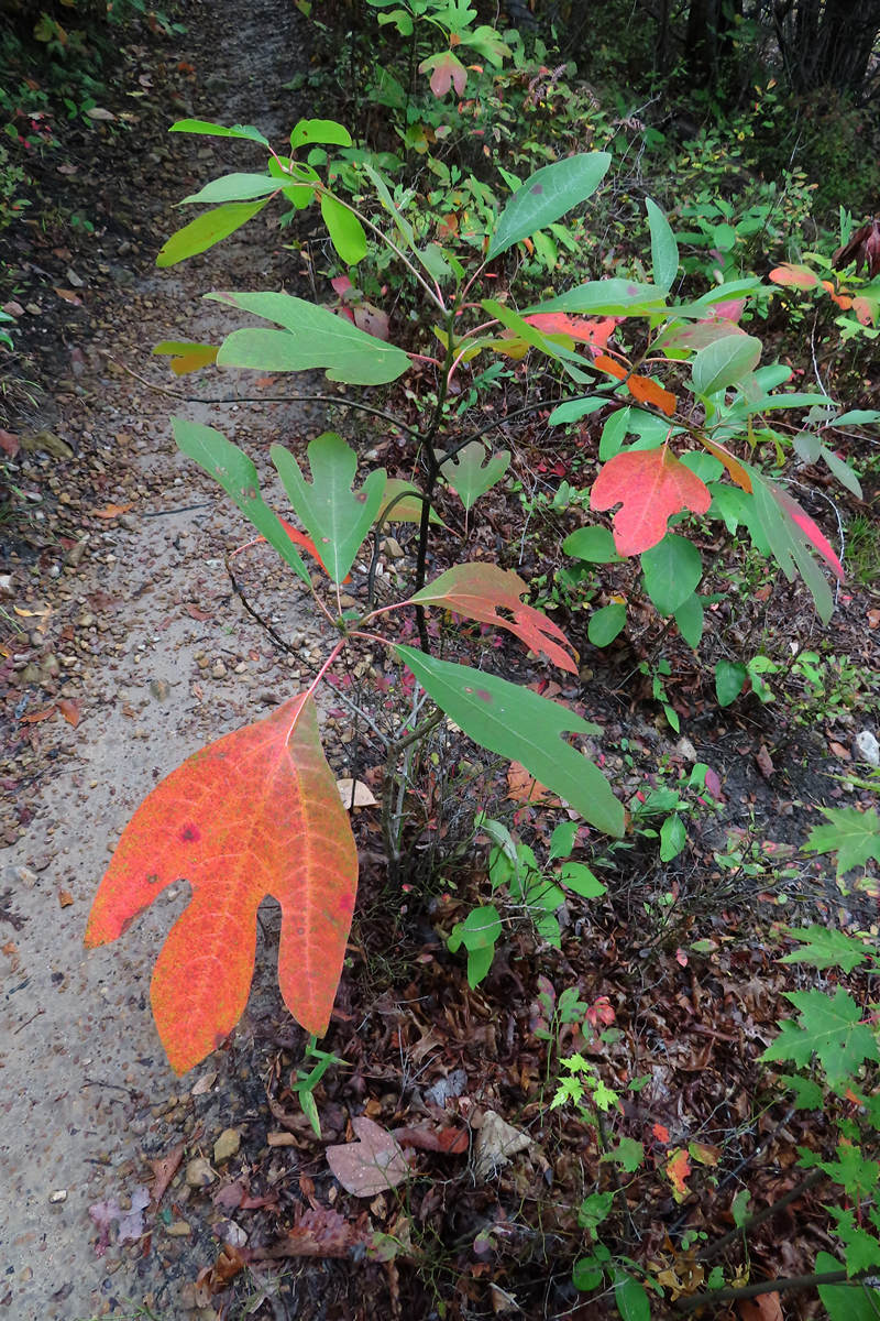
The sassafras is one of my favorite trees. It has interesting flowers and leaves and beautiful fall color. And the bark of the roots makes a delicious tea.
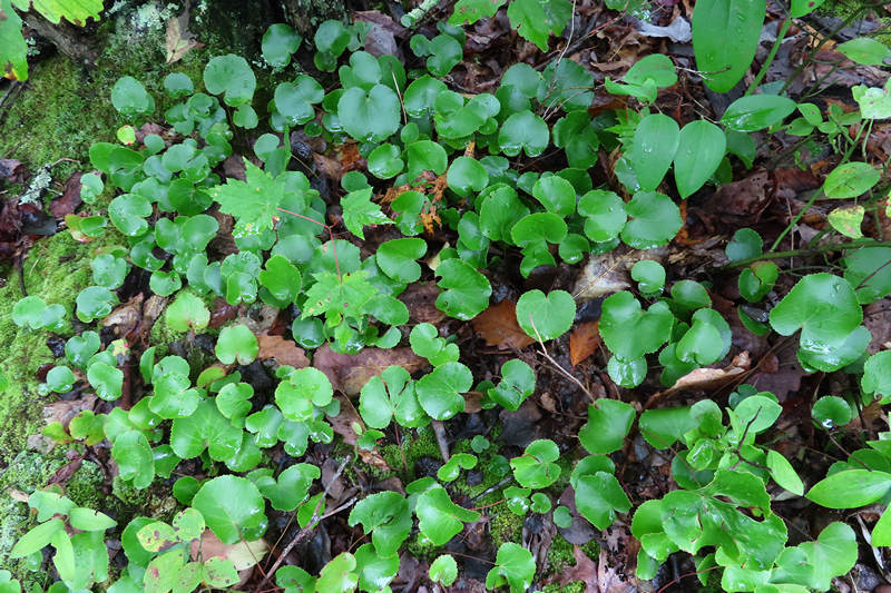
Here is a plant Chuck and saw on our McAfee Knob hike. It is called Galax and the shiny green leaves and white flower spikes in the spring add a lot of color to the forest floor. I rarely see this plant as I am seldom in the Blue Ridge/Great Smoky Mountains area.
Galax, the wandplant, wandflower, or beetleweed, is a genus in the flowering plant family Diapensiaceae, containing a single species, Galax urceolata (syn. G. rotundifolia, G. aphylla). It is native to the southeastern United States from Massachusetts and New York south to northern Alabama, growing mainly in the Appalachian Mountains at altitudes of up to 1,500 m, where it grows in shaded places in forests. Galax urceolata may be a diploid, triploid, or autotetraploid (autopolyploid).
Source: WikiPedia
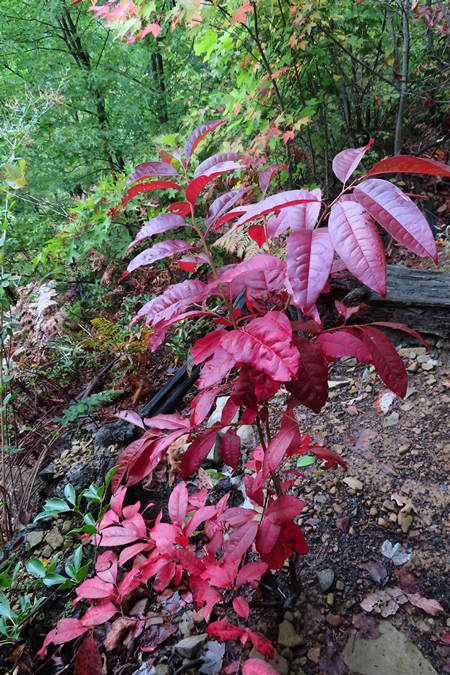
The fall color combination of the sourwood and sassafras was quite the eye popper.
More tight trail. I loved it!
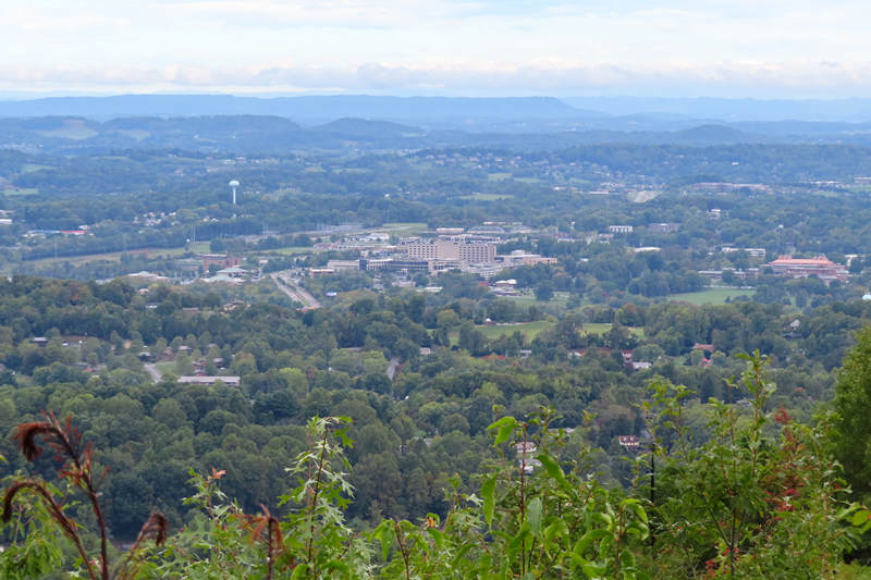
This is looking down into Johnson City. For most of the hike it was very quiet but on this side of the mountain the Interstate 81 noise was quite loud.
The beautiful and rich color of the sourwood would make a find addition to Cabin № 18 and I am going to have to start looking for one to transplant.
Wow! The dark green of the mountain laurel really accentuates the color of the sourwood leaves.
"The Autumn leaves drift by my window..."
My mom loved Nat King Cole and we all grew up listening to his songs. This one is a particular favorite of mine.
Not surprisingly I saw the leaves of the pink lady slipper orchid. On May the 29th of 2020 Betsy, Petra and John and I saw some in bloom at Coopers Rock State Forest. The photo below was taken on that day.

Some of the slopes were dense thickets of the Big Laurel (Rhododendron maximum ) 10-20' feet tall. These little seedlings have a long way to go before they reach such heights.
The last shot before I made my way down the mountain and back to the van.
When I arrived at trails end there were a number of cars at both the lower and upper parking lots. In one of the vehicles I noticed the passenger door was open and when I looked over there was a man and women my age doin' the Wild Thing! A most unusual way to end a hike - Auto Erotica!
When I got to JB's it was...? Yep. You guessed it - Happy Hour. JB was still out paddling so I relaxed outside until he arrived with some take out dinner which his two sons and I enjoyed. We did a little catching up but I was soon to bed.
The next morning JB and I chewed the fat until about 10:00. JB, like Chuck was involved in trail work in Morgantown and we had fun talking about the good old days.
Then it was south back down I-81. Next stop - Jasper TN with a little side trip added on.
⋄⋄⋄⋄⋄⋄⋄⋄⋄⋄⋄⋄⋄⋄
Friday, 08 October 2021
Johnson City to Jasper TN
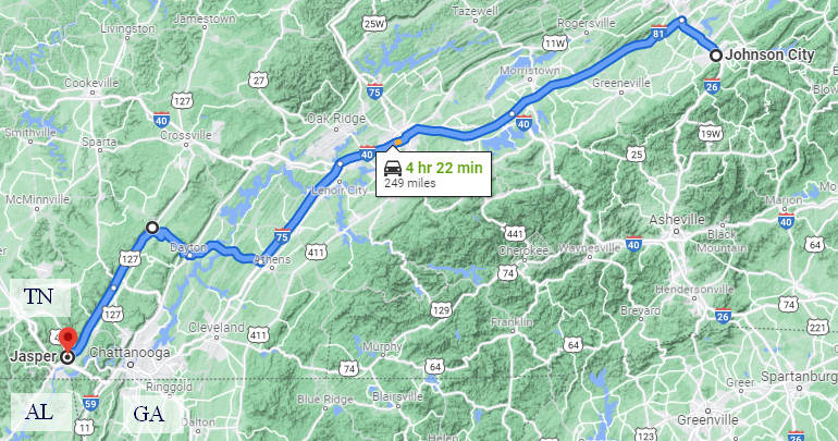
About 10:00 I hit the road heading north on I-26 to I-81 and then south towards Knoxville where I picked up I-75 south. Had I stayed on I-75 I would have been in Chattanooga in no time and then on to Jasper. But I had other plans.
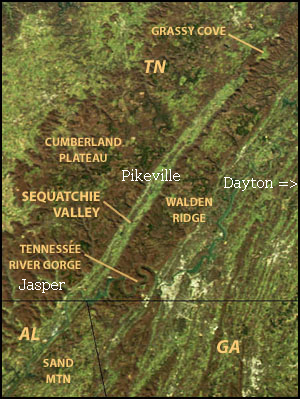
Once on I-75 I took exit 49 at Athens and got onto SR 30 which would take me through Dayton, Summer City and then onto Pikeville where I would pick up SR 28 south to Jasper.
This route would take me up onto the Cumberland Plateau where I would top out at an elevation of 2098'.
The Cumberland Plateau is the southern part of the Appalachian Plateau in the Appalachian Mountains of the United States. It includes much of eastern Kentucky and Tennessee, and portions of northern Alabama and northwest Georgia. The terms "Allegheny Plateau" and the "Cumberland Plateau" both refer to the dissected plateau lands lying west of the main Appalachian Mountains.
The plateau contains some of the largest stretches of contiguous forest in the eastern United States. Regionally, forests are intermediate between oak (Quercus) and hickory (Carya) forest types with pines (Pinus) occurring on dry, upland sites and mesophytic species occurring in protected coves.
Source: WikiPedia
And then it would be the long descent back down into the low country of Pikeville in the Sequatchie Valley.

A distinctive feature of the Sequatchie Valley is its straightness. From its northern end to its geological southern end at Browns Valley, the valley is almost perfectly straight. It is over 150 miles (240 km) long in the geologic sense and about 65 miles (105 km) long as the valley of the Sequatchie River. Its width is about 3–5 miles (5–8 km).
The valley is bounded on either side by escarpments of the Cumberland Plateau.
Source: WikiPedia
My first stop on this route section was the small town of Dayton in Rhea County. Dayton became famous, or some might say infamous when in 1925 high school teacher John T. Scopes was accused of violating Tennessee's Butler Act which had made it unlawful to teach human evolution in any state-funded school.
And so began "The Scopes Monkey Trial". Clarence Darrow served as the defense attorney for Scopes who was found guilty and fined $100, the equivalent of $1,500 in 2021.
The trial had staying power in the minds of Americans and in 1955 a play was produced that fictionalized the 1925 "Scopes Monkey Trial" and this in turn was the basis for the 1960 movie "Inherit the Wind" starring Spencer Tracy.
Inherit the Wind is a 1960 American film based on the 1955 play of the same name written by Jerome Lawrence and Robert Edwin Lee. The film was directed by Stanley Kramer. It stars Spencer Tracy as lawyer Henry Drummond and Fredric March as his friend and rival Matthew Harrison Brady. It also features Gene Kelly, Dick York, Harry Morgan, Donna Anderson, Claude Akins, Noah Beery Jr., Florence Eldridge, and Jimmy Boyd.
The script was adapted by Nedrick Young (originally as Nathan E. Douglas) and Harold Jacob Smith. Stanley Kramer was commended for bringing in writer Nedrick Young, as the latter was blacklisted and forced to use the pseudonym Nathan E. Douglas.Inherit the Wind is a parable that fictionalizes the 1925 Scopes "Monkey" Trial as a means to discuss McCarthyism. Written in response to the chilling effect of the McCarthy era investigations on intellectual discourse, the film (like the play) is critical of creationism.
Source: WikiPedia
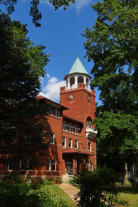
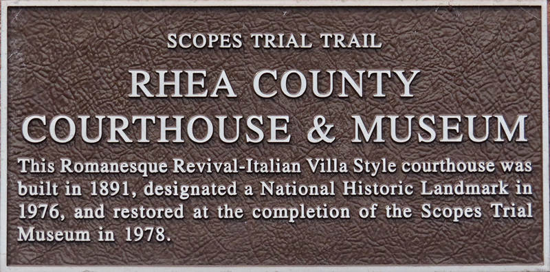
This sign is on 3rd Avenue in front of the Rhea county courthouse in Dayton Tennessee.
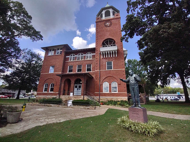
In 1979 over $1 million dollars was spent renovating the courthouse including the second floor courtroom where the famous Monkey Trial was held. In 2018 another $800,000 was spent on roof and masonry repairs. All this work certainly made for a fine looking and photogenic courthouse.
Mr. Darrow makes a point.
Unfortunately the entire courthouse was closed thanks to Mr. COVID and I was unable to see the second floor courtroom or the basement museum.
Before I left Dayton I took a look at the road map and noticed some green spots just outside of town and to the north. This green spot was labelled "Laurel-Snow State Natural Area". I decided to check it out.
Laurel-Snow State Natural Area is a Tennessee Class II Natural-Scientific State Natural Area located in Rhea County, Tennessee, near Dayton, on Walden Ridge of the Cumberland Plateau. The 2,259-acre (9.14 km2) area is owned by the State of Tennessee and managed by the Tennessee Department of Environment and Conservation. It is a component of the Cumberland Trail, a linear park.
The Laurel-Snow trail within the natural area was the first National Recreation Trail designated in Tennessee.
The Laurel-Snow State Natural Area got its name from two of the four waterfalls in the area, the 80-foot (24 m) Laurel Falls[2] and the 12-foot (3.7 m) Snow Falls.
A 710-acre (2.9 km2) portion of the area was formerly a Bowater pocket wilderness.
Source: WikiPedia
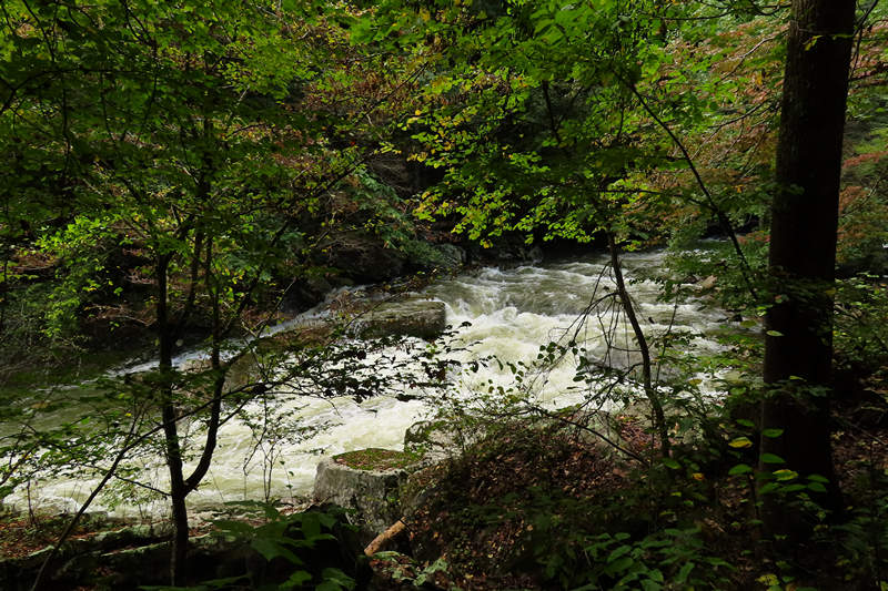
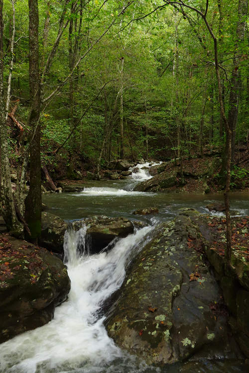
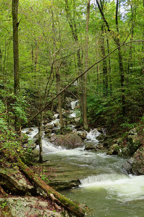
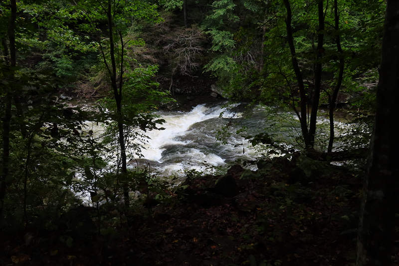
When I arrived at the trailhead via a rough and rocky "unimproved" road I found a parking area along a rushing torrent of crystal clear water tumbling its way down stream over many large boulders. This was Richland Creek and I immediately thought of JB and wondered if he had ever run this creek.
I was taken aback by the volume and speed of the water as it made its way through what was essentially a linear boulder field. Wow!
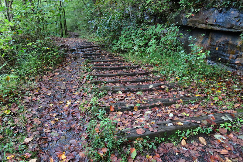
This is looking back at the trailhead parking area. The trail is an old rail-road corridor.
The creeks waterfalls and rock bluffs within Laurel Snow State natural area have been admired by visitors since the 19th century. Surprisingly the thick forests of Richland Creek gorge disguise one of Tennessee's great adventures of the industrial age - a massive coal and Coke operation at this very site which brought national and international attention to the new town of Dayton for 48 years.
The sons of Sir Titus Salt of Bradford England launched the enterprise in 1877 after Sir Titus relieved close associates from the debt burdened purchase of 40,000 acres in Tennessee and Georgia including the 800 acres of the state natural area. Salt had attracted widespread admiration in the 1850s as developer of Saltair a model progressive mill town with superior housing for employees and a hospital, central park, library, schools and advanced anti-pollution technology to benefit the community. Solitaire is now a UNESCO world heritage site
Titus Salt Jr took up the Tennessee project guiding early development before his early death at age 44 and 1887. During the next 38 years under British and Scottish successors then Tennessee investors the operation kept up to 1,200 men on payroll during peak production. In or near this site Dayton Coal and Iron Company constructed and operated seven major coal mines, 375 Coke ovens, two blast furnaces, 17 miles of railroad and 200 employee houses.
Source: Interpretive sign
This web article: "Saltaire’s connection with Dayton Tennessee (USA)" has more info on this enterprise and the people involved.
A look at Richland Creek from the trail. It was difficult to get good photos as the water was too swift and deep to take the chance of falling in.
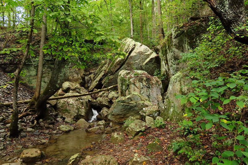
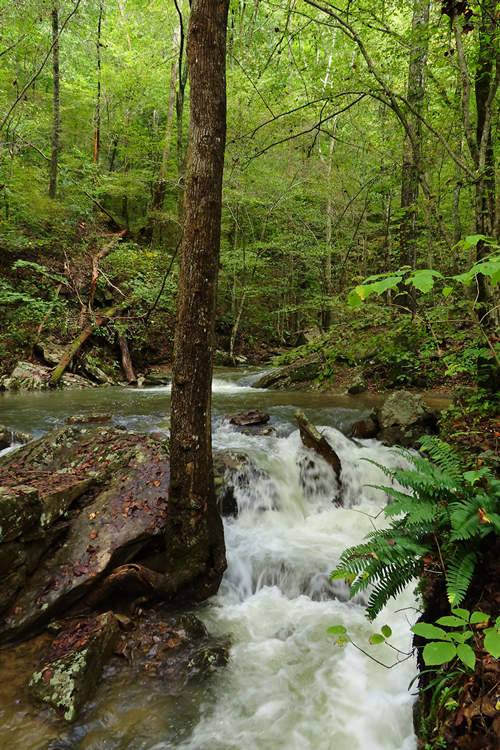
There were a number of rock strewn tributaries some of which were running quite strongly.
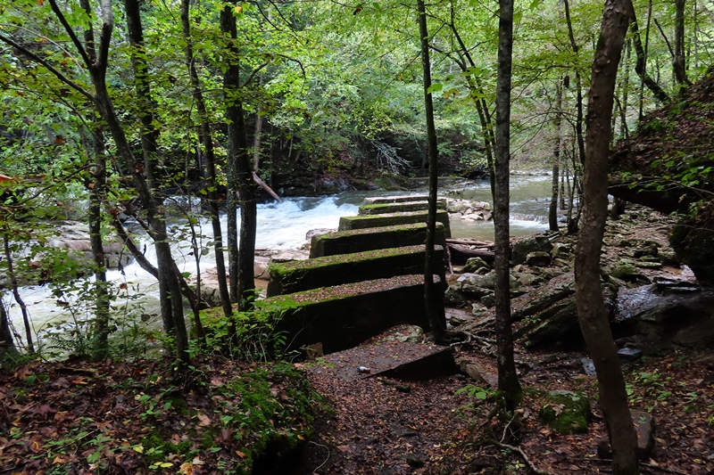
This foot bridge utilized the stone piers of one of the old trestle foundations.
A look up one of the tributaries of Richland Creek from the foot bridge.
This and the photo below are the same tributary shown above.
I was told by another visitor this was
an old mine ventilation shaft.
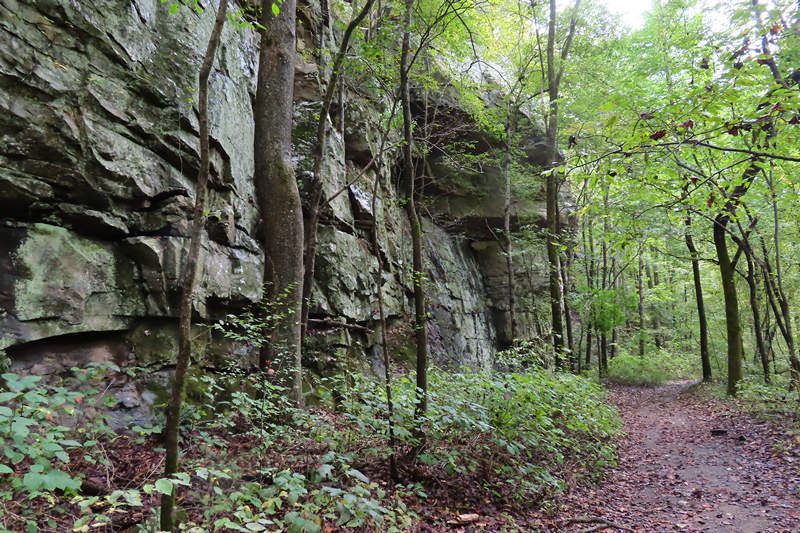
One of the rock cuts made to get the line through.
One of the articles I looked at about this area stated the rail-road criss-crossed Richland Creek to the mine portals.
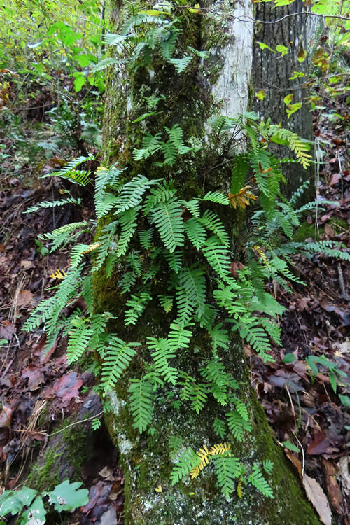
A fern! But not just any fern. Here we have the resurrection fern (Pleopeltis polypodioides) so called because it curls up and "dies" when there is a lack of moisture but with the first rain it "resurrects" and rises from the dead.
A bit of tangible history.
I can see the kayaks flyin'! I am sure by some standards this is pretty tame boating but it looked pretty exciting to me.
Click here to watch the water move.
Seeing how beautiful it was here I hated to leave but I was due in Jasper and so it was down the road I went.
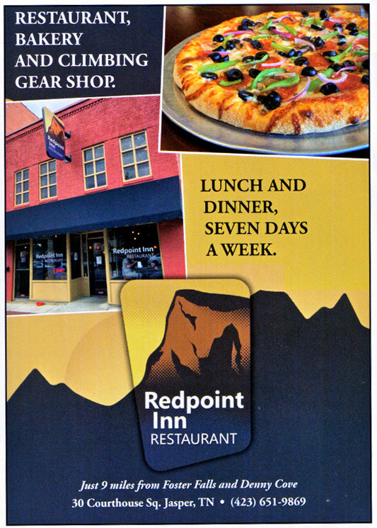
Way back in the late 1970s when I was a counselor at Oglebay Institute's Junior Nature Camp (JNC) I became acquainted with the Doherty family. Bill, Bob and Donna all attended JNC and their parents Bill and Lee attended the Oglebay Mountain Camp at Terra Alta. And that is how I met Bob, who along with his wife Carol are the proud owners of the Redpoint Inn located on the Courthouse Square in Jasper TN.
I decided to add a few historic photos from the archives.
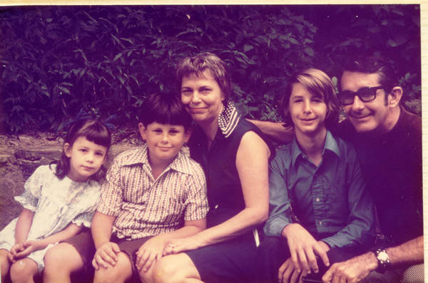
The Doherty Family around 1972
Donna, Bob, Lee, Bill Jr, and Bill Sr.
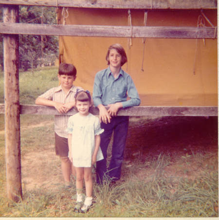
Donna, Bob and Bill at Junior Nature Camp.
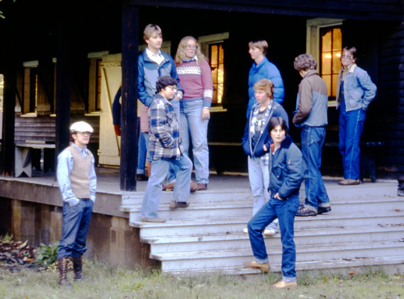
This was probably around 1980. Bob is a bit older here. He is center at the bottom of the steps.
And who is that at far left?
In their previous lives Bob and Carol both had jobs which they found unsatisfying - to say the least. They were both familiar with the Cumberland Plateau area and loved to hike and climb there and so when it came time to move their lives in a new direction they made the move to Jasper, bought an old historic building on the Square and started the long and laborious process of turning into what what is the most popular eatery in Jasper.
The above is the simplified version of what Bob and Carol did. The amount of time, money and effort they have put into the Redpoint Inn cannot be understated.
Many, many long days and short nights were required to get where they are now and that continues as they grow the business.
I had been wanting to visit Bob and Carol for a number of years to see their labor of love and when I finally made plans to visit it was the Year of COVID and those plans were squashed. So, now I am finally here!
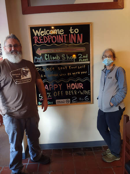
Bob and Carol - the happy and proud owners of the Redpoint Inn.
Note the "Climb Shop 2nd Floor" on the sign. Jasper is near some world class climbing which includes destinations like Foster Falls, Castle Rock and Denny Cove. So, what better way to wrap a day of climbing than one the best pizzas you will ever eat and maybe pick up some new gear in the Climbing Shop.
Of course Bob and Carol offer much more than pizza. Take a look at the menu here.
Check out this guide to local climbing spots. The area has much more than climbing. There are many miles of trails and some world famous pits for those who want to try a little vertical caving.
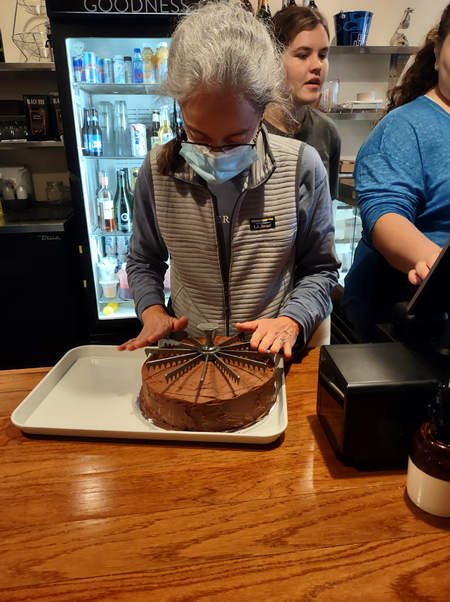
Mmmmm... yummy! Here Carol carefully scores a cake to get it ready for cutting. Carol bakes from scratch and they have a delectable selection of pastries. The pizza dough is made daily using their own recipe.
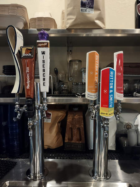
The Redpoint has a nice selection of local beers which you just might need if you decide to order up some Redpoint Wings.
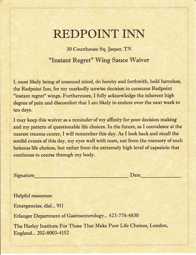
Bob always did have a good sense of humor. It's one of his more endearing qualities.
After a tour of the Inn Bob drove me around the 'hood to look at the access path to South Pittsburgh Pit Preserve and the entrance to Nickajack Cave which was partially flooded in 1967 by the Tennessee Valley Authority's Nickajack Lake, created by the construction of Nickajack Dam. At least three endemic species were exterminated when the cave was inundated. How considerate of the TVA. Nickajack Cave currently has a population of about 100,000 grey bats.
When we arrived back at Redpoint it was time for a tasty pizza and a pint of beer which was graciously provided. Not just the pizza crust is home made, the sausage is made right at the Inn using their own recipe.
It looks like Bob is thinking: "Is he going leave any for me?" I did.
Carol went home for some much needed shut eye while Bob and I emptied a few more pints and listened to some live music on the second floor. Eventually I made my way to Bob and Carol's house and then the next morning I was on my way to New Orleans.
⋄⋄⋄⋄⋄⋄⋄⋄⋄⋄⋄⋄⋄⋄
Saturday, 09 October 2021
Jasper TN to New Orleans LA
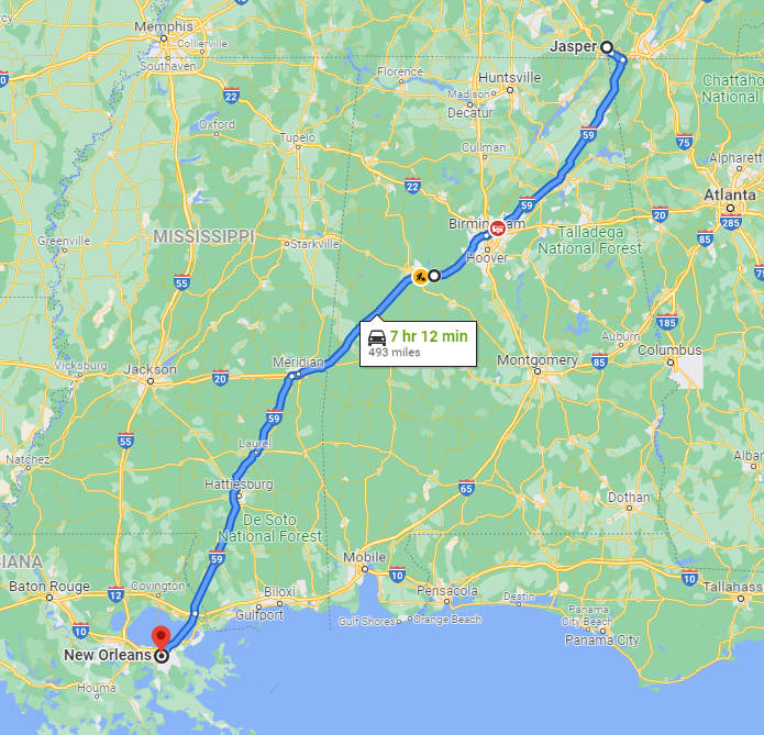
Another "If everything is perfect" time estimate by Google. My driving time was 8.5 hours.
About 20 years ago Tony and Donna Cook left Morgantown and settled in New Orleans on the West Bank. Betsy and I have both been down to visit and the four of us have had some fun times together. Here are some photos of when Betsy and I visited in 2003 - shortly after Tony and Donna had moved there.
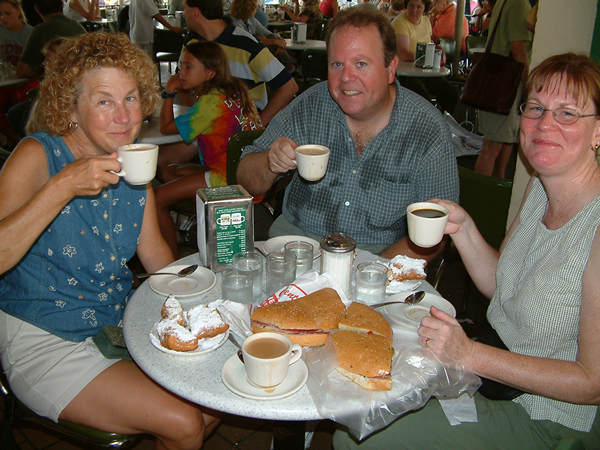
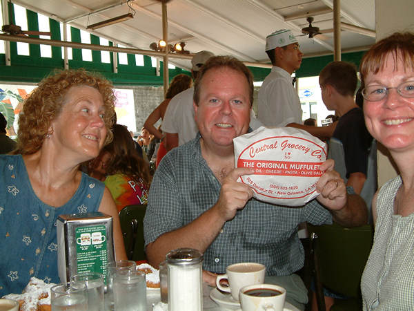
Beignets and Muffalettas - what could be more New Orleans? - Music!!
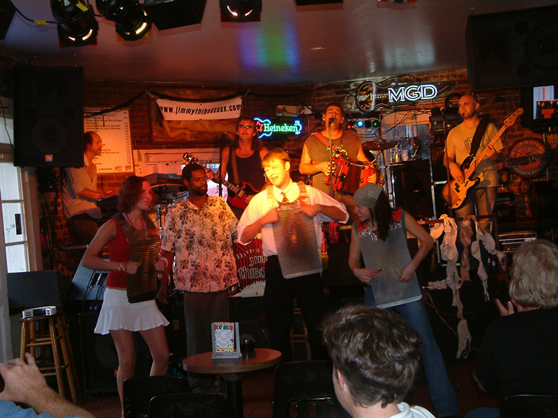
The four of us had some fun times at "The Crazy Corner" on Bourbon street. Seen here is the Jimmy Thibodeaux Band who rocked down the house anytime we were there. What a blast!
OK! Back to the future...
After a nice Happy Hour Donna went to get some take out - Poor Boys! I got a half shrimp with a side of jambalaya and potato salad. Filling and tasty. I can still remember the first Poor Boy I had from Danny & Clyde's. I thought I had died and gone to heaven! Sorta like how I felt when I had Donna's chicken pot pie.
As you can see I had some good eats while I was at T&Ds. Donna made this delicious chicken pot pie for our Saturday dinner. It was the best I have ever eaten. And, I have the recipe now!
Thanks, Donna!
Tony didn't cook me anything but he let me buy him a beer. What a swell guy. After we left Second Line Brewing we went back home and had Happy Hour with Donna.
It was during that Happy Hour I noticed my leg wound was oozing and I emailed the surgeon with my concerns. More on that later.
The next day (Monday) Tony and Donna were off to work and I spent the day working on my trip report, looking at maps, and reorganizing the van.
When T&D got home we had our last Happy Hour and talked about what route would be best to get me on my way to San Antonio. They strongly advised me to stay on the west side and take US 90 west so I could avoid going through Baton Rouge which is always a mess with traffic.
And so, On Tuesday morning I was off down the road at 5:45 am.
⋄⋄⋄⋄⋄⋄⋄⋄⋄⋄⋄⋄⋄⋄
Tuesday, 12 October 2021
New Orleans to San Antonio
As you can see from the route map above I may have missed the traffic in Baton Rouge but I did have the joy of driving through Houston. Never again.

Welcome to the Great State of Texas!
The drive was uneventful and I arrived in San Antonio at around 4:00 and then made my way across town to Geary and Sue Schindel's house.
I first met Geary in Morgantown when I joined the WVU Student Grotto (caving club). That would have been in the early 80's. Geary had just taken the Grotto position of Grand Poobah and quickly went about the job of roping (pun intended) in members to go on a survey trip to Roppel Cave all the while plying us with venison chili at his student apartment and pizza at the "after meeting meetings".
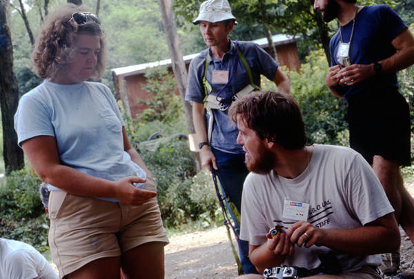
This photo was taken in 1980 at the Old Timers Reunion which is a huge get together for cavers at Alpine Shores in Randolph County WV.
Pictured above are Sue Dowds (Schindel) "Vertical" Bill Cuddington and Geary. Although both Sue and Geary were well know in the caving community Bill Cuddington was legendary and is now considered the father of vertical caving.
I think it was on the Roppel trip that I first met Sue. She and Geary were dating at the time. Ahhh... young love. At that same time Betsy and I were also sparkin' and after 17 hours of hard caving in Roppel I drove 450 miles to Cleveland Heights to visit her for a bit and then drove 650 miles to Boston to visit my ex brother-in-law Mike Taymor and then drove the 600 miles back to Morgantown. Sheesh!! I am getting tired just thinking about all that running around!
As with New Orleans it was much warmer in San Antonio than I expected.
I had originally planned to stay several days to enjoy some hiking but the combination of warm, muggy weather and the dang leg wound I managed to re injure put the kibosh on that.
Hey, wanna hear about my leg wound?!
It started back in May when I noticed something odd on my left calf. Thinking it was an aggravated insect bite I more or less ignored it. But, when Geary and Sue visited us in Morgantown in early August Geary saw it and said: "You might want to have that looked at." I had been thinking about it but that was the push I needed to get me to a dermatologist.
Long story short - It turned out to be an invasive squamous cell carcinoma and I was scheduled for Mohs surgery to get the nasty thing cut out. And cut it out they did!
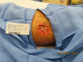
The final wound from my Mohs surgery.
Fortunately the lab results showed no need to remove more tissue so the next step was to close it up. It was interesting watching the stitching process. The hole was deep enough it had to be stitched internally as well as surficially.
When the surgeon started the interior stitching he stopped, turned around and said to the nurse: "You better give me the heavy duty suture." (Paraphrased)
So he pulled out the original suture and started sewing again. I was amazed to seee him pull the wound shut. I kept thinking - "the sutures are going to rip right though!" But, of course they did not. And then he closed it up using the surface sutures.
Now we get to the part where the relatively short section of suture turned into a much longer one.
When he closed up my little crater he turned to me and said. "Ok, we are done with that part. But do you see how the excess skin on either side of the wound is puckered up? I am going to trim that down flat and then suture it so it will heal better and leave less of a scar."(Paraphrased)
And what did I say? "OK". Now, I have to admit I did not watch the original excavation or trimming. But now I wish I had.
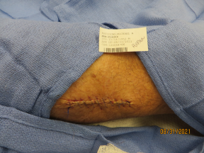
The final repair after trimming and suturing.

This was about a week after the surgery.
This was my very first surgery so I felt like I should run right out and get a bottle of champagne since it went so well.
But now the recovery begins. Although a minor surgery it was still the biggest and deepest damned wound I had ever had. And I have had some doozies!
So I got all the instructions about covering it with antibiotic cream, then a thick layer of petroleum jelly and to make sure I changed it every day and did not submerge it.
And to take it easy. No strenuous hikes and absolutely no cycling. Bummer. But I did as instructed and 3 weeks later when the stitches came out I was told to be careful but I could start being more active and I did not have to keep it bandaged.
Well, at least that's what I thought the surgeon said. Time passed and Betsy had left for Tucson. I closed up the house and was then on my way with two back-to-back strenuous hikes which I reported on above.
By the time I got to New Orleans I though my wound was looking a little angry. And it was oozing a thick pink liquid. Hmmm... this did not look good. So I snapped a picture and sent it to the surgeon.
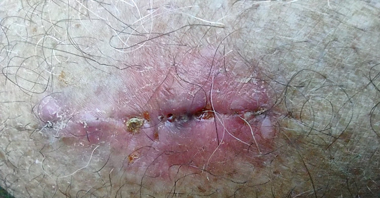
My angry wound.
Several hours later I got a call from the surgeon. He thanked me for the photo and said based on that it appeared I had torn it open again. You can see this in the above photo. The tears are small, but it is now once again an open wound. So, back to the salve, vaseline and bandage and no more strenuous exercise. Great.
And that is my long winded explanation why I could not do any hiking in San Antonio.
But, I could still eat! And drink! And indeed I did. And I had another excellent meal this time prepared by Geary and Sue: Grilled pork ribs with Coopers (of New Braunfels, TX) BBQ rub and grilled veggies with good old Lawry's seasoned salt and lots of black pepper. Delish! There is nothing better than home cookin' while one is on the road, that's for sure!
The next morning both Geary and Sue had remote work to do. Sue was at it first and Geary and I shot the shit for a while and then in about 20 minutes flat he had a hydration pack I had brought with me completely re strapped. At one time Geary made soft caving and climbing gear and so he is pretty handy with the industrial sewing machine and all the various kinds of strapping, buckles and keepers.
Geary worked quickly and efficiently and finished up with only minutes to spare before his Zoom session started at 9:00.
So it was to work for Geary and behind the wheel for me. Next stop: Van Horn TX.
⋄⋄⋄⋄⋄⋄⋄⋄⋄⋄⋄⋄⋄⋄
Wednesday, 13 October 2021
San Antonio to Van Horn

Once again I opted to take US 90 for part of my route to Van Horn. It is not all that interesting a drive until you get past Del Rio and then it is much more scenic. Del Rio is where as many as 15,000 migrants, mostly from Haiti, recently crossed the Rio Grande and spent days under the international bridge.
What can I say about Van Horn? Been there, done that. Lots of motels and fast food but I have never poked about to see what else it there. Usually by the time I am in Van Horn I just want to get out and get going.
Usually I book a room at the Motel 6 but this time I noticed they were up to $65 (without taxes) a night. So when I arrived I cruised up and down E. Broadway for some alternatives. I saw the Village Inn Motel which turned out to be your typical Patel Motel. The rate was $54 with tax so I was soon in a room. The money I saved went right into the gas tank.
The next morning I was up at 4:30 to start the last leg which would get me to Tucson.
⋄⋄⋄⋄⋄⋄⋄⋄⋄⋄⋄⋄⋄⋄
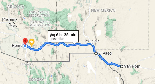
Just a few miles west of Van Horn I entered Mountain Time which meant I would be going through El Paso about 5:30. It was still dark and the city lights could be seen for miles and miles. Even at that time of the morning there was a good bit of traffic but I breezed through without any problems unlike previous times when it was a mess of traffic and construction.
When I entered AZ I gained another hour and so arrived in Tucson around 11:30.
And there you have it: Morgantown to Tucson - 2021. It was great to visit so many Morgantown Expats and catch up on everyone's life. Thanks to you ALL for making the trip a fun time.
⋄⋄⋄⋄⋄⋄⋄⋄⋄⋄⋄⋄⋄⋄
I know some of you dying to know the status of my leg wound which you were able get a look at above.
It was on October the 10 when I received instructions from the surgeon to once again start the vaseline and bandage routine, which I did. And no strenuous hikes or cycling. I obeyed.
But two days after I arrived in Tucson I did start a walking regimen and for the last two weeks Betsy and I have been walking 3 miles a day, every day and it looks like the care and caution I have shown is helping.
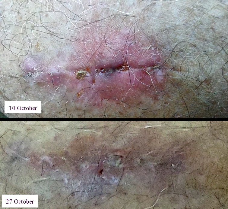
In two weeks I have an 8 mile, 2000' elevation gain hike which starts at 5400'. Will I be ready? We shall see...
Until next time,
-Mike

