09 July 2014
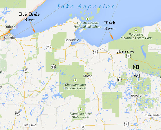
Today I would explore another river. This river, unlike the slow and lazy backwaters of the boggy Brule, was to be a fast flowing canyon river with thundering waterfalls. This river was the Black, located in the far northwest corner of Michigan's Upper Peninsula.
All of the falls can be accessed by car with only a short walk. However I decided to take the more circuitous and scenic 8 mile hiking route which follows the North Country Trail.
Click on the photos below for a larger image.

On my way through Bessemer I passed by this fabulous stone building. It is the Gogebic County Courthouse which has been placed on the National Register of Historic Places.
Gogebic County was split from Ontonagon County in 1887. The county immediately started work on a courthouse, jail, and sheriff's office. The buildings were designed by the firm of Charlton and Kuenzli, and constructed in 1888 for $50,000 by contractor Herman Gundlach.
The Gogebic County Courthouse is a rectangular Romanesque red sandstone building, two stories tall with a full basement. It has a hipped roof and a four-story square tower on the front facade. The entrance is through a carved, round arched entryway in the base of the tower. Farther up the tower are rectangular windows with transons, surrounded by carved stone, and a porthole window. A dentilated cornice runs around the roofline of the building.
Source: WikiPedia
The town of Bessemer was incorporated in 1884 as iron mining started growing throughout the Gogebic Range. It is named after the Bessemer Process. The process is named after its inventor, Henry Bessemer, who took out a patent on the process in 1855.
Sir Henry Bessemer (19 January 1813 – 15 March 1898) was an English engineer, inventor, and businessman.

An 11 mile section of Gogebic County Road 513 is now designated as the National Black River Scenic Byway. The route of the byway first existed as a wagon road in the 1840s and as a county road in the 1920s
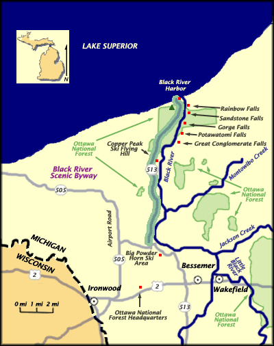
The National Black River Scenic Byway (Rt 513 highlighted in map above) includes, Great Conglomerate Falls, Potawatomi, Gorge, Sandstone, and Rainbow Falls. As you visit our waterfalls, stop and take notice of the signs explaining the conglomerate rock formations.
Source: Waterfalls of The Western U.P.
On my way to the Black River Harbor Recreation Area parking lot I swung by the campground to have a look around. I found 40 nicely maintained and spaced wooded campsites on a bluff overlooking Lake Superior. There are two trails at the campground. One goes down to the harbor and the other goes down to a nice secluded beach. Betsy would like that! I will have to make sure we stay at this campground on our next visit to The Yooper.
Speaking of "Yooper", check out this fascinating article on Yooper dialect.
Known for its spectacular waterfalls, idyllic beaches, scenic hiking trails and tranquil campground, the Black River Harbor Recreation Area is a popular destination throughout the year. Originating in Wisconsin, the Black River flows through forested areas of large pine, hemlock and hardwood trees. The River has a series of scenic waterfalls as it drops in elevation to meet Lake Superior. Tannin (tanic acids)from hemlock trees is what gives it its unique color.
The Harbor offers one of the area's few access points to Lake Superior, with boating being a major summer time activity. The boat ramp can accommodate almost any craft trailered in. There is no launching fee. Boat fuel and snacks are available through the concessionaire. Parking for trucks and boat trailers is ample. A historic pavillion built by the CCC is also located here.
Source: USFS
Black River Harbor is first on my waterfall tour. From here I can access the trail which parallels the Black River and offers a great view point from which to see Rainbow Falls. There is a large grassy area with picnic tables on the way to the falls trail. It passes by a remnant from the past.

In the 1920s the Black River harbor was home to a small fishing village. The Nancy Jean was part of the fishing fleet in the 1930s. She did not initially have a happy retirement.
The hazards of being on Lake Superior are well documented and there have been nearly 50 ship wrecks since 1892. Although not all the wrecks were due to inclement weather, many were. Some ran aground in fog, some broke apart in heavy seas, some capsized, some sank. And the icy water often insured there would be few if any survivors.

Click this photo to read more about the Nancy Jean.
When looking at this little wooden 32 footer I could not help but think of the SS Edmund Fitzgerald a steel bulk freighter of 729' feet.
The SS Edmund Fitzgerald was an American Great Lakes freighter that sank in a Lake Superior storm on November 10, 1975, with the loss of the entire crew of 29. When launched on June 8, 1958, she was the largest ship on North America's Great Lakes, and she remains the largest to have sunk there.
Many theories, books, studies and expeditions have examined the cause of the sinking. Fitzgerald may have fallen victim to the high waves of the storm, suffered structural failure, been swamped with water entering through her cargo hatches or deck, experienced topside damage, or shoaled in a shallow part of Lake Superior.
The sinking of the Edmund Fitzgerald is one of the best-known disasters in the history of Great Lakes shipping. Gordon Lightfoot made it the subject of his 1976 hit song "The Wreck of the Edmund Fitzgerald".Source: WikiPedia
"The wind in the wires made a tattletale sound and a wave broke over the railing. And every man knew, as the captain did too, t’was the witch of November come stealing." ~ Gordon Lightfoot.

Not far from the Nancy Jean is a CCC built suspension bridge which crosses the Black River. This 193' span was built in the 1930s.
Reconstructed, 1968, but appears to have retained its original appearance.
Tom Haapoja provided information about this bridge. His father worked on its construction: "Built in 1938-39. They had a sawmill on site from which they took 'select' lumber for the bridge and boat docking area. I think the sawmill was located on the present-day parking lot. Each anchor for the suspension cables consisted of 44 tons of concrete. The concrete was transported to the forms via wheelbarrows. The construction of the East anchor was difficult because the wheelbarrows travelled uphill, and each were pushed by one man and pulled by another.""It was a WPA and CCC effort. The CCC Camp discipline and logistics were provided by the US Army, but the construction supervision was provided by the WPA. About 200 Men from the Norrie CCC camp (Ironwood, Michigan) participated in the construction of the bridge and surrounding park. They worked during the cold of winter and rode to and from Camp Norrie in open trucks. Each trip took 1 1/2 hours. The architect of the bridge was 'Oakey' Johnson. The WPA construction foreman was 'Charlie' Johnson."
Source: BridgeMeister.com

Click the photo to read the details.
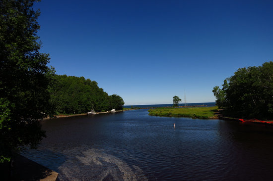
Black River Harbor as seen from the suspension bridge.

A short walk from the bridge is the trail to Rainbow Falls.

The trail clearly showed a lack of regular maintenance for the USFS.

The timber steps were so in need of maintenance an unofficial side path had been worn to avoid them. This will surely lead to more and more erosion of the trail.

Once up on the bluff there were some nice views of beautiful Lake Superior.

Yippee! A new horsetail for this trip! I am pretty sure this is the Meadow Horsetail (Equisetum pratense). This Equisetum is sometimes confused with the Common horsetail (Equisetum arvense) which is, as the name would suggest - quite common and much more widespread than the Meadow Horsetail.

A closer look at the structure of this interesting group of plants.

Once upon a time these plants grew to heights of 45 feet and probably grew in densely packed clumps like modern bamboo. This was during the Carboniferous Period when Ferns ruled the earth. Ahh... those were the days!
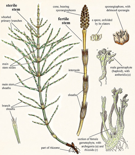
This beautiful illustration explains the morphology and anatomy of Equisetum better than I could ever hope to. "A picture..."
Click here to view the full size image in all its glorious detail.

Here we are at Rainbow Falls: a swimmer's nightmare and a boater's dream!
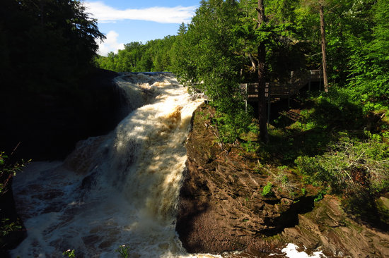
Quite the raging torrent.
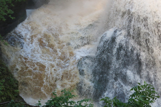
The brownish color of the water is from the tannin produced by the conifer needles.
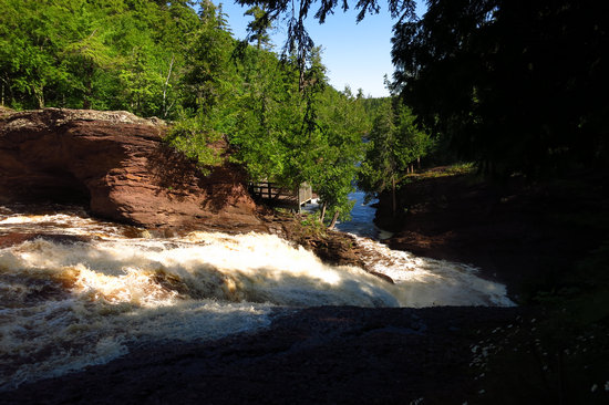
The viewing platform seen here is accessed with the trail from the parking lot which is off the Scenic Byway.
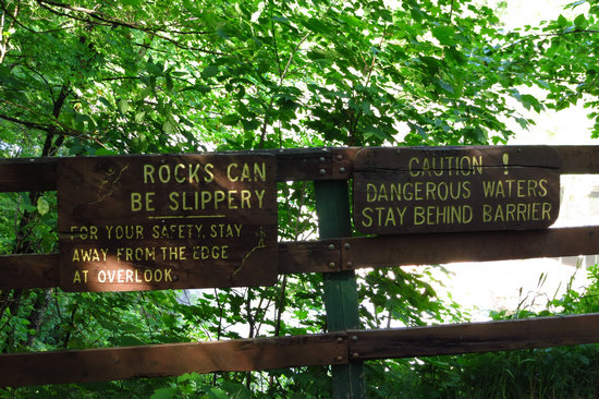
The official view area. Can't see much, can you?
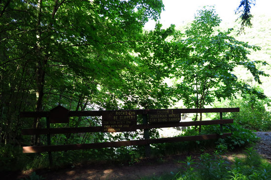
The official viewing area is now completely blocked by vegetation. Once again a clear indication of the lack of maintenance this area now receives. Having the view obscured pretty much guarantees people will seek out their own point of view - exactly what the signs are trying to prevent.
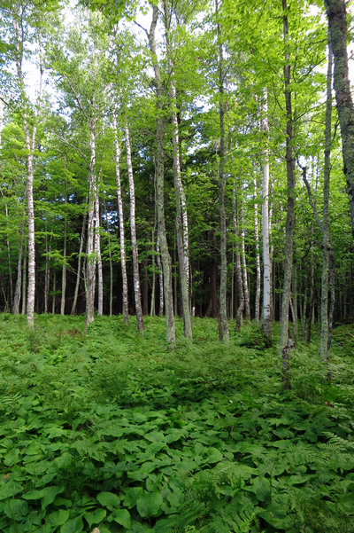
One of the reason I like hiking up north is the novelty of being able to see into the woods. Back home in the Appalachians you would either see air or another hillside. Rarely can one see 100s of feet into the forest.
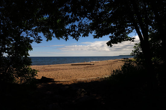
When I got back to the start of the trail I made a left and took a short walk along the shore line. I thought of Betsy when I saw this beautiful and quiet beach. The photo below shows the beach area and much more.
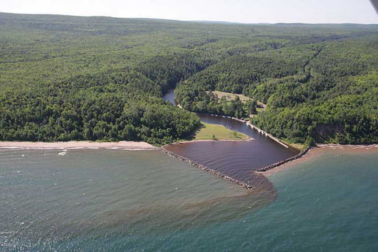
Copyright © 2009 by The Superior Watershed Partnership
This amazing photo shows the vast expanse of unbroken forest which is the Ottawa National Forest. The parking area can be seen on the right side of this photo.
The mountains in the background are probably the Porcupine Mts and the Trap Hills area.
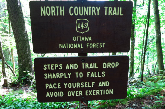
Fair warning! And I saw more than one pudgy person huffin' and puffin' their way back up from the observation platform.
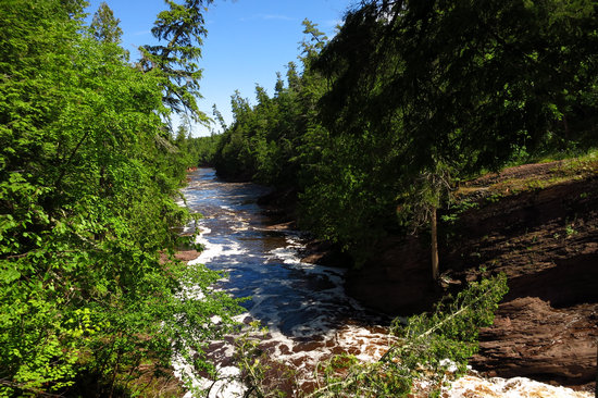
This is the view downriver from the observation platform at Rainbow Falls.
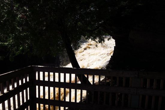
The view of the falls is much better from the other side.
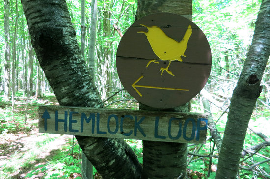
As I made my way along the trail to Sandstone Falls I came across numerous trail intersections marked with these trail signs. As of yet I have not been able to find out any info on this trail network.
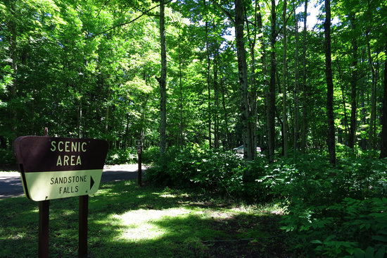
Those who arrive by car are greeted with this sign.
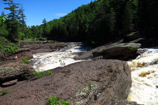
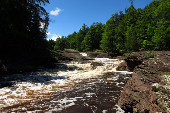
Here we are at Sandstone falls. This is looking downstream and shot from the main falls. You can see two people in the left hand corner of the photo.
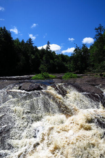
The falls took quite a long tumble but without anything for scale it is hard to get an idea of the run of the falls.
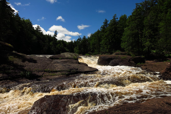
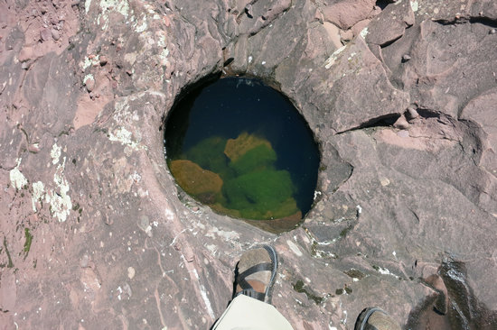
This pot hole must have been ground out by the rotating action of water and stones.
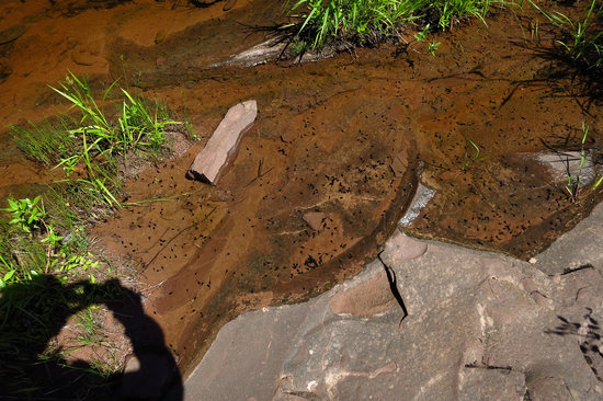
There were several small pools adjacent to the falls. This one had lots of tadpoles in it.
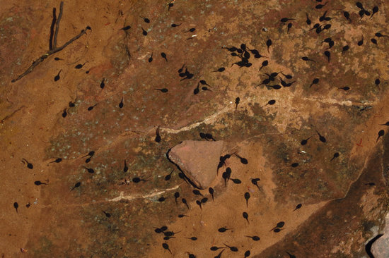
A tadpole (also called pollywog or porwigle in British English) is the larval stage in the life cycle of an amphibian, particularly that of a frog or toad. They are usually wholly aquatic, though some species have tadpoles that are terrestrial.
As a tadpole matures, it most commonly metamorphosizes by gradually growing limbs (usually the legs first, followed by the arms) and then (most commonly in the case of frogs) outwardly absorbing its tail by apoptosis. Lungs develop around the time of leg development, and tadpoles late in development will often be found near the surface of the water, where they breathe air. During the final stages of external metamorphosis, the tadpole's mouth changes from a small, enclosed mouth at the front of the head to a large mouth the same width as the head.
Source: WikiPedia
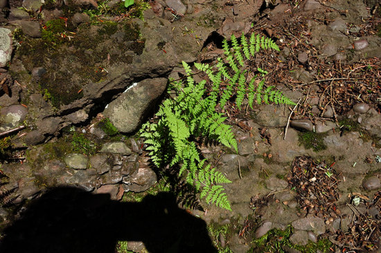
Ah ha! What do we have here? Woodsia obtusa perhaps? Or possibly W. oregana? The later is a western species but this area is within its known range. Since I did not take a very close look I cannot be sure.
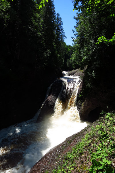
I snapped only one shot of Gorge Falls and that was it for the day.
Betsy and I will be coming through this area in mid-September and by then there might even be some fall color starting.
This trip is winding to a close and I will leave you with this final shot of Sunrise on the North Shore of Lake Michigan.

'Till next time...