Mike Breiding's Epic Road Trips ~September 2015~
New Brunswick
Exploring the Fundy Trail
Into and Orientation
05 September 2015
New Brunswick: Exploring the Fundy Trail
When my Tucson hiking buddy Stephen presented a slide show about hiking in his native Canada one of the areas he had some nice photos of was the East Coast Trail in Newfoundland.
At some point later while we were on a hike in the Tucson Mountains I asked him for more details about this yummy sounding East Coast trail. We got to talking. I had lots questions.
At some point I asked Stephen: "Newfoundland? Is that in Canada?" He stopped dead in his tracks speechless and I was met with the incredulous look I am sure I give people when I tell them I am from West Virginia and they tell me they have been to Richmond.
HEY! Geography has never been my strong suit. But I always learn a bit when trip planning and traveling. This upcoming trip to the Bay of Fundy will be no different - I hope! For some reason I always seem to use Newfoundland and New Brunswick interchangeably. To me they were just places "up there". You know - up there towards Canada. I never really thought about whether they were actually in Canada or not.
Well, hopefully with the help of Stephen's "You must be an idiot" look and a few maps I will get this all sorted out. Maybe.
Once I started doing some reading and webbing I found out New Brunswick and Newfoundland are in what is called the Maritime provinces.
Following the northerly retreat of glaciers at the end of the Wisconsin glaciation over ten thousand years ago, human settlement by First Nations began in the Maritimes with Paleo-Indians during the Early Period, ending around six thousand years ago.
The Maritime provinces, also called the Maritimes or the Canadian Maritimes, is a region of Eastern Canada consisting of three provinces: New Brunswick, Nova Scotia, and Prince Edward Island. On the Atlantic coast, the Maritimes is often mentioned in conjunction with the northeastern province of Newfoundland and Labrador; together they represent Atlantic Canada. The population of the Maritime provinces was 1,813,102 in 2011.
Source: WikiPedia
I had heard and read a bit about this area before when I got interested in New Orleans and the Louisiana Acadians (AKA Cajuns) but of course I had long since forgotten most of the that. I guess it is time to visit Tony and Donna again and bone up on the area again.
Acadian
1705, from Acadia, Latinized form of Acadie, French name of Nova Scotia, probably from Archadia, the name given to the region by Verrazano in 1520s, from Greek Arkadia, emblematic in pastoral poetry of a place of rural peace (see Arcadian); the name may have been suggested to Europeans by the native Micmac (Algonquian) word akadie "fertile land."
The Acadians, expelled by the English in 1755, settled in large numbers in Louisiana (see Cajun, which is a corruption of Acadian).Source: © 2001-2015 Douglas Harper - Online Etymology Dictionary
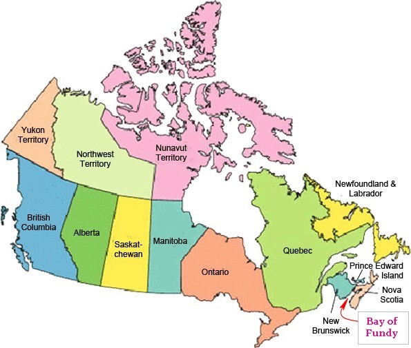
Here is a more colorful look at the Provinces and territories of Canada. Now we see more clearly exactly where this trip will take us - The Bay of Fundy.
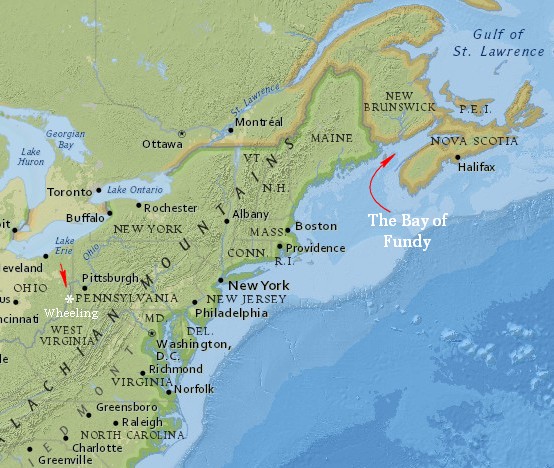
As the crow flies it is about 850 miles from Wheeling WV to St John on the Bay of Fundy. This sounds like it would be a short flight - right? Well for reasons we know not, the only connection we could get will end up being a looong day. Out flight leaves Pittsburg PA at 6:00am arrives at St John NB at 6:00pm. If you factor in the time zone change that is 11 hours travel time. To go less than a 1000 miles. Ugh.
Ahh... but that is a small price to pay to spend so much time in such a wonderful place with my wonderful wife.
How did this trip come about?
When Betsy retired in 2010 she told me wanted to take one Big Trip a year. What is a "big trip"? It is an expensive, self indulgent splurge. Not that there is anything wrong with that!
So, last fall she booked the program "New Brunswick: Exploring the Fundy Trail" through Road Scholar. These are the same folks who organized "Walking the Scottish Highlands" which we went on back in May of 2013.
At the time Betsy booked this Fundy trip we had not yet been faced with all the complications of selling our Morgantown house and buying a house in Wheeling and also a place in Tucson. When all of that come about, it looked like things were going to be a complicated fiscal mess. So we decided to cancel the Fundy trip to be on the safe side.
Fast forward from November 2014 to June 2015. Betsy was trolling the Road Scholar site and happened to see there were still openings for the Fundy trip in September. We talked about it and decided to book the trip. It was sorta last minute and this might have been a factor in our getting such crappy connections flying up there.
Okay. Here is what Road Scholar says about the Fundy program.
Explore the rugged beauty of the Bay of Fundy along diverse coastal trails that range from the groomed paths of the Fundy Trail to remote tidal beaches, ocean floor, sea cliffs, woodland and salt marsh. Experience a week of hiking that is built around the rhythm of the world's highest tides. At low tide walk the ocean floor out to explore sea caves carved into red sandstone cliffs by crashing waves.
Hike up to sea cliffs to watch the incoming high tide erase your footsteps and fill the caves with water. Explore the Fundy Trail, a hike along the last undeveloped stretch of coastline on the Eastern seaboard.
In North America's first Global Geopark, walk through 1 billion years of history learning about the geological forces, ages and giant tides that have shaped the land and seascapes around the Bay of Fundy.Highlights
Based in beautiful St. Martins, hike to secluded beaches, along sea cliffs and across the ocean floor.
During an afternoon hike, learn about the logging settlement that flourished in the early 1900s on the Big Salmon River.
Pay a visit to the Quaco Museum to learn about the shipbuilding industry that once made St. Martins the second-wealthiest community in the British Empire.Source: Road Scholar
Whew! If that isn't a long winded intro I don't know what is. I am hoping the next time we talk it will be about the groovy day we just spent tromping around the Bay of Fundy and detailing the menu from our candle light suppers. That's right - candle light suppers. That Betsy!!!
Hopefully there will be time and motivation to send out trip reports. We shall see...
Click on the photos below for a larger image.
Day 1 - Monday, 07 September 2015
We were picked up at the airport on schedule and rode with another couple from Seattle. We swapped travel stories and got acquainted with Aaron and Kate during the 30 minute drive to the Tidal Watch Inn.
We arrived in St Martin's just in the nick of time for dinner. After 11 hours of being in transit we were both ready for beer!
Dinner was a stuffed pork dish with potatoes and veggies and more beer. After dinner we got an orientation and talked about the coming weeks schedule. Then it was off to bed.
The next morning after my coffee I walked down to the beach which is just a few hundred yards away. It was a foggy morning with a nice breeze and temps in the 50s.
This is looking towards McCumber's head river which flows next to the sea caves. Later that day we would get a better look as the caves.
I went for a short stroll down the beach and then cut up to Main Street to head back the Tidal Watch Inn.
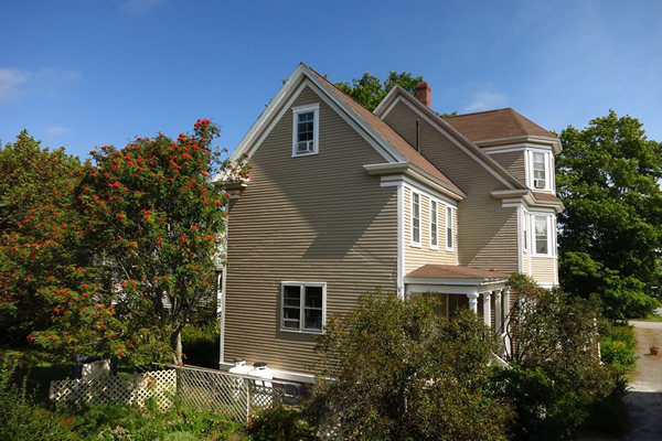
There are some lovely and well maintained homes along the main roadway. But, apparently it is not uncommon for housed here to remain empty for decades. In fact there Inn where we are staying was once empty for 50 years. Now it is been restored to it's former glory.
Across the street from the house above sits this old derelict house. The owner will not sell and it sits empty. But, he still visits occasionally. We were told he shows up in his car, pulls into the yard and sleeps the night in the vehicle. The locals consider him a bit eccentric.
Beautiful old place. One can only hope the roof will be kept up.
On the way back I spotted the rose hips. There are three species of "beach roses" here. Based on the size of the fruits I suspect this one is (Rosa rugosa).
About 9:00 we all assembled for a walk down the beach with Naturalist Nancy Sears. As some of you know I do not use the title "Naturalist" for just anyone. But, Nancy certainly has earned that lofty designation. Her knowledge of local natural and cultural history is encyclopedic and nicely presented for easy digestion.
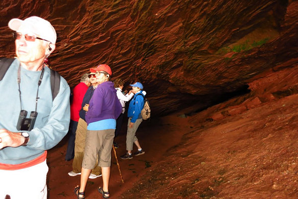
Note the fellow in the middle of the photo. He is adjusting the ear piece for radio receivers which were passed out to all of us. Nancy had the transmitter so when she spoke we could all hear her. I was dubious about these gadgets at first but they worked great. We could all walk at our own pace and never had bunch up to hear what Nancy was saying. Better living with gadgets!
We saw many interesting beach plants. Too many for me to keep track of. So, for now, they shall remain nameless. Of course Nancy knows each one intimately and had many interesting tid-bits of info to relate to us.
As I had earlier we cut up to the road and walked towards McCombers Head. As one might expect in a place which relies on the tourist dollar to stay in business there is competition for dollars spent. This means anyone who makes chowder has the best, the most famous, award winning, or they are mentioned in this book or on that web site. Nancy assured us they are all tasty and all different. This made me think of all the different gumbos that are mighty tasty - and all different.
We saw some nice roses on the walk down the roadway towards the small community of Orange. Like some of the women I have know and loved these rose bushes had mighty fine hips!
Here is something you don't see two often. Two covered bridges in one fell swoop. And the lighthouse replica was a bonus.
These are some carved bluffs we saw on the way to the caves. You can see a couple of windows on the left.
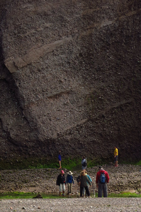
Here is what McComber Head is composed of. As I was standing there taking this picture i was being pelted by small pebbles that were eroding from the side of the bluff. Fortunately nothing egg sized came down and bonked me on the head.
Nancy gives us more details on the geology of the area. More details to forget!
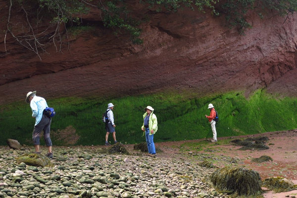
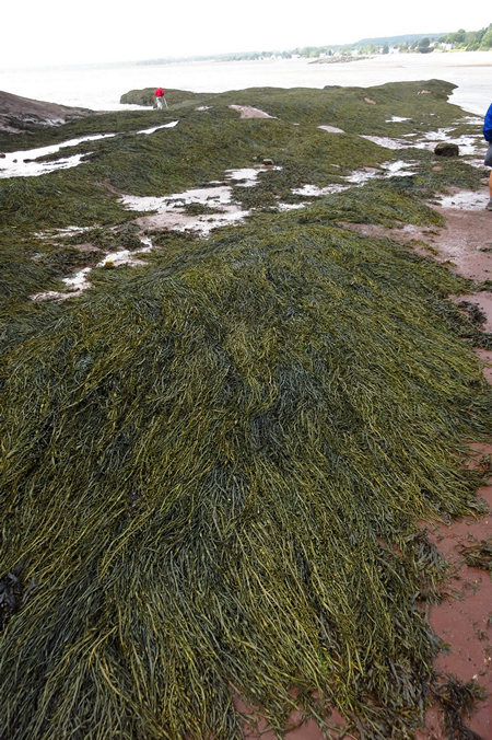
Here you can get an idea of where the high tide is. The green mossy stuff is under water at high tide and the shrubs above always water free.
A closer look at the "green mossy stuff".
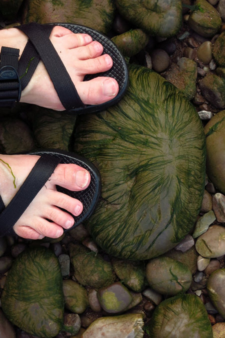
All the boulders were covered with this growth. It made for slippery walking.
Here at the entrance of the sea cave Nancy points out something interesting us.
This is what she was pointing out - a band of petrified fern spores. Whoda thunkit!
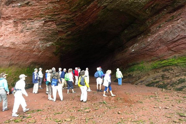
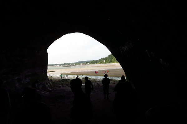
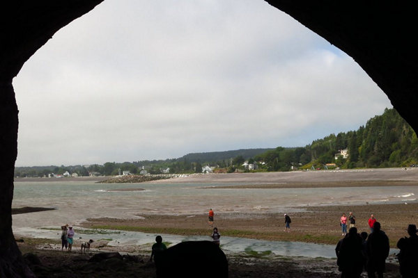
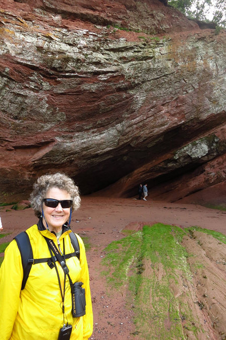
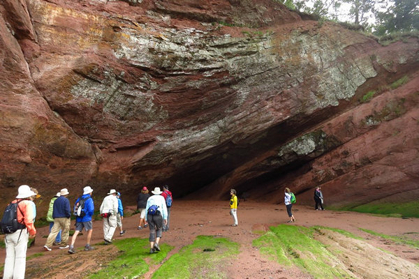
We all had fun gawking at the inside (and outside) of the cave.
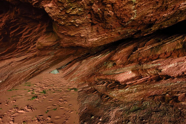
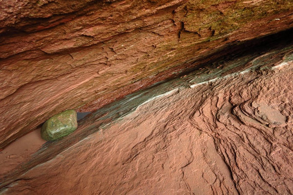
At the back the cave pinched out. We all wondered what it must sound like when the tidal waves slammed into the back wall.
At the pinch this boulder was wedged in tight. I think Nancy told us the boulder was made of jasper which accounts for the greenish-blue color.
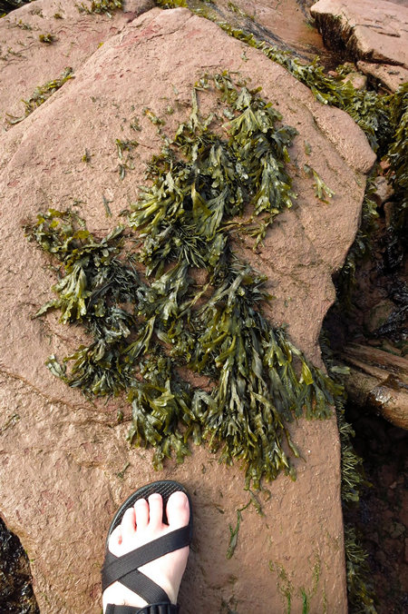
Here Nancy points out a seaweed that is commercially harvested for it carrageenan content.
Gelatinous extracts of the Chondrus crispus (Irish Moss) seaweed have been used as food additives since approximately the 1400s. Carrageenan is a vegetarian and vegan alternative to gelatin in some applications, in some instances it is used to replace gelatin in confectionery.
Carrageenans or carrageenins (from Irish carraigín, "little rock") are a family of linear sulphated polysaccharides that are extracted from red edible seaweeds. They are widely used in the food industry, for their gelling, thickening, and stabilizing properties. Their main application is in dairy and meat products, due to their strong binding to food proteins. There are three main varieties of carrageenan, which differ in their degree of sulphation. Kappa-carrageenan has one sulphate group per disaccharide. Iota-carrageenan has two sulphates per disaccharide. Lambda carrageenan has three sulphates per disaccharide.
Source: WikiPedia
If you squeezed the little bulbs attached to the "leaves" they would ooze a slippery, slimy gel which contains the carrageenan.
When we exited the sea cave we walked the beach for a bit and Nancy pointed out more goodies for us too look at.
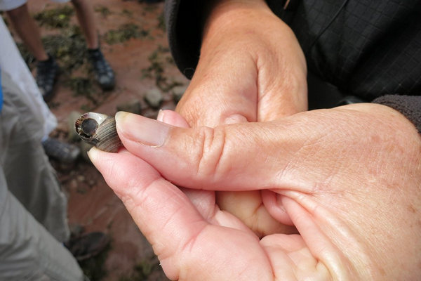
Nancy had a name for this little sea snail but I neglected to make a note of it.
If one thinks about the amount of vegetation which must be growing in the salt waters of the world it seems hard t comprehend. At to that all the other marine life and it does indeed seem other worldly.
This shot gives some idea of the massive size of the bluff that contains the sea cave.
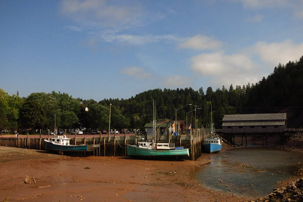
When we got back to the covered bridge at Orange we could clearly see the effect of the lowering tide. We then started the walk back to the Inn where we arrived just in time for Happy Hour.
This is the view of the Inn from the refurbed coach house where Betsy and I stayed. Note the nice sized Mountain Ash (AKA Rowan) on the left. We have seen many fine specimens thus far and will no doubt see many more.
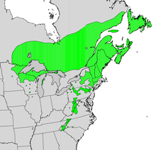
As you can see the range for the Mountain Ash in mainly in the north east US and Canada. However it can be found in the higher elevations of West Virginia in places such as Dolly Sods. That is where I first became familiar with this tree.
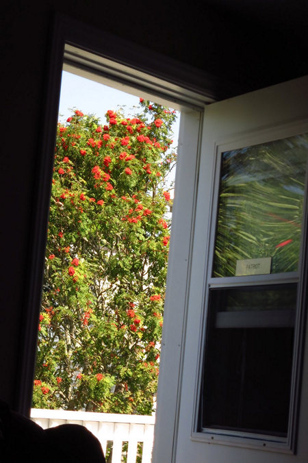
The view of "our" Mountain Ash Sorbus americana from the room.
That wraps up day one.
I am not sure if I will bet more photos posted while we are here are not. The internet connection is slow and only available form the common room in the main house.
ADDENDUM: Day 1 - Monday, 07 September 2015
It would be remiss of me if I did not mention the interesting lecture we attended on Monday afternoon as well as some basic info as to the origin of the name "fundy".
When Morgantown Ed asked me: "And where did the name Fundy come from?" It jogged my memory to send out this info.
Here's a commonly asked question: where did the Bay of Fundy get its name? It turns out that there are three possible sources (or perhaps it's a combo deal).
1.The name "Fundy" could date back to the 16th century when Portuguese fishermen referred to the bay as "Rio Fundo" or "deep river". Aptly named ... to these early visitors Fundy would have seemed like a massive and mysterious river that flowed in both directions!
2. "Fundy" may have evolved from the name given the bay by early French explorers & cartographers (in 1604): "Baie François" (meaning "French Bay").
3. Or possibly the name is a version of the French word "Fendu", meaning "split". One of the most impressive outcroppings on the bay is still called "Cape Split" (see photo). BTW, the correct pronounciation of Fundy is "fu(n'de-", not "fun-day".Source: Bay of Fundy Blog
On Monday afternoon Nancy Sears gave us an in depth talk about the tides in the Bay of Fundy. These are the highest tides in the world with heights reaching in excess of 50' at the east end of the bay.
I think it is safe to say be the end of the talk Nancy had bent most peoples brain a bit. Especially after she had thrown in explanations of "races", "slack water" and "tidal bores".
To help illustrate here points Nancy drew some flip chart maps and illustrations.
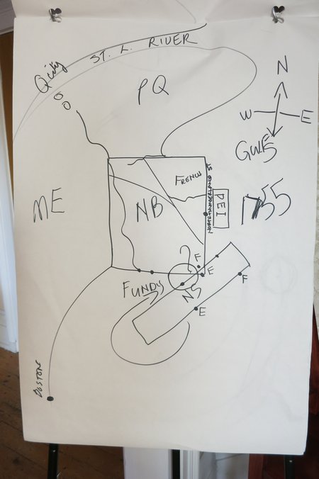
I think it is safe to say Nancy will never win any awards for outstanding cartography but quickly sketched map did the trick in orienting us.
Can you figger out what her abbreviations refer to?
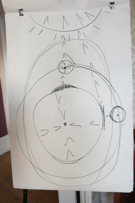
This diagram helped us get and idea of the various influences on the tides - the gravitational pull of the earth, the moon and the sun. The combinations of these made for an explanation only Morgantown Martin could understand!
Ahhh... nothing like stretching the brain.

Here's the illo I like: Fundy Bay as a claw foot bath tub.
To the north east (left) is where the bay slims down and bifurcates. This would be near the towns of Moncton and New Glasgow.
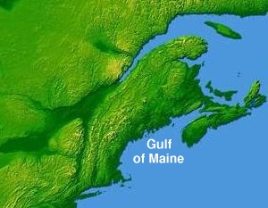
To the south west where water from the Gulf of Maine enters Fundy Bay is a 600' high basalt wall which restricts the water flow. During high tides the water is pulled over in a series of waves until it finally break over the wall and surges into the bay. This causes a phenomenon called a " tidal race".
Tidal race or tidal rapid is a natural occurrence whereby a fast moving tide passes through a constriction resulting in the formation of waves, eddies and hazardous currents. The constriction can be a passage where the sides narrow, for example the Gulf of Corryvreckan and the Saltstraumen maelstrom, or an underwater obstruction (a reef or rising seabed), such as is found at the Portland Race.
In extreme cases, such as Skookumchuck Narrows in British Columbia, through which tides can travel at more than 17 knots, very large whirlpools develop, which can be extremely hazardous to navigation.
Source: WikiPedia
The Bay of Fundy also experiences whirlpools like the one mentioned above.
There are two other interesting phenomena that occur: Tidal slack waters and bores.
Simply put slack water occurs when the outflow of a river and the inflow of the tidal achieve equilibrium and cancel each other out. This creates a body of still water.
Slack water, which used to be known as 'the stand of the tide', is a short period in a body of tidal water when the water is completely unstressed, and therefore no movement either way in the tidal stream, and which occurs before the direction of the tidal stream reverses.
Source: WikiPedia
When the tidal water exceeds the velocity of the river water it pushes tidal water up stream. I experienced this first hand on my very first kayak trip. It was on the Edisto River in South Carolina. We had paddled down stream for several hours to an old plantation site where we had lunch. By the time we put back in the tide was rising and had the effect of pushing us back up the river. This made for very easy and enjoyable paddling.
The other phenomena is called "Tidal bore"
Even if you’ve never previously been to the Bay of Fundy, you may have heard about the phenomenon known as the tidal bore: out flowing rivers flowing back upstream as the tide comes in. Folks who have never been to Fundy before tend to take our 50 foot tide measurement and combine it with the bore concept — then end up thinking that we have a 50 foot (think: tsunami!) bore twice a day, which we do not. The actual rapids of a tidal bore are between 10 and 12 feet, which is still pretty cool.
WikiPedia tells us a bit more:
Bores occur in relatively few locations worldwide, usually in areas with a large tidal range (typically more than 6 metres (20 ft) between high and low water) and where incoming tides are funneled into a shallow, narrowing river or lake via a broad bay. The funnel-like shape not only increases the tidal range, but it can also decrease the duration of the flood tide, down to a point where the flood appears as a sudden increase in the water level. A tidal bore takes place during the flood tide and never during the ebb tide.
Source: WikiPedia
Apparently there are people who come to the Bay of Fundy just to surf the tidal bores. Now that I would like to see.
There you have it - the low (and high) down on the tides in the Bay of Fundy.
Day 2 - Tuesday, 08 September 2015
Tuesday was to be our 6+ mile hike on the Fundy Trail and we awoke to a steady rain on that morning.
At breakfast, Tidal Watch Inn proprietress Kathy Zinn went over the day's schedule. She had checked the weather and it looked like it would clear up by 10ish so we would delay our start by about 30 minutes to a 9:45 departure. This would put us at the trailhead 10:15 or so.
When we arrived at the Trail entrance fee station we parked and with Kathy in the lead we immediately headed up to the Fox Rock overlook.
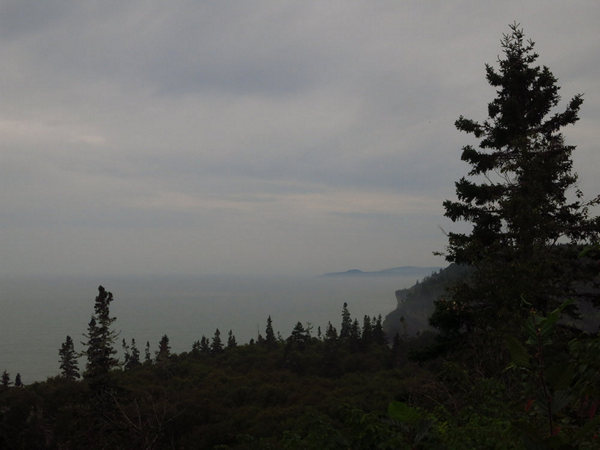
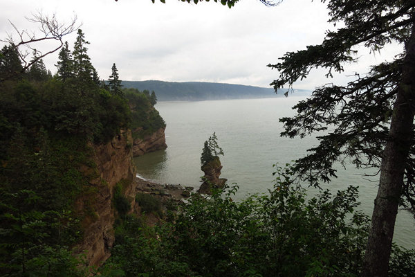
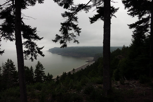
I had hoped for blue skies and sparkling water for this day of hiking, but it was not to be. This dashed my hopes for taking any decent photos of the now fog and mist enshrouded coastline. The scene was atmospheric to be sure. But not what I was hoping for.
The view above is looking south west back towards St Martins and Quaco Bay. The farthest point is Quaco Head which we would visit later in the week.
Once at the overlook we all started shedding clothes. The cool weather in the early morning had turned warm and very muggy.
Kathy oriented us as to what we would see from the overlook and a bit of history and geology as well.
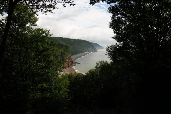
This is looking north east towards Melvin Beach and the Salmon River area.
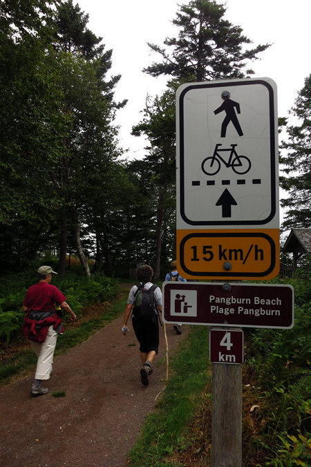
At this point I should mention there are two Fundy Trails. One is the auto parkway and the other is the walking and biking path which parallels it.
"The Fundy Trail opens up previously unreachable areas of the Bay of Fundy coastline. One of the easiest ways to see one of world’s most stunning coastlines is from the comfort of your vehicle."
The above quote from the official Fundy Trail web site made me flinch a bit. The roadway has required extensive blasting, earth moving and tree felling in an area which was previously wilderness. What will this bring for the future? More development? More people? More noise? Almost certainly.
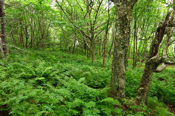
On our walk down to Melvin Beach we entered a dense forest of birch. The forest floor was carpeted with Mountain Wood fern (Dryopteris campyloptera). I first became acquainted with this fern in my home state of West Virginia where it is a bit on the rare side. But here there were many thousands of plants, some with fronds a long as 3 feet. Jumbo!
This fern is a tetraploid species of hybrid origin, the parents being Dryopteris intermedia and Dryopteris expansa. Phenotypologically, the fern greatly resembles the second parent.
Source: WikiPedia
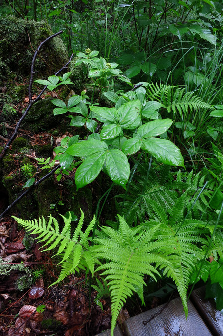
Another fern we saw was the Northern Beech fern (Phegopteris connectilis). We were to see much more of the plant on this hike and later in the week.
Also seen in the photos is Wild Sarsaparilla (Aralia nudicaulis). The roots, which taste like licorice, have been used as substitutes for true Sarsaparilla in herbal medicine and a tasty beverage which was once very popular. Remember the scenes in movies when wimpish types would order sarsaparilla in a saloon and often met with mockery by the manly cowboys nearby who were belting down their shots of whisky.
Behind the Wild Sarsaparilla is a small clump of Bunchberry, aka Dwarf Cornel (Cornus canadensis). Believe it or not this diminutive little plant is in the same genus as Flowering Dogwood (Cornus florida) which is a small tree. But if you saw the Bunchberry in bloom in the spring you would immediately see the resemblance.
I can still remember the first time Betsy and I saw this lovely little plant. It was on one of our courtship camping trips to the Upper Peninsula of Michigan. That was back in 1980 and the place was Pictured Rocks National Lakeshore.
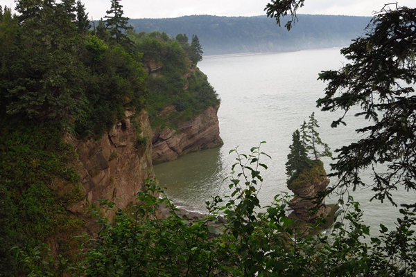
As I recall this is the overlook from Fownes Head. The formation on the beach is referred to as Flower Pot Rock.
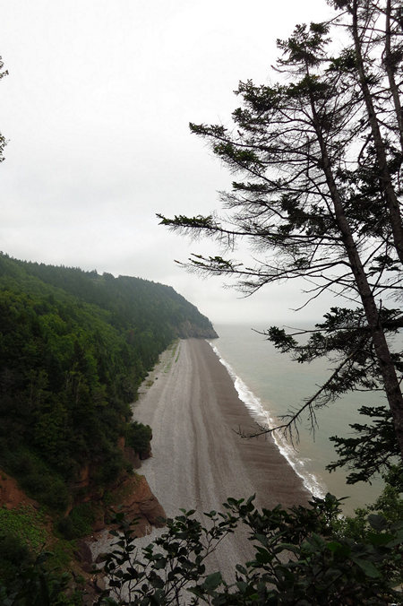
In the distance we could get a glimpse of Melvin and Pangburn Beach.
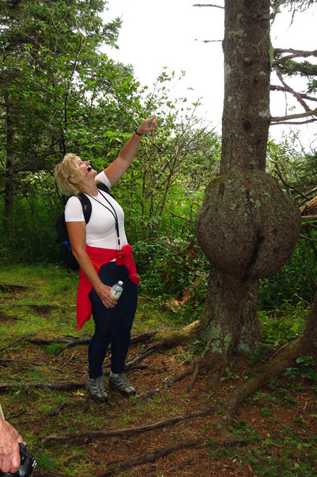
Check out that burl cleavage! The tree is either a White, Black or Red Spruce (Picea) and the tree was full of burls. Bizarre. Largest burl I have ever seen. But, they get much bigger. Check out this Google image gallery for more burl photos.
What is a burl?
A burl results from a tree undergoing some form of stress. It may be caused by an injury, virus or fungus. Most burls grow beneath the ground, attached to the roots as a type of malignancy that is generally not discovered until the tree dies or falls over. Such burls sometimes appear as groups of bulbous protrusions connected by a system of rope-like roots. Almost all burl wood is covered by bark, even if it is underground. Insect infestation and certain types of mold infestation are the most common causes of this condition.
In some tree species, burls can grow to great size. The largest, at 26 ft (7.9 m), occur in coast redwoods (Sequoia sempervirens) and can encircle the entire trunk; when moisture is present, these burls can grow new redwood trees. The world's second-largest burls can be found in Port McNeill, British Columbia. One of the largest burls known was found around 1984 in the small town of Tamworth, New South Wales. It stands 6.4 ft (2.0 m) tall, with an odd shape resembling a trombone. In January 2009, this burl was controversially removed from its original location, and relocated to a public school in the central New South Wales city of Dubbo.
Source: WikiPedia
Why the species ambiguity in the Spruce? In West Virginia we have only Red Spruce and that is restricted to the higher elevations. Black Spruce and White Spruce are northern species with ranges primarily in Canada, Alaska and the northern Great Lakes area of the US.
There are range maps for Red, White and Black spruce here.
There is more info on the genus Picea (Spruce) here.
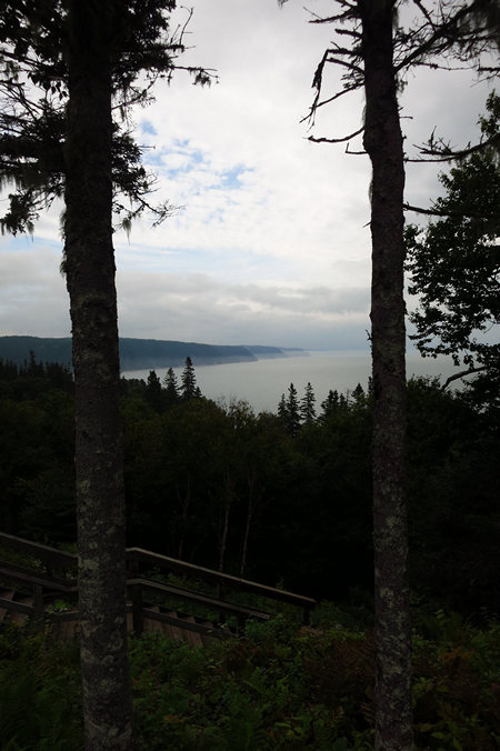
This is the view of Melvin and Pangburn beach from one of the overlook decks.
Beautiful spot to be sure.
My memory is fuzzy on the details but I think at this point we walked down to Melvin Beach.
Here we are at Melvin Beach which is the gateway, at low tide only, to Pangburn Beach.
This reminded me of Ruby Beach in the Olympic Peninsula.
This is looking towards Pangburn Beach. The tide was low enough we could sneak around some rocks to get to it.
Looking back towards Melvin Beach from Pangburn Beach.
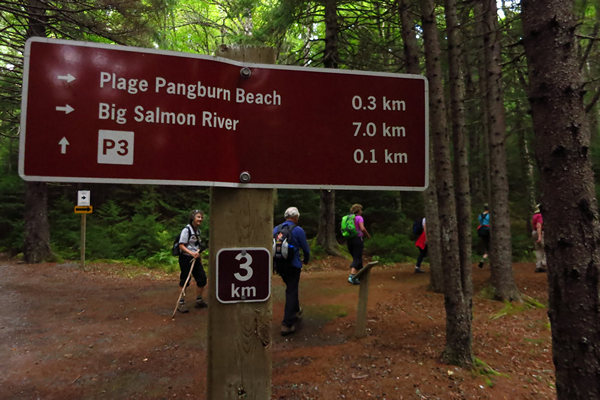
The trail continued on through some nice, quiet woods. Big Salmon River will be our final stop which will make a nice 6 mile walk.
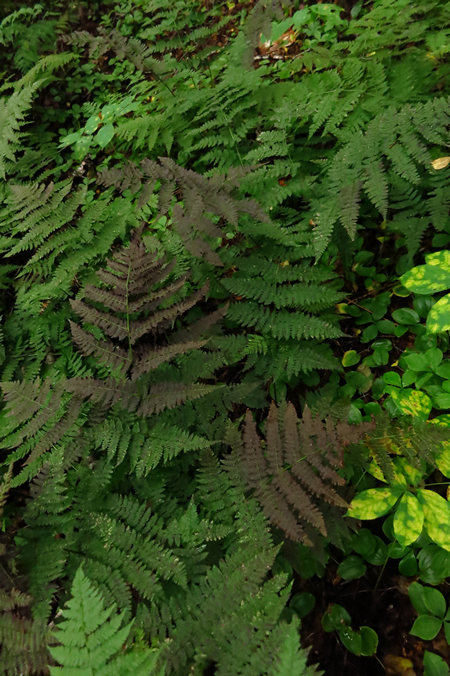
I had not noticed this purplish color on Wood Ferns before. Maybe Mountain Wood fern has a fall color?
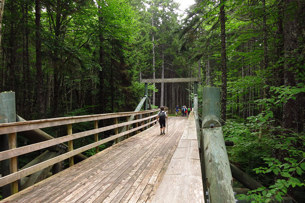
This was one of two very large bridges we crossed. This baby won't be going anywhere anytime soon!
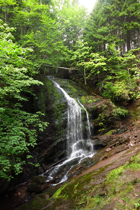
Our route took us right by the cable stay stairway to Fuller Falls. The steps were steep and a bit intimidating looking. Only a few of our group made the descent.
Hi Ho! Hi Ho! It's off to lunch we go!
While lunch was being set up we took in the views of Pangburn Beach.
I am pretty sure the rock at lower left is where I was previously when we went down to Melvin Beach.
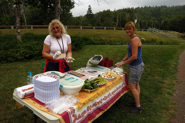
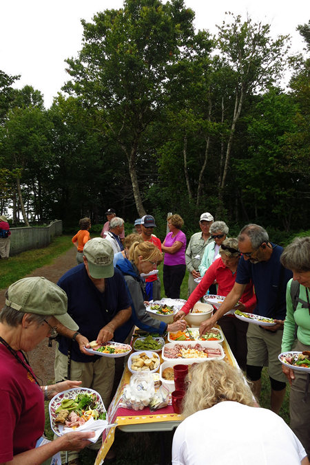
Kathy and June laid out quite a spread for the 24 hungry hikers.
Save some for me!!!!
Actually there was plenty for all and plenty tasty it was.
At this point about half the group took the auto option to Salmon River, the rest of us continued on foot.
Another nice view of Pangburn and Rogers beaches, this time looking to the south west.
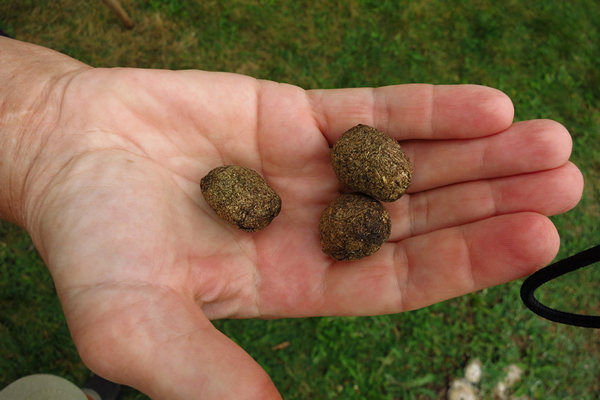
Whenever I see scat on hikes I like to check it out. I had never seen any quite like this but I was pretty sure I knew who made it. A moose. Kathy later confirmed this.
The last shot of the day - a nice view towards Salmon River and Long Beach - I think...
When we arrived at Salmon River the rest of the group was waiting for us at the interpretive center. We watched a short video on the history of the area and also had a look at some interesting old photos from the lumbering hey day.
As it turns out much of the land in the area of the Salmon River was owned by Hearst Publishing which at the time was owned and operated by William Randolph Hearst.
There were timber cutting and ship building operations at the mouth if the Salmon River. The trees would be cut into 4' bolts and loaded on boats to a pulp mill in Maine. Here it was turned into newsprint for the news papers of Hearst Publishing.
After a bit we boarded the bus and cars and got back to the Inn just in time for Happy Hour.
Tomorrow we go for a walk to a coastal marsh with Nancy and then on to Brown's Beach and Giffin Pond.
See you then.
~~~~~~~~~~~~~
After going though the rest of my photos and looking at my sketchy, incomplete and nearly indecipherable notes I have decided to forgo any more personal posts and let Betsy take the stage to wrap things up for the Fundy trip.
When I first met my WonderfulWife back in 1980 she had with her a 35mm SLR and was shooting negative film. She showed me some of her shots. I was impressed. She had a good feel for composure and selecting interesting and compelling subject matter. But then, like yours truly, Betsy wandered away from the viewfinder for many years.
Then came the Digital Age and Betsy started shooting again. But, being out of practice there were many mis fires and she was not always on target. That's OK. These things take time and now is apparently the time.
Betsy has pretty much set aside her digital point-and-shoot and has started using here recently acquired Samsung Galaxy tablet to shoot with. I have been impressed. It looks like Betsy is back in the game as the photos below will show.
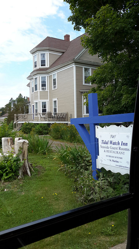
The Tidal Watch Inn - our home away from home for this trip - shot from the bus window. The Tidal Watch Inn was previously called the Quaco Inn, derived from a Micmac word meaning "place of the hooded seal".
The stump to the left is an old elm tree which has been carved into a seat. ~mb
More than a century ago the prosperous Skillen family built the gracious home that is now the Tidal Watch Inn. Their home became the social center of St. Martins where friends and family gathered. This community of shipbuilders became one of the wealthiest communities in the British Empire during the 1800’s as they built and launched over 500 ships to sail the world.
Today the beaches in front of the Tidal Watch Inn are quiet and serene. While the beaches no longer ring with the labour of building great ships, the hospitality remains unchanged. Tidal Watch Inn continues the great tradition of gracious hospitality welcoming guests from all over the world.
Source: © 2015 Tidal Watch Inn
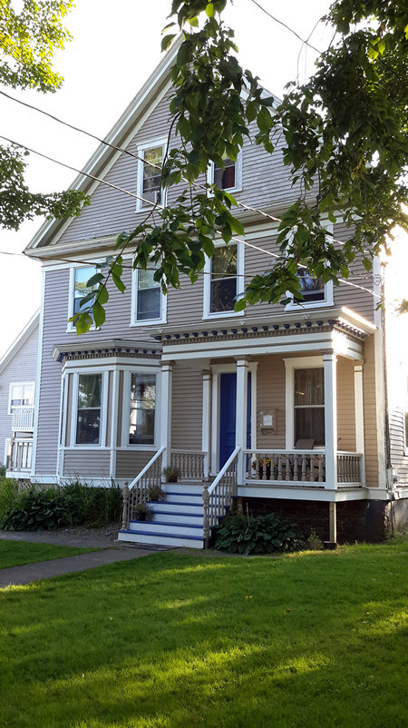
Front entrance of the Tidal Watch Inn.
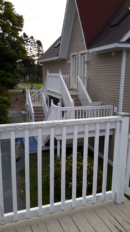
Not all the guest rooms were in the main house. This picture, taken from our room in the carriage house, shows another of the guest houses.
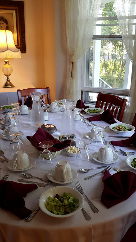
Set for the evening meal, our dining table looked quite lovely.
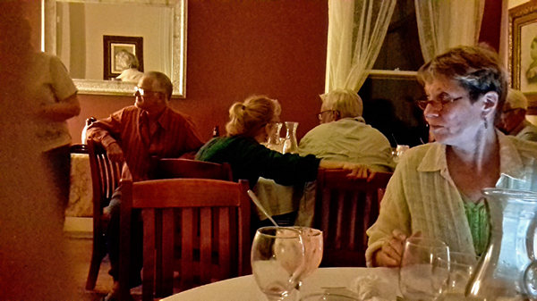
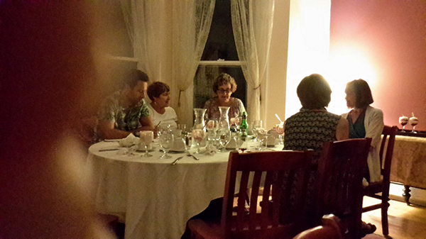
The dining room is in the main house. There were no assigned seats, so for each meal, Mike and I rotated tables so as to enjoy everyone's company.
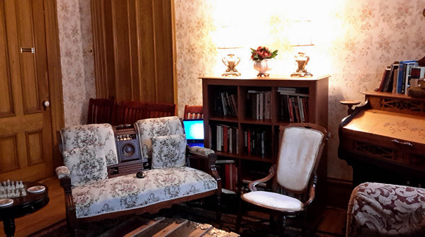
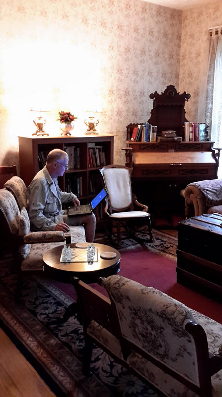
Here we see the commons room where people would gather before meals to talk and perhaps enjoy a Happy Hour drink.
Mike often came over in the early morning hours to catch up on his email and do a little web work.
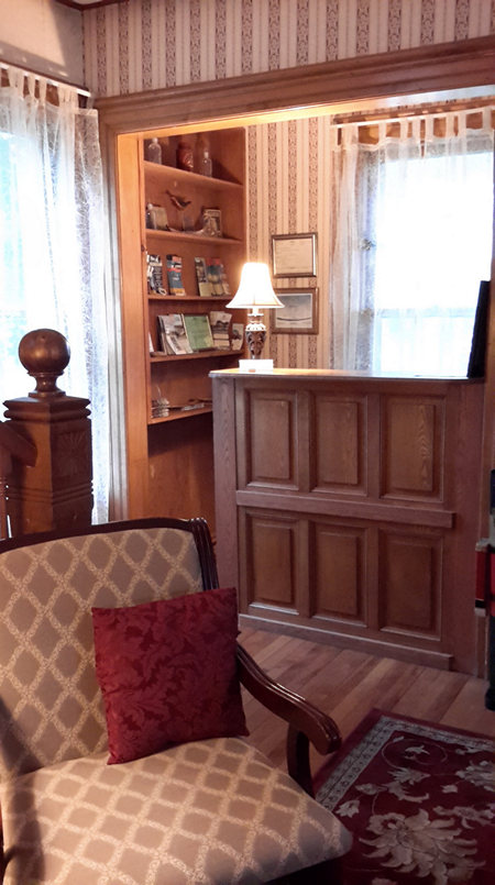
The registration desk at the Tidal Watch Inn.
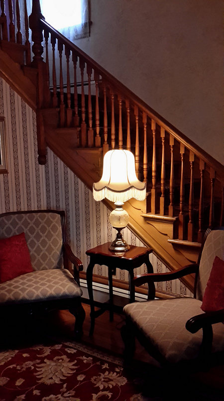
This staircase led up to the guest rooms in the main house. Every day I meant to take a walk up there, but just never got around to it. On the last day, Kathy mentioned that groups of guests would sometimes agree among themselves to open their rooms for a tour so they could see all the other guest rooms. Wish we had thought of that! Each room in the inn and adjacent buildings is unique.
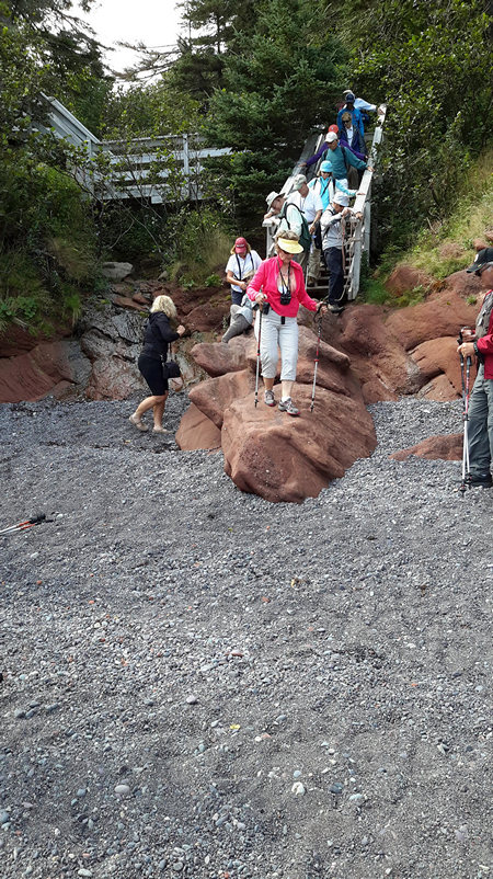
Here we are descending the stairs and scrambling over the rocks to get down to Brown's Beach. Kathy stands by to lend a hand.
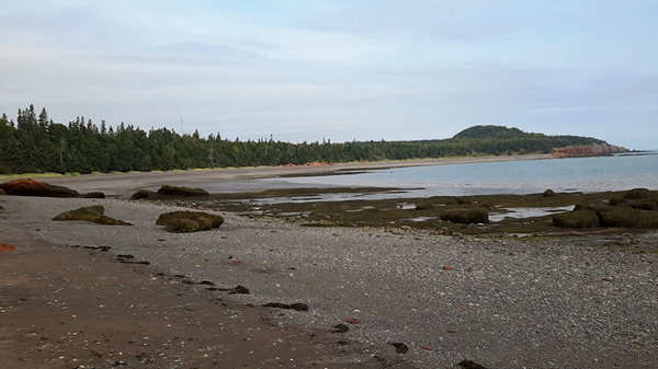
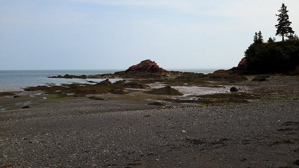
The low tide showed off the beautiful, rocky coastline.
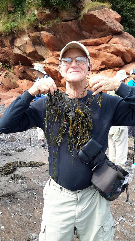
Mike displays his new necklace of interesting looking seaweed.
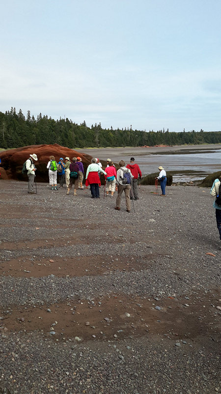
Here we all troop along Brown's Beach, looking for cool rocks and listening to Kathy give us interesting tidbits of information.
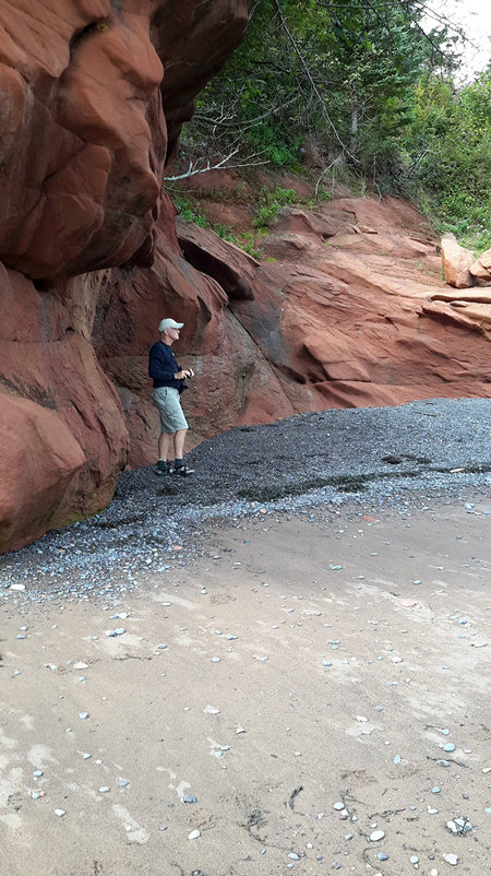
Mike scopes out the beach for his next shot.
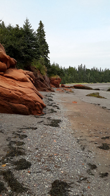
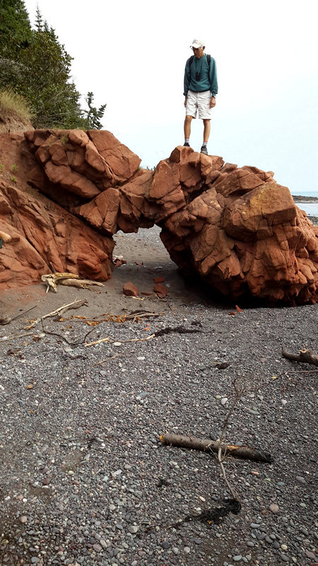
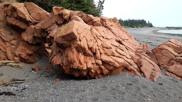
The formations along the beach and cliffs were made up of these beautiful orange/red rocks. Stan climbs up to get a better view.
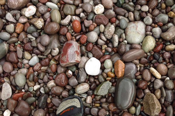
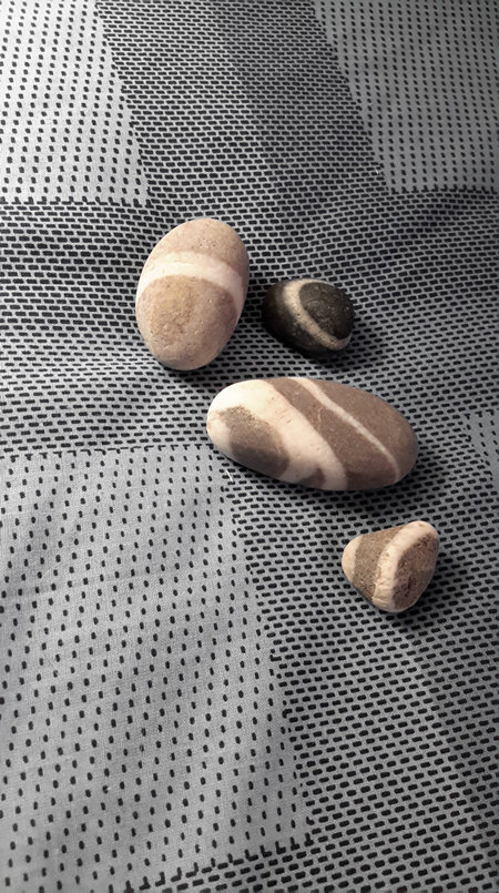
Here you see the "wishing stones" I collected. If I have the story right, when walking on the beach at St. Martin's, if you happen to find a rock with an uninterrupted white ring around it, you can make a wish on it. When your wish comes true, you then pass the wishing stone on to someone else.
As you can see, I still have all four of mine! On the first day of our trip, we encountered a large group of people from a tour bus from St. John. All were wondering the beach with their eyes cast downward. Nancy said they must have just been told the story of the wishing stones!
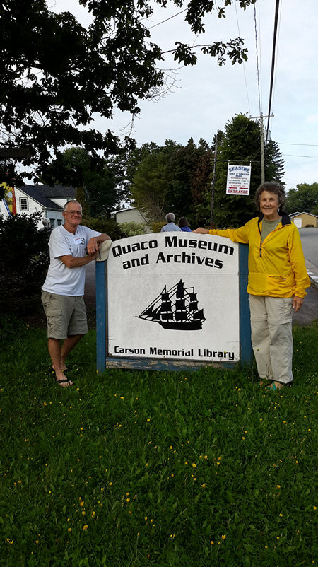
On the morning of our last full day, we walked to the nearby Quaco Museum for a program called "The Legacy of Sea Captains and Shipbuilders". The museum was housed in what used to be a gas station and restaurant.
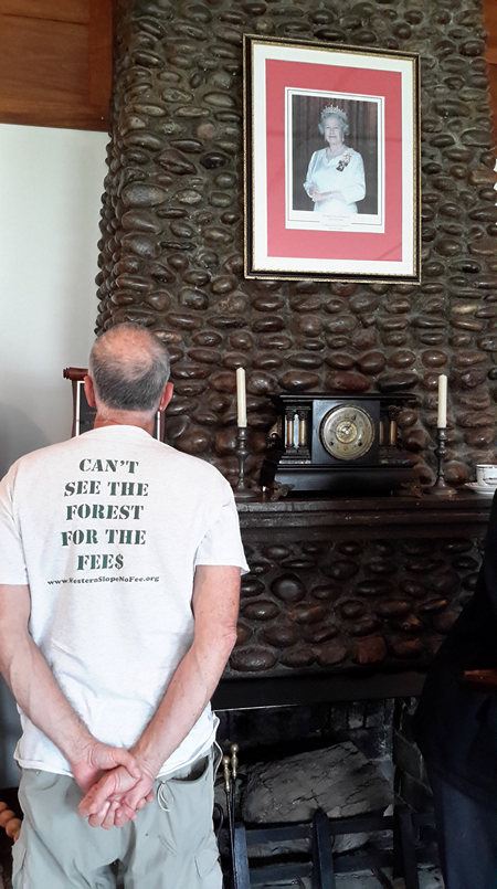
In the interior of the museum, Mike stands in front of the fireplace which was hand built with stones from the beach. Our speaker seemed to indicate it was too bad they had varnished it, as it hid the individuality of the stones, but Mike and I both thought the varnish gave the fireplace a very old fashioned funky look which we found attractive. Also in the picture we see Queen Elizabeth, who on that day became Britain's longest reigning monarch.
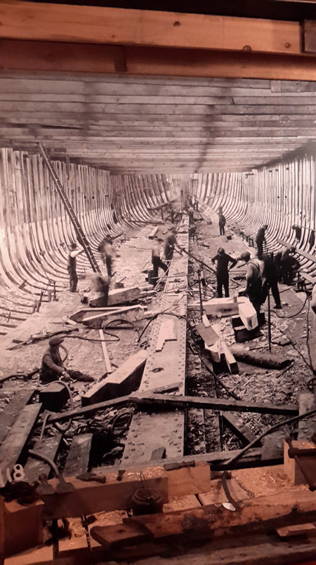
I loved this large, floor to ceiling picture which gave me the feeling I was actually in the belly of the ship, watching the work going on. The man who spoke to us about the shipbuilding process and the sea captains was very informative and absolutely fascinating and his stories made me wish we had longer to stay and listen.
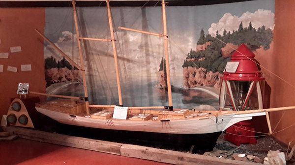
Wish I could remember the name of the ship this model represented.
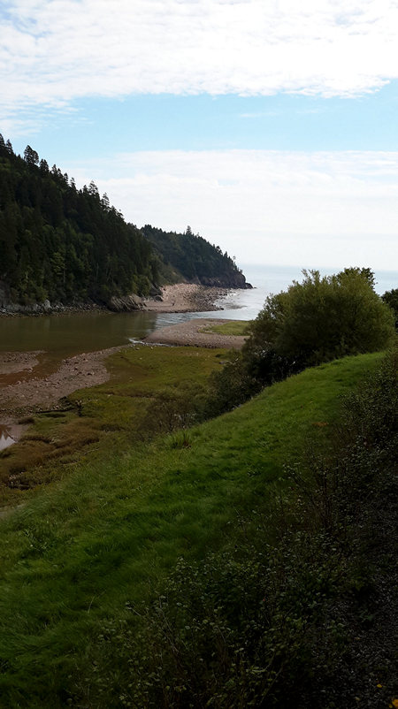
We then headed back to the Fundy Trail Interpretive Center where another delicious buffet lunch awaited us. In the afternoon we enjoyed views of the Salmon River, which we see here flowing out to join the Bay of Fundy.
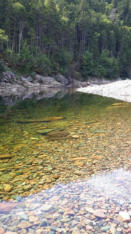
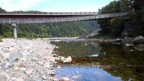
This view of the Salmon River was shot from the suspension bridge. The clear, inviting water beckoned, but the signs said swimming was not permitted. Darn!
The Salmon River Suspension Bridge. Aaron, Kate, Mike and I crossed it to take a short hike on the Fundy Footpath. We were hoping to find a place we could ford the river and return to the interpretive center without retracing our steps on the Footpath, but the water was moving along quickly, the rocks looked quite slippery and we didn't see a place that looked shallow enough or safe enough to risk it.
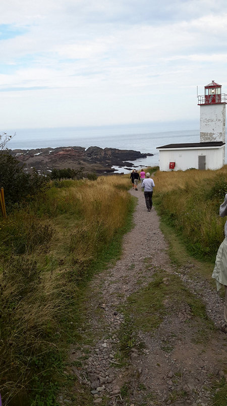
Our last stop of the day was the Quaco Head Lighthouse. As I stopped to snap this picture, the scene before me gave me a sudden feeling of deja vu, as if I had seen this quaint but stunning view before. Unfortunately it was something my photo could not capture.
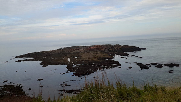
The distant singing of the harp seals from these rocks was unearthly and haunting.
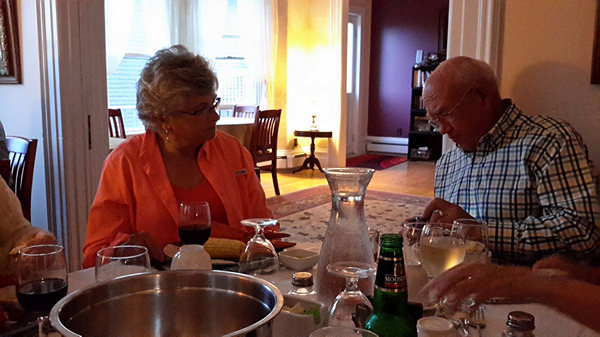
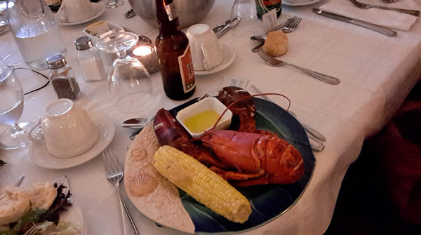
Our last evening's dinner was lobster! The other choice was roast beef, but for me there was no choice! Here Betty and Bill are waiting with anticipation.
Yum!!!
Plates and glasses were empty but we were full and happy. We relaxed and chatted with our new friends about our week's adventures and where the coming days would be taking us. A most pleasant ending to a good week!
~FINIS~
Epilogue
One of the benefits of sharing these trip reports is the feedback I occasionally get from people about the trip in general or specific incidents or places.
Sometime the trip reports bring back memories of the readers own trips and sometimes I get lucky and they share these memories with me.
Below are a couple of interesting and fun ones.
~~~~~~~~~~~~~
When I first met Bill it was in the early 1980s. At that time he was the President of a local chapter of the American Rhododendron Society (ARS).
And as a new member of the ARS and budding "Rhody Devodee" I was notified of a chapter meeting which was to take place in Virginia. This was my first of many such meetings I attended throughout the 80s and early 90s.
Going off somewhere and staying in a hotel was new to me. As was paying a registration fee for a meeting, meals and transportation. In an effort to cut my costs I decided to try to find someone I could share a room with and thus cut my lodging costs is half. Not being shy I went right to the top and contacted the President of the chapter. That was Bill. And, as luck would have it Bill was attending the meeting solo as well. So we ended up sharing a room.
That was the beginning of what has been over 3 decades of interesting stories, advise on growing Rhodies and horticulture in general or simply "hanging out" with Bill other Rhody Devotees at chapter meetings.
I am glad Bill has kept the lines of communication open between us for all these years.
Thanks, Bill.
Mike and Betsy,
Thanks for that most interesting first Chapter of your latest One Big Trip of the Year. It must be difficult to decide which of your Big Trips is the One Big Trip, but choosing the financial distinction is a good way to do it.I am awaiting the next Chapter with enthusiasm. For years, I too was not very familiar with those “places up there” in Canada, but thanks to trips to ARS Conventions, I have been to Canada at least five times. Years ago two of us went on a road trip to the ARS Convention held barely into Canada at Niagara Falls. That was my second trip “up there.” For one of the tours, instead of gardens, I chose a trip that explored some of the biological and geological diversity of the Lake Ontario area, which included some brief nature hikes with one to an area that had trees and vegetation more appropriate for Virginia than Canada. I have forgotten the name for that biological oddity. One of the trees was a magnolia native to Virginia and my property. The young woman who was the main leader told about things all through the trip but she had professors and other even more knowledgeable naturalist type people who would join us at various points. I remember as we walked through that forest a Collie suddenly joined us and then we began hearing some distant music. Eventually we came to a slightly open area in the shady forest where some musicians were playing and singing folk songs of Scotland, England, and Ireland.
On that trip to many places around Lake Ontario, we saw numerous geological curiosities and got some good explanations. We had lunch at a winery. We traveled to some interesting property owned by a woman who was a fascinating “back to the Earth” type person. She took us to her cave and we saw some other geological features of the area.
Our bus went by some farm fields owned by some Dutch guy and saw a long row of workers bending over but they stood up and looked at us. All had dark hair or hats except for one with slightly long, bright blonde hair who stood out. A Dutch boy hair style. They were too far away to see details of their facial features but they looked like a long Conga line. The bus stopped or slowed down briefly while they told us about the farm.
Then we went drove a little further to see the remains of an area where Canadian Sphagnum peat moss was, or had been harvested, for shipment to the US for rhododendron growers. Lots of interesting little plants in that area. After that we reversed directions on the same road and once again passed that farm field where all the workers stood up once again but then turned around in unison and bent over and the blonde guy mooned us. Probably the son of the Dutch owner. Most likely, all of them were supposed to do it but the others did not cooperate and left him with egg on his face ... or his “wherever”, as Donald Trump would say.The Convention had the theme of Rhododendrons on the Edge and the talks revolved around that theme, including dwarfed trees and shrubs that grew on vertical rocky cliffs and the speaker had to rappel down the side of the cliff to get the photos. That excellent speaker program was organized by a professor in that area. One of the speakers was a Scotsman from Newfoundland who made a big issue of correcting the popular mispronunciation of Newfoundland where he emphasized “land” instead of “found.” His talk was about his success with growing rhododendrons, including more tender ones, at his place in Newfoundland.
Other talks were about some local hybridizers who developed more cold hardy rhododendrons. That was one of the most enjoyable conventions ever. In the fall of 2014, I think, I passed up an invitation to join three friends on a road trip to the Eastern Regional ARS Meeting in Halifax, Nova Scotia. I really regret that I did not get to go and I think one of them may have missed my presence the most, since the three of them tried to squeeze into one hotel room for most or all of the trip. They took turns sleeping on the cot provided for one of them to use and one developed terrible back problems for weeks after that. Mike, I think you had similar experience in Texas some years ago. Had I been on the trip, they would have gotten two rooms and had more comfort.I look forward to your next Chapter of “New Brunswick: Exploring the Fundy Trail.” Already you have taught me more about the geography of the area. Thanks.
Bill
I cannot be 100% certain but I think I first met Craig in 1998. He was at a Mon Valley Greenspace Coalition "Show and Tell" event in a local school auditorium.
This "Show and Tell" consisted of informational tables set up throughout the area with various people, many of them volunteers, at each table to explain either their groups or individual efforts to the folks who stopped by to see what was going on at the event.
This was a greenie/treehugger event and there were folks manning tables from the Mountaineer Audubon club, Dunkard Creek Watershed Association and a host of other groups.
Craig had a table set up with some maps and publications.
That map showed all the streams in Preston County WV. Each stream was color coded. Each color represented a streams health and/or level of impairment. The map was based on Craig's countess hours spent collection and analyzing water samples from all those creeks in Preston county.
Craig was selling the maps and the report which he had written based on the data produced from the samples.
I bought a copy of each.
After that initial meeting I started seeing Craig on and off at various Greenspace and other meetings and parties over the years.
Craig and I never spent a whole lot of time together but there has always been dialog between us over the years. I have always enjoyed Craig's insight into things "Watersheddy" as well as his dry wit which was always accompanied by a knowing smile. Through out the years Craig would send me a line or two commenting on my trip reports.
Last year (2014), shortly after I had driven across Utah, Craig sent me some wonderful recollections he had of hitch hiking in the southwest with "Michigan Bob" who I also had known for many years. Bob is no longer with us so Craig's shared memories for that trip were particularly poignant and bitter - sweet for me.
For this Fundy trip Craig sent me another batch of goodies - memories of another hitch hiking trip through Canada.
Now, for your reading pleasure, here is Craig.
Mike, I hope you and Betsy enjoy your time in NB. I have fond memories of hitchhiking in Canada. During the 1970s when Pierre Trudeau was prime minister he set up a network of government-supported youth hostels across Canada. He basically came out and encouraged Canadian youth to bum around and see their own country. It was a major contrast to the way the US seemed to view its own youth at the time. For $1 you got a place to stay (usually just a floor to throw your sleeping bag on); sometimes a shower, which was sometimes even hot; and sometimes a meal—usually breakfast, occasionally dinner—nothing fancy, to be sure. It was never lunch because everyone was kicked out of the hostels during the day. Even in hostels where there were no prepared meals there was often a kitchen where you could fix your own dinner. This usually led to a bunch of people contributing to a communal meal of some sort. It seemed like at whatever hostel you stayed at you already knew someone there from a previous hostel you had stayed at—“hey, didn’t I meet you at the hostel in Halifax?” Some of the best times I had bumming around were in Canada.
I hope you guys have good weather for Fundy. The one time I was at Bay of Fundy National Park it was very chilly, drizzly and foggy. I really didn’t get to see too much, except a moose a little too close for comfort. At the time, the park seemed to be pretty much undeveloped. I felt like I was the only person in it, but that may have had something to do with the weather. Afterwards, I recall walking through the nearby village of Alma past a little restaurant and a couple of charming, pretty waitresses must have spotted me, came to the door, and said something like, “it’s much too unpleasant to be outside on a damp, chilly morning like this, you silly boy. Get in here and let us pour you a nice hot cup of coffee, ay.” I think they were just bored—the breakfast rush was probably over. It was one of the most pleasant cups of coffee I ever had though. I hope Canadians are still that hospitable.
Craig


