Mike Breiding's Epic Road Trips ~2016~
64 & Counting
Getting High on My Birthday
Solo Hike to the Summit of Mount Wrightson in the Santa Rita Mountains
December the 14th 2016
64 & Counting: Getting High on My Birthday
Solo Hike to the Summit of Mount Wrightson in the Santa Rita Mountains
This morning I awoke with screaming calves, tender quads and a sore butt. Here is why.
As I am sure you all know by now the main reasons we are now wintering in Tucson for 6 months each year are the warm temps, sunny skies and endless hiking. And if you throw in the 100+ miles of The Loop cycling path one has a good reason to spend a lot of time outdoors. And we do.
Why does the Tucson area have 100s of miles of deluxe hiking? In a word: mountains.
Although not all of the mountains shown above have well established hiking trails, many do. I think it is safe to say the most popular hikes for those living in the Tucson area are in the Tucson, Santa Rita, Rincon, Tortolita and Santa Catalina Mountains. And it is not just the mountains. There is open desert hiking as well. Especially in the Tucson Mountains where we live.
The two highest peaks in the mountain ranges mentioned above are Mount Lemmon in the Catalina Mountains at 9,157', and Mount Wrightson in the Santa Rita Mountains at 9,453'.
Although Mount Wrightson is the higher by nearly 300', I have talked to a number of people, some of them long time residents, who will tell you Mount Lemmon is the highest mountain in the area.
The reasons for this are familiarity and accessibility. The Catalinas are so close to Tucson proper one could almost consider them part of the city. And there is a network of paved roads that climb nearly to the summit of Mt Lemmon where there are ski slopes.
The access to Mount Wrightson is much different. The closest you can get to Wrightson by car is the dead end of Madera Canyon Road which sits at 5400' elevation. From this point one must hike to the summit. And that is what I did and that is how I got high on my birthday.
Click on the photos below for a larger image.
The Santa Ritas have a very distinctive profile. Mount Wrightson is on the left and Mount Hopkins (el 8,586') is on the right.This shot was taken from the Tucson Mountains on one of the trails which is about a 15 minute walk from where we live.
William Wrightson and Gilbert Hopkins both worked for the Salero Mining Company which was headquartered in nearby Tubac. Both men were killed by Apaches. At that time, this area of Arizona was the domain of the Apache Indians who murdered whites working and living in the area, stole their cattle and destroyed most anything that could be destroyed.
The Whipple Observatory is located on Hopkins.
Here are two distant views of the Santa Rita Mountains as seen from Cardiac Gap in the Santa Catalina Mountains.
Thankfully the sprawling population of the Tucson basin is isolated from the Santa Rita Mountains by the Coronado National Forest.
Ok. Time for a hike. But first I gotta eat!
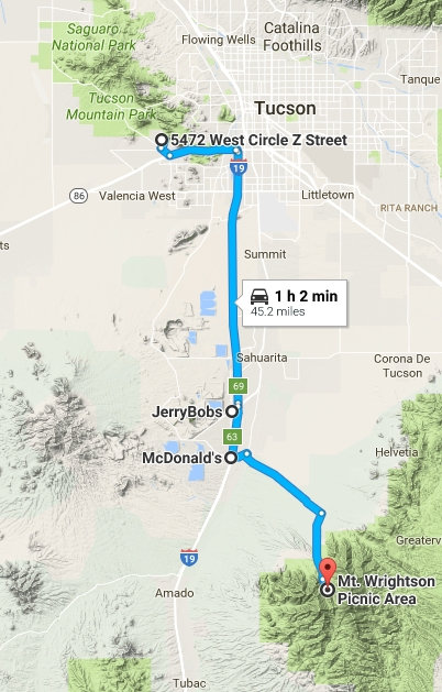
I left the house around 5:30 and headed to the only place I could find enroute to the trailhead which opened at 6:00am - Jerry -Bob's. Here I loaded up on breakfast at yet another overpriced and mediocre Green Valley restaurant. Ugh.
Breakfast is over. But what about lunch? Oh, boy - MickyD's! That was my next stop and then it was on to the trailhead.
Now it is time to hike.
There are several routes to the summit of Mount Wrightson and I chose the one Tucson Estates hiking buddy Stephen and I hiked in March of 2015. That was the first time for both of us. That route consists of only one trail: The Old Baldy Trail. This route is the shortest - 12 miles round trip and includes a hefty 4000' feet of elevation gain.
I think of this route as being in 3 sections: TH to Josephine Saddle, Josephine Saddle to Baldy Saddle, Baldy Saddle to summit. BTW - if you look around you will get various mileages for this round trip route. Mine is based on my recently acquired Garmin eTrex 35T.
I pulled into the trail head parking lot just before 7:00am. There were only 2 other vehicles to be see in any of the various lots at the Mount Wrightson Picnic area. I was ready to go and I started what was to be 3 hours and 45 minutes of relentless elevation gain.
Here is my first shot of the day - looking across Madera Canyon to the summit of Mount Hopkins. The facilities for the Whipple Observatory can clearly be seen.
At this point I am looking up to the summit of Mount Hopkins. I cannot tell what a relief it was when I was finally looking down at it. But that was a few hours away.
Yikes. This I was not expecting. The weather had been relatively warm of late and I did not expect to see any snow today. Ha!
To be sure this amount of snow looks insignificant. But it can still make the going tough and slow one down. There was one area where I would call it hazardous. Why? What happens is this. A few inches of snow fall. Then it gets compressed by hikers. It partially thaws during the day. And then at night when the temperature drop like a rock it freezes to an icy and very slippery surface.
This did not cause any real problems on the way up. But on the way down it was a different story. I was very glad I had my trekking poles which I always carry as a "just in case". This was one of those "just in case" times. And in spite of having the poles there was still one treacherous section where I had to get down on my butt and scoot along a section that was cambered to the outside edge of the trail and a steep drop off.
The first section - from the trail head to Josephine Saddle - went quick and easy, relatively. But it is still a gain of 1700' feet which is not insignificant.
Then came the "killer" section: Josephine Saddle to Baldy Saddle.
I had forgotten how hard my heart could beat and still not explode out of my chest! It was quite amazing. Exhausting, but still amazing.
This why it is amazing. With each turn in a switch back the views open up more and more.
After quite a few stops to catch my breath and get my heart rate down, I arrived at Baldy Saddle. The only sign of life I saw was two distant figures with backpacks heading off in the opposite direction. There was not a human sound to be heard. Heaven.
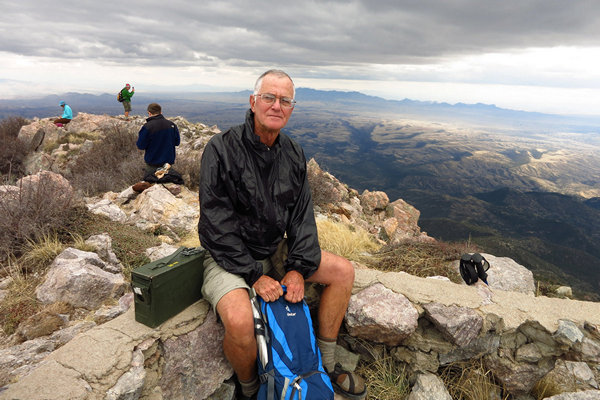
Here is what I saw at the summit. No one! I was surprised and delighted. I stayed for about a half an hour and saw not a soul. Ahh...
The stone and mortar foundation is all that remains of the Old Baldy Fire Lookout.
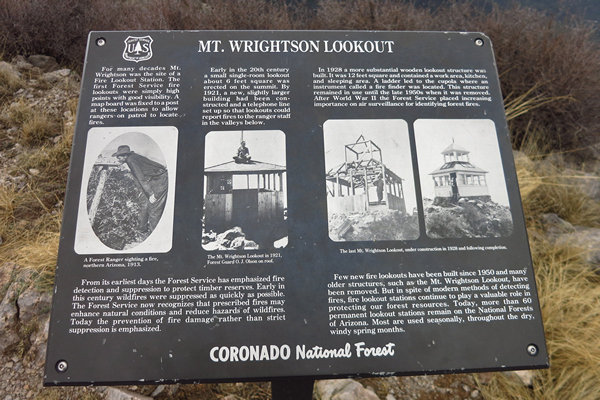
The first fire lookout on Mt. Wrightson was constructed around 1909 and was extremely rudimentary. The structure was very small, had no windows and provided virtually no protection from the elements. Judging from the size of the Forest Rangers, the structure was less than six feet square.
The first fire lookout was replaced about 1920 with a slightly larger structure. This lookout was also a relatively small, austere structure (approximately 8 feet by 8 feet). Like the first lookout, it also had neither windows nor doors to protect the Rangers from the elements.
The second iteration of the lookout was replaced in 1928 with a more substantial building (approximately 12 feet x 12 feet) that contained a work area, kitchen and sleeping area. It also had a cupola that contained a fire finder instrument. The structure was classified as a D-6 Cupola and was mounted on a platform 4 feet above ground level. This final version of the Mt. Wrightson Fire Lookout was removed in the late 1950s and all that remained for a while was the decking with a crawl space underneath. The only remnants of the lookout that remain today (2011) are parts of the stone foundation
Source: Green Valley Hiking Club
Munching on my now cold Egg McMuffin I took in the views with not one distracting and noisy human voice. The loudest noise was the sound of my still thumping heart. The combination of the strain of hiking and elevation of 9000' feet was making it work overtime.
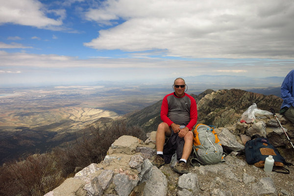
The obligatory self conscious selfie
And with that it was back down the mountain. I had been thinking about that snow and ice the whole time on the summit. But now rested, watered and fed, I felt ready to be on my way.
I arrived back at the trail head without incident, then back to Tucson Estates, showered, picked up Betsy from her Christmas Concert (she sings in the chorus) and then it was off to 1702 Craft Beer & Pizza where we met good friends Donna and Ashok for a delicious pizza and several tasty beers.
This was a good day.
~~~~~~~~~~~~~~~~~~~~~~~~~~~~~~~~~
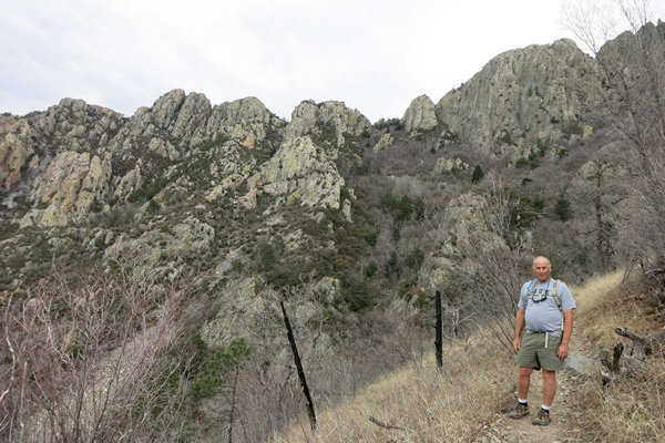
Here are a few pics from the Mt Wrightson hike Stephen and I went on in March of 2015.

Ready to go!

The mileage is WRONG!
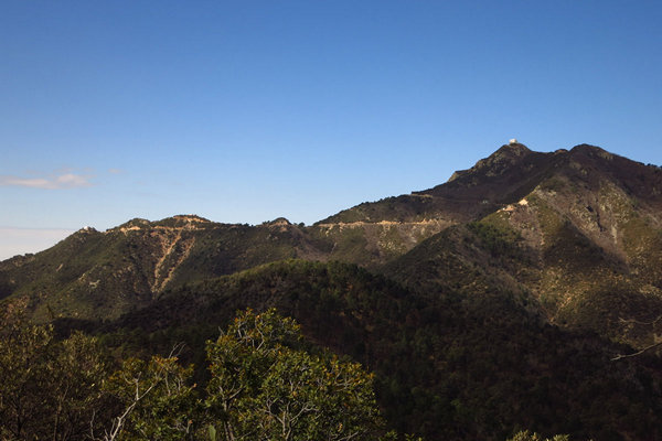
Looking up on Mount Hopkins.

Looking down on Mount Hopkins.
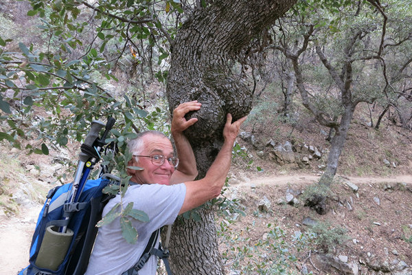
A parting shot...


